
|
| |||||||||||||||||||

|
Please note that JDLand is no longer being updated.
peek >>
Near Southeast DC Past News Items: photos
- Full Neighborhood Development MapThere's a lot more than just the projects listed here. See the complete map of completed, underway, and proposed projects all across the neighborhood.
- What's New This YearA quick look at what's arrived or been announced since the end of the 2018 baseball season.
- Food Options, Now and Coming SoonThere's now plenty of food options in the neighborhood. Click to see what's here, and what's coming.
![-]()
- Anacostia RiverwalkA bridge between Teague and Yards Parks is part of the planned 20-mile Anacostia Riverwalk multi-use trail along the east and west banks of the Anacostia River.
![-]()
- Virginia Ave. Tunnel ExpansionConstruction underway in 2015 to expand the 106-year-old tunnel to allow for a second track and double-height cars. Expected completion 2018.
![-]()
- Rail and Bus Times
Get real time data for the Navy Yard subway, Circulator, Bikeshare, and bus lines, plus additional transit information. - Rail and Bus Times
Get real time data for the Navy Yard subway, Circulator, Bikeshare, and bus lines, plus additional transit information. - Canal ParkThree-block park on the site of the old Washington Canal. Construction begun in spring 2011, opened Nov. 16, 2012.
![-]()
- Nationals Park21-acre site, 41,000-seat ballpark, construction begun May 2006, Opening Day March 30, 2008.
![-]()
- Washington Navy YardHeadquarters of the Naval District Washington, established in 1799.
![-]()
- Yards Park5.5-acre park on the banks of the Anacostia. First phase completed September 2010.
![-]()
- Van Ness Elementary SchoolDC Public School, closed in 2006, but reopening in stages beginning in 2015.
![-]()
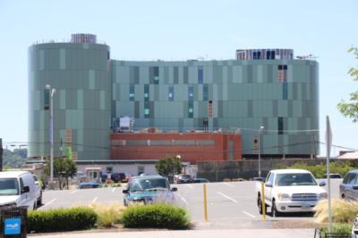
- Agora/Whole Foods336-unit apartment building at 800 New Jersey Ave., SE. Construction begun June 2014, move-ins underway early 2018. Whole Foods expected to open in late 2018.
![-]()
- New Douglass BridgeConstruction underway in early 2018 on the replacement for the current South Capitol Street Bridge. Completion expected in 2021.
![-]()
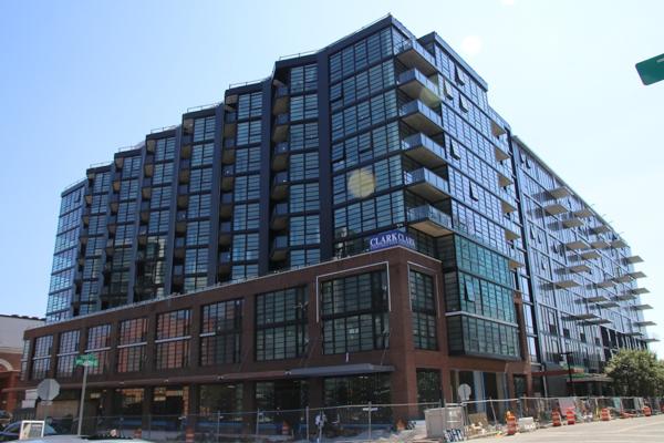
- 1221 Van290-unit residential building with 26,000 sf retail. Underway late 2015, completed early 2018.

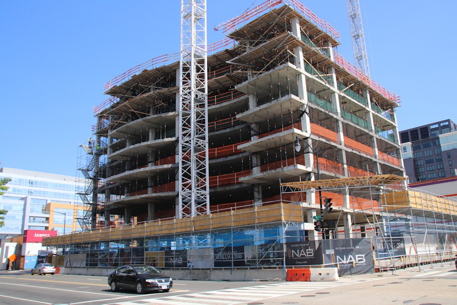
- NAB HQ/AvidianNew headquarters for National Association of Broadcasters, along with a 163-unit condo building. Construction underway early 2017.

- Yards/Parcel O Residential ProjectsThe Bower, a 138-unit condo building by PN Hoffman, and The Guild, a 190-unit rental building by Forest City on the southeast corner of 4th and Tingey. Underway fall 2016, delivery 2018.

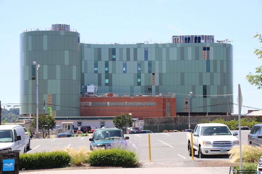
- New DC Water HQA wrap-around six-story addition to the existing O Street Pumping Station. Construction underway in 2016, with completion in 2018.

- The Harlow/Square 769N AptsMixed-income rental building with 176 units, including 36 public housing units. Underway early 2017, delivery 2019.

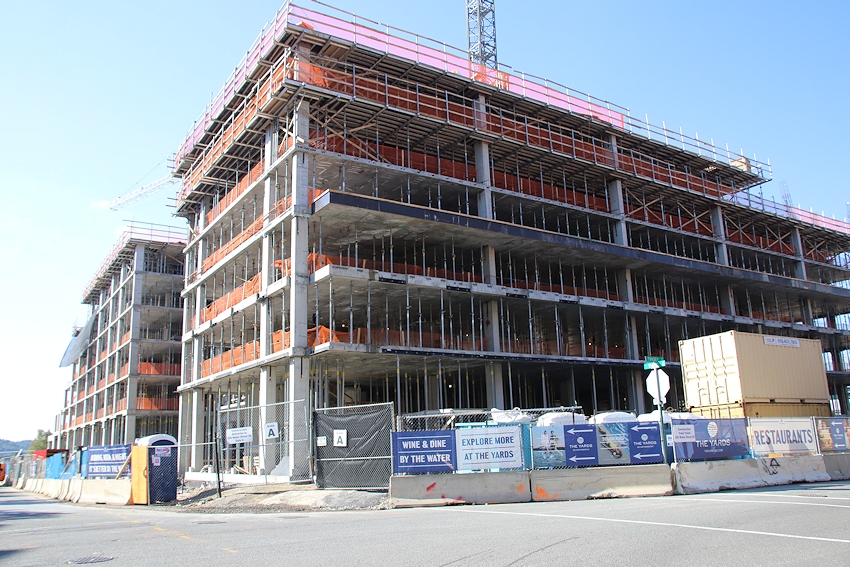
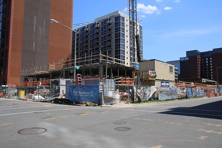
- West Half Residential420-unit project with 65,000 sf retail. Construction underway spring 2017.
![-]()
- Novel South Capitol/2 I St.530ish-unit apartment building in two phases, on old McDonald's site. Construction underway early 2017, completed summer 2019.
![Novel South Capitol]()
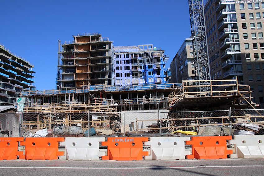
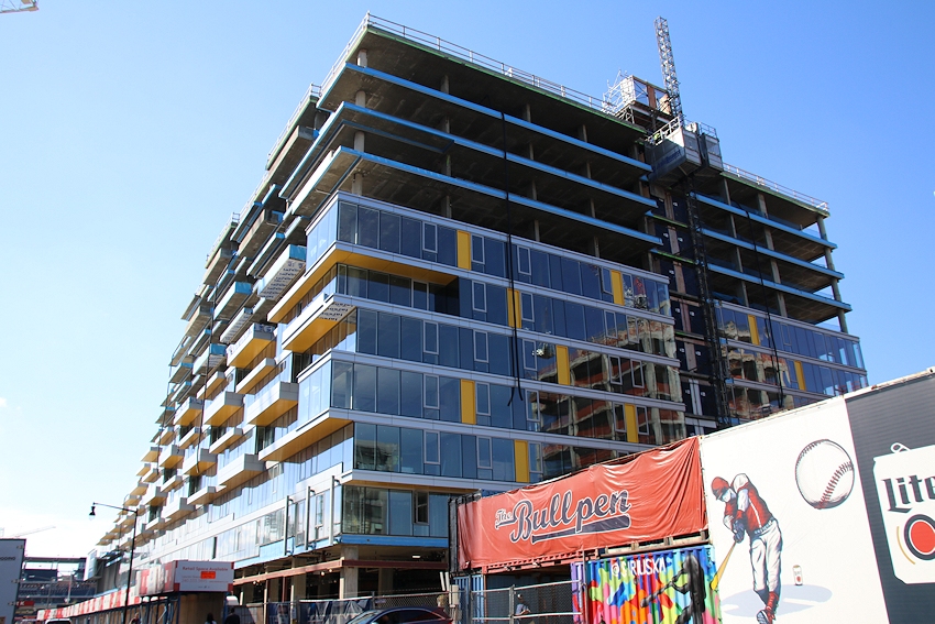
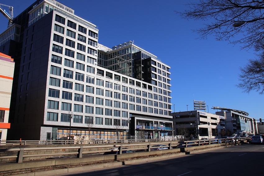
- 1250 Half/Envy310 rental units at 1250, 123 condos at Envy, 60,000 square feet of retail. Underway spring 2017.
![-]()
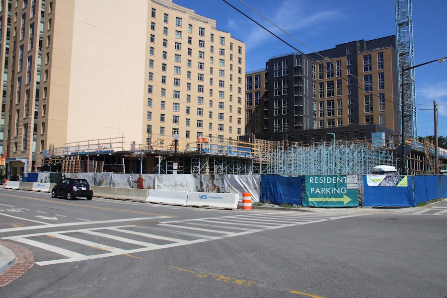
- Parc Riverside Phase II314ish-unit residential building at 1010 Half St., SE, by Toll Bros. Construction underway summer 2017.
![-]()
- 99 M StreetA 224,000-square-foot office building by Skanska for the corner of 1st and M. Underway fall 2015, substantially complete summer 2018. Circa and an unnamed sibling restaurant announced tenants.
![-]()
- The Garrett375-unit rental building at 2nd and I with 13,000 sq ft retail. Construction underway late fall 2017.
![-]()
- Yards/The Estate Apts. and Thompson Hotel270-unit rental building and 227-room Thompson Hotel, with 20,000 sq ft retail total. Construction underway fall 2017.
![-]()
- Meridian on First275-unit residential building, by Paradigm. Construction underway early 2018.
![-]()
- The Maren/71 Potomac264-unit residential building with 12,500 sq ft retail, underway spring 2018. Phase 2 of RiverFront on the Anacostia development.
![-]()
- DC Crossing/Square 696Block bought in 2016 by Tishman Speyer, with plans for 800 apartment units and 44,000 square feet of retail in two phases. Digging underway April 2018.
![DC Crossing]()
- One Hill South Phase 2300ish-unit unnamed sibling building at South Capitol and I. Work underway summer 2018.
![One Hill South Phase 2]()
- New DDOT HQ/250 MNew headquarters for the District Department of Transportation. Underway early 2019.
![New DDOT HQ]()
- 37 L Street Condos11-story, 74-unit condo building west of Half St. Underway early 2019.
![37 L Condos]()
- CSX East Residential/Hotel225ish-unit AC Marriott and two residential buildings planned. Digging underway late summer 2019.
![CSX East Residential/Hotel]()
- 1000 South Capitol Residential224-unit apartment building by Lerner. Underway fall 2019.
![1000 South Capitol Residential]()
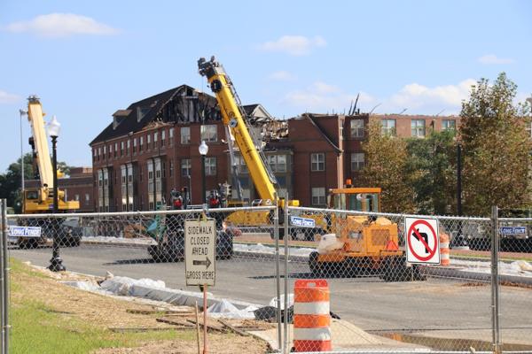
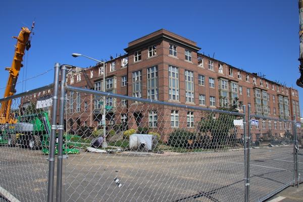
- Capper Seniors 2.0Reconstruction of the 160-unit building for low-income seniors that was destroyed by fire in 2018.
![1000 South Capitol Residential]()
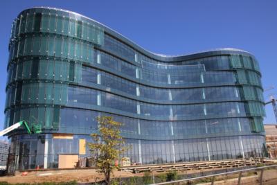
- Chemonics HQNew 285,000-sq-ft office building with 14,000 sq ft of retail. Expected delivery 2021.
![1000 South Capitol Residential]()


A few morsels:
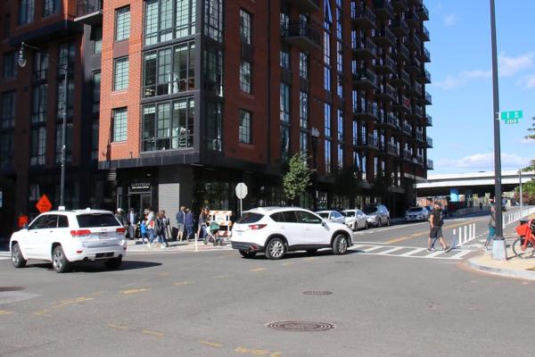 * NJ & I: ANC 6D07 commissioner Edward Daniels put out the word on Facebook this week that "after numerous emails, walk-throughs, and (personal) hours spent watching the intersection from Slipstream, DDOT has finally responded and are working on a design and construction plan to install a traffic light at the intersection of New Jersey Ave & I Street SE." It's still a ways off, but there's no doubt that this intersection is a busy one and in need of some containment. (Wish I had a better picture to illustrate, but I usually try my best to let roads clear before I click the shutter. Which is not easy at New Jersey and I.)
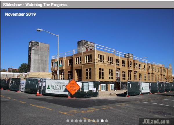 * SLIDESHOWS: I got on a bit of a tear and finally figured out how to more easily create a "representative" photo slideshow for projects, using larger photos to illustrate a project's progress from before to after, without completely rebuilding the existing small-image'd photo archive. (Not much space in my brain for this level of creativity for, oh, the past 10 years or so.) You can see these on pages for active projects, like Capper Seniors 2.0 (which is a good example, since the slideshow captures the rise and fall and rise) and others on the homepage map. I'm going to work my way through older projects, which will take some time. This also means that it's going to be much quicker to update the project pages when I take new photos, since I've been manually adding the large photos each time I go out. Kind of wish I had figured this out a few years ago, when this crazy stretch of new construction was getting started, but, like I said, I've had a lot on my mind. You'll also note that there are mini-slideshows showing up randomly on the JDLand home page, as well as the sliders (which remain a very labor-intensive activity). I imagine some day I will redo the photo archive in larger versions, but not this week.
 * NJ & I: ANC 6D07 commissioner Edward Daniels put out the word on Facebook this week that "after numerous emails, walk-throughs, and (personal) hours spent watching the intersection from Slipstream, DDOT has finally responded and are working on a design and construction plan to install a traffic light at the intersection of New Jersey Ave & I Street SE." It's still a ways off, but there's no doubt that this intersection is a busy one and in need of some containment. (Wish I had a better picture to illustrate, but I usually try my best to let roads clear before I click the shutter. Which is not easy at New Jersey and I.)
* BID ANNUAL REPORT: It's time once again for the Capitol Riverfront BID's annual report, which has all sorts of information about the neighborhood's progress, but I think it's worth highlighting some of the numbers. The BID estimates there are now 11,200 residents in 7,100 residential units, 78 restaurants, 44 shops and services, two grocery stores, and two professional sports stadiums (alas, the BID mucks with my statistics by also having Buzzard Point in its boundaries). I'm so old I remember a brief period when the resident count was about 300, if that.
* BRIDGE LATEST: The progress on the arches keeps right on going, and if you want to know more about the new Douglass Bridge, the winter newsletter is available for your perusal.
* SLIDESHOWS: I got on a bit of a tear and finally figured out how to more easily create a "representative" photo slideshow for projects, using larger photos to illustrate a project's progress from before to after, without completely rebuilding the existing small-image'd photo archive. (Not much space in my brain for this level of creativity for, oh, the past 10 years or so.) You can see these on pages for active projects, like Capper Seniors 2.0 (which is a good example, since the slideshow captures the rise and fall and rise) and others on the homepage map. I'm going to work my way through older projects, which will take some time. This also means that it's going to be much quicker to update the project pages when I take new photos, since I've been manually adding the large photos each time I go out. Kind of wish I had figured this out a few years ago, when this crazy stretch of new construction was getting started, but, like I said, I've had a lot on my mind. You'll also note that there are mini-slideshows showing up randomly on the JDLand home page, as well as the sliders (which remain a very labor-intensive activity). I imagine some day I will redo the photo archive in larger versions, but not this week.|
Comments (13)
|
 It's Slider Time once again!
Not only have I updated more than *30* locations, I've added a number of new ones, including this one, looking east on Potomac at South Capitol (which will change pretty substantially once again when the new traffic oval arrives).
So go browse through the Slider Gallery to spend untold hours controlling the slide line yourself, going back and forth and back and forth and back and forth.... (and don't miss the "Browse Older Sliders" link to see the others that didn't get updated this time around.)
Working on these has really gotten me thinking about doing more with them, like allowing you to choose which photos of that view you want to slide between, etc. But these aren't auto-generated--every time I update them, I have to go find a new photo that at least sort of matches the original one, then crop it so they align as much as possible. So I might keep thinking on this for a while longer.
(In the meantime, try not to be mesmerized by the animated GIF. Watch the smokestacks at the far end of the street.)
PS: I've now created one additional slider, thanks to a reader request. If you scroll down a smidge on the Douglass Bridge project page, you can slide between a satellite view of the existing roadway and the overlay of the new oval.
|
Comments (11)
More posts:
Development News, photos
|
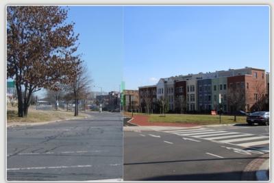
 It's Slider time! It takes a fair amount of work to update the cool little displays of then-and-now photos that allow you to slide a bar back and forth to compare the images, but I have now finished the Herculean task of not only updating *26* existing sliders, but adding 10 new locations to the Slider lineup. (Plus there's all the ones that just didn't need an update this time around.)
Below are the 10 new angles, and clicking on them takes you to the Photo Archive page for that angle, which will not only allow you to see the Slider but also all of the photos I've taken of that particular angle over the years.
But if you want to play with all 36 new and updated locations at once, go to the Sliders page. From there, if you choose, you can then go to the individual archive pages to see the additional photos.
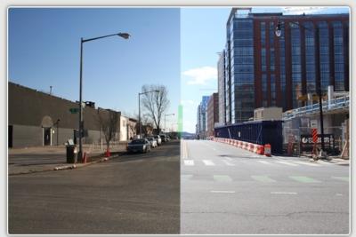
These might be in order of which ones are my favorites--but I'll also bring attention to the 4th and Virginia slider, which does a really good job of showing how Virginia Avenue has been straightened in the wake of the tunnel construction.

Again, the page for all 36 new and updated sliders is here. There's also always a "Sliders" link in the photo box at the top of the home page.
Slide away!
|
Comments (29)
More posts:
Development News, photos
|
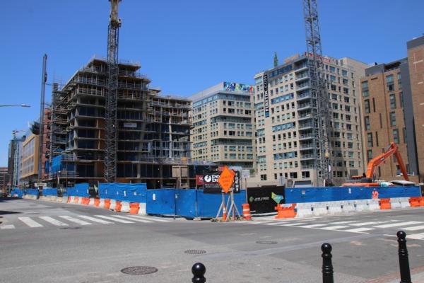
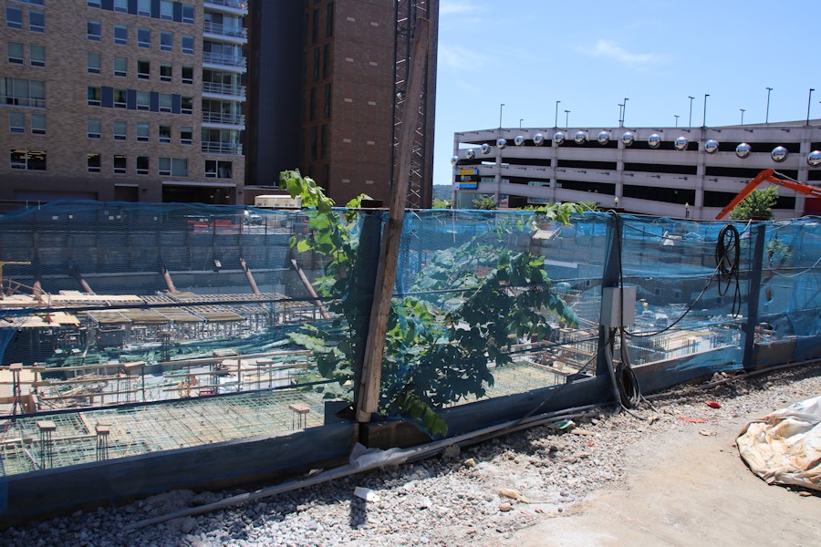
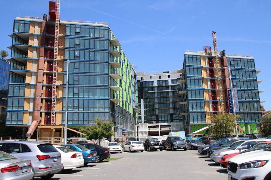
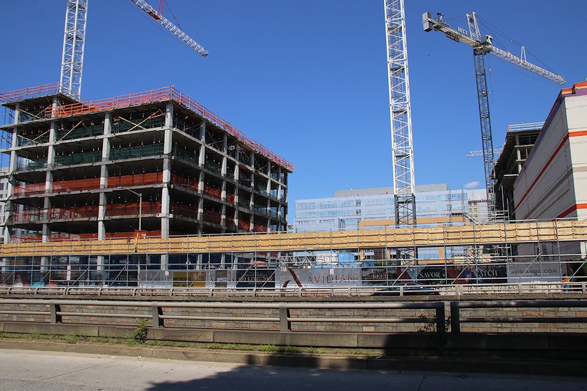
It would be terribly hokey for me to say something along the lines of, "It's almost Halloween, and the neighborhood is appropriately decked out with skeletons." So, I won't. But there is a whole lot of construction going on, counting not only nearly finished buildings, but also buildings getting their faces put on or heading toward topping out or now "going vertical" below ground level.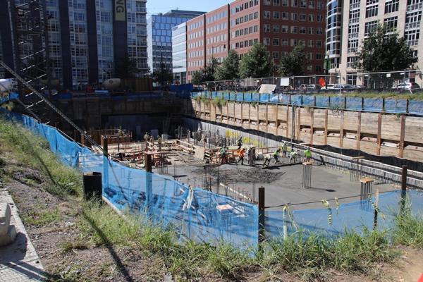


I'll go in order from newest to oldest, starting with peering down into holes that you might not be looking into yourselves.

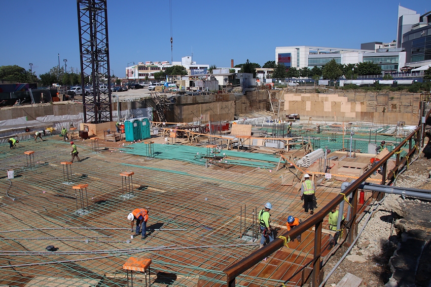

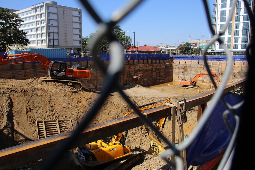
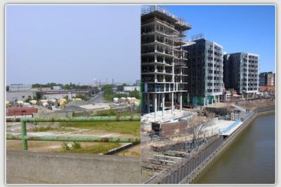
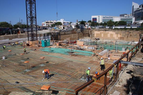
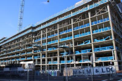
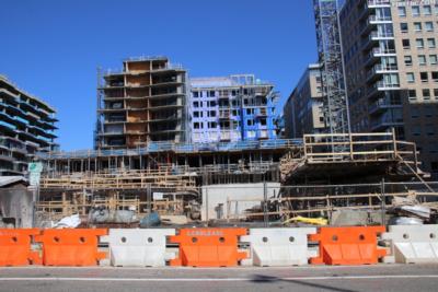
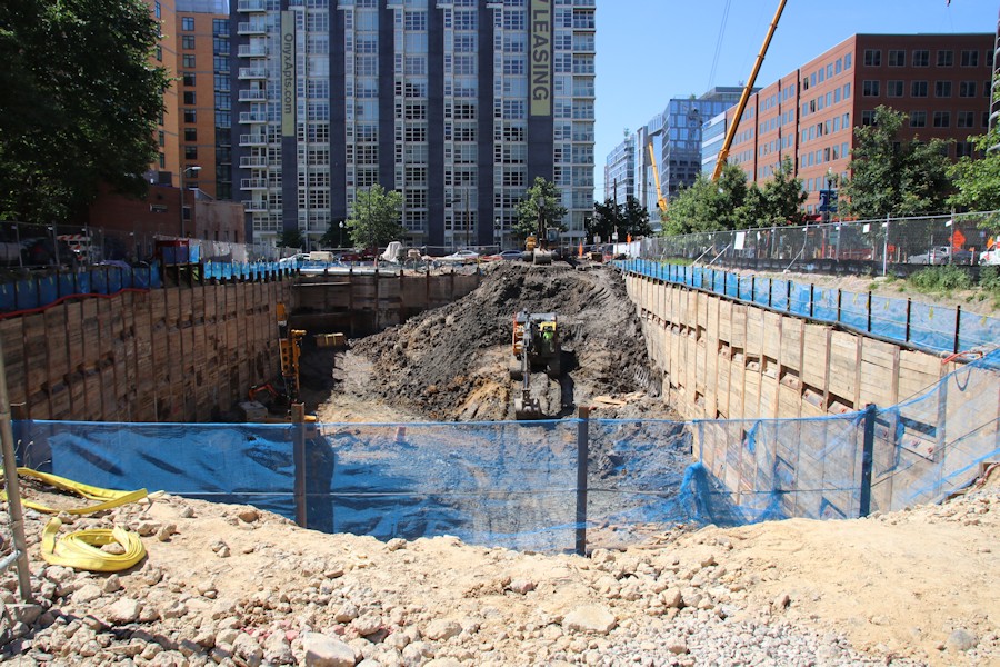
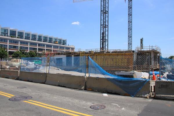
Three residential projects that began excavating in the spring are already starting to climb upward, as you can see in the above photos from 1000 1st Street and the Maren at Florida Rock. Tishman Speyer's mystery residential project that covers all of what's known as Square 696 is a hybrid, with some excavation still underway while the eastern half is now starting to rise. (and no, we still don't have renderings.) Then there's phase two of One Hill South (Two Hill South? One Hill South Two? Return of One Hill South? One Hill South, Electric Boogaloo?), where digging is being hampered by complaints of fumes emanating from the site's past life as a gas station.
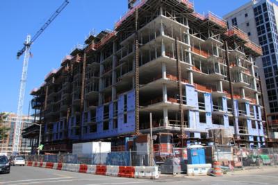
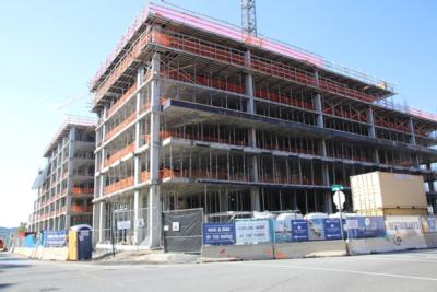
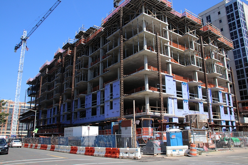
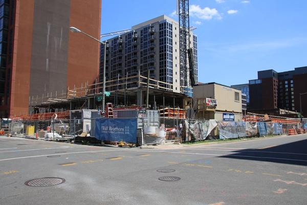
Next we turn to the neighborhood's EIGHT projects that are above ground but not yet topped out. (I could call it six, since there are two projects with two buildings going up concurrently, but let's call an eight an eight.)
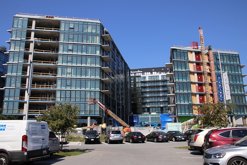
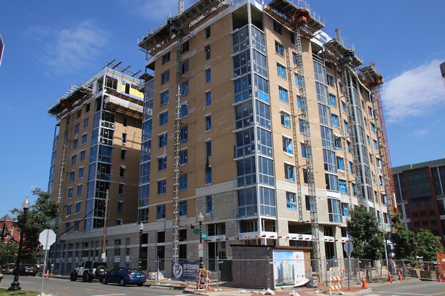
Let's start with residential projects The Garrett at 2nd and I, Parc Riverside Phase II at Half and L, and the second phase of Novel South Capitol at 4 I, which was kind of a shocker to see go up since it was never really announced that the entire project would be under construction at once:


I'll note that the photo of the Garrett is a bit of a triumph, because it's the first one I've gotten from the northeast, now that the wrapping up of tunnel construction has given me some sidewalk access to the intersection at 2nd and H. (Which hopefully will be open completely by Oct. 18, the Whole Foods Day of All Days.)
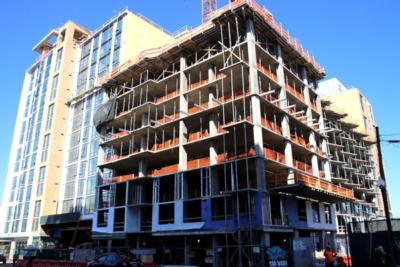
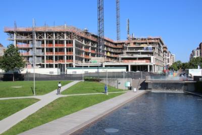
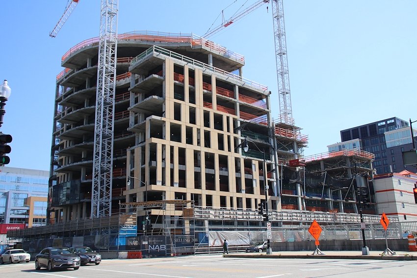
Next, let's wander down to the Ballpark District, where the National Association of Broadcasters headquarters is a whisker away from topping out and its sibling the Avidian condo building is now well visble. One block away, 1250 Half is in its final minutes of not being completely above ground, as the portion closer to N Street is now right even with the street, while its northern portion has been skeletoning for quite some time. And at 3rd and Tingey, the combo project of the Thompson hotel and the Estate apartment building are beginning to change the feel of the western side of the Yards Park.

{Pant, pant.}
Now, a quick look at the buildings getting their faces on, since this is the stage when everyone is pretty much tapping their toes and waiting for the projects to be finished already. (There's a section of Virginia Avenue that qualifies for that, too.) May I present West Half at Half and N, the Harlow mixed-income building at 3rd and L, the Bower/Guild condo/rental buildings, and the new DC Water headquarters.

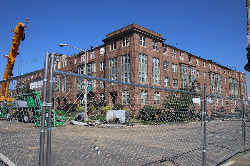
To wrap it up, there's one additional ghostly building to keep an eye on, though I don't wish to be flippant about it. Ward 6 councilmember Charles Allen is holding a hearing on Oct. 25 about the fire and response, for those interested.

And that's "it." Ha. Ha. I imagine the next major update will be in December, when I will spend most of the time complaining about how the low sun angle and a decade's worth of construction has made it impossible to take photos unruined by shadows. I may have to (gasp!) go out on cloudy days until spring.
|
Comments (60)
More posts:
10001st, 1250 Half St., Novel South Capitol, One Hill South, Avidian Condos, Capper, Capper Senior Apt Bldgs, Development News, Florida Rock, The Garrett Apts., Maren Apts., Nat'l Assoc of Broadcasters HQ, photos, WC Smith/Square 737, The Harlow/Capper, Square 696 Residential, Parc Riverside Apts, DC Water (WASA), West Half St., Thompson Hotel/Estate Apts./Yards, Bower Condos/Guild Apts/Yards
|
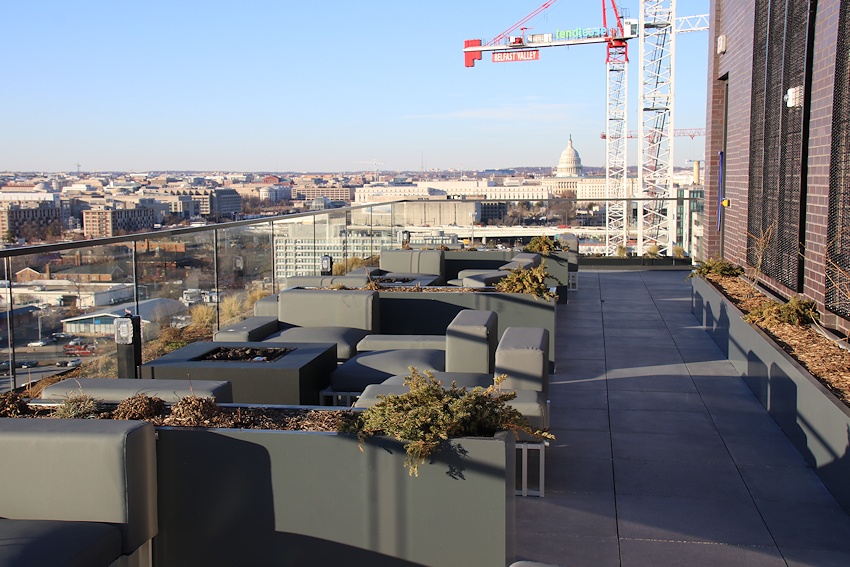
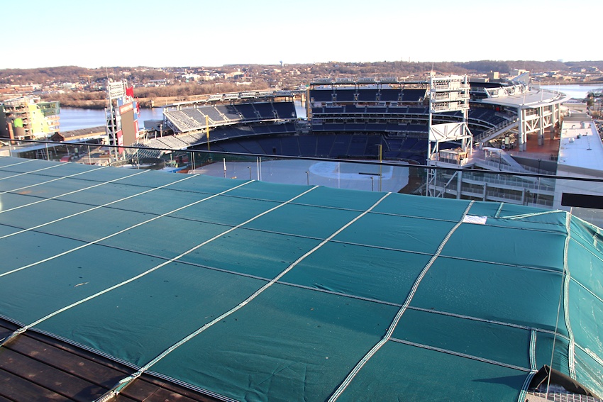
Going to be a pretty Nats Park-centric bunch of posts in the next few days thanks to All-Star Fever, so I thought I'd start off with a bit of a look back, while looking out.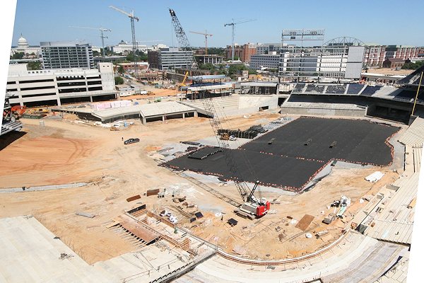
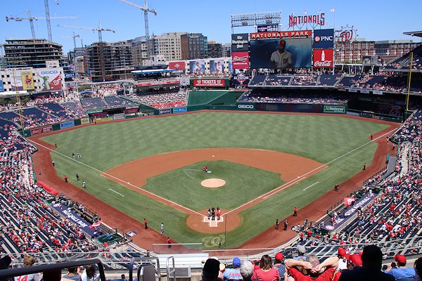
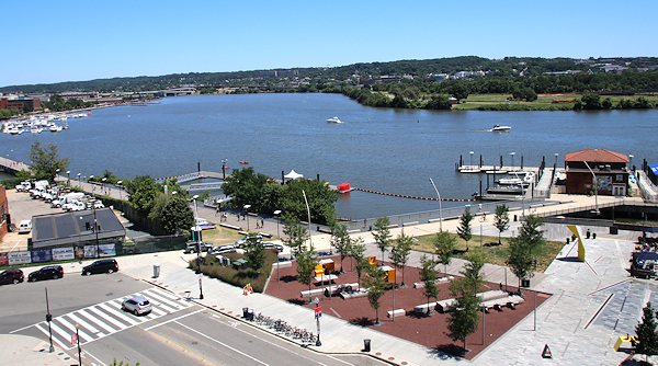
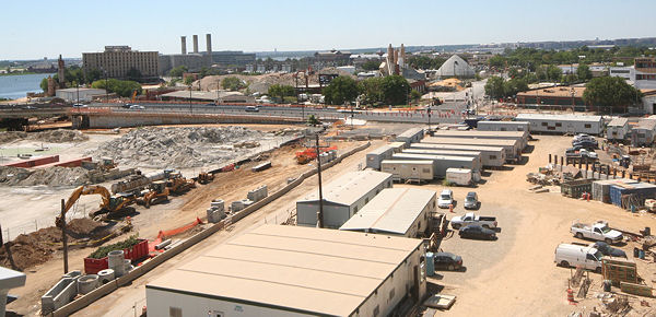
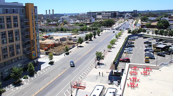
This weekend I brought the JDLand camera to a ballgame for the first time in a while, and spent much of the time wandering from vantage point to vantage point to take pictures. It's really hard for me to believe that it's been nearly 11 years since I first was shepherded up to the upper concourse and out onto various viewing platforms, with someone holding the back of my jacket while I shot because the railings weren't in place yet.
The obvious skyline view, of the buildings now going up along Half Street and N Street, is the subject of much discussion these days (Lookit tthe cranes! Why did they allow them to block the dome? What about the parking garages?), but I also have great fondness for the viewing platform on the southeast side. So here's a quick sampling (click to enlarge):
If you want to see many more photos from these vantage points, dig deep down into the site for my Overhead Photos gallery, and choose either Ballpark, Southeast Viewing Platform, or Northwest Viewing Platform.
|
Comments (3)
More posts:
Development News, photos, Nationals Park
|
In the past few posts I've shown you the neighborhood's newest skeletons/skeletons to be, I've shown you buildings that are topped out but still getting exterior work done, and holes in the ground, and I know you are long since bored of this stretch of posts, but I will still do one more, looking at two projects that between them are managing to fall into all categories at once. 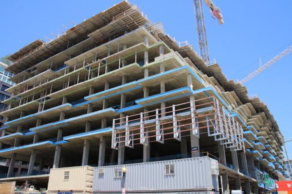


Plus, they are probably the two most watched projects in the neighborhood at the moment.
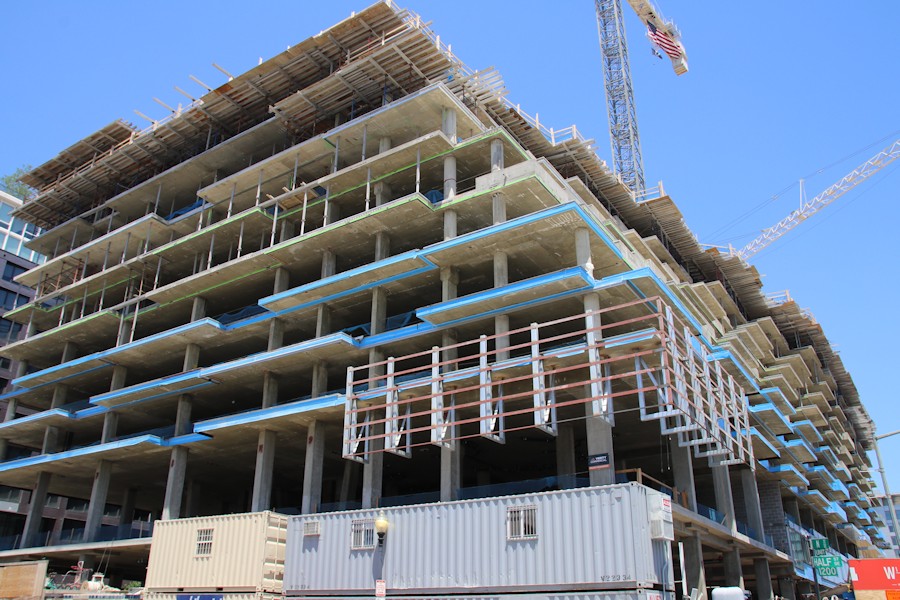
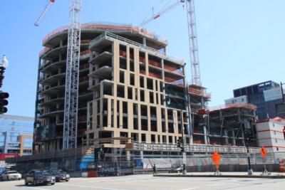
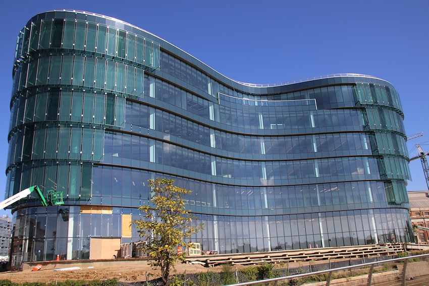
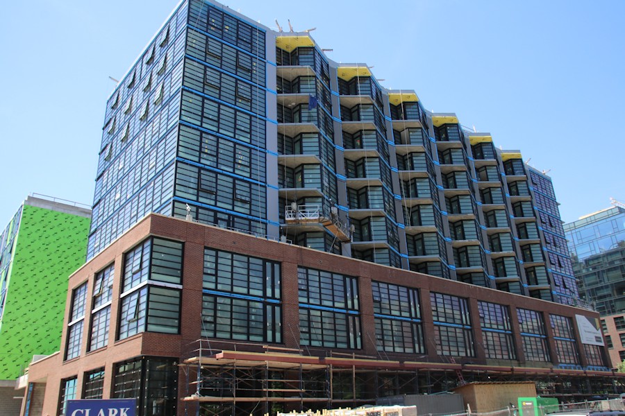
These are two views of JBG Smith's West Half 420-unit residential development, which, if I can count floors correctly, is still not yet topped out, but which, as seen in the second photo, is already hanging glass on the lower floors, presumably to protect the spaces from the roving gangs of All-Star hooligans that will descend next month. I think both photos do a good job of showing the very unique structure of this building, as it appears from the north to be funneling down into the ballpark. It also looks like the corner of the building facing the ballpark is prepped to have some signage hung. Digital? Temporary? Permanent? We Shall See! This building is expected to have about 65,000 square feet of retail on its first two floors.
And, across the way, we have:
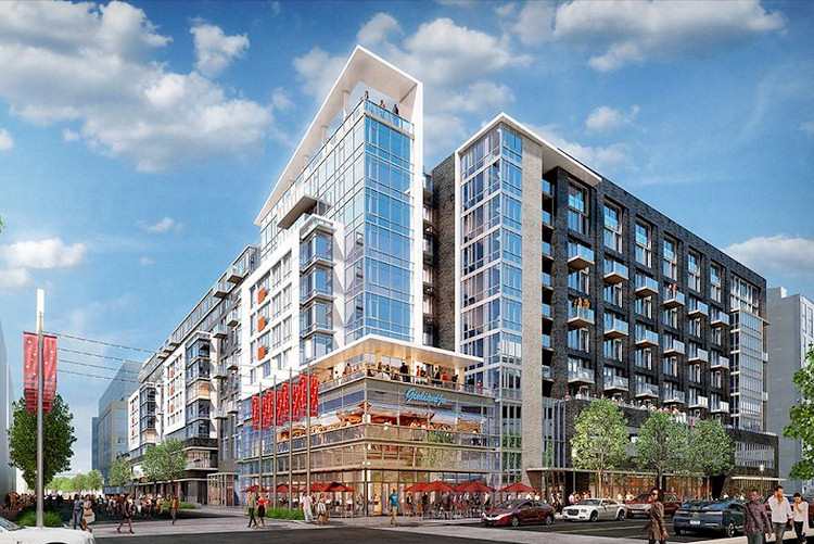
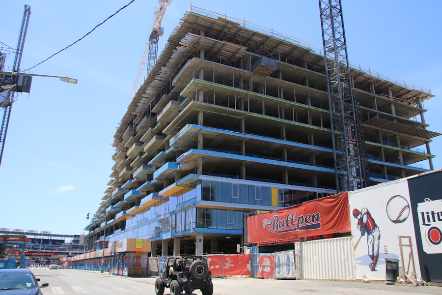
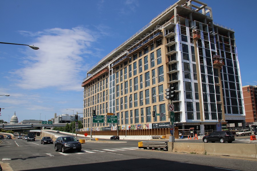
The east side of the street will be home to 1250 Half Street, a residential project that is both a nearly topped-out skeleton (on the north end of the site) and a still-not-yet-out-of-the-ground hole to peer into (on the south end of the site). It is actually all one building, it's just that the foundation was built on the north end back when Monument Realty had plans to develop the rest of the block as it was building the 55 M office building, before, well, you know, Things Happened. So this allowed Jair Lynch Development Partners to plow ahead with above-ground work there while prepping the rest of the former Monument Valley hole to go vertical. This building will have as many as 440 rental units and over 60,000 square feet of retail (including anchor tenant Punch Bowl Social) when it's finished, though I should note that it is going to be completed in two phases, with construction of the phase two "boutique residential building" facing N Street coming later.
And here's what both will look like to people exiting the ballpark when they are finished.
Which is a little different from:
With that, I am done running down all of the latest construction statuses (statusi?). If you are worn out, don't blame me, blame the SEVENTEEN separate construction projects underway (19 if you include the Virginia Avenue Tunnel and the new South Capitol Street bridge).
|
Comments (12)
|
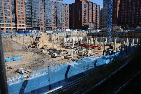
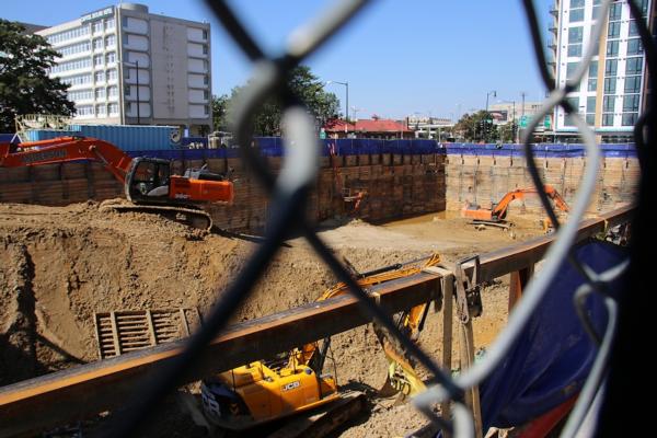
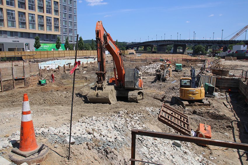
I'll make this one a little more succinct. These are holes. They are all holes being dug for new residential buildings. There may be two additional holes by the end of the year. 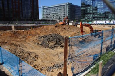
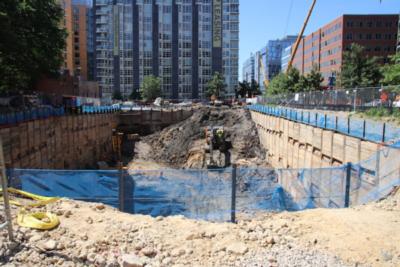
May I present to you the residetial projects of: Square 696, 1000 1st Street, and the Maren. Check the project pages for details.

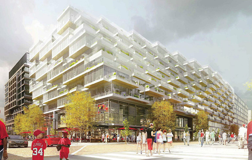
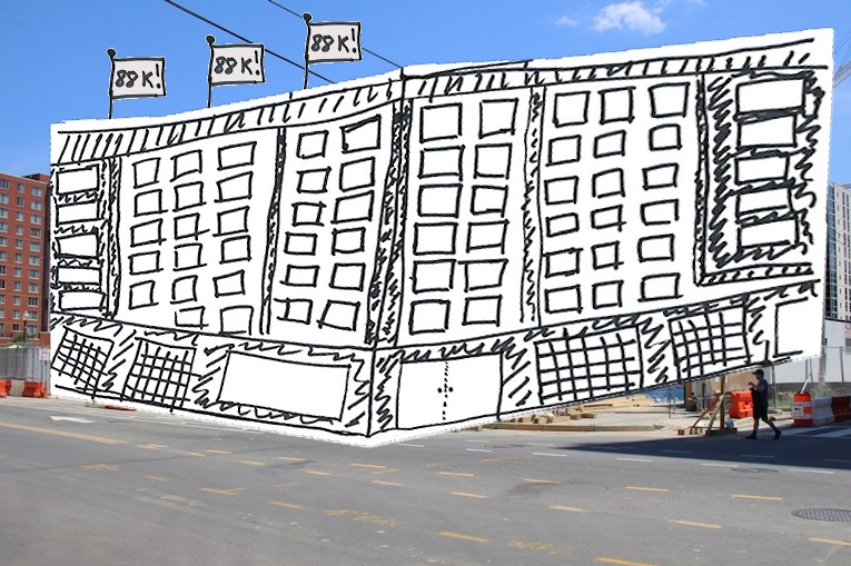
And, speaking of Square 696, there still are no publicly available renderings for this 800-unit two-phase residential project by Tishman Speyer. So, you know what that means....
|
Comments (3)
More posts:
10001st, 71potomac, Development News, Florida Rock, photos, sq740, Square 696 Residential
|
Having talked you through the tour of new skeletons, I'll now move to the buildings that have been topped out for a while and are getting their faces on. as I like to say.


* At left, we have what is now known as "Novel South Capitol," previously known as 2 I Street, aka The Building That Took Away McDonald's and Broke JD's Heart. And, as a tidbit for loyal readers who actually read what I write in this posts, I see an approved building permit for phase two of this project, at 4 I Street. (There's a reference in the permit to a name "Velocity"--I assume someone will point out the error of that at some point.) This first phase is a 380-unit apartment building.
* At right, we have the still-as-yet-unnamed mixed-income apartment building at 2nd and L, just a few steps from Canal Park. It is slated to 179ish units, of which 36 will be for public housing residents. This building is part of the huge Capper/Carrollsburg redevelopment, and may before long have DDOT as a sibling on the south side of that block. It's also supposed to have a small amount of retail in the portion of the ground floor that faces the park.
But wait, there's more!
*Transition from beige brick to red brick, we have the latest look at the Bower, the 138-unit condo building at 4th and Tingey in the Yards. This photo is taken from its east side, at what will be a new intersection of 5th and Tingey. And behind the Bower, where you see the green wall covering, we have...
* The Guild (at least we think it's going to be called the Guild), the 190-unit rental building that is actually two parallel towers that run north/south behind the Bower, as more clearly seen in the middle photo. There will be a new block of Water Street running between the Guild and the parking lot, hooking up with the new 5th Street to the east.
* Lastly, I decided to toss in a photo of the back of the new DC Water headquarters, to not only show how the new building wraps around the existing (and still operational) O Street pumping station, but how the back of the building now has colored panels that mimic the front's glass, so that it isn't the stark green monolith that had people a little nervous a few months ago.
Head to the project pages of each of these buildings to see more before and afters, renderings, sliders, and whatnot.
Coming next, a look at two projects that are refusing to adhere to my facile skeletons/facings/holes construct.
|
Comments (9)
More posts:
Novel South Capitol, Development News, photos, The Harlow/Capper, DC Water (WASA), The Yards, Bower Condos/Guild Apts/Yards
|
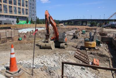
It took 27,000 steps and 1,600 photos for me to thoroughly photograph the status of the neighborhood's current construction projects--but I was up to the task, albeit with a necessary moment of refueling. 

But there's no way that these seventeen projects can be well surveyed in one post, so let's start with the five projects now that have arrived above the fence line or right at it in the past few weeks:
* First up is the one that's probably making the biggest splash, which is the new National Association of Broadcasters HQ at South Capitol and M. (Its sibling, the Avidian condo building, isn't quite keeping up, and is still below the fence line.)
* Meanwhile, up at Half and K, It's taken a while but the second phase of the Parc Riverside apartments is now visible from street level as well.
* Trekking over to the Yards, the Thompson Hotel on the south side of Tingey Street is visible, while *its* sibling, the 227-unit apartment building apparently dubbed The Estate, has rebar juuuuuuust poking up above the fence line, but not obvious enough to bother with a photo. (See, I'm not COMPLETELY OCD about this.)
* The last new arrival, the third portion of "The Collective" group of apartments known as the Garrett, is past the fences.
Stay tuned for more.
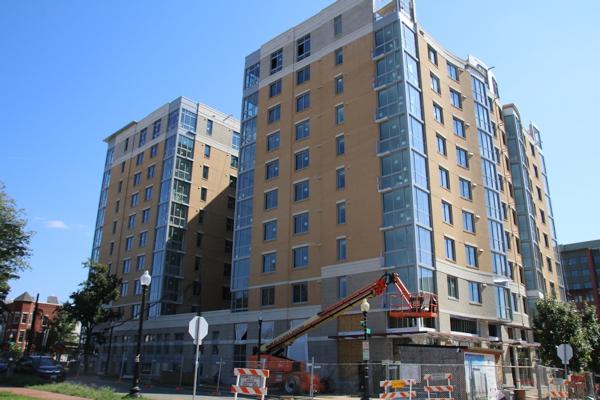
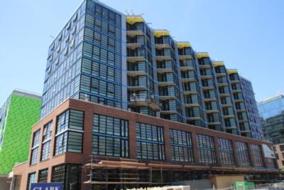
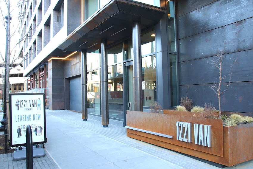 Getting in just under the wire before my assignment to the 60-day disabled list, the JDLand camera and I made a visit on Monday to 1221 Van, the 290-unit apartment building at South Capitol and N, immediately north of Nats Park.
Many photos were taken, and the most informative of them are in this photo gallery, but a sampling of the offerings are included below.
The official web site has more details on the building and its amenities, as well as the floor plans page that is filterable by price, size, etc. The monthly rents range from $1,725 for the smallest studio to $3,600 and up for penthouse-level 2BR/2.5 BA units (including a 1,638-square-foot unit for $8,200, at least according to their web site).
The building has more than 20,000 square feet of retail, and word came out in late January that Mission Dos will be taking the two-story corner space at Van and N.
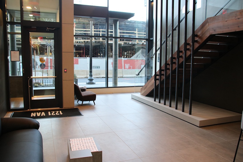
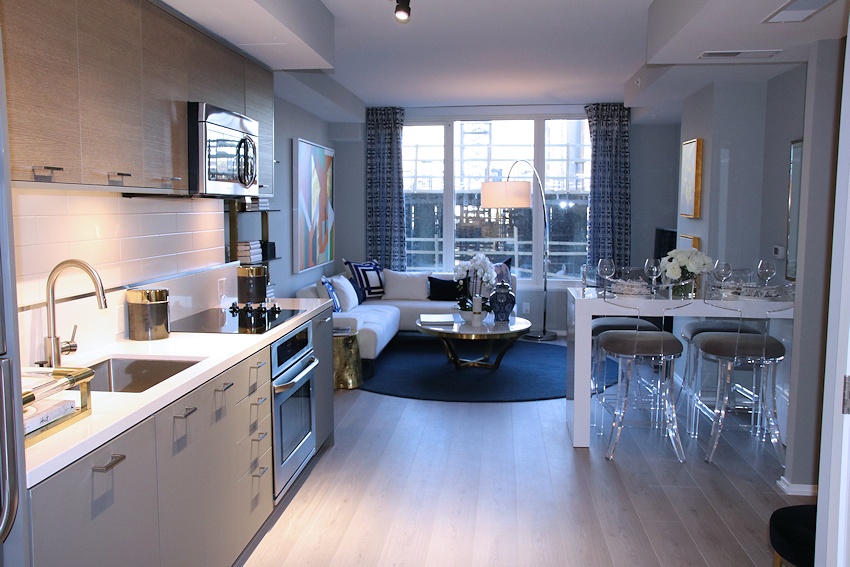
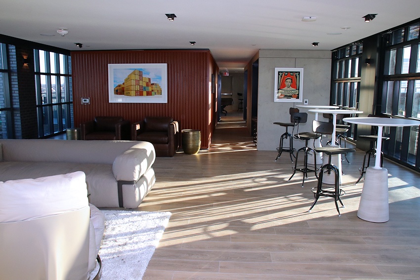
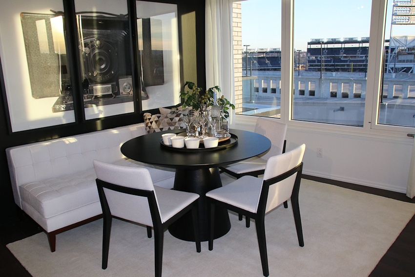
But really, go check out the full gallery, which has many more photos.
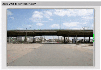
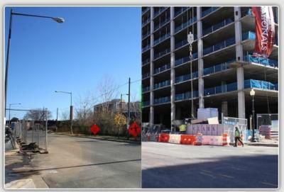
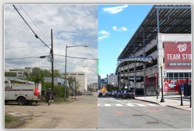
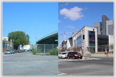
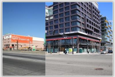
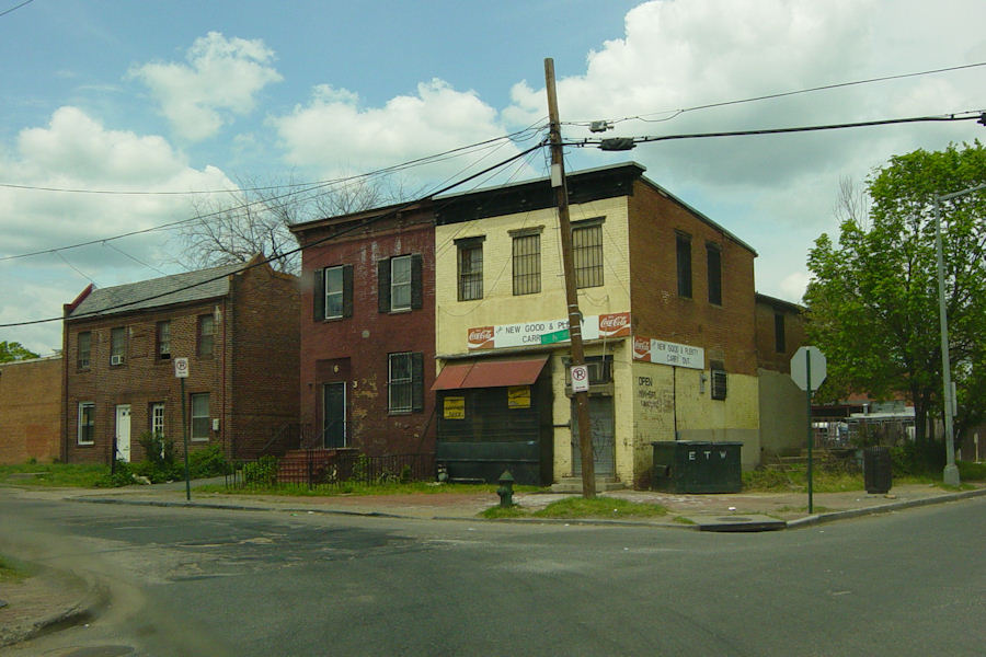
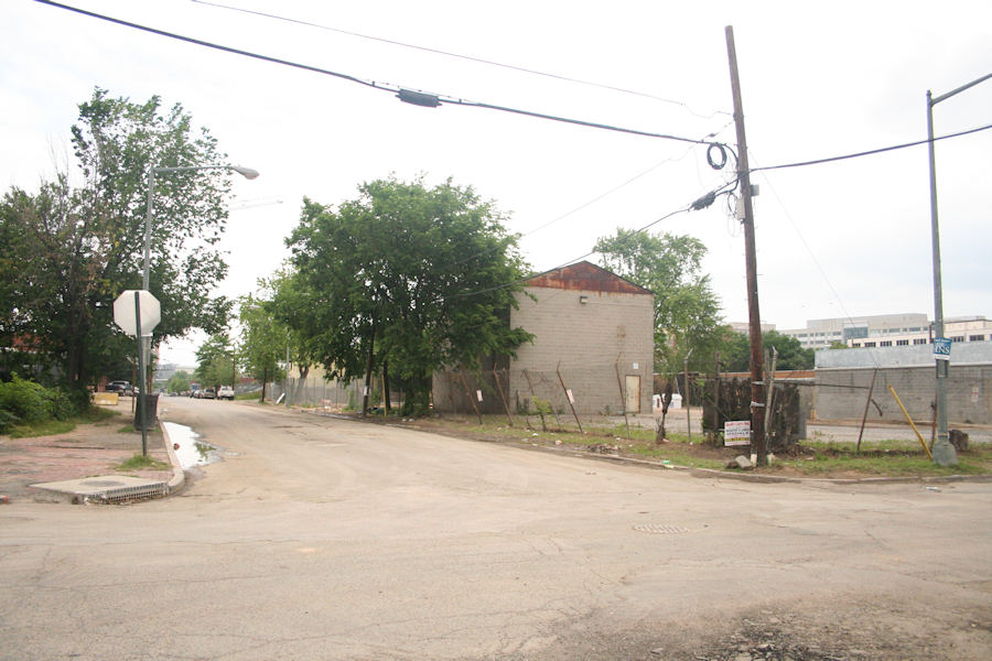
With this, 1221 Van becomes the 45th project to be completed since I started watching the neighborhood 15 years ago, and the sixth within the past twelve months. So here's a final before-and-after, showing what corner of South Capitol and N looked like up until early 2007, and now:
And now I shall go silent for a bit as I get my hip socket resewn and shaved (not replaced!--yet), but hopefully I will doing some housebound blogging before too long. Might be a while before I take any new photos, since the JDLand camera has in its contract that it does not risk its life for use while on crutches. UPDATE: But I should have noted to keep an eye on my Twitter feed, where it's easier for me to pass along quick updates (like this morning's retweet that apparently the Five Guys is "closed for renovations" again, until baseball season).
|
Comments (36)
More posts:
1221 Van, Development News, photos
|