
|
| |||||||||||||||||||

|
Please note that JDLand is no longer being updated.
peek >>
Developer: Forest City Washington/GSA | Yards Park Official Web Site
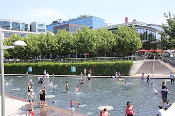
Yards Park Ribbon Cutting (9/7/10)
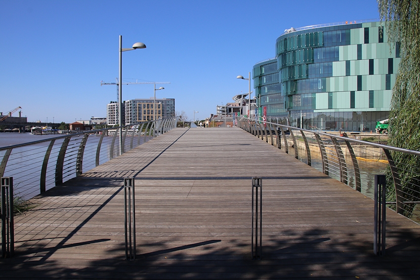
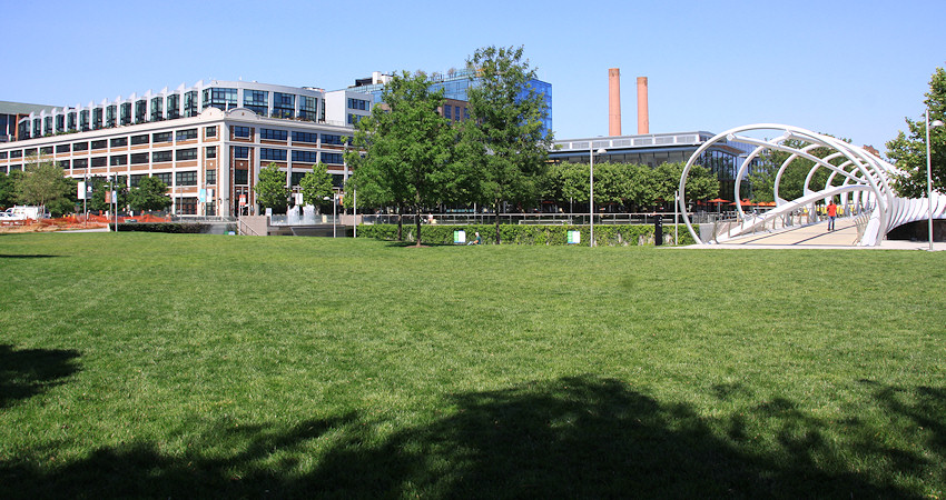
The Yards: Yards Park
A 5.8-acre park along the Anacostia River; construction begun in 2008, officially opened Sept. 7, 2010
Developer: Forest City Washington/GSA | Yards Park Official Web Site
Yards Park Ribbon Cutting (9/7/10)
- Full Neighborhood Development MapThere's a lot more than just the projects listed here. See the complete map of completed, underway, and proposed projects all across the neighborhood.
- What's New This YearA quick look at what's arrived or been announced since the end of the 2018 baseball season.
- Food Options, Now and Coming SoonThere's now plenty of food options in the neighborhood. Click to see what's here, and what's coming.
![-]()
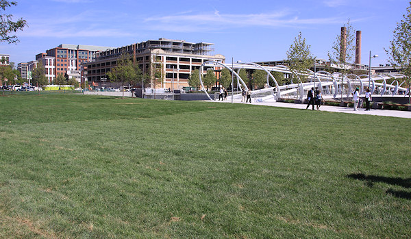
- Anacostia RiverwalkA bridge between Teague and Yards Parks is part of the planned 20-mile Anacostia Riverwalk multi-use trail along the east and west banks of the Anacostia River.
![-]()
- Virginia Ave. Tunnel ExpansionConstruction underway in 2015 to expand the 106-year-old tunnel to allow for a second track and double-height cars. Expected completion 2018.
![-]()
- Rail and Bus Times
Get real time data for the Navy Yard subway, Circulator, Bikeshare, and bus lines, plus additional transit information. - Rail and Bus Times
Get real time data for the Navy Yard subway, Circulator, Bikeshare, and bus lines, plus additional transit information. - Canal ParkThree-block park on the site of the old Washington Canal. Construction begun in spring 2011, opened Nov. 16, 2012.
![-]()
- Nationals Park21-acre site, 41,000-seat ballpark, construction begun May 2006, Opening Day March 30, 2008.
![-]()
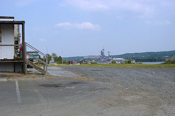
- Washington Navy YardHeadquarters of the Naval District Washington, established in 1799.
![-]()
- Yards Park5.5-acre park on the banks of the Anacostia. First phase completed September 2010.
![-]()
- Van Ness Elementary SchoolDC Public School, closed in 2006, but reopening in stages beginning in 2015.
![-]()
- Agora/Whole Foods336-unit apartment building at 800 New Jersey Ave., SE. Construction begun June 2014, move-ins underway early 2018. Whole Foods expected to open in late 2018.
![-]()
- New Douglass BridgeConstruction underway in early 2018 on the replacement for the current South Capitol Street Bridge. Completion expected in 2021.
![-]()
- 1221 Van290-unit residential building with 26,000 sf retail. Underway late 2015, completed early 2018.

- NAB HQ/AvidianNew headquarters for National Association of Broadcasters, along with a 163-unit condo building. Construction underway early 2017.

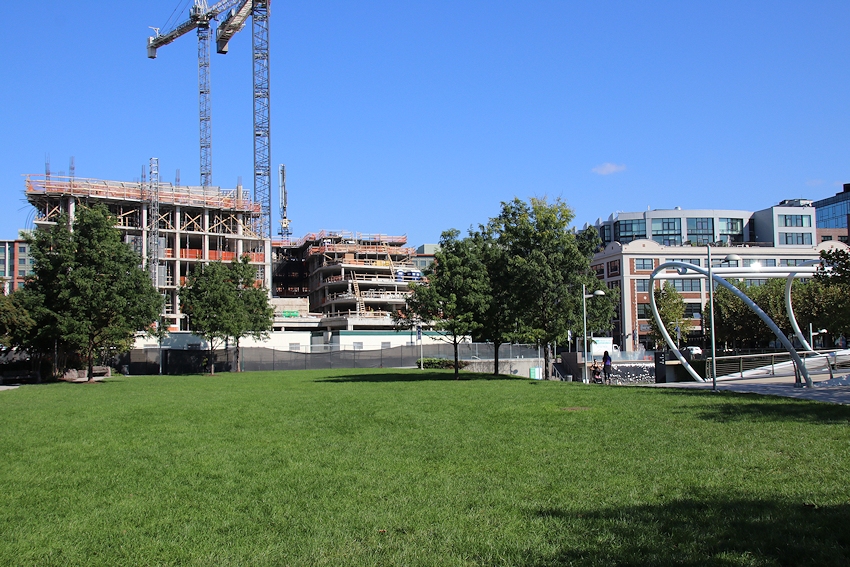
- Yards/Parcel O Residential ProjectsThe Bower, a 138-unit condo building by PN Hoffman, and The Guild, a 190-unit rental building by Forest City on the southeast corner of 4th and Tingey. Underway fall 2016, delivery 2018.

- New DC Water HQA wrap-around six-story addition to the existing O Street Pumping Station. Construction underway in 2016, with completion in 2018.

- The Harlow/Square 769N AptsMixed-income rental building with 176 units, including 36 public housing units. Underway early 2017, delivery 2019.

- West Half Residential420-unit project with 65,000 sf retail. Construction underway spring 2017.
![-]()
- Novel South Capitol/2 I St.530ish-unit apartment building in two phases, on old McDonald's site. Construction underway early 2017, completed summer 2019.
![Novel South Capitol]()
- 1250 Half/Envy310 rental units at 1250, 123 condos at Envy, 60,000 square feet of retail. Underway spring 2017.
![-]()
- Parc Riverside Phase II314ish-unit residential building at 1010 Half St., SE, by Toll Bros. Construction underway summer 2017.
![-]()
- 99 M StreetA 224,000-square-foot office building by Skanska for the corner of 1st and M. Underway fall 2015, substantially complete summer 2018. Circa and an unnamed sibling restaurant announced tenants.
![-]()
- The Garrett375-unit rental building at 2nd and I with 13,000 sq ft retail. Construction underway late fall 2017.
![-]()
- Yards/The Estate Apts. and Thompson Hotel270-unit rental building and 227-room Thompson Hotel, with 20,000 sq ft retail total. Construction underway fall 2017.
![-]()
- Meridian on First275-unit residential building, by Paradigm. Construction underway early 2018.
![-]()
- The Maren/71 Potomac264-unit residential building with 12,500 sq ft retail, underway spring 2018. Phase 2 of RiverFront on the Anacostia development.
![-]()
- DC Crossing/Square 696Block bought in 2016 by Tishman Speyer, with plans for 800 apartment units and 44,000 square feet of retail in two phases. Digging underway April 2018.
![DC Crossing]()
- One Hill South Phase 2300ish-unit unnamed sibling building at South Capitol and I. Work underway summer 2018.
![One Hill South Phase 2]()
- New DDOT HQ/250 MNew headquarters for the District Department of Transportation. Underway early 2019.
![New DDOT HQ]()
- 37 L Street Condos11-story, 74-unit condo building west of Half St. Underway early 2019.
![37 L Condos]()
- CSX East Residential/Hotel225ish-unit AC Marriott and two residential buildings planned. Digging underway late summer 2019.
![CSX East Residential/Hotel]()
- 1000 South Capitol Residential224-unit apartment building by Lerner. Underway fall 2019.
![1000 South Capitol Residential]()
- Capper Seniors 2.0Reconstruction of the 160-unit building for low-income seniors that was destroyed by fire in 2018.
![1000 South Capitol Residential]()
- Chemonics HQNew 285,000-sq-ft office building with 14,000 sq ft of retail. Expected delivery 2021.
![1000 South Capitol Residential]()


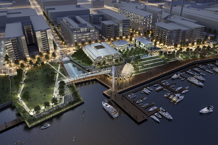
A pre-construction rendering showing an aerial view of the Yards Park at dusk. The "Great Lawn" is the green patch at left, the expanded Canal Basin with its pedestrian bridge is just to the right, the Lumber Shed and its plaza is at top center, and the boardwalk runs across the bottom past marinas and piers and west to Diamond Teague Park. The park officially opened on Sept. 7, 2010.
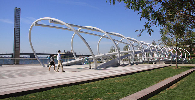
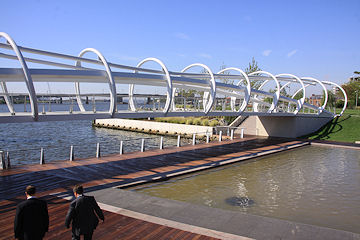
Sept. 7, 2010 - The Pedestrian Bridge and Light Tower, seen at the park's Sept. 7 grand opening. For many more photos from the ribbon cutting, see this Gallery.
Sept. 7, 2010 - What the park's waterfront looked like on its opening day in 2010, back when the Display Ship Barry was still docked up river.
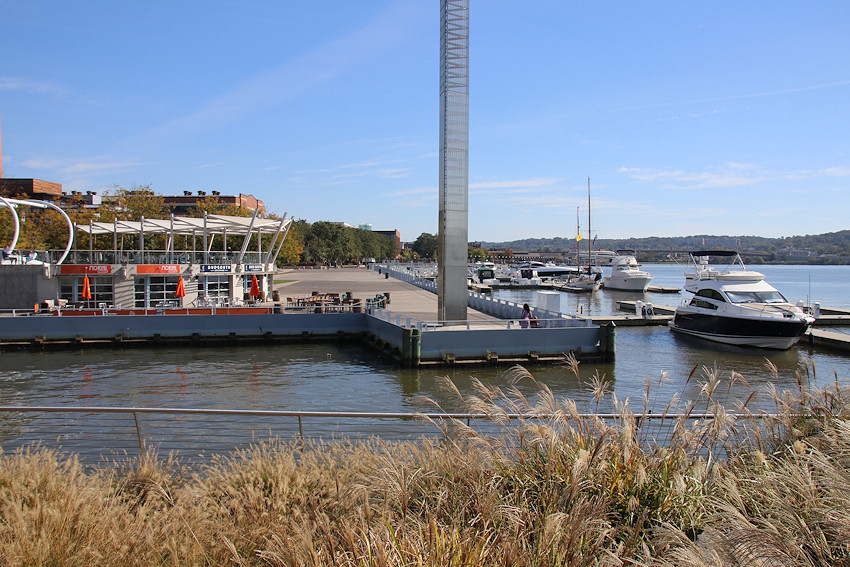
Oct. 22, 2017 - And sort of the same angle, with the Barry gone but with the park's new marina open and the boarddwalk kiosks at last occupied and opened.
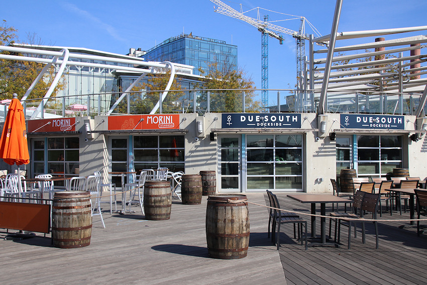
Oct. 22, 2017 - A close-up of Morini Piccolo and Due South Dockside, soon after their debuts.
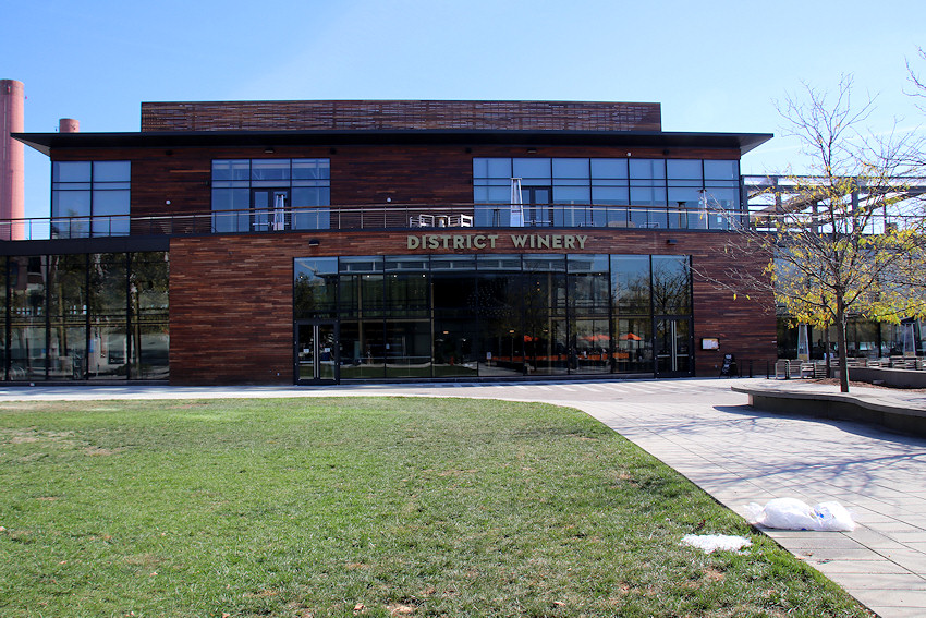
Oct. 22, 2017 - And the District Winery building, not long after it opened in late summer 2017.
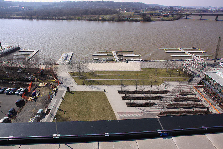
March 7, 2016 - An on-high view of the central area of the Park, seen from Arris, while the marina was still under construction and before District Winery occupied the lower left grassy lot.
A before-and-after-and-after of the park as seen from Poplar Point, looking north up Third Street, SE, first on March 3, 2005 (top), then and Jan. 8, 2012 (middle), then on Feb. 27, 2016 (bottom  ). The large bunnies were a temporary art exhibit, not an invasion. Note the changes to the building housing the Foundry Lofts and the Lumber Shed, along with the arrival of the Arris apartment building. Not to mention the appearance of the US Department of Transportation HQ.
 ). The large bunnies were a temporary art exhibit, not an invasion. Note the changes to the building housing the Foundry Lofts and the Lumber Shed, along with the arrival of the Arris apartment building. Not to mention the appearance of the US Department of Transportation HQ.
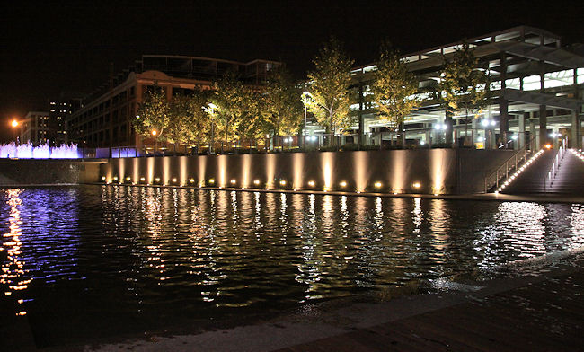
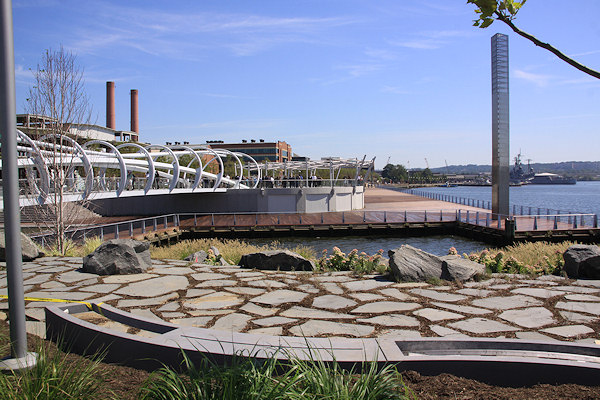
Sept. 24, 2010 - A nighttime shot at the park, showing the canal basin, the Lumber Shed, and the ghostly presence of the Foundry Lofts building. For more nighttime shots of the park, see this gallery.
A view from the overlook toward the open grass and boardwalk. (8/27/10)
Sept. 7, 2010 - Standing on the Great Lawn the day of the park's opening, looking back toward the Canal Basin and the Foundry Lofts.
 Sept. 29, 2018 - And a tighter view of the same spot eight years later, showing the completed work on the Foundry Lofts and the construction on "The Estate."
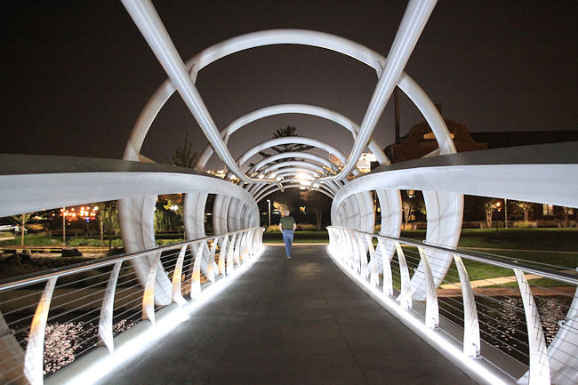
Walking on the bridge at night. For more nighttime shots of the park, see this gallery. (9/24/10)
Nov. 25, 2011 - In late 2011, the bridge connecting Yards Park with Diamond Teague Park and Nationals Park opened. (See a gallery of photos of the new bridge.)
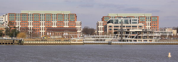
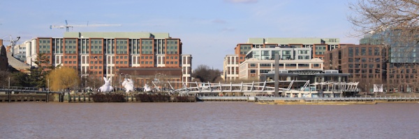
 Sept. 29, 2018 - And the same view more than six years later, with the new DC Water headquarters and the Dock 79 apartment building changing the horizon.
Aug. 6, 2005 - A "before" view of the park's footprint along 3rd Street south of Water, in August 2005.
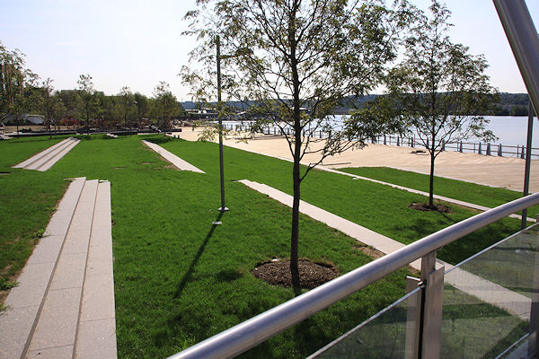
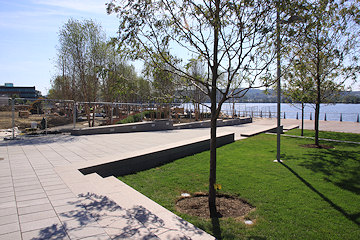
May 19, 2019 - The same location, now known as the Third Street Plaza. For many more before-and-afters in the park, see the Expanded Archive.
Aug. 6, 2005 - Turning around and looking north up Third Street from south of what would become Water Street, in 2005.
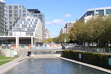
Nov 3, 2019 - The same location, showing off the canal basin, the waterfall, and the fountains at the Third Street Plaza.
July 17, 2008 - The riverfront near the bulkhead, before.
Sept. 7, 2010 - A similar view of the same location, with the park completed.
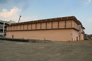
July 17, 2008 - The historic Lumber Storage Shed, built in the 1930s and showcasing its decidely non-historic salmon-colored tin exterior.
May 19, 2019 - A similar view, with the shed long since de-skinned and now open as a retail pavilion. (More details here.)
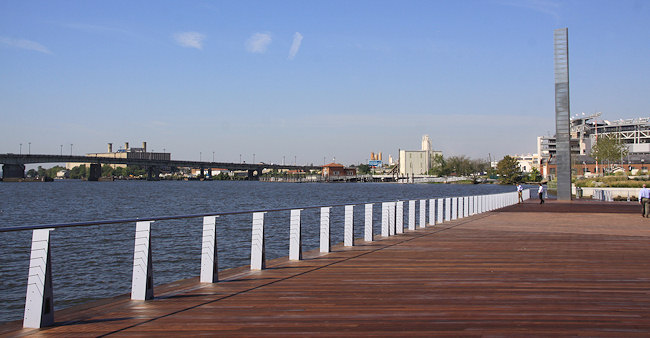
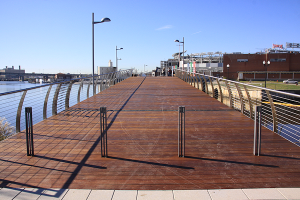
The boardwalk and the light tower, looking toward Diamond Teague Park and the Florida Rock site and the Douglass Bridge (and Buzzard's Point in Southwest) in the distance. (9/7/10)
Looking at the park footprint from the southeast viewing platform at Nationals Park, first on 9/1/07 while the stadium was in under construction, and then at the end of the ballpark's third season, a few weeks after the Yards Park opened. (9/25/10)
June 9, 2016 - A slightly shifted angle of the same location, not quite six years later, with the Foundry Lofts' renovation long since complete and Arris now finished next door.
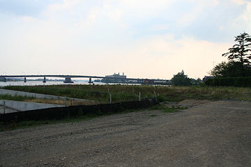
Standing south of the axis of Fourth Street, looking east toward the Navy Yard and the Display Ship Barry, in 2005. (8/6/05)
The same location, with the location known as the "Virginia Avenue Gardens" getting some down-to-the-wire work done just before the park's opening. (9/7/10)
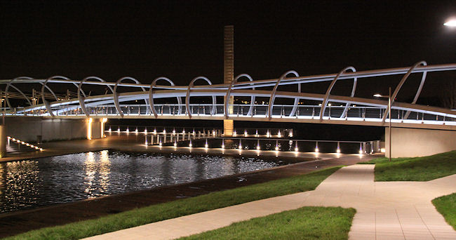
Another nighttime look at the park, showing the canal basin, the pedestrian bridge, and the light tower. For more shots of the park after dark, see this gallery. (9/24/10)
Latest News
July 18, 2020
Roundup of Some Recent Retail and Public Space Items
October 23, 2017
A Visual Catching Up on the Latest Goings-On
October 17, 2016
District Winery Popping Up, Parcel O Digging Down
June 21, 2016
Yards Marina Grand Opening on Sunday, June 26
February 23, 2016
Zoning Commission Gives Approval to District Winery Design
February 21, 2016
Light Yards: Light-Themed Art Installation Through March 6