
|
| |||||||||||||||||||

|
Please note that JDLand is no longer being updated.
- Full Neighborhood Development MapThere's a lot more than just the projects listed here. See the complete map of completed, underway, and proposed projects all across the neighborhood.
- What's New This YearA quick look at what's arrived or been announced since the end of the 2018 baseball season.
- Food Options, Now and Coming SoonThere's now plenty of food options in the neighborhood. Click to see what's here, and what's coming.
![-]()
- Anacostia RiverwalkA bridge between Teague and Yards Parks is part of the planned 20-mile Anacostia Riverwalk multi-use trail along the east and west banks of the Anacostia River.
![-]()
- Virginia Ave. Tunnel ExpansionConstruction underway in 2015 to expand the 106-year-old tunnel to allow for a second track and double-height cars. Expected completion 2018.
![-]()
- Rail and Bus Times
Get real time data for the Navy Yard subway, Circulator, Bikeshare, and bus lines, plus additional transit information. - Rail and Bus Times
Get real time data for the Navy Yard subway, Circulator, Bikeshare, and bus lines, plus additional transit information. - Canal ParkThree-block park on the site of the old Washington Canal. Construction begun in spring 2011, opened Nov. 16, 2012.
![-]()
- Nationals Park21-acre site, 41,000-seat ballpark, construction begun May 2006, Opening Day March 30, 2008.
![-]()
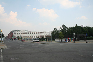
- Washington Navy YardHeadquarters of the Naval District Washington, established in 1799.
![-]()
- Yards Park5.5-acre park on the banks of the Anacostia. First phase completed September 2010.
![-]()
- Van Ness Elementary SchoolDC Public School, closed in 2006, but reopening in stages beginning in 2015.
![-]()
- Agora/Whole Foods336-unit apartment building at 800 New Jersey Ave., SE. Construction begun June 2014, move-ins underway early 2018. Whole Foods expected to open in late 2018.
![-]()
- New Douglass BridgeConstruction underway in early 2018 on the replacement for the current South Capitol Street Bridge. Completion expected in 2021.
![-]()
- 1221 Van290-unit residential building with 26,000 sf retail. Underway late 2015, completed early 2018.

- NAB HQ/AvidianNew headquarters for National Association of Broadcasters, along with a 163-unit condo building. Construction underway early 2017.

- Yards/Parcel O Residential ProjectsThe Bower, a 138-unit condo building by PN Hoffman, and The Guild, a 190-unit rental building by Forest City on the southeast corner of 4th and Tingey. Underway fall 2016, delivery 2018.

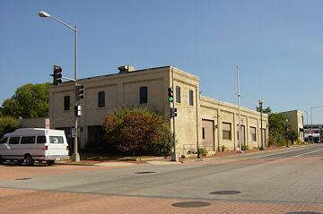
- New DC Water HQA wrap-around six-story addition to the existing O Street Pumping Station. Construction underway in 2016, with completion in 2018.

- The Harlow/Square 769N AptsMixed-income rental building with 176 units, including 36 public housing units. Underway early 2017, delivery 2019.

- West Half Residential420-unit project with 65,000 sf retail. Construction underway spring 2017.
![-]()
- Novel South Capitol/2 I St.530ish-unit apartment building in two phases, on old McDonald's site. Construction underway early 2017, completed summer 2019.
![Novel South Capitol]()
- 1250 Half/Envy310 rental units at 1250, 123 condos at Envy, 60,000 square feet of retail. Underway spring 2017.
![-]()
- Parc Riverside Phase II314ish-unit residential building at 1010 Half St., SE, by Toll Bros. Construction underway summer 2017.
![-]()
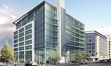
- 99 M StreetA 224,000-square-foot office building by Skanska for the corner of 1st and M. Underway fall 2015, substantially complete summer 2018. Circa and an unnamed sibling restaurant announced tenants.
![-]()
- The Garrett375-unit rental building at 2nd and I with 13,000 sq ft retail. Construction underway late fall 2017.
![-]()
- Yards/The Estate Apts. and Thompson Hotel270-unit rental building and 227-room Thompson Hotel, with 20,000 sq ft retail total. Construction underway fall 2017.
![-]()
- Meridian on First275-unit residential building, by Paradigm. Construction underway early 2018.
![-]()
- The Maren/71 Potomac264-unit residential building with 12,500 sq ft retail, underway spring 2018. Phase 2 of RiverFront on the Anacostia development.
![-]()
- DC Crossing/Square 696Block bought in 2016 by Tishman Speyer, with plans for 800 apartment units and 44,000 square feet of retail in two phases. Digging underway April 2018.
![DC Crossing]()
- One Hill South Phase 2300ish-unit unnamed sibling building at South Capitol and I. Work underway summer 2018.
![One Hill South Phase 2]()
- New DDOT HQ/250 MNew headquarters for the District Department of Transportation. Underway early 2019.
![New DDOT HQ]()
- 37 L Street Condos11-story, 74-unit condo building west of Half St. Underway early 2019.
![37 L Condos]()
- CSX East Residential/Hotel225ish-unit AC Marriott and two residential buildings planned. Digging underway late summer 2019.
![CSX East Residential/Hotel]()
- 1000 South Capitol Residential224-unit apartment building by Lerner. Underway fall 2019.
![1000 South Capitol Residential]()
- Capper Seniors 2.0Reconstruction of the 160-unit building for low-income seniors that was destroyed by fire in 2018.
![1000 South Capitol Residential]()
- Chemonics HQNew 285,000-sq-ft office building with 14,000 sq ft of retail. Expected delivery 2021.
![1000 South Capitol Residential]()


A Guide to M Street
(Some projects already have their own page on this site, click the red headers to see those pages.)
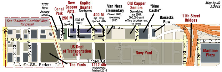

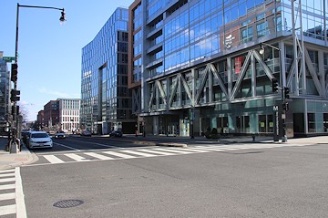
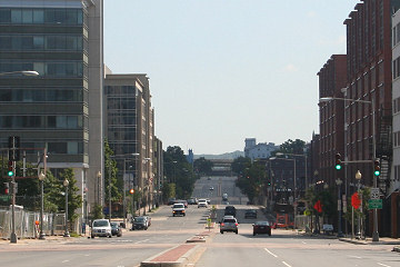
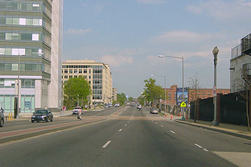
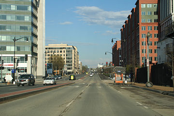
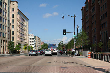
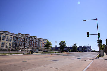
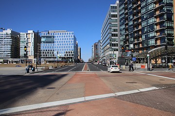
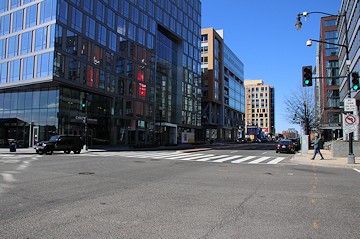
Looking East: Two views of M Street, looking east from South Capitol Street. (Left) January 2003; 80 M (left front) and 300 M (left rear) are completed, and 1100 New Jersey is under construction. (Right) November 2019, shows a much different landscape: along the left, 20 M and 100 M are done, with 1100 New Jersey long since completed. On the right, the bus garage is replaced with the Fairgrounds, 55 M opened in 2009, and the US Department of Transportation HQ in 2007, in the distance. 

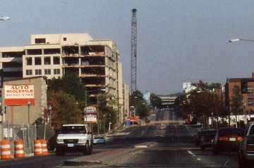
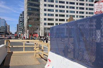
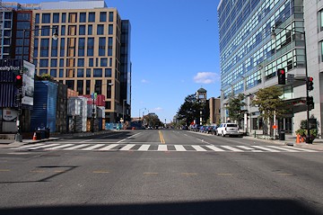
This is the fabulously scenic view northward up South Capitol Street at its intersection with M. Now you see why The Powers That Be want to rebuild South Capitol? (The chainlink fences currently used on the M Street overpass were replaced in 2008 with new wrought-iron versions.) (10/05)
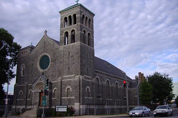
Driving East: St. Vincent de Paul's Catholic Church, on the northeast corner of M and South Capitol, welcomes you to Near Southeast. (06/05)
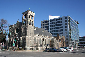
St. Paul's hasn't changed, but it does now have 20 M Street lurking over its shoulder, and changing dramatically the western entrance to M Street. (01/07)
Driving East: Looking along the north side of M Street from Van Street in January 2003. 80 M is the completed building in the foreground, followed by the under-construction 1100 New Jersey Avenue and the completed 300 M Street. (01/03)
Driving East: The northeast corner of Half and M, where a Sunoco station lived until 2006. (07/06)

In 2014, it was announced a Homewood Suites would be built at the 50 M site.

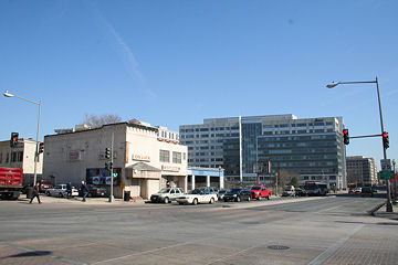
Driving East: The southeast side of M Street, from Half Street toward Cushing and First, in July 2006. The Navy Yard Metro station's west entrance is at far right. The white building in the distance was then home to the National Geospatial-Intelligency Agency; behind it is the US Department of Transportation HQ. (07/06)
January 6, 2019 - The same location, with Monument Realty's 55 M now dominating and the NGA building going bye-bye. The Metro station entrance is now in the ground floor of the building.
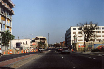
Driving East: Looking east on M Street SE, near Cushing Street, in September 2000. Under construction are 80 M Street (left foreground) and 300 M Street. (09/00)
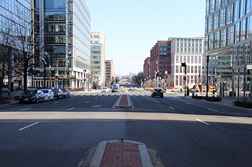
January 6, 2019 - The same location, 19 years later. 80 and 300 M Street along the north side of the street are completed, 55 M now casts a shadow in the foreground, 1100 New Jersey has sprouted between them, 100 M is done, and the Department of Transportation HQ is the red mass on the south side of the street. And the white NGA building is disappearing.
Cropping the Sept. 2000 picture from above, I can give you my only photo of 300 M Street under construction. (09/00)
Cropping a Sept. 2006 photo to show 300 M completed but now obscured by 1100 New Jersey, and with the US DOT at right. (09/06)
Driving East: The northern side of M Street at First Street, with the On Luck Cafeteria at center, in February 2006. (02/06)
November 4, 2019 - The same location, with 100 M now in place.
Driving East: Further east on M, at its intersection with New Jersey Avenue, in April, 2004. (04/04)
The same location, three years later, with DOT now dominating the streetscape. The block on the left with the trees became the southern end of Canal Park in 2012. (04/07)

Driving East: The northeast corner of 2nd and M, back in August 2003, which is slated to become... (08/03)
250 M Street ("Federal Gateway Two"), an office building to be developed by the William C. Smith company. Construction is not scheduled to begin until the building has pre-leased some space.
Driving East: Further east on M, at its intersection with 3rd Street, in July 2004. 300 M Street is at left, followed by the Carroll Apartments (seniors housing). At the right is the DOT HQ land, followed by a Southeast Federal Center building. (07/04)
The same location, not quite three years later, with the DOT HQ now finished, and with the Capper Building #2 wrapping around the Carroll Apartments now visible at far left. (05/07)
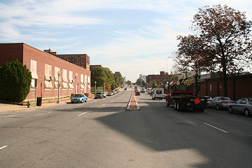
Driving East: The eastern section of M Street, from just west of 5th Street; now-closed (but reopening for the 2015 school year) Van Ness Elementary is at near left, with the old Capper Seniors building to its rear. The Navy Yard runs along the south side of M Street from this location all the way to 11th Street. If you look closely in the distance you can see the "Blue Castle" building at left and the white Latrobe Gate of the Navy Yard at right. (10/06)
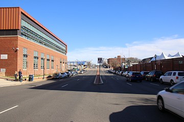
January 12, 2020 - The same location, with the old Capper Seniors demolished.
Driving East: A closer view of the old Capper Seniors building in the 600 block of M Street, just before demolition began. (11/07)
July 17, 2016 - The same location, with the old Capper Seniors building demolished. Eventually a 500,000-sq-ft office building may be developed on this site.
Driving East: On the northeast corner of 9th and M, a nondescript building that was once home to a Hudson auto dealership and more recently a dialysis unit was converted into a retail space, now housing a Domino's and Wagtime. (10/05)
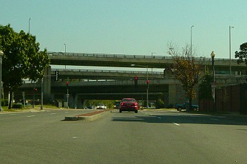
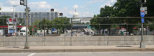
Driving East: M Street east of 8th Street is dominated by the 11th Street Bridges, though this view changed substantially once the 11th Street Bridges project got underway. (10/03)

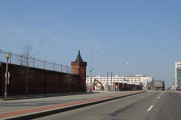
Driving West: Turning around at 11th Street, the red brick wall of the Navy Yard begins its five-block run along the south side of M. (10/03)
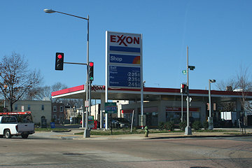
Driving West: On the north side of M at 11th, this Exxon used to be one of five gas stations in Near Southeast. When it closed in June 2008, it was the only one left. (11/06)

Driving West: The Navy Yard's Latrobe Gate, at 8th and M; the original gate was built in 1805-06, with the three-story late-Victorian building constructed over and around it completed in 1881. (10/05)
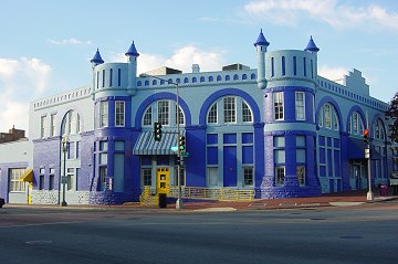
The "Blue Castle" building at 8th and M, originally a car barn and now a multi-use building that serves as a gateway to the 8th Street Historic District. It has changed hands multiple times, as developers don't quite seem able to decide what to do with it. (10/05)
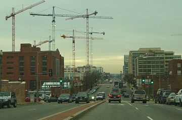
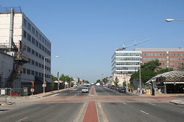
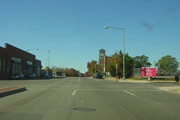
Driving West: M Street just east of its intersection with Hull Street, in December 2004. The Navy Yard is to the left, and the cranes mark the DOT HQ construction. (12/04)
The same location, two years later, with not only the DOT HQ now clearly part of the landscape, but 20 M, way at the end of M Street, is visible as well. (12/06)
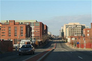
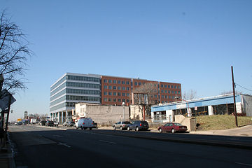
Driving West: Looking west on M Street just east of its intersection with 5th Street, back in March, 2004. The red brick fence of the Southeast Federal Center is to the left; the DOT HQ is now under construction there. (03/04)
July 17, 2016 - The same location, with the DOT HQ completed in 2007 and now the Twelve12 apartment building--with a Harris Teeter--at left.
Driving West: The northwest corner of 3rd and M, in September 2000. This is another view of the 250 M Street lot. The building under construction is 80 M Street. (09/00)
The same intersection, nearly six years later. The 140 M Street/1100 New Jersey office building was completed in 2003; the gas station was torn down in September, 2003; Capitol Hill Tower is at back; and Capper buildings behind the parking lot have been demolished. (06/06)
Driving West: Going one block west, to the northwest corner of M Street and the eastern half of 2nd Street. (09/00)
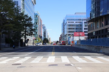
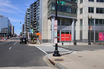
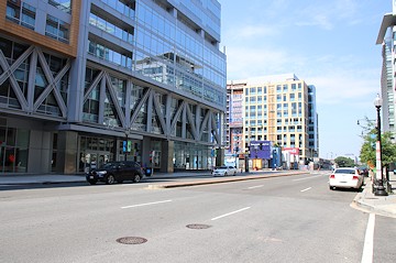
March 24, 2019 - The same location, in 2019. The overgrown fenced-in school bus lot turned into Canal Park, and the line of office buildings now stretches to South Capitol Street.
Driving West: Going one block west, to the northwest corner of M Street and the western half of 2nd Street. The building under construction is 80 M Street. (09/00)
Driving West: Looking west on M Street at New Jersey Avenue, in May 2006. The white building at left is home to the National Geospatial Intelligence Agency, which vacated in 2011. (05/06)
March 17, 2019 - The same location, with buildings sprouting (and disappearing) everywhere.
Driving West: The northern side of M Street, coming to 1st Street, in early 2006. (02/06)
March 21, 2009 - The same location, with the 100 M Street office building completed. (And with 20 M down the street.)
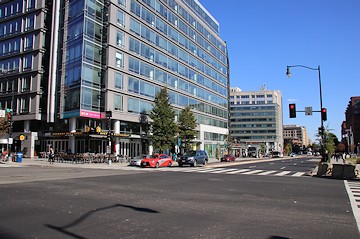
Driving West: The southwest corner of First and M streets, where Normandie Liquors held down the fort until February 2008. (09/06)
March 17, 2019 - The same location, with Normandie gone, a Nationals ballpark parking lot built, and 55 M now towering. Plans exist for an office building on this corner.
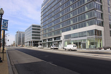
Driving West: The south side of M Street, from just east of the intersection with Cushing "Street" (basically an alley), in May 2006. (05/06)
May 19, 2019 - The same spot, dominated by 55 M Street,a 275,000-sq-ft office building on top of the Navy Yard Metro east entrance.
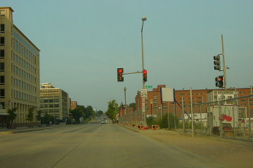
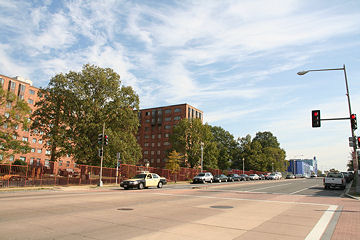
Looking west on M Street at Half Street, with the 20 M Street SE lot (8 months before the start of construction) and St. Vincent de Paul's church to the right. And, one block further west, at South Capitol Street, my obsession with M Street peters out, and someone with a similar obsession about Southwest (and a cleaner windshield!) will have to pick up the slack! (11/04)
November 3, 2019 - The same location, with 20 M having been completed in 2007, and the WMATA Southeastern Bus Garage at left was demolished in 2009. The stoplights were installed in early 2008.
Latest News
December 22, 2014
Latest South Capitol Corridor Draft Plan Released; Meeting Jan. 22
March 4, 2014
Tuesday Tidbits: Coming in Like a Lion
December 20, 2012
Monument Realty Planning 'One M Street' Office Building
July 12, 2012
Thursday Tidbits: Low Weight But High Volume Edition
February 16, 2012
Old Domino's Building at South Capitol and M Demolished
January 12, 2012
M Street Transportation Study Meeting Documents