
|
| |||||||||||||||||||

|
Please note that JDLand is no longer being updated.
peek >>
Canal Park
200 M St., SE
Named for the historic Washington Canal, which connected the Anacostia and Potomac rivers via the National Mall.
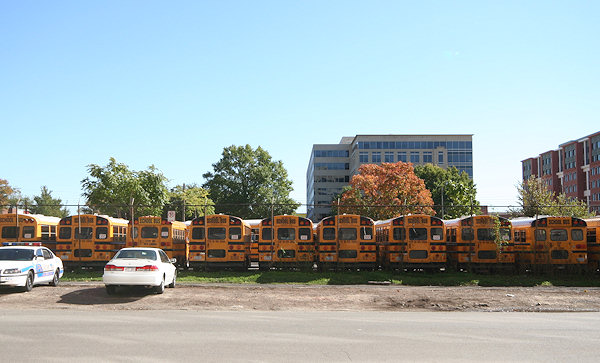
Home to a school bus parking lot until 2009; construction begun spring 2011, officially opened November 16, 2012.
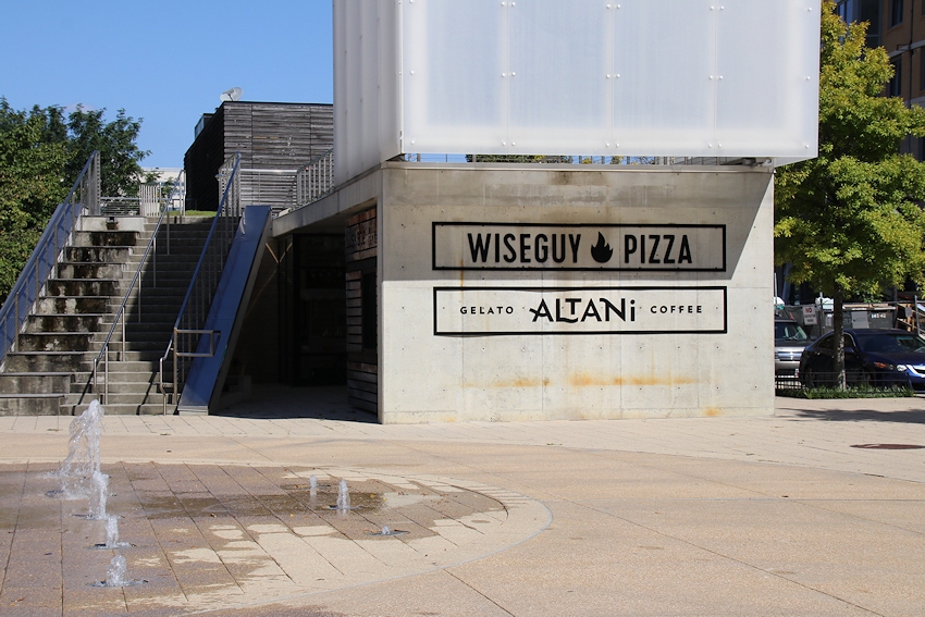
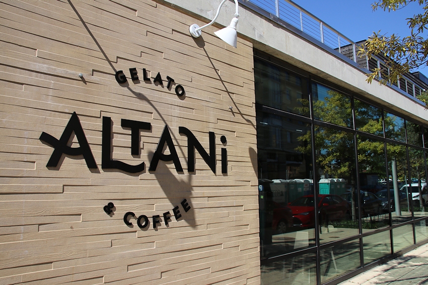
Pavilion tenant: Wiseguy Pizza and Altani Gelato and Coffee
- Full Neighborhood Development MapThere's a lot more than just the projects listed here. See the complete map of completed, underway, and proposed projects all across the neighborhood.
- What's New This YearA quick look at what's arrived or been announced since the end of the 2018 baseball season.
- Food Options, Now and Coming SoonThere's now plenty of food options in the neighborhood. Click to see what's here, and what's coming.
![-]()
- Anacostia RiverwalkA bridge between Teague and Yards Parks is part of the planned 20-mile Anacostia Riverwalk multi-use trail along the east and west banks of the Anacostia River.
![-]()
- Virginia Ave. Tunnel ExpansionConstruction underway in 2015 to expand the 106-year-old tunnel to allow for a second track and double-height cars. Expected completion 2018.
![-]()
- Rail and Bus Times
Get real time data for the Navy Yard subway, Circulator, Bikeshare, and bus lines, plus additional transit information. - Rail and Bus Times
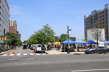
Get real time data for the Navy Yard subway, Circulator, Bikeshare, and bus lines, plus additional transit information. - Canal ParkThree-block park on the site of the old Washington Canal. Construction begun in spring 2011, opened Nov. 16, 2012.
![-]()
- Nationals Park21-acre site, 41,000-seat ballpark, construction begun May 2006, Opening Day March 30, 2008.
![-]()
- Washington Navy YardHeadquarters of the Naval District Washington, established in 1799.
![-]()
- Yards Park5.5-acre park on the banks of the Anacostia. First phase completed September 2010.
![-]()
- Van Ness Elementary SchoolDC Public School, closed in 2006, but reopening in stages beginning in 2015.
![-]()
- Agora/Whole Foods336-unit apartment building at 800 New Jersey Ave., SE. Construction begun June 2014, move-ins underway early 2018. Whole Foods expected to open in late 2018.
![-]()
- New Douglass BridgeConstruction underway in early 2018 on the replacement for the current South Capitol Street Bridge. Completion expected in 2021.
![-]()
- 1221 Van290-unit residential building with 26,000 sf retail. Underway late 2015, completed early 2018.

- NAB HQ/AvidianNew headquarters for National Association of Broadcasters, along with a 163-unit condo building. Construction underway early 2017.

- Yards/Parcel O Residential ProjectsThe Bower, a 138-unit condo building by PN Hoffman, and The Guild, a 190-unit rental building by Forest City on the southeast corner of 4th and Tingey. Underway fall 2016, delivery 2018.

- New DC Water HQA wrap-around six-story addition to the existing O Street Pumping Station. Construction underway in 2016, with completion in 2018.

- The Harlow/Square 769N AptsMixed-income rental building with 176 units, including 36 public housing units. Underway early 2017, delivery 2019.

- West Half Residential420-unit project with 65,000 sf retail. Construction underway spring 2017.
![-]()
- Novel South Capitol/2 I St.530ish-unit apartment building in two phases, on old McDonald's site. Construction underway early 2017, completed summer 2019.
![Novel South Capitol]()
- 1250 Half/Envy310 rental units at 1250, 123 condos at Envy, 60,000 square feet of retail. Underway spring 2017.
![-]()
- Parc Riverside Phase II314ish-unit residential building at 1010 Half St., SE, by Toll Bros. Construction underway summer 2017.
![-]()
- 99 M StreetA 224,000-square-foot office building by Skanska for the corner of 1st and M. Underway fall 2015, substantially complete summer 2018. Circa and an unnamed sibling restaurant announced tenants.
![-]()
- The Garrett375-unit rental building at 2nd and I with 13,000 sq ft retail. Construction underway late fall 2017.
![-]()
- Yards/The Estate Apts. and Thompson Hotel270-unit rental building and 227-room Thompson Hotel, with 20,000 sq ft retail total. Construction underway fall 2017.
![-]()
- Meridian on First275-unit residential building, by Paradigm. Construction underway early 2018.
![-]()
- The Maren/71 Potomac264-unit residential building with 12,500 sq ft retail, underway spring 2018. Phase 2 of RiverFront on the Anacostia development.
![-]()
- DC Crossing/Square 696Block bought in 2016 by Tishman Speyer, with plans for 800 apartment units and 44,000 square feet of retail in two phases. Digging underway April 2018.
![DC Crossing]()
- One Hill South Phase 2300ish-unit unnamed sibling building at South Capitol and I. Work underway summer 2018.
![One Hill South Phase 2]()
- New DDOT HQ/250 MNew headquarters for the District Department of Transportation. Underway early 2019.
![New DDOT HQ]()
- 37 L Street Condos11-story, 74-unit condo building west of Half St. Underway early 2019.
![37 L Condos]()
- CSX East Residential/Hotel225ish-unit AC Marriott and two residential buildings planned. Digging underway late summer 2019.
![CSX East Residential/Hotel]()
- 1000 South Capitol Residential224-unit apartment building by Lerner. Underway fall 2019.
![1000 South Capitol Residential]()
- Capper Seniors 2.0Reconstruction of the 160-unit building for low-income seniors that was destroyed by fire in 2018.
![1000 South Capitol Residential]()
- Chemonics HQNew 285,000-sq-ft office building with 14,000 sq ft of retail. Expected delivery 2021.
![1000 South Capitol Residential]()


For a complete set of Before-and-After photos from around the park's perimeter,
see my Canal Park Expanded Photo Archive.
May 26, 2013 - Looking north across the park's footprint in spring 2013, seven months after the park opened....
(Browse the opening day photo galleries for images from the ribbon cuttng.)
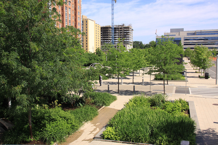
May 28, 2016 - .... And the same view, after a few years of growth (and a wet spring). Alas, the view of the Capitol dome is gone, thanks to the Park Chelseaand Agora.
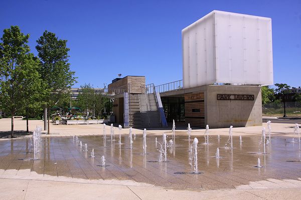
May 26, 2013 - The park's southern block, home to what was then the Park Tavern restaurant and a water feature in the warm months....
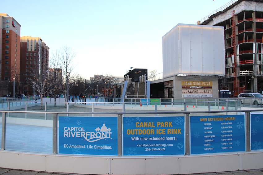
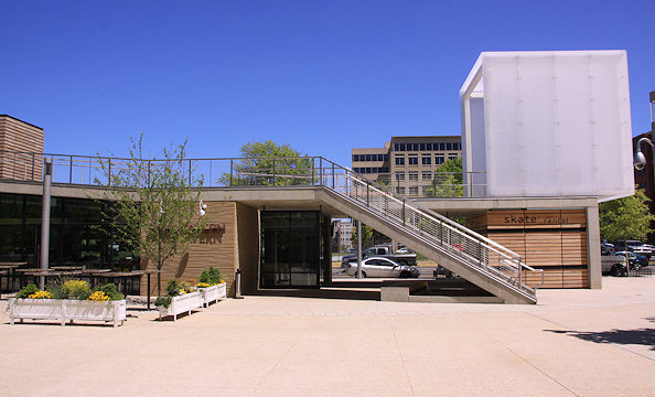
February 5, 2018 - ... And a slightly different outdoor experience in the winter, not quite five years after the park opened, and with signage announcing Wiseguy Pizza as restaurant tenant #3. In the background is the construction of the Harlow apartment building. (More skating photos here.)
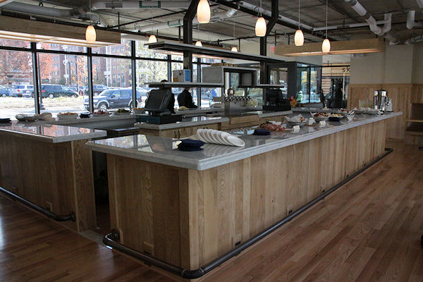
 Sept. 30, 2018 - Signage announcing the arrival of the pavilion's newest tenant, offering all manner of easily grabbed offerings with its opening on Oct. 2, 2018.
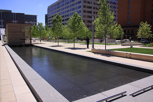
May 2, 2013 - The middle block's pavilion and water feature.
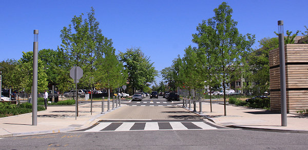
May 2, 2013 - The new L Street within the park, looking eastward. Visible are the pavers, lighted bollards, and almost-invisible curbs that, along with the narrowness of the street in comparison to the next block, are to signal to drivers to slow down. No parking is allowed on L or K.
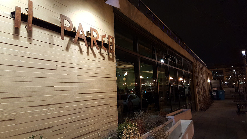
March 4, 2016 - The eastern side of the pavilion, not long after Il Parco's opening.
 Sept. 30, 2018 - The same spot, 2 1/2 years later.
November 16, 2012 - The interior of the Park Tavern restaurant, inside the main pavilion, on the day of the park's opening. In late 2015, the owners closed the Park Tavern and reopened it in early 2016 as "Il Parco," a Neapolitan pizza restaurant. Il Parco then closed in August 2017.
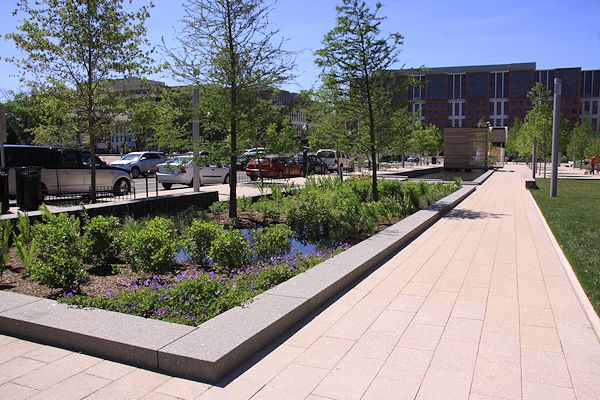
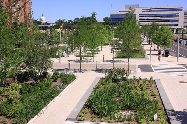
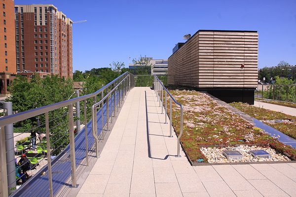
May 26, 2013 - Walkways and greenery in the park's middle block.
May 2, 2013 - The very northern portion of the park, looking southward.
May 26, 2013 - On the roof of the pavilion that houses the Park Tavern restaurant, with some al fresco diners visible at left.
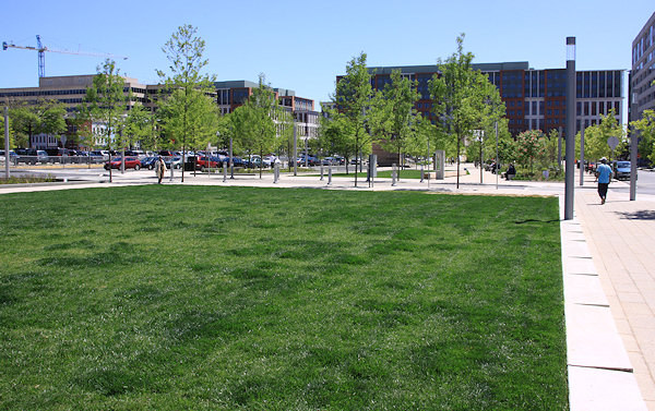
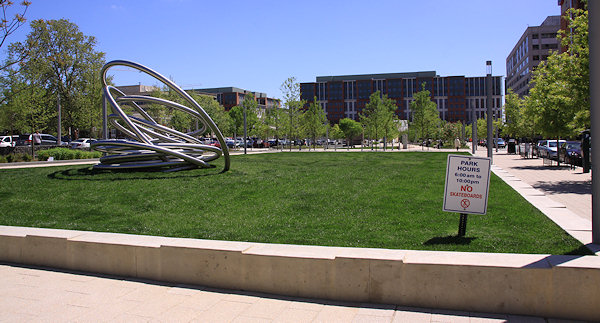
May 2, 2013 - The green, green grass of the northern block.
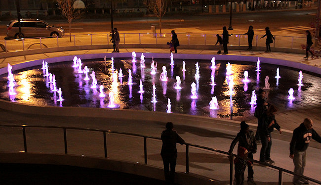
November 16, 2012 - Nighttime skating. For more images of the park at night in winter, see this gallery.
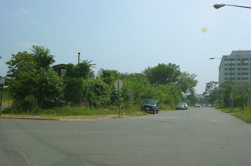
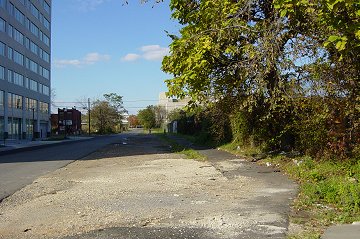
What the Canal Park site looked like, north of M Street facing east, for many many years. (10/14/06)
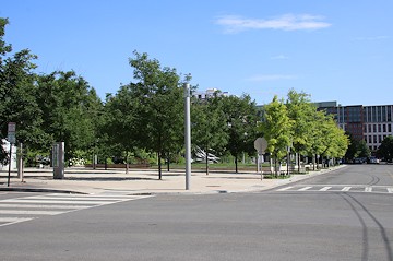
... And the same view, more than six years later. (5/2/13)
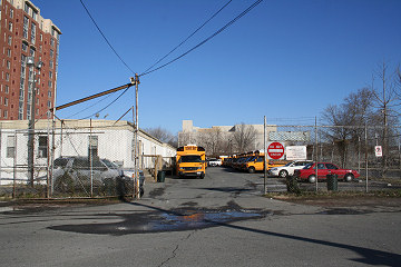
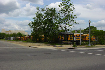
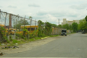
A northward-facing view of the middle block of the park, with the school buses still in residence. (2/3/07)
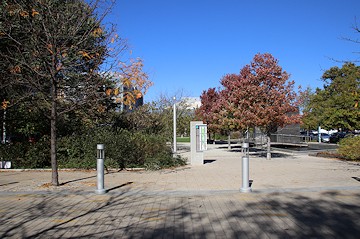
November 4, 2019 - The same location, with the park completed. 

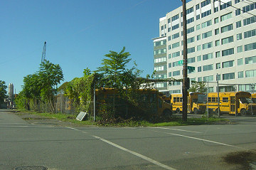
The view to the south on 2nd Street just north of L, before the US Deparment of Transportation came along, but with the schoolbuses firmly entrenched. (9/19/04)

July 8, 2018 - The same location, completed.
Canal Park's footprint covers three blocks running north from M Street SE to I Street. This shows the view from M Street looking north, in May 2003. (5/03)
May 19, 2019 -The same location, completed. The building in the distance is 225 Virginia/200 I, itself having undergone a transformation.
Two views of the western side of the park, looking southward, first in August 2003. (I always loved the wooden elevated guardhouse that's just barely visible at left.) (08/03)
June 16, 2018 - The same location, long after the construction of the US Department of Transportation in the distance, and with trees in place.
Looking north on 2nd Street (or is it Canal Street? The world may never know), just past its intersection with M Street, in October 2003. The park now runs along the right; 1100 New Jersey is at left, completed in 2003. (10/03)
Again looking north, but this time on the east side of the park's footprint, in May 2003. (05/03)
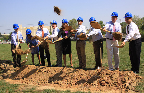
On August 31, 2010, a ceremonial groundbreaking with Mayor Fenty, Ward 6 council member Tommy Wells, and other dignataries was held to mark the start of construction on the park. (See more photos of the groundbreaking.)
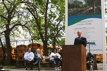
In April 2007, the JBG Cos. (developers of the DOT HQ at the southern end of the Canal Park site) presented the city with a check for $4 million, $2.5 million of which will go toward the creation of both Canal Park (the rest will help fund Diamond Teague Park a few blocks away). The contribution was required as part of the zoning order that established the Department of Transportation HQ Here, Mayor Fenty speaks to the crowd assembled at 2nd and M Streets, with the ubiquitous School Buses of Canal Park in the background. (04/07)
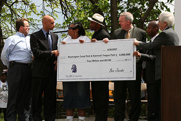
From left: Chris Smith of William C. Smith, Mayor Fenty, the mother and father of ECC volunteer Diamond Teague, Councilman Tommy Wells, Deputy Mayor for Planning and Development Neil Albert, and Ben Jacobs, CEO of JBG Cos. (see ceremony video from DC16) (04/07)

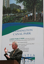
(Left) A rendering of the original Gustafson, Guthrie & Nichol park design, looking south toward the Department of Transportation HQ. This rendering was displayed on the large sign at 2nd and M Streets (right), which was the backdrop for councilman Tommy Wells' remarks at a check presentation ceremony in April 2007 (see ceremony video from DC16).
Latest News
October 2, 2018
Wiseguy Pizza Opening Today, And a Few Other Tidbits
August 21, 2018
Dryy Coming to 55 M; August Doldrums Tidbit Catcher
May 21, 2018
Weekly Open Thread and Tidbit Catcher
January 27, 2018
Wiseguy Pizza, Altani Gelato and Coffee Coming to Canal Park
October 25, 2017
Wednesday Tidbits: Cava Opening, New Ice Rink Operator
August 16, 2017
Il Parco (nee Park Tavern) Shuttered for Good
March 14, 2016
Lineup Announced for Summer Outdoor Movie Series
February 26, 2016
Choose Your Favorites for the 2016 Outdoor Movie Series
January 30, 2016
Soft Opening Tonight at Il Parco
January 22, 2016
A Blizzard of Friday Tidbits: Il Parco Signage and More