
|
| |||||||||||||||||||

|
Please note that JDLand is no longer being updated.
peek >>
South Capitol Street/Frederick Douglass Bridge
Ribbon cut in Feb. 2018 for the replacement Anacostia River bridge crossing
Preliminary design work and land acquistion began in 2012; RFQ for the first two phases released in spring 2013
$441 million design-build contract awarded in summer 2017; Construction underway early 2018, estimated completion 2021
- Full Neighborhood Development MapThere's a lot more than just the projects listed here. See the complete map of completed, underway, and proposed projects all across the neighborhood.
- What's New This YearA quick look at what's arrived or been announced since the end of the 2018 baseball season.
- Food Options, Now and Coming SoonThere's now plenty of food options in the neighborhood. Click to see what's here, and what's coming.
![-]()
- Anacostia RiverwalkA bridge between Teague and Yards Parks is part of the planned 20-mile Anacostia Riverwalk multi-use trail along the east and west banks of the Anacostia River.
![-]()
- Virginia Ave. Tunnel ExpansionConstruction underway in 2015 to expand the 106-year-old tunnel to allow for a second track and double-height cars. Expected completion 2018.
![-]()
- Rail and Bus Times
Get real time data for the Navy Yard subway, Circulator, Bikeshare, and bus lines, plus additional transit information. - Rail and Bus Times
Get real time data for the Navy Yard subway, Circulator, Bikeshare, and bus lines, plus additional transit information. - Canal ParkThree-block park on the site of the old Washington Canal. Construction begun in spring 2011, opened Nov. 16, 2012.
![-]()
- Nationals Park21-acre site, 41,000-seat ballpark, construction begun May 2006, Opening Day March 30, 2008.
![-]()
- Washington Navy YardHeadquarters of the Naval District Washington, established in 1799.
![-]()
- Yards Park5.5-acre park on the banks of the Anacostia. First phase completed September 2010.
![-]()
- Van Ness Elementary SchoolDC Public School, closed in 2006, but reopening in stages beginning in 2015.
![-]()
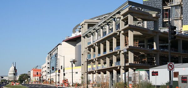
- Agora/Whole Foods336-unit apartment building at 800 New Jersey Ave., SE. Construction begun June 2014, move-ins underway early 2018. Whole Foods expected to open in late 2018.
![-]()
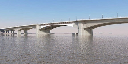
- New Douglass BridgeConstruction underway in early 2018 on the replacement for the current South Capitol Street Bridge. Completion expected in 2021.
![-]()
- 1221 Van290-unit residential building with 26,000 sf retail. Underway late 2015, completed early 2018.

- NAB HQ/AvidianNew headquarters for National Association of Broadcasters, along with a 163-unit condo building. Construction underway early 2017.

- Yards/Parcel O Residential ProjectsThe Bower, a 138-unit condo building by PN Hoffman, and The Guild, a 190-unit rental building by Forest City on the southeast corner of 4th and Tingey. Underway fall 2016, delivery 2018.

- New DC Water HQA wrap-around six-story addition to the existing O Street Pumping Station. Construction underway in 2016, with completion in 2018.

- The Harlow/Square 769N AptsMixed-income rental building with 176 units, including 36 public housing units. Underway early 2017, delivery 2019.

- West Half Residential420-unit project with 65,000 sf retail. Construction underway spring 2017.
![-]()
- Novel South Capitol/2 I St.530ish-unit apartment building in two phases, on old McDonald's site. Construction underway early 2017, completed summer 2019.
![Novel South Capitol]()
- 1250 Half/Envy310 rental units at 1250, 123 condos at Envy, 60,000 square feet of retail. Underway spring 2017.
![-]()
- Parc Riverside Phase II314ish-unit residential building at 1010 Half St., SE, by Toll Bros. Construction underway summer 2017.
![-]()
- 99 M StreetA 224,000-square-foot office building by Skanska for the corner of 1st and M. Underway fall 2015, substantially complete summer 2018. Circa and an unnamed sibling restaurant announced tenants.
![-]()
- The Garrett375-unit rental building at 2nd and I with 13,000 sq ft retail. Construction underway late fall 2017.
![-]()
- Yards/The Estate Apts. and Thompson Hotel270-unit rental building and 227-room Thompson Hotel, with 20,000 sq ft retail total. Construction underway fall 2017.
![-]()
- Meridian on First275-unit residential building, by Paradigm. Construction underway early 2018.
![-]()
- The Maren/71 Potomac264-unit residential building with 12,500 sq ft retail, underway spring 2018. Phase 2 of RiverFront on the Anacostia development.
![-]()
- DC Crossing/Square 696Block bought in 2016 by Tishman Speyer, with plans for 800 apartment units and 44,000 square feet of retail in two phases. Digging underway April 2018.
![DC Crossing]()
- One Hill South Phase 2300ish-unit unnamed sibling building at South Capitol and I. Work underway summer 2018.
![One Hill South Phase 2]()
- New DDOT HQ/250 MNew headquarters for the District Department of Transportation. Underway early 2019.
![New DDOT HQ]()
- 37 L Street Condos11-story, 74-unit condo building west of Half St. Underway early 2019.
![37 L Condos]()
- CSX East Residential/Hotel225ish-unit AC Marriott and two residential buildings planned. Digging underway late summer 2019.
![CSX East Residential/Hotel]()
- 1000 South Capitol Residential224-unit apartment building by Lerner. Underway fall 2019.
![1000 South Capitol Residential]()
- Capper Seniors 2.0Reconstruction of the 160-unit building for low-income seniors that was destroyed by fire in 2018.
![1000 South Capitol Residential]()
- Chemonics HQNew 285,000-sq-ft office building with 14,000 sq ft of retail. Expected delivery 2021.
![1000 South Capitol Residential]()


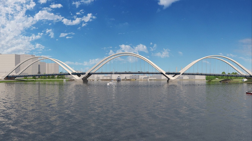
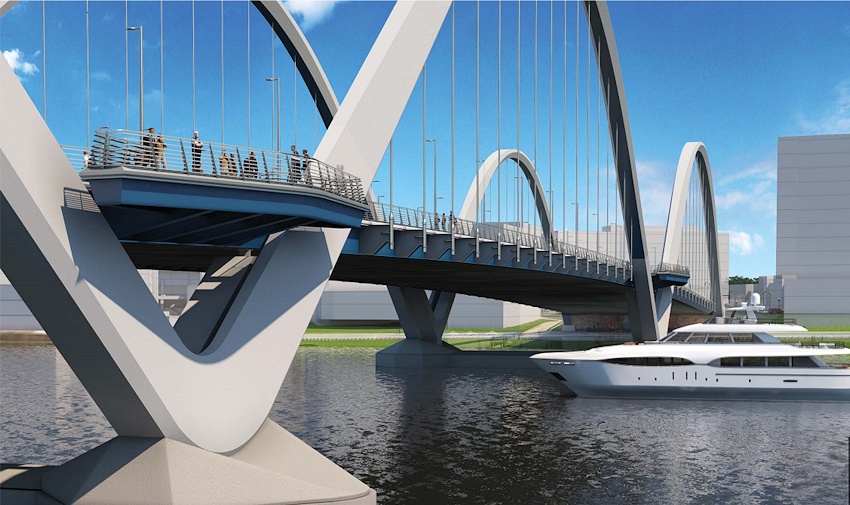
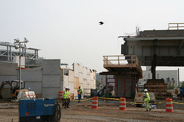
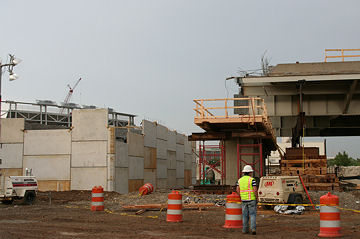
Aug. 10, 2017 - With the current South Capitol Street Bridge now past its useful lifespan, and as part of the plans to revitalize South Capitol Street from its intersection with I-395 south to Firth Sterling Avenue in Anacostia, early construction work began in February 2018 on the new $441 million Frederick Douglass Memorial Bridge, situated slightly to the southwest of the existing Douglass Bridge's location (see top of page). The city unveiled this new design, with three sets of parallel arches, in August 2017.
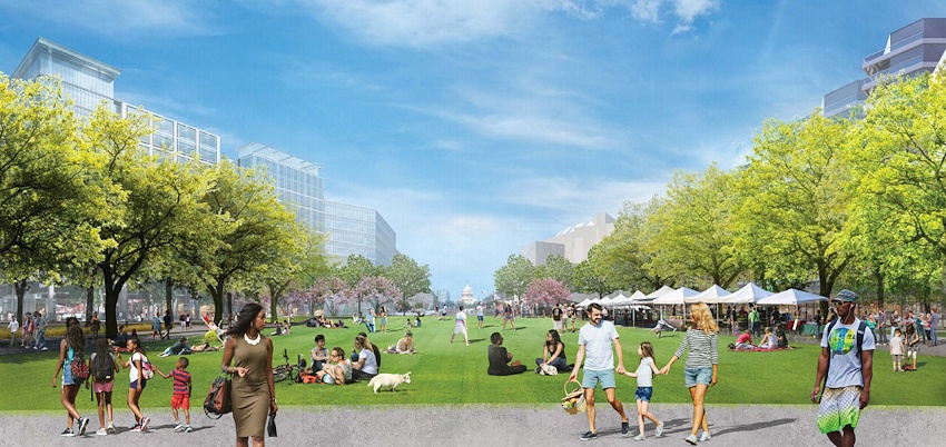
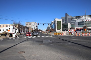
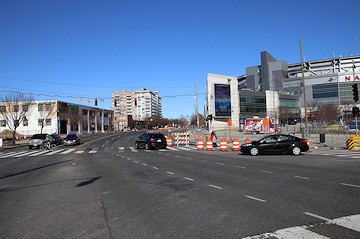
New South Capitol Street Traffic Oval
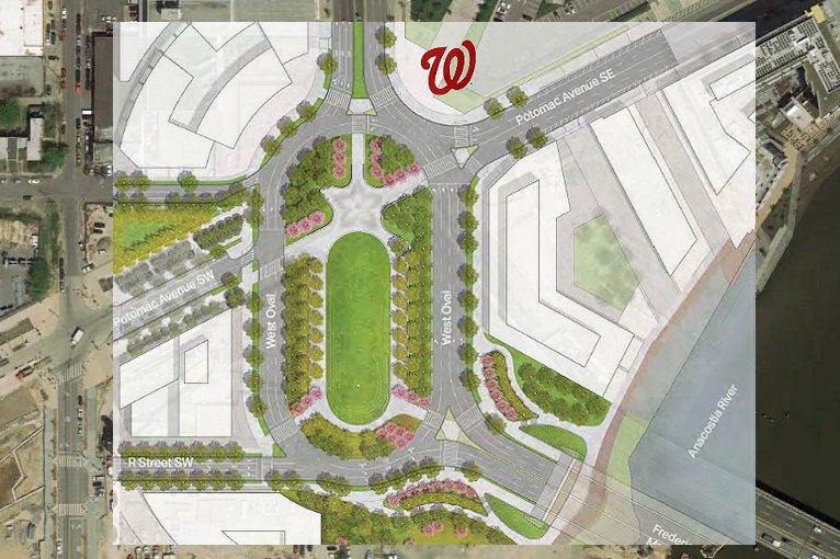
A sense of what the change that is coming to the intersection of South Capitol and Potomac will be like.
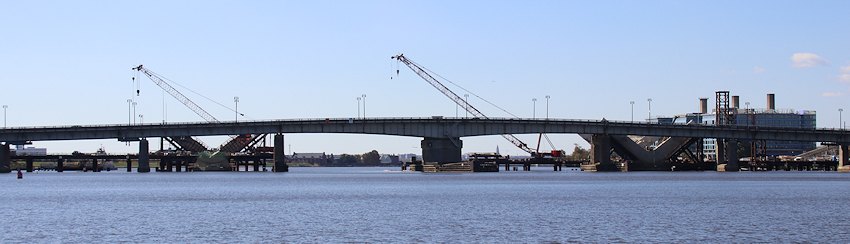
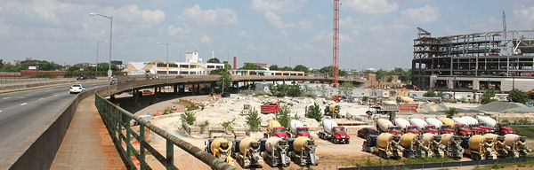
 November 3, 2019 - Looking down river at the old Douglass Bridge, with the construction of the new one finally becoming visible on the existing bridge's other side. The "V"s are the bases of the new bridge, as seen in the rendering.
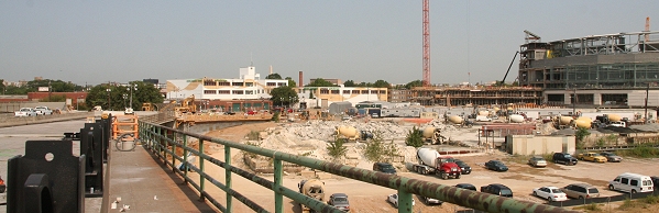
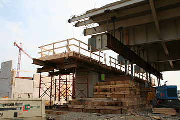
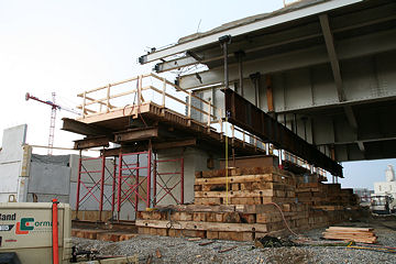
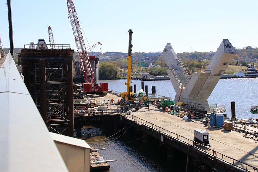 November 3, 2019 - Up on the current Douglass Bridge, looking at the bridge bases under construction.
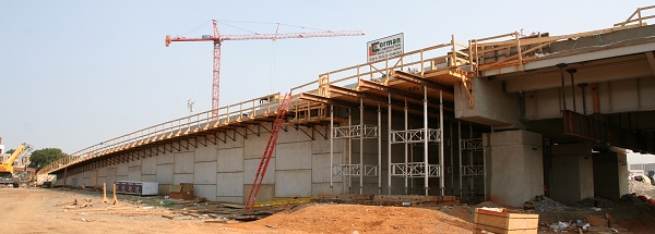
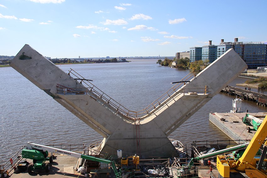 November 3, 2019 - ... And one of the "Vs", up close and personal.
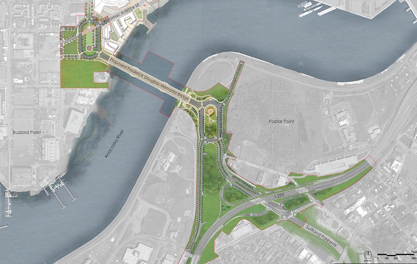
Aug. 10, 2017 - The site plan for this first phase of the South Capitol Street reconstruction plan, which includes the new Douglass Bridge as well as the reconstruction of the interchange of Interstate 295 and the Suitland Parkway.
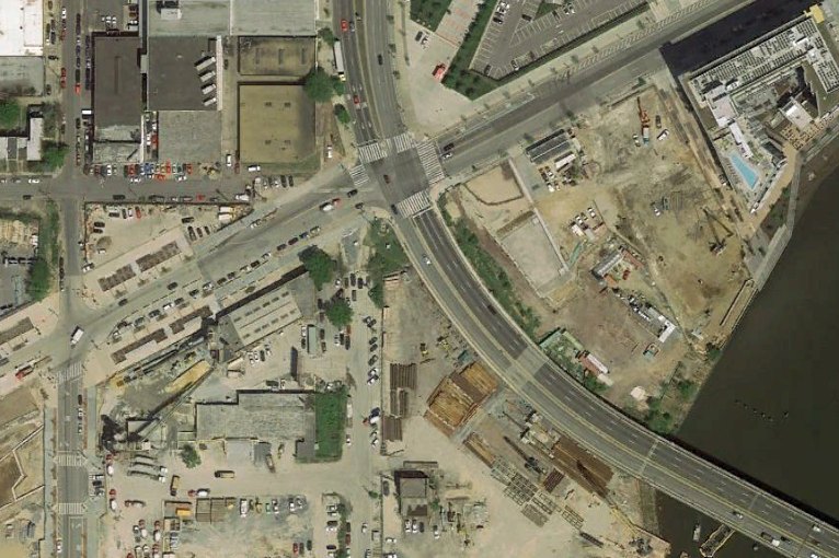
Feb. 16, 2006 - This is what the "intersection" of South Capitol and Potomac used to look like. No, really.
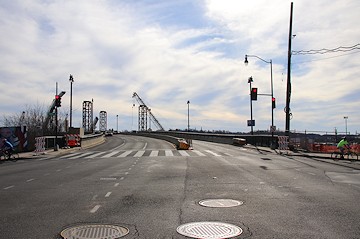
January 12, 2020 - The current view, long after the 2007 demolition of the current bridge's raised approach ramp, and with the work on the new bridge visible. In the new design, this spot will be inside the traffic oval on the bridge's western side. 

March 30, 2018 - A rendering showing what the view up South Capitol from the West Oval could be. This is the space at Potomac Avenue, by Nationals Park (which would be off to the north-northeast).
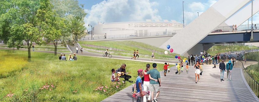
March 30, 2018 - The esplanade underneath the new 2017 bridge design, and the paths and slope down from the West Oval. This is looking along the Riverwalk toward The Salt Line and Diamond Teague Park.
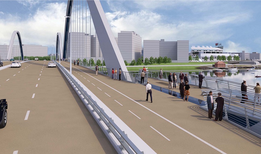
March 30, 2018 - What the wide side paths on both sides of the bridges will look like, with separate bike and pedestrian lanes, as well as overlooks situated out of the line of movement.
March 30, 2018 - What the bridge and its overlooks would look like from below.
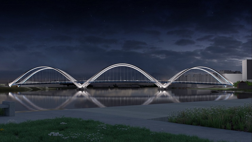
Aug. 10, 2017 - A nighttime view.
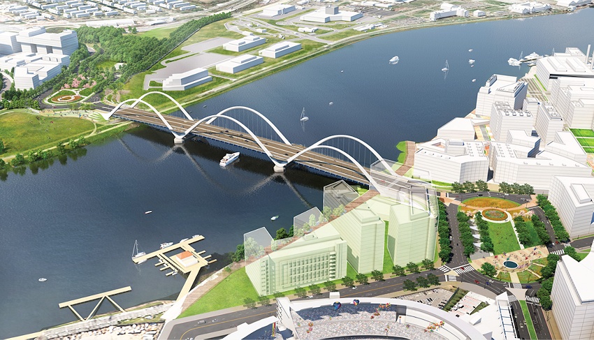
Aug. 10, 2017 - An overhead view, showing the traffic ovals, as seen from above Nats Park.
An overhead view of the revamped Douglass Bridge ramp and intersection at Potomac Avenue, as seen from Nationals Park, in May 2008. In the new design of this intersection, the traffic oval's northeast edge will meet with the ballpark's promenade entrance at far right. The new bridge itself will be "behind" (to the southwest) of the ramp seen here. The industrial area at left is the Florida Rock/RiverFront project, which will eventually also occupy the land where the current bridge arrives on the western shore. (5/26/08)
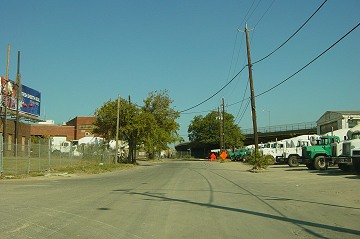
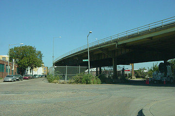
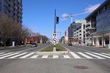
Looking northward on South Capitol Street at R Street/Water Street, in October 2005, before the demolition of the viaduct north of Potomac Avenue. This location would be the southern tip of the traffic oval in the new configuration, with the new bridge meeting the oval just to the right of this spot. (10/05)
Looking to the southeast at Water and South Capitol, where the new bridge would arrive from across the Anacostia. (10/05)
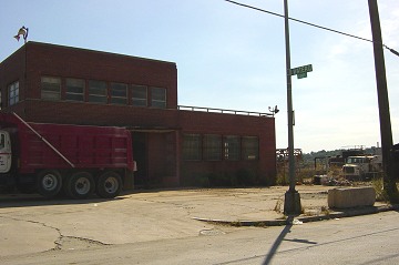
Someday there will be miles of waterfront amenities along the Anacostia; right now, not so much. (This is at South Capitol, north of S Street, right where the new bridge will arrive on the north shore.) (10/05)
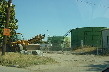
South Capitol's terminus, at S Street. Plans call for parks or some sort of public use from this spot south to the river. (10/05)
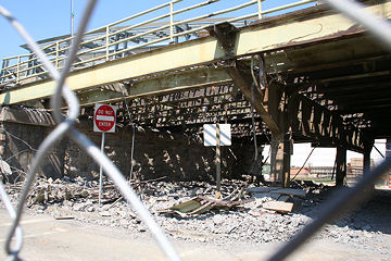
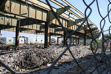
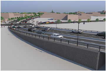
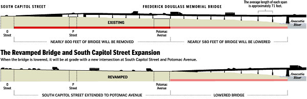
In July and August 2007 DDOT undertook a $27 million major reconfiguration to dismantle the existing 400 feet of raised viaduct from Potomac Avenue north to O Street, with an additional 200 feet of the bridge from south of Potomac Avenue to the river's edge being lowered using jacks, allowing the bridge to come to street level at Potomac Avenue.
Want even more photos of the changed face of South Capitol Street? See the Extended Photo Archive.
Standing in the middle of the South Capitol Street/Potomac Avenue intersection, looking south, in July 2007. The old bridge didn't reach ground level until three blocks further to the north, at O Street, and the Potomac Avenue intersection was a scary dark spot. (07/07)
January 12, 2020 - The same spot, reopened.
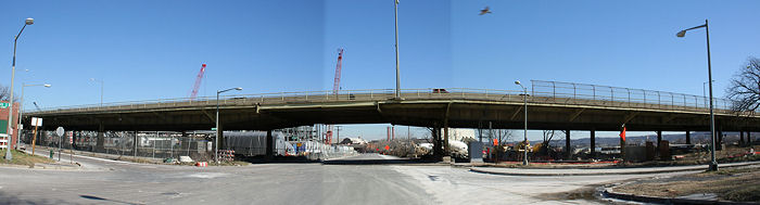
A stitched-together view looking east toward the South Capitol Street and Potomac Avenue intersection, in January 2007. (01/07)
And the same location, six months after the reopening of the bridge, on the day of its rededication. (3/13/08)
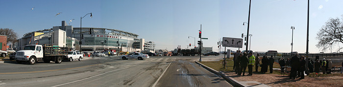
An overhead view of the new Douglass Bridge ramp and intersection at Potomac Avenue, as seen from the Nationals Ballpark, in May 2008. (5/26/08)

The new iron railings between the right-of-way and the sidewalk were in place by the time the bridge reopened, though the bridge's new side railings still awaited installation. The historic "globe" lights across the length of the bridge are visible here. (8/29/07)
Looking south down the new South Capitol Street from the ballpark, in May 2008. The old viaduct used to begin at the bottom center of the photo. (5/26/08)
Looking north up South Capitol Street from south of Potomac Avenue, in October, 2005, gives a good idea of how the old viaduct split the boulevard down the middle. (10/05)
January 12, 2020 - The same spot, with the viaduct gone and South Capitol Street reopened.
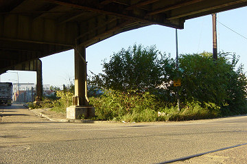
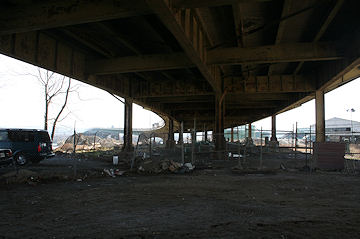
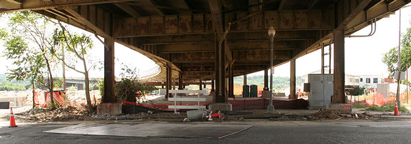
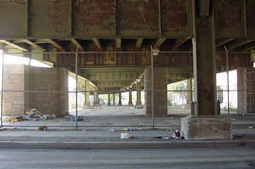
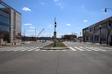
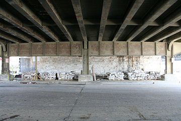
This was the view for many years from underneath the current Frederick Douglass Bridge, looking north, on Potomac Avenue. (09/04)
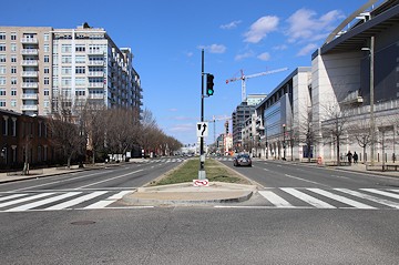
January 12, 2020 - The same spot, reopened.

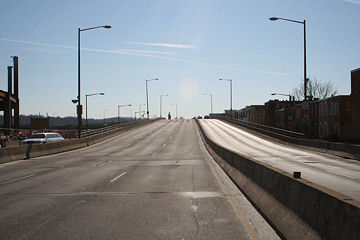
A view north on South Capitol Street from south of O Street, up on the viaduct, in January 2006. (01/06)
March 17, 2019 - The same view, now at grade.
Standing on the Douglass Bridge looking to the north-northeast, a few days before the July 6, 2007, closure. (06/07)
The same location, five weeks after the bridge was closed for demolition and lowering. To see the changes, follow the bridge from the far left in both photos to see how the viaduct is now gone, and the ramp to street level starts much earlier. You can see at left the iron pieces where the new railing will be built--the old green railing at right will also be replaced with a new wrought-iron structure. (The Nationals' administration building is now under construction at rear right, next to the ballpark.) (8/15/07)
The new ramp, leading up from Potomac Avenue, now connected to the original bridge structure. (8/15/07)
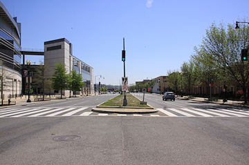
This is what you saw if you stood in the "center" of South Capitol Street at P Street, looking south, until July 2007. (10/05)
March 17, 2019 - The same location, slightly different.
... And turning to look north, standing in the "center" of South Capitol Street at P Street, just before the demolition. (06/07)
March 17, 2019 - Exactly the same spot. Really, honestly, truly. It just about makes me cry.
The start of the South Capitol Street viaduct, looking south from about O Street, in January 2007. (Don't worry, the street was closed that day, I wasn't about to be killed.) (01/07)
April 17, 2016 - The same location, now slightly different.
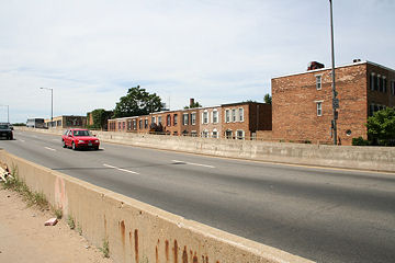
If you're a commuter affected by the summer closure of the Douglass Bridge, take one moment out from your justified grousing to give thanks that you don't live in the 1400 block of South Capitol Street; this is what the view out their front doors looked like for years and years, and they dealt with construction 20 hours a day seven days a week during the eight-week closure of the bridge. (7/1/07)
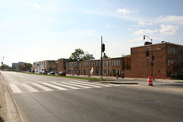
The new vista. (11/11/07)

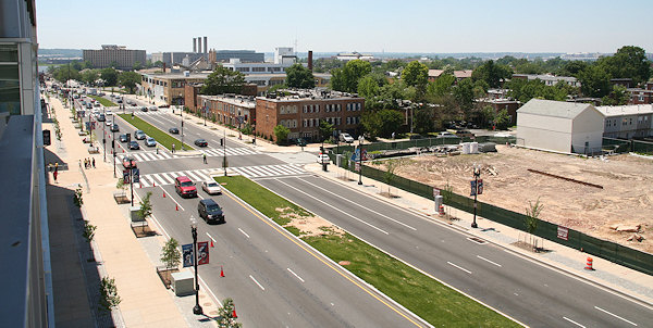
A lot of people were inconvenienced by this bridge demolition, but it should be remembered that the goal was to change from a gritty industrial speedway to an urban boulevard showcasing the Capitol dome and a new ballpark. (6/16/07)
Yeah. Like that. (10/21/07)
The bridge in mid-demolition, at South Capitol and P, looking at the north side of P Street under the bridge. (7/8/07)
... And looking southward down South Capitol under the bridge from south of P Street. (7/8/07)
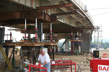
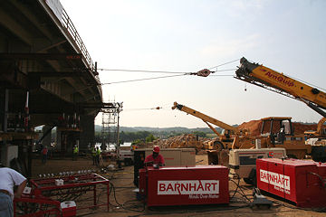
The Lowering, July 19
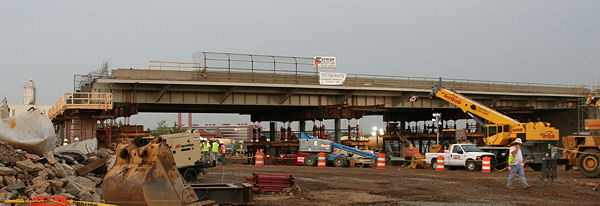
On July 19, the northernmost 200 feet of the remaining bridge was lowered two inches every hour on hydraulic jacks, from a few inches at the shoreline to 51 inches at its northern edge. (This shot is about 15 hours into the lowering. I can't believe I didn't think to take it during my morning visit!) (7/19/07)
This is the bridge's northern edge one hour into the process; the new earth-fill ramp up from Potomac Ave. is at left. (7/19/07)
The same location, seven hours later, about 90 minutes before the lowering was completed. Not a dramatic difference, but a difference nonetheless. (7/19/07)
The underside of the northern edge of the ramp, at the two-hour mark; you can see the hydraulic jacks, with four feet of lowering still to go. (7/19/07)
The same angle, seven hours later, and about 90 minutes before the lowering was completed. Look at the silver hydraulic jacks to get a feeling for the amount the bridge has been lowered. (7/19/07)
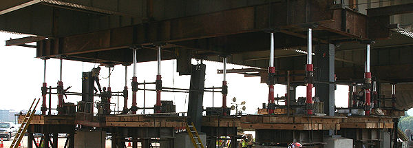
A closer view of the configuration of the jacks and the new columns, one hour into the lowering. (You can see one of the sheared-off old columns still hanging from the bridge in the center.) (7/19/07)
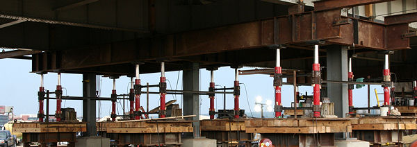
The same spot, seven hours later. Look at the silver jacks to tell the amount the bridge has been lowered. The new columns are in place as well. (7/19/07)
Looking south at the two other sets of jacks in place beneath the bridge, one hour into the lowering. The new columns in the foreground show the final height of this portion. (7/19/07)
A system of pulleys helped to keep the bridge in place during the lowering. (7/19/07)
(Top left) The configuration of the Douglass Bridge before July 2007 as it came across the north/west shore of the Anacostia River. Potomac Avenue ran underneath the viaduct at the rear of the image.
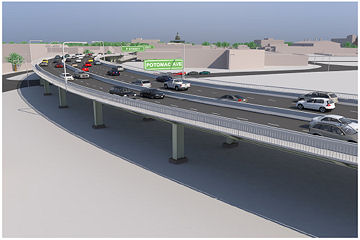
(Top right) What the South Capitol and Potomac intersection will look like after the makeover is finished. (The stadium will be at the upper right, on the northeast corner of the intersection.)
(Bottom left) An envisioning of what the intersection will look like when the stadium is finished and with other possible potential development.
Portion of a Washington Post graphic detailing how it will be accomplished; See the complete graphic for additional details.
The previous arched bascule design for the new bridge, announced in 2012.
Traffic modeling flyover of the previous design Douglass Bridge and its approaches, released by the DC government in December 2012.
Latest News
January 12, 2020
Hallo, Douglass Bridge Arches!
November 3, 2019
The New Douglass Bridge: A Look Ahead to the West Traffic Oval
September 15, 2019
CSX East Three-Building Project Getting Underway, Plus Tidbits
July 19, 2019
Tidbits: Lazy Hazy Heat-Emergency Days of Summer
May 20, 2019
Catching Up with the New Douglass Bridge
February 12, 2019
Tuesday Tidbits: Food Now, Food Later, and More
February 4, 2019
Quick Tidbit Roundup
January 10, 2019
Construction Update: Welcoming Newbies and Checking Out Faces
October 2, 2018
Wiseguy Pizza Opening Today, And a Few Other Tidbits
September 21, 2018
ANC 6D07 Candidates Forum, Douglass Bridge Meetings