
|
| |||||||||||||||||||

|
Please note that JDLand is no longer being updated.
peek >>
Progress Photo Galleries:
5/26/13, 5/26/13 Pt 2, 1/27/13, 9/14/12, 5/19/12, 1/8/12, 10/10/11, 10/7/11
Developer: District Department of Transportation
11th Street Bridges Reconstruction
Four-year reconstruction beginning in late 2009
Two freeeway spans completed by early 2012; 11th Street Local Bridge completed Sept. 2013
Progress Photo Galleries:
5/26/13, 5/26/13 Pt 2, 1/27/13, 9/14/12, 5/19/12, 1/8/12, 10/10/11, 10/7/11
Developer: District Department of Transportation
- Full Neighborhood Development MapThere's a lot more than just the projects listed here. See the complete map of completed, underway, and proposed projects all across the neighborhood.
- What's New This YearA quick look at what's arrived or been announced since the end of the 2018 baseball season.
- Food Options, Now and Coming SoonThere's now plenty of food options in the neighborhood. Click to see what's here, and what's coming.
![-]()
- Anacostia RiverwalkA bridge between Teague and Yards Parks is part of the planned 20-mile Anacostia Riverwalk multi-use trail along the east and west banks of the Anacostia River.
![-]()
- Virginia Ave. Tunnel ExpansionConstruction underway in 2015 to expand the 106-year-old tunnel to allow for a second track and double-height cars. Expected completion 2018.
![-]()
- Rail and Bus Times
Get real time data for the Navy Yard subway, Circulator, Bikeshare, and bus lines, plus additional transit information. - Rail and Bus Times
Get real time data for the Navy Yard subway, Circulator, Bikeshare, and bus lines, plus additional transit information. - Canal ParkThree-block park on the site of the old Washington Canal. Construction begun in spring 2011, opened Nov. 16, 2012.
![-]()
- Nationals Park21-acre site, 41,000-seat ballpark, construction begun May 2006, Opening Day March 30, 2008.
![-]()
- Washington Navy YardHeadquarters of the Naval District Washington, established in 1799.
![-]()
- Yards Park5.5-acre park on the banks of the Anacostia. First phase completed September 2010.
![-]()
- Van Ness Elementary SchoolDC Public School, closed in 2006, but reopening in stages beginning in 2015.
![-]()
- Agora/Whole Foods336-unit apartment building at 800 New Jersey Ave., SE. Construction begun June 2014, move-ins underway early 2018. Whole Foods expected to open in late 2018.
![-]()
- New Douglass BridgeConstruction underway in early 2018 on the replacement for the current South Capitol Street Bridge. Completion expected in 2021.
![-]()
- 1221 Van290-unit residential building with 26,000 sf retail. Underway late 2015, completed early 2018.

- NAB HQ/AvidianNew headquarters for National Association of Broadcasters, along with a 163-unit condo building. Construction underway early 2017.

- Yards/Parcel O Residential ProjectsThe Bower, a 138-unit condo building by PN Hoffman, and The Guild, a 190-unit rental building by Forest City on the southeast corner of 4th and Tingey. Underway fall 2016, delivery 2018.

- New DC Water HQA wrap-around six-story addition to the existing O Street Pumping Station. Construction underway in 2016, with completion in 2018.

- The Harlow/Square 769N AptsMixed-income rental building with 176 units, including 36 public housing units. Underway early 2017, delivery 2019.

- West Half Residential420-unit project with 65,000 sf retail. Construction underway spring 2017.
![-]()
- Novel South Capitol/2 I St.530ish-unit apartment building in two phases, on old McDonald's site. Construction underway early 2017, completed summer 2019.
![Novel South Capitol]()
- 1250 Half/Envy310 rental units at 1250, 123 condos at Envy, 60,000 square feet of retail. Underway spring 2017.
![-]()
- Parc Riverside Phase II314ish-unit residential building at 1010 Half St., SE, by Toll Bros. Construction underway summer 2017.
![-]()
- 99 M StreetA 224,000-square-foot office building by Skanska for the corner of 1st and M. Underway fall 2015, substantially complete summer 2018. Circa and an unnamed sibling restaurant announced tenants.
![-]()
- The Garrett375-unit rental building at 2nd and I with 13,000 sq ft retail. Construction underway late fall 2017.
![-]()
- Yards/The Estate Apts. and Thompson Hotel270-unit rental building and 227-room Thompson Hotel, with 20,000 sq ft retail total. Construction underway fall 2017.
![-]()
- Meridian on First275-unit residential building, by Paradigm. Construction underway early 2018.
![-]()
- The Maren/71 Potomac264-unit residential building with 12,500 sq ft retail, underway spring 2018. Phase 2 of RiverFront on the Anacostia development.
![-]()
- DC Crossing/Square 696Block bought in 2016 by Tishman Speyer, with plans for 800 apartment units and 44,000 square feet of retail in two phases. Digging underway April 2018.
![DC Crossing]()
- One Hill South Phase 2300ish-unit unnamed sibling building at South Capitol and I. Work underway summer 2018.
![One Hill South Phase 2]()
- New DDOT HQ/250 MNew headquarters for the District Department of Transportation. Underway early 2019.
![New DDOT HQ]()
- 37 L Street Condos11-story, 74-unit condo building west of Half St. Underway early 2019.
![37 L Condos]()
- CSX East Residential/Hotel225ish-unit AC Marriott and two residential buildings planned. Digging underway late summer 2019.
![CSX East Residential/Hotel]()
- 1000 South Capitol Residential224-unit apartment building by Lerner. Underway fall 2019.
![1000 South Capitol Residential]()
- Capper Seniors 2.0Reconstruction of the 160-unit building for low-income seniors that was destroyed by fire in 2018.
![1000 South Capitol Residential]()
- Chemonics HQNew 285,000-sq-ft office building with 14,000 sq ft of retail. Expected delivery 2021.
![1000 South Capitol Residential]()


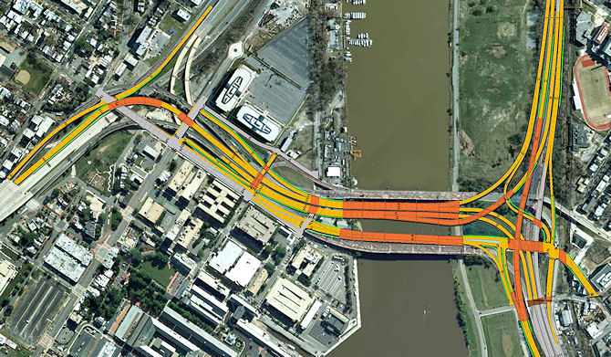
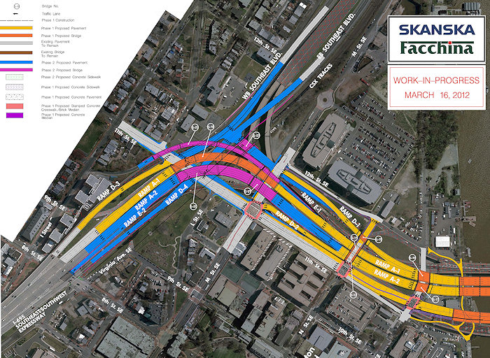
An overview of the Phase I plans for the new 11th Street Bridges, showing how the three new spans and approaches were designed, inside the footprint of the two existing spans. The southern/down-river span will be a "local street that happens to cross a river," connecting Near Southeast directly with Anacostia. The two northern spans will be all freeway traffic, and include new ramps to and from I-295 to allow for access to northbound 295 and from southbound 295 that hasn't existed before. The $300 million project was mostly completed by fall 2013. See also this Jan. 2012 YouTube Video explaining the phases of construction. (12/09)
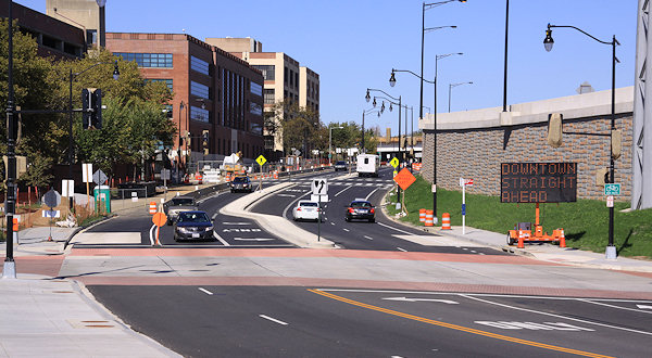
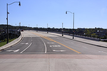
The second phase of the project received the green light in spring 2012, bringing a series of additional movements to the 11th Street area, as well as new "Southeast Boulevard," replacing the sunken freeway to and from Barney Circle with a road that will be accessed from 11th Street. (6/12)

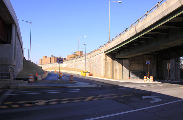
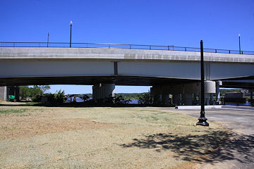
The new 11th Street Bridges, with the I-695/freeway bridge at far left and the Officer Kevin Welch 11th Street Local Bridge at right. The freeway bridge opened in late 2011/early 2012, and the local bridge was completed in Sept. 2013. (10/20/13)
The view from the new 11th Street Local bridge to its northern end at O Street SE, with two-way traffic along 11th now flowing. (10/20/13)
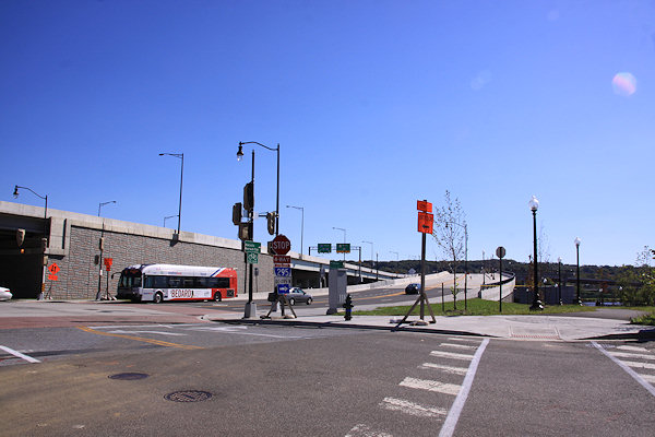
Using a "slider" to help grasp how much the intersection at 11th and O streets has changed. The "before" photo (left), from 2011, shows the embankment of the old outbound 11th Street Bridge dominating and the old inbound bridge visible at far left. The "after" photo (right), from Oct. 2013, displays the vastly different vista, with the new freeway bridge at left and the local bridge at center, and the cleaned up Anacostia Riverwalk Trail approach at far right.
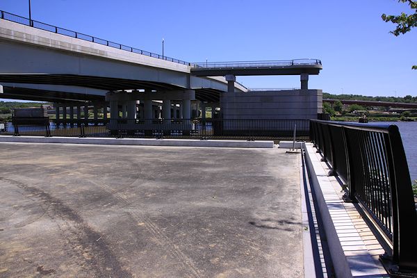
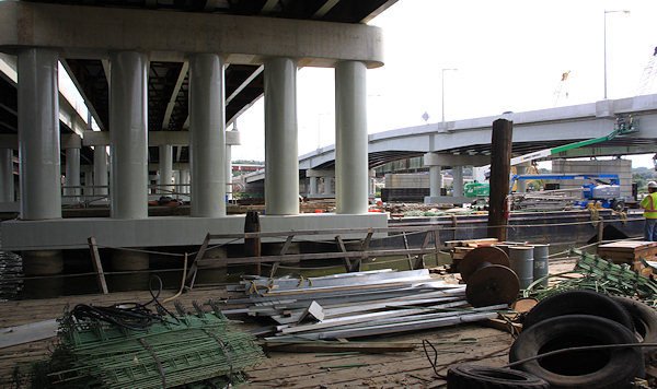
Arriving at the Anacostia River, at a new concrete landing just completed. (This spot used to look a bit different.) Jutting out from the new 11th Street Local Bridge onto the piers from the old bridge are two pedestrian overlooks. It's possible the 11th Street Bridge Park could be built on top of these piers. (5/26/13)
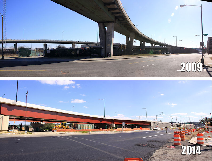
Panoramas showing the new vista at 11th and L to the southeast, in 2009 and 2014. 

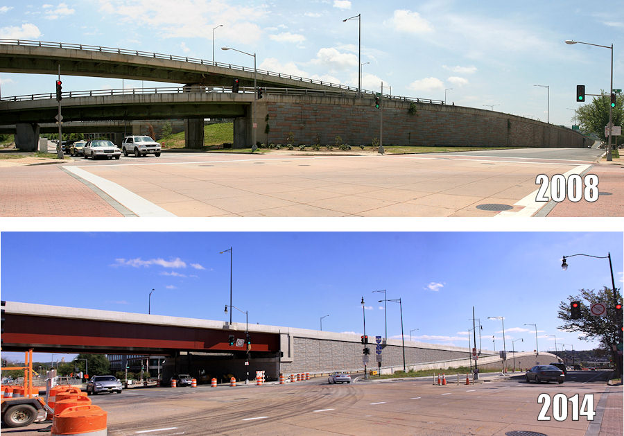
... And at 11th and M, in 2008 and 2014.
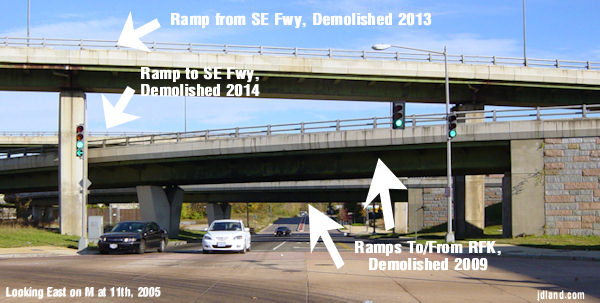
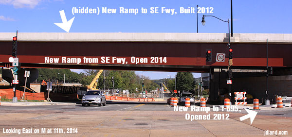
Two annotated photos of the view at 11th and M, looking east, to try to illustrate the considerable changes along 11th Street during this project. See the full progression.
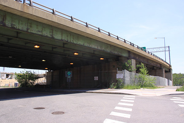
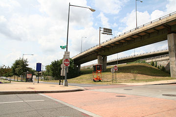
Standing on 11th Street SE, under the two new flyovers built to move traffic between the bridges and the Southeast Freeway. At far left is the one flyover remaining from the old configuration, bringing traffic inbound from the freeway bridge to 8th Street, SE. But its days are numbered. (10/20/13)
Another view at 11th Street, showing construction continuing on the new flyover that will take traffic from the Southeast Freeway to the I-695 freeway bridge. At left is where a new ramp from the freeway will deposit drivers at a signalized intersection at 11th Street, as part of the new Southeast Boulevard.
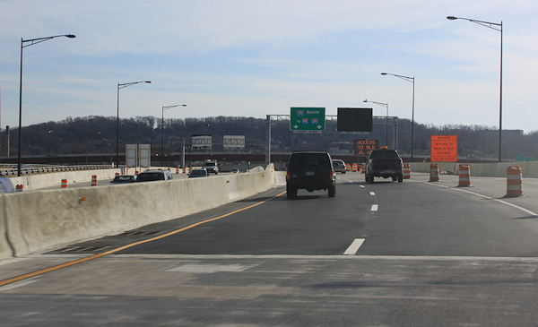
Late in 2012, a new ramp opened from 11th Street SE to the westbound freeway, just north of the new flyover. The signage doesn't necessarily leap out at drivers, but those in the know from the 11th Street area and points east now can get on the freeway here rather than traveling down I Street for 8 blocks to the 3rd Street ramp. (1/6/13)
Looking south from O Street, just east of the outbound 11th Street Bridge, in November 2005. This was one of the two brick storage buildings that stood by the river until construction began on the new bridges. (11/14/05)
The same location (honest!), with the new 11th Street Local bridge completed. (10/20/13)
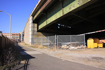
Standing under the old outbound bridge, at the entrance to the Navy Yard Riverwalk, in November 2005. (11/13/05)
May 26, 2013 - The same location, looking slightly different with the plaza area at the waterfront now completed. (See more before-and-afters from 11th and O to see the progress on the demolition of the old bridge and its on-ramp.)

Turning to look to the north, along the path of the Anacostia Riverwalk just east of the Navy Yard, in November 2005. (2/26/12)
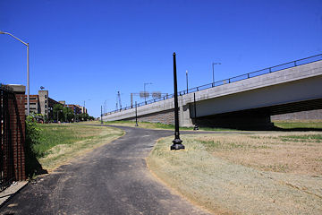
May 26, 2013 - The same location, looking slightly different, and showing that approach to the riverwalk will be a bit less Escape-From-New-York-ish.

Looking north on 11th from N in 2011. The street at the time was one way, with the embankment at right leftover from the old ramp from RFK to the outbound bridge, and the traffic in the left lane preparing to enter the ramp to the old outbound bridge. (4/30/11)
March 9, 2014 - The same location, with the embankment for the old RFK ramp demolished and the new ramp open up from M Street to the outbound freeway bridge. You can also see how the street is wider. (See more before-and-afters from 11th and N to see the progress on the embankment demolition and new ramp.)
The southwest corner of 12th and M, where traffic exiting the old bridges arrived at M Street. (08/08)
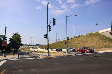
August 29, 2015 - The same location, with the new exit ramp from the inbound freeway bridge open, on the right side of the photo.
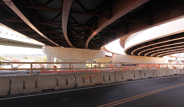
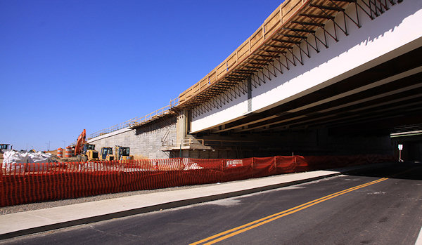
Standing on the almost-completed ramp that will eventually carry inbound I-695 traffic to the westbound SE/SW Freeway, but will be used temporarily starting in 2013 to handle outbound freeway traffic, while the old two-lane flyover at right is demolished and a new three-lane flyover is built in the gap seen here. More September 2012 images are in this gallery. (9/14/12)
Getting a little closer to the 11th and L flyover reveals this gem, from a decidedly different era. (1/25/09)
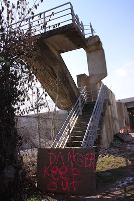
This staircase used to lead to the old inbound ramp to 12th Street, but now.... (1/27/13)
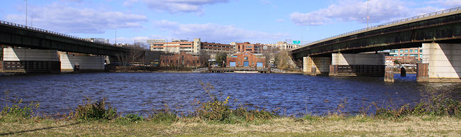
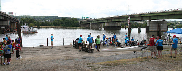
The two spans of the old 11th Street Bridges, as seen from Anacostia Park, looking west toward Near Southeast, about a year before construction began on the new bridges. The buildings in the center were home to the Anacostia Community Boathouse Association (see more about this area before the new bridges were built). (12/08)
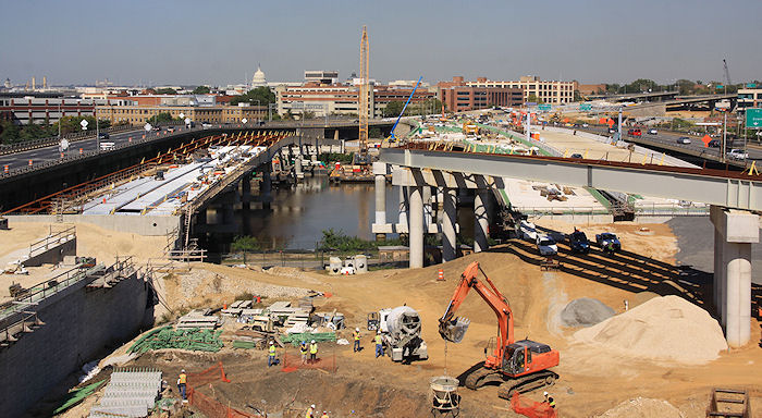
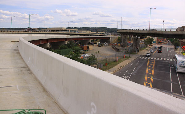
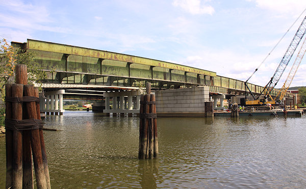
A wider and higher view also looking west, in October 2011. On the left is the new 11th Street Local bridge, which moves two-way traffic between old town Anacostia and 11th Street SE next to the Navy Yard. To the right are the two new freeway bridges, inbound and outbound, which will connect the Southeast Freeway to DC 295, which opened in late 2011 and early 2012. In the middle is the new ramp that will take traffic from the outbound bridge toward northbound DC 295, a connection that doesn't exist with the current bridge configuration. It opened in Dec. 2012. See also this panoramic image of the workzone, and the western shore of the Anacostia. More October 2011 images are in this gallery. (10/7/11)
The western side of the bridges footprint, at the old Anacostia Boathouse docks. (See more photos of how the boathouse area between the bridges looked before construction started.) (8/23/08)
The same location (see the wooden pier?), under construction. More September 2012 images are in this gallery. (9/14/12)
And the same view from the top side. The two 11th Street Bridge freeway spans opened in December 2011 and January 2012, with ramps connecting to and from DC-295 also opening in 2012. This is a not-very-exciting photo from my first trip across the outbound bridge, the day after it opened. (You can also see this short montage of photos I took while crossing.) More January 2012 images are in this gallery. (1/8/12)
My final photo of the old outbound bridge, as seen from the Navy Yard Riverwalk, as its girders were being removed. (9/14/12)
And a last top-side view of the old outbound bridge. (9/14/12)
Latest News
October 15, 2015
Thursday Tidbits: Las Placitas, Navy Yard Items, South Park
March 31, 2015
Tuesday Tidbits: All Over the Map
March 3, 2015
Tuesday Tidbits: What's in a Name, Anyway?
February 26, 2015
I-695 Ramp to 8th Street On its Way Back from a Year's Sabbatical
October 29, 2014
Closures of 11th and M SE Intersection Planned for This Weekend
October 16, 2014
OMA/Olin Design Chosen for 11th Street Bridge Park
June 5, 2014
Thursday Tidbits: Plain White Concrete Sandlot
May 6, 2014
Tuesday Tidbits: Beta Edition