
|
| |||||||||||||||||||

|
Please note that JDLand is no longer being updated.
peek >>
Overview: East M Street
"Cut off from rest of the Near Southeast to the west and the Capitol Hill district the north by highway overpasses and rail connections, this sub-area has been physically and psychologically isolated." (Near Southeast Urban Design Framework)
- Full Neighborhood Development MapThere's a lot more than just the projects listed here. See the complete map of completed, underway, and proposed projects all across the neighborhood.
- What's New This YearA quick look at what's arrived or been announced since the end of the 2018 baseball season.
- Food Options, Now and Coming SoonThere's now plenty of food options in the neighborhood. Click to see what's here, and what's coming.
![-]()
- Anacostia RiverwalkA bridge between Teague and Yards Parks is part of the planned 20-mile Anacostia Riverwalk multi-use trail along the east and west banks of the Anacostia River.
![-]()
- Virginia Ave. Tunnel ExpansionConstruction underway in 2015 to expand the 106-year-old tunnel to allow for a second track and double-height cars. Expected completion 2018.
![-]()
- Rail and Bus Times
Get real time data for the Navy Yard subway, Circulator, Bikeshare, and bus lines, plus additional transit information. - Rail and Bus Times
Get real time data for the Navy Yard subway, Circulator, Bikeshare, and bus lines, plus additional transit information. - Canal ParkThree-block park on the site of the old Washington Canal. Construction begun in spring 2011, opened Nov. 16, 2012.
![-]()
- Nationals Park21-acre site, 41,000-seat ballpark, construction begun May 2006, Opening Day March 30, 2008.
![-]()
- Washington Navy YardHeadquarters of the Naval District Washington, established in 1799.
![-]()
- Yards Park5.5-acre park on the banks of the Anacostia. First phase completed September 2010.
![-]()
- Van Ness Elementary SchoolDC Public School, closed in 2006, but reopening in stages beginning in 2015.
![-]()
- Agora/Whole Foods336-unit apartment building at 800 New Jersey Ave., SE. Construction begun June 2014, move-ins underway early 2018. Whole Foods expected to open in late 2018.
![-]()
- New Douglass BridgeConstruction underway in early 2018 on the replacement for the current South Capitol Street Bridge. Completion expected in 2021.
![-]()
- 1221 Van290-unit residential building with 26,000 sf retail. Underway late 2015, completed early 2018.

- NAB HQ/AvidianNew headquarters for National Association of Broadcasters, along with a 163-unit condo building. Construction underway early 2017.

- Yards/Parcel O Residential ProjectsThe Bower, a 138-unit condo building by PN Hoffman, and The Guild, a 190-unit rental building by Forest City on the southeast corner of 4th and Tingey. Underway fall 2016, delivery 2018.

- New DC Water HQA wrap-around six-story addition to the existing O Street Pumping Station. Construction underway in 2016, with completion in 2018.

- The Harlow/Square 769N AptsMixed-income rental building with 176 units, including 36 public housing units. Underway early 2017, delivery 2019.

- West Half Residential420-unit project with 65,000 sf retail. Construction underway spring 2017.
![-]()
- Novel South Capitol/2 I St.530ish-unit apartment building in two phases, on old McDonald's site. Construction underway early 2017, completed summer 2019.
![Novel South Capitol]()
- 1250 Half/Envy310 rental units at 1250, 123 condos at Envy, 60,000 square feet of retail. Underway spring 2017.
![-]()
- Parc Riverside Phase II314ish-unit residential building at 1010 Half St., SE, by Toll Bros. Construction underway summer 2017.
![-]()
- 99 M StreetA 224,000-square-foot office building by Skanska for the corner of 1st and M. Underway fall 2015, substantially complete summer 2018. Circa and an unnamed sibling restaurant announced tenants.
![-]()
- The Garrett375-unit rental building at 2nd and I with 13,000 sq ft retail. Construction underway late fall 2017.
![-]()
- Yards/The Estate Apts. and Thompson Hotel270-unit rental building and 227-room Thompson Hotel, with 20,000 sq ft retail total. Construction underway fall 2017.
![-]()
- Meridian on First275-unit residential building, by Paradigm. Construction underway early 2018.
![-]()
- The Maren/71 Potomac264-unit residential building with 12,500 sq ft retail, underway spring 2018. Phase 2 of RiverFront on the Anacostia development.
![-]()
- DC Crossing/Square 696Block bought in 2016 by Tishman Speyer, with plans for 800 apartment units and 44,000 square feet of retail in two phases. Digging underway April 2018.
![DC Crossing]()
- One Hill South Phase 2300ish-unit unnamed sibling building at South Capitol and I. Work underway summer 2018.
![One Hill South Phase 2]()
- New DDOT HQ/250 MNew headquarters for the District Department of Transportation. Underway early 2019.
![New DDOT HQ]()
- 37 L Street Condos11-story, 74-unit condo building west of Half St. Underway early 2019.
![37 L Condos]()
- CSX East Residential/Hotel225ish-unit AC Marriott and two residential buildings planned. Digging underway late summer 2019.
![CSX East Residential/Hotel]()
- 1000 South Capitol Residential224-unit apartment building by Lerner. Underway fall 2019.
![1000 South Capitol Residential]()
- Capper Seniors 2.0Reconstruction of the 160-unit building for low-income seniors that was destroyed by fire in 2018.
![1000 South Capitol Residential]()
- Chemonics HQNew 285,000-sq-ft office building with 14,000 sq ft of retail. Expected delivery 2021.
![1000 South Capitol Residential]()


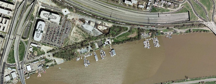
The easternmost portion of Near Southeast is bounded by the 11th Street Bridges, the Southeast Freeway, Pennsylvania Avenue's Sousa Bridge, and the Anacostia River. Maritime Plaza is an office development at the northwest corner of the area (along 12th Street south of M) on what was once a huge Washington Gas property. Also on the former Washington Gas site is the planned residential project at 1333 M Street. Along the water's edge, and even continuing east past the Sousa Bridge, is Boathouse Row. (image from Google Earth)
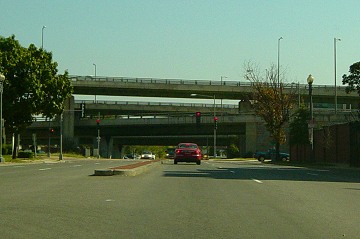
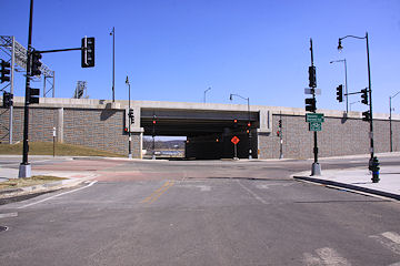
The two street entrances to the East M area from the west have undergone a fair amount of change since 2009. Here's the lovely M Street entrance (showing the equally lovely 11th Street Bridges) in 2003. (10/03)
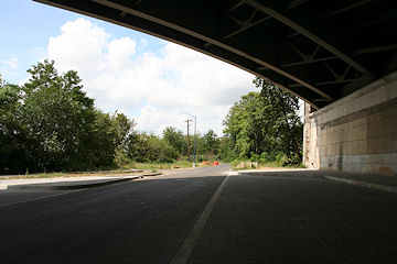
September 6, 2015 - And the same location, with old flyovers gone and new ones in place. 

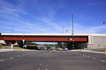
There is also the lovely entrance at O Street, seen here as it was in 2008. (08/08)
March 9, 2014 - And the same location, with the new two-way 11th Street and the new local bridge changing the entry point.
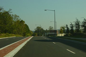
M Street is the northern boundary of this area, and some very nice streetscaping was done to it as it runs past Maritime Plaza. (10/03)
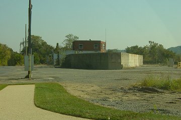
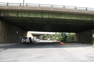
However, once you get past the traffic circle at the northeastern edge of the development, M Street becomes downright rural. A local developer tried to build a residential project on this land south of M and north of Boathouse Row in the late 90s, but could not get the necessary zoning changes passed. (10/03)
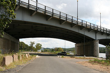
If you continue along M Street, eventually you get to Pennsylvania Avenue's Sousa Bridge; this road continues east/northeast, but the bridge marks the easternmost boundary of Near Southeast. (8/23/08)
Turning around under the Sousa Bridge to see the view when arriving in Near Southeast along M. (8/23/08)
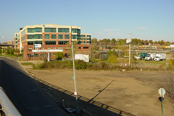
Here's a four-step panorama of the area as seen from the 11th Street Bridge's old M Street exit ramp before it was demolished. First, looking to the northeast, with Maritime Plaza dominating.... (11/05)
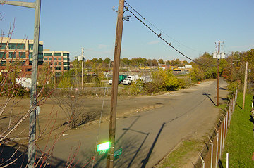
Then the east-northeast... (11/05)
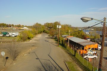
... Then the east, where Water Street runs along Boathouse Row.... (11/05)
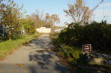
... And then to the southeast, where someday the Anacostia Riverwalk Trail's construction should cleanup the waterfront considerably. (11/05)
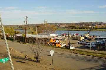
In some spots along the river, you can be mere steps from it and it doesn't seem much like a waterfront. (11/05)
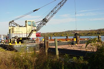
Then, once you get to the river bank, it's not exactly a natural delight. (11/05)
Latest News
September 28, 2010
Maritime Plaza Changes Hands for $119M
August 2, 2010
Maritime Plaza About to Change Hands?
June 13, 2010
Upcoming Road Work on O Street, SE
May 6, 2010
Another Waterfront Project on the Boards
January 11, 2010
Tidbits (ANC 6D, Boathouse, Georgia Ave, Cupcakes!)
August 7, 2009
Reminder: Youth River Sports Day on Saturday
July 31, 2009
11th Street Bridges Open House (+ Boathouse News)
July 14, 2009
Upcoming Events, and Other Linky Goodness
April 9, 2009
Brief Morning Linkage (Ballpark, Boathouse Row)
March 11, 2009
Midweek Mish-Mash
December 15, 2008
Reminder: This Week's Flurry of Events
December 4, 2008
Flurry of Mid-December Meetings and Events