
|
| |||||||||||||||||||

|
Please note that JDLand is no longer being updated.
peek >>
Near Southeast DC Past News Items: South Capitol St.
|
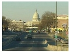
See JDLand's South Capitol St. Project Page
for Photos, History, and Details |
- Full Neighborhood Development MapThere's a lot more than just the projects listed here. See the complete map of completed, underway, and proposed projects all across the neighborhood.
- What's New This YearA quick look at what's arrived or been announced since the end of the 2018 baseball season.
- Food Options, Now and Coming SoonThere's now plenty of food options in the neighborhood. Click to see what's here, and what's coming.
![-]()
- Anacostia RiverwalkA bridge between Teague and Yards Parks is part of the planned 20-mile Anacostia Riverwalk multi-use trail along the east and west banks of the Anacostia River.
![-]()
- Virginia Ave. Tunnel ExpansionConstruction underway in 2015 to expand the 106-year-old tunnel to allow for a second track and double-height cars. Expected completion 2018.
![-]()
- Rail and Bus Times
Get real time data for the Navy Yard subway, Circulator, Bikeshare, and bus lines, plus additional transit information. - Rail and Bus Times
Get real time data for the Navy Yard subway, Circulator, Bikeshare, and bus lines, plus additional transit information. - Canal ParkThree-block park on the site of the old Washington Canal. Construction begun in spring 2011, opened Nov. 16, 2012.
![-]()
- Nationals Park21-acre site, 41,000-seat ballpark, construction begun May 2006, Opening Day March 30, 2008.
![-]()
- Washington Navy YardHeadquarters of the Naval District Washington, established in 1799.
![-]()
- Yards Park5.5-acre park on the banks of the Anacostia. First phase completed September 2010.
![-]()
- Van Ness Elementary SchoolDC Public School, closed in 2006, but reopening in stages beginning in 2015.
![-]()
- Agora/Whole Foods336-unit apartment building at 800 New Jersey Ave., SE. Construction begun June 2014, move-ins underway early 2018. Whole Foods expected to open in late 2018.
![-]()
- New Douglass BridgeConstruction underway in early 2018 on the replacement for the current South Capitol Street Bridge. Completion expected in 2021.
![-]()
- 1221 Van290-unit residential building with 26,000 sf retail. Underway late 2015, completed early 2018.

- NAB HQ/AvidianNew headquarters for National Association of Broadcasters, along with a 163-unit condo building. Construction underway early 2017.

- Yards/Parcel O Residential ProjectsThe Bower, a 138-unit condo building by PN Hoffman, and The Guild, a 190-unit rental building by Forest City on the southeast corner of 4th and Tingey. Underway fall 2016, delivery 2018.

- New DC Water HQA wrap-around six-story addition to the existing O Street Pumping Station. Construction underway in 2016, with completion in 2018.

- The Harlow/Square 769N AptsMixed-income rental building with 176 units, including 36 public housing units. Underway early 2017, delivery 2019.

- West Half Residential420-unit project with 65,000 sf retail. Construction underway spring 2017.
![-]()
- Novel South Capitol/2 I St.530ish-unit apartment building in two phases, on old McDonald's site. Construction underway early 2017, completed summer 2019.
![Novel South Capitol]()
- 1250 Half/Envy310 rental units at 1250, 123 condos at Envy, 60,000 square feet of retail. Underway spring 2017.
![-]()
- Parc Riverside Phase II314ish-unit residential building at 1010 Half St., SE, by Toll Bros. Construction underway summer 2017.
![-]()
- 99 M StreetA 224,000-square-foot office building by Skanska for the corner of 1st and M. Underway fall 2015, substantially complete summer 2018. Circa and an unnamed sibling restaurant announced tenants.
![-]()
- The Garrett375-unit rental building at 2nd and I with 13,000 sq ft retail. Construction underway late fall 2017.
![-]()
- Yards/The Estate Apts. and Thompson Hotel270-unit rental building and 227-room Thompson Hotel, with 20,000 sq ft retail total. Construction underway fall 2017.
![-]()
- Meridian on First275-unit residential building, by Paradigm. Construction underway early 2018.
![-]()
- The Maren/71 Potomac264-unit residential building with 12,500 sq ft retail, underway spring 2018. Phase 2 of RiverFront on the Anacostia development.
![-]()
- DC Crossing/Square 696Block bought in 2016 by Tishman Speyer, with plans for 800 apartment units and 44,000 square feet of retail in two phases. Digging underway April 2018.
![DC Crossing]()
- One Hill South Phase 2300ish-unit unnamed sibling building at South Capitol and I. Work underway summer 2018.
![One Hill South Phase 2]()
- New DDOT HQ/250 MNew headquarters for the District Department of Transportation. Underway early 2019.
![New DDOT HQ]()
- 37 L Street Condos11-story, 74-unit condo building west of Half St. Underway early 2019.
![37 L Condos]()
- CSX East Residential/Hotel225ish-unit AC Marriott and two residential buildings planned. Digging underway late summer 2019.
![CSX East Residential/Hotel]()
- 1000 South Capitol Residential224-unit apartment building by Lerner. Underway fall 2019.
![1000 South Capitol Residential]()
- Capper Seniors 2.0Reconstruction of the 160-unit building for low-income seniors that was destroyed by fire in 2018.
![1000 South Capitol Residential]()
- Chemonics HQNew 285,000-sq-ft office building with 14,000 sq ft of retail. Expected delivery 2021.
![1000 South Capitol Residential]()


246 Blog Posts Since 2003
Go to Page: 1 | ... 20 | 21 | 22 | 23 | 24 | 25
Search JDLand Blog Posts by Date or Category
Go to Page: 1 | ... 20 | 21 | 22 | 23 | 24 | 25
Search JDLand Blog Posts by Date or Category
The DC Zoning Commission will be taking up the stadium text amendment to the Capitol Gateway Overlay District at tonight's meeting. This should be when they vote for final approval--although with the discussions these days about building heights near the stadium, I wonder if there will be some revisions in the works.
|
|
In case you don't have enough Near Southeast items on your calendar:
· The October meeting of ANC 6D (which includes about 85% of Near Southeast in its borders) will be held Monday, Oct. 17. The agenda includes two presentations of Near Southeast interest: one on the Capper/Carrollsburg Second Stage PUD, and one on the Florida Rock PUD. [entry repeated from a few days ago as a reminder]
· The Capitol Hill Restoration Society will be hosting a forum about the Anacostia Waterfront Initiatve on October 25. In addition to outlining the framework of the redevelopment plans (from the South Capitol Street corridor to the new stadium (!) through the Navy Yard up through Reservation 13 and RFK), the presentation will highlight how the initiative will relate to Capitol Hill in terms of business opportunities, urban density, and historic preservation.
· The small mixed-use project at 801 Virginia Avenue winds its way through the bureaucracy with a hearing in front of the Historic Preservation Review Board on October 27. The developer wishes to demolish the auto repair shop and replace it with a four-story building with 17 residences and ground-floor retail.
|
More posts:
801va, ANC News, Capper, 8th Street, Florida Rock, Navy Yard, South Capitol St., Nationals Park
|
It's been a busy busy weekend here at the Near Southeast page. To reflect the true boundaries of the area I'm tracking, the map at right has been expanded, to 11th Street to the east and to South Capitol and S Streets in the south. I've also added two new pages to the site: the New South Capitol Street Bridge page, and the Near Southeast East End page, both of which have lots and lots of photos, and links to information about what's happening in those spots. I've also finally made my Navy Yard page more than an afterthought, adding many more pictures (although not so many from inside the Navy Yard walls, I don't want a visit from the Homeland Security folks). I know this makes the map smaller and a bit harder to read, but I also needed to leave some space for when more projects get underway. And, in the midst of all that, I added new photos to many of the existing pages: check out the DOT HQ, Washington Canal Park, Capitol Hill Tower, Florida Rock, and WASA pages to see them. (You'll also find a few new pictures on some other pages, but it'd be embarassing to mention them here when there's only one new photo on a page.)
|
More posts:
Canal Park, Capper, Capper Senior Apt Bldgs, Capitol Hill Tower, US Dept. of Transportation HQ, 8th Street, Florida Rock, M Street, Navy Yard, South Capitol St., Douglass Bridge, DC Water (WASA)
|
The Anacostia Waterfront Corporation has posted the draft summary of its Ballpark District Urban Development Strategy (PDF). This is an important document that should be read by anyone interested in the development plans around the stadium. It defines the Ballpark District as 60 acres surrounding the baseball stadium site, including the two blocks north of the stadium site, the western portion of the Southeast Federal Center, a few acres of the WASA site, the Florida Rock site, and additional land at the foot of South Capitol Street (currently owned by Douglas Jemal). The document describes its vision for a "vibrant mixed-use waterfront district":
· Shops, and restaurants and entertainment venues along Half Street, First Street and the Anacostia River;
· An engaging pedestrian environment with strong linkages to and along the waterfront;
· Major public gathering spaces along Half Street, at the ballpark, and at the foot of First Street at the river;
· A grand promenade along the Anacostia River and Potomac Avenue;
· Upper-level offices, hotel rooms and housing that create a diverse population of residents, workers and visitors; and
· A state-of-the-art ballpark that contributes to the life and identity of the neighborhood.
In all, the AWC envisions 465,000-785,000 sq ft of retail and restaurant uses, 350,000-1.6 million sq ft of office space; 1,900,000 to 3,600,000 sq ft (1570 to 2980 units) of housing; and 7,000 to 8,000 parking spaces. (We also find out that the traffic circle being planned as the terminus for the new South Capitol Street Bridge will be called "Potomac Circle.") Vision documents are wonderful things, I look forward to living long enough to see what the reality actually ends up being :-).
|
More posts:
Anacostia Waterfront Corp., Florida Rock, South Capitol St., staddis, Nationals Park, DC Water (WASA), The Yards
|
Speaking of bridges and environmental impact statements, I've only now stumbled across both the South Capitol Street Bridge Study web site and SouthCapitolEIS.com, two efforts that ran concurrently over the last six months as part of the project to replace the Frederick Douglass Bridge. (I've only been checking the DDOT Public Meetings page on a daily basis for weeks now, sure would have been nice if one of their announcements had ever mentioned these URLs!) Both sites have lots of links and information, and should be required bookmarks for anyone interested in the replacement (and most likely realignment) of the South Capitol Street Bridge. Materials from the summer meetings of these projects are available, as is a mammoth, crash-your-computer PDF showing two of the proposed alternate alignments. I believe these two stages are pretty much over, so I'll try to keep you posted on the next phases.
|
More posts:
South Capitol St., Douglass Bridge, Traffic Issues
|
The District Department of Transportation has received a Best Practices in Smart Growth and Transportation Award for the South Capitol Gateway Project from the American Association of State Highway and Transportation Officials. According to the DDOT press release, "The award singles out DDOT in the category of Revitalizing Communities and Corridors for the smart growth features planned for the corridor and for realizing South Capitol Street as the southern grand entrance to the US Capitol, as envisioned in the historic L'Enfant Plan for the Nation's Capital." Quoting Transportation Director Dan Tangherlini, "The signature South Capitol/Frederick Douglass Bridge will be sensitively designed to connect travelers and neighborhoods to the river and to each other. The new bridge and streetscape will draw people to the corridor to live, work and enjoy the Anacostia River and waterfront." The release also describes planned transportation improvements for the corridor, including "a green median, wide sidewalks and street amenities as well as roadway, pedestrian, transit and bicycle improvements." For more, see DDOT's South Capitol Gateway Corridor and Anacostia Access Study as well as the National Capital Planning Commission's New Vision for South Capitol Street.
|
More posts:
South Capitol St.
|
Near Southeast hits the bigtime, with a front-page story in Monday's Post ("A Transformed Neighborhood Awaits Stadium") that jumps to two full pages of information and photos about the 'hood. The story gives a great feel for the mood as the land rush by developers transforms this formerly neglected neighborhood. A huge map lists 64 spots within Near Southeast that are being developed, sought after, or are held by developers who aren't divulging their plans. If some of the information and photos seem familiar, that's because your humble Near Southeast webmaster temporarily escaped the Post's Newsroom IT department and helped put together the package. Dana Hedgpeth and I will be taking questions and comments on Monday Aug. 15 at 11 am in a washingtonpost.com Live Online chat, so please join in to talk about all the goings on.
While frequent JDLand visitors will be up-to-speed on much on the content, there are some new nuggets to be found:
· Construction is expected to start in 2007 on the first project within the Southeast Federal Center, 400 residential units with accompanying small retail, with delivery anticipated in 2008. (Don't yet know where on the SFC's 44 acres these will be built.)
· Monument Realty has now acquired all parcels on N Street between South Capitol and Half streets, as well with properties on both South Capitol and Half (in what I'm anticipating the city is going to start calling the Stadium District, so of course I had to create a new page for it).
· Faison Associates has just acquired an acre of property that covers almost the entire western half of the block between 1st, New Jersey, L, and M. (But the On Luck Cafeteria on the corner of 1st and M remains a holdout.)
· The owner of the Splash car wash on I Street reveals that he has received multiple $8 million offers for his property and a neighboring parcel.
· The Donohoe Cos. appear to be planning an office building for their property in the 1100 block of New Jersey Avenue.
· And, for those of you who've been following along for a while, you'll also enjoy reading the story of the Star Market at 2nd and L, which lived a solitary life until Capitol Hill Tower rose up around it.
|
More posts:
1111 New Jersey/Insignia on M, Florida Rock, Little Red Bldg/Lot 38 Espresso, mnorth, Monument Valley/Half St., Onyx, South Capitol St., staddis, Nationals Park, The Yards
|
The DC Department of Transportation will hold a public meeting regarding Early Right of Way Acquisitions on the South Capitol Street Bridge Alignment Study Project, Tuesday, August 16, 2005, at 10 am, at the Reeves Municipal Center at 14th and U, NW. According to the press release, the "purpose of this meeting is to provide the landowners and other interested persons with an opportunity to receive information about the project, DDOT's Early Acquisition Program, and to submit written and verbal comments." The realignment of the South Capitol Street (Frederick Douglass) Bridge is part of the huge plans for the redesign and redevelopment of South Capitol Street, as detailed in both the New Vision for South Capitol Street (NCPC), and DDOT's South Capitol Gateway Corridor and Anacostia Access Study. (UPDATE: Bumped up as a reminder.)
|
More posts:
Douglass Bridge, Traffic Issues
|
The mammoth transportation bill that's making its way through Congress contains a few nuggets for Near Southeast--$123 million for the rehabilitation of the South Capitol Street Bridge, and $17.6 million for upgrading of the 11th Street Bridge and construction of new ramps for access to M Street, SE.
|
|
A reminder that the next South Capitol Street Corridor and Baseball Master Plan public meeting will be held May 24, 2005 from 6:00 - 8:30 pm at the King-Greenleaf Recreational Center, 201 N Street SW. The DC Office of Planning has posted the presentation materials and flipchart notes from the April 23 workshop.
|
More posts:
South Capitol St., Nationals Park
|
246 Posts:
Go to Page: 1 | ... 20 | 21 | 22 | 23 | 24 | 25
Search JDLand Blog Posts by Date or Category
Go to Page: 1 | ... 20 | 21 | 22 | 23 | 24 | 25
Search JDLand Blog Posts by Date or Category