
|
| |||||||||||||||||||

|
Please note that JDLand is no longer being updated.
peek >>
Official Web Sites: TheMaren.com | Dock79.com Developers: Florida Rock Properties | MRP Realty
Dock 79 Interior Photo Gallery
The Maren / Dock 79
Florida Rock/RiverFront on the Anacostia
25 and 79 Potomac Ave., SE
Florida Rock/RiverFront on the Anacostia
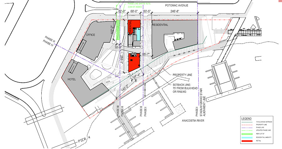
Four-phase waterfront site on about six acres; in development since the 1990s
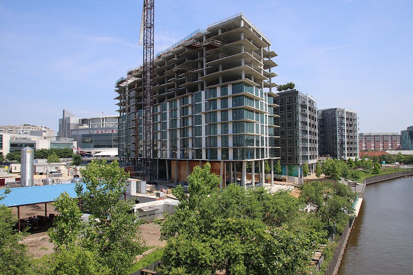
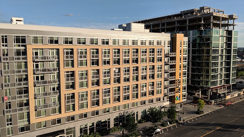
Construction of 9-story, 305-unit residential building "Dock 79" begun late 2014, completed Fall 2016; 15,266 sq ft retail
Phase 2, The Maren, a 264-unit residential building with 12,500 sq ft retail, underway spring 2018
Phase 3 planned as 12-story, 313,705-sq-ft office building with 11,500 sq ft retail;
Phase 4 planned as 14-story, 261,760-sq-ft building (type undecided) with 12,610 sq ft retail;
Dock 79 Retail Tenants: The Salt Line, All-Purpose Pizzeria, Dacha Beer Garden
Official Web Sites: TheMaren.com | Dock79.com Developers: Florida Rock Properties | MRP Realty
Dock 79 Interior Photo Gallery
- Full Neighborhood Development MapThere's a lot more than just the projects listed here. See the complete map of completed, underway, and proposed projects all across the neighborhood.
- What's New This YearA quick look at what's arrived or been announced since the end of the 2018 baseball season.
- Food Options, Now and Coming SoonThere's now plenty of food options in the neighborhood. Click to see what's here, and what's coming.
![-]()
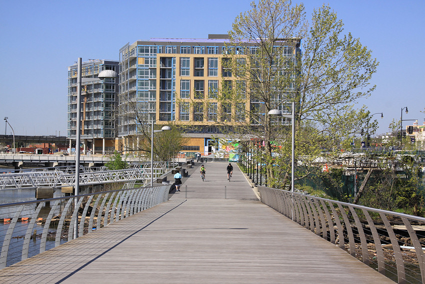
- Anacostia RiverwalkA bridge between Teague and Yards Parks is part of the planned 20-mile Anacostia Riverwalk multi-use trail along the east and west banks of the Anacostia River.
![-]()
- Virginia Ave. Tunnel ExpansionConstruction underway in 2015 to expand the 106-year-old tunnel to allow for a second track and double-height cars. Expected completion 2018.
![-]()
- Rail and Bus Times
Get real time data for the Navy Yard subway, Circulator, Bikeshare, and bus lines, plus additional transit information. - Rail and Bus Times
Get real time data for the Navy Yard subway, Circulator, Bikeshare, and bus lines, plus additional transit information. - Canal ParkThree-block park on the site of the old Washington Canal. Construction begun in spring 2011, opened Nov. 16, 2012.
![-]()
- Nationals Park21-acre site, 41,000-seat ballpark, construction begun May 2006, Opening Day March 30, 2008.
![-]()
- Washington Navy YardHeadquarters of the Naval District Washington, established in 1799.
![-]()
- Yards Park5.5-acre park on the banks of the Anacostia. First phase completed September 2010.
![-]()
- Van Ness Elementary SchoolDC Public School, closed in 2006, but reopening in stages beginning in 2015.
![-]()
- Agora/Whole Foods336-unit apartment building at 800 New Jersey Ave., SE. Construction begun June 2014, move-ins underway early 2018. Whole Foods expected to open in late 2018.
![-]()
- New Douglass BridgeConstruction underway in early 2018 on the replacement for the current South Capitol Street Bridge. Completion expected in 2021.
![-]()
- 1221 Van290-unit residential building with 26,000 sf retail. Underway late 2015, completed early 2018.

- NAB HQ/AvidianNew headquarters for National Association of Broadcasters, along with a 163-unit condo building. Construction underway early 2017.

- Yards/Parcel O Residential ProjectsThe Bower, a 138-unit condo building by PN Hoffman, and The Guild, a 190-unit rental building by Forest City on the southeast corner of 4th and Tingey. Underway fall 2016, delivery 2018.

- New DC Water HQA wrap-around six-story addition to the existing O Street Pumping Station. Construction underway in 2016, with completion in 2018.

- The Harlow/Square 769N AptsMixed-income rental building with 176 units, including 36 public housing units. Underway early 2017, delivery 2019.

- West Half Residential420-unit project with 65,000 sf retail. Construction underway spring 2017.
![-]()
- Novel South Capitol/2 I St.530ish-unit apartment building in two phases, on old McDonald's site. Construction underway early 2017, completed summer 2019.
![Novel South Capitol]()
- 1250 Half/Envy310 rental units at 1250, 123 condos at Envy, 60,000 square feet of retail. Underway spring 2017.
![-]()
- Parc Riverside Phase II314ish-unit residential building at 1010 Half St., SE, by Toll Bros. Construction underway summer 2017.
![-]()
- 99 M StreetA 224,000-square-foot office building by Skanska for the corner of 1st and M. Underway fall 2015, substantially complete summer 2018. Circa and an unnamed sibling restaurant announced tenants.
![-]()
- The Garrett375-unit rental building at 2nd and I with 13,000 sq ft retail. Construction underway late fall 2017.
![-]()
- Yards/The Estate Apts. and Thompson Hotel270-unit rental building and 227-room Thompson Hotel, with 20,000 sq ft retail total. Construction underway fall 2017.
![-]()
- Meridian on First275-unit residential building, by Paradigm. Construction underway early 2018.
![-]()
- The Maren/71 Potomac264-unit residential building with 12,500 sq ft retail, underway spring 2018. Phase 2 of RiverFront on the Anacostia development.
![-]()
- DC Crossing/Square 696Block bought in 2016 by Tishman Speyer, with plans for 800 apartment units and 44,000 square feet of retail in two phases. Digging underway April 2018.
![DC Crossing]()
- One Hill South Phase 2300ish-unit unnamed sibling building at South Capitol and I. Work underway summer 2018.
![One Hill South Phase 2]()
- New DDOT HQ/250 MNew headquarters for the District Department of Transportation. Underway early 2019.
![New DDOT HQ]()
- 37 L Street Condos11-story, 74-unit condo building west of Half St. Underway early 2019.
![37 L Condos]()
- CSX East Residential/Hotel225ish-unit AC Marriott and two residential buildings planned. Digging underway late summer 2019.
![CSX East Residential/Hotel]()
- 1000 South Capitol Residential224-unit apartment building by Lerner. Underway fall 2019.
![1000 South Capitol Residential]()
- Capper Seniors 2.0Reconstruction of the 160-unit building for low-income seniors that was destroyed by fire in 2018.
![1000 South Capitol Residential]()
- Chemonics HQNew 285,000-sq-ft office building with 14,000 sq ft of retail. Expected delivery 2021.
![1000 South Capitol Residential]()


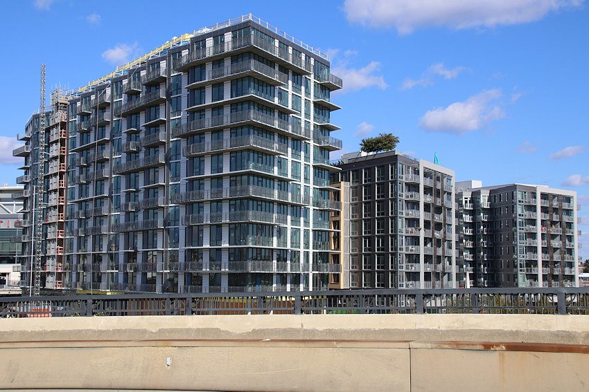 Nov. 3, 2019 - The Maren, getting its face on, as seen from the Douglass Bridge, with its sibling Dock 79 to the right, and with the Anacostia River at right. Alas, the upriver pedestrian path is closed, so I had to shoot from across the bridge. Waaaah!
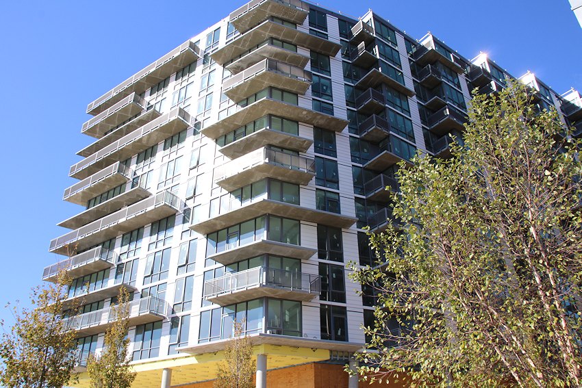 Nov. 3, 2019 - Looking at the Maren up close.
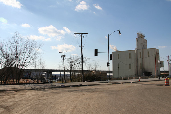
March 23, 2006 - The site known as Florida Rock in its pre-redevelopment phase.
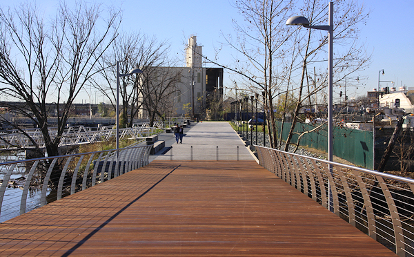
 Nov. 3, 2019 - Basically the same location, 13 years later, with the Maren at left and Dock 79 at right.
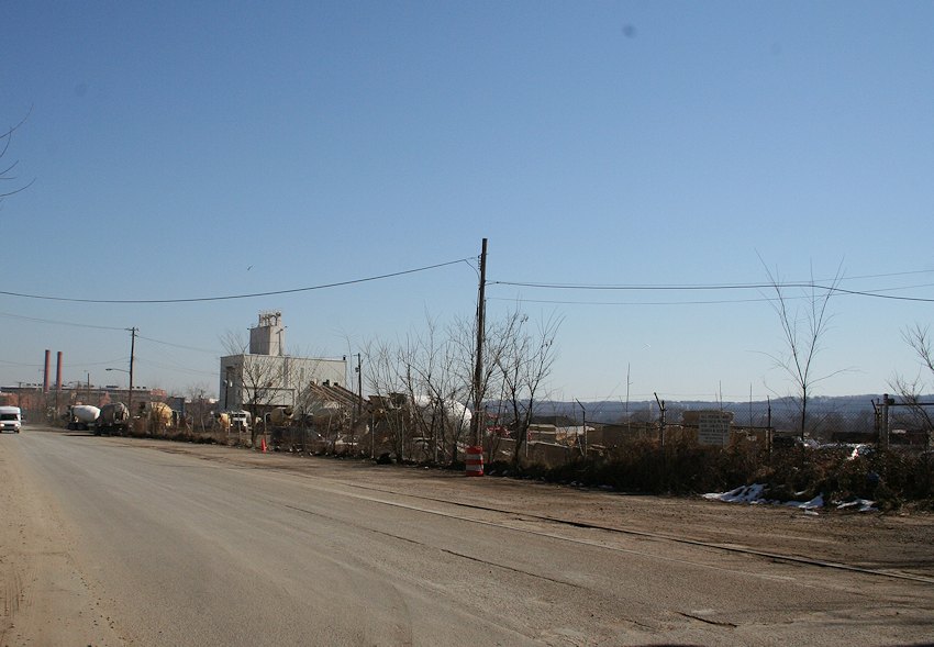
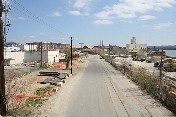
Feb. 16, 2006 - Looking south-southeastward from east of the intersection of South Capitol and Potomac in early 2006.
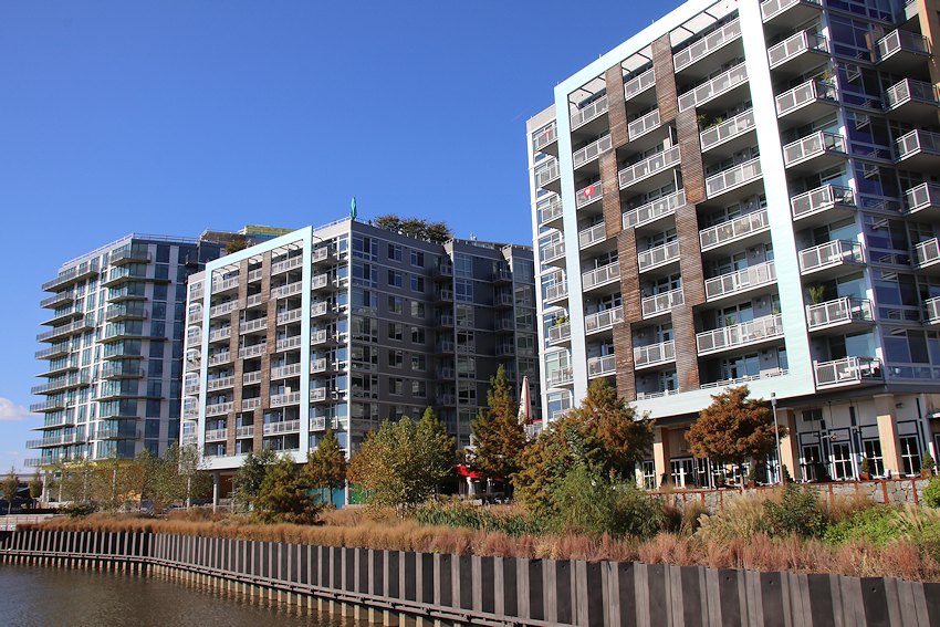
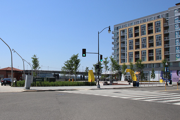
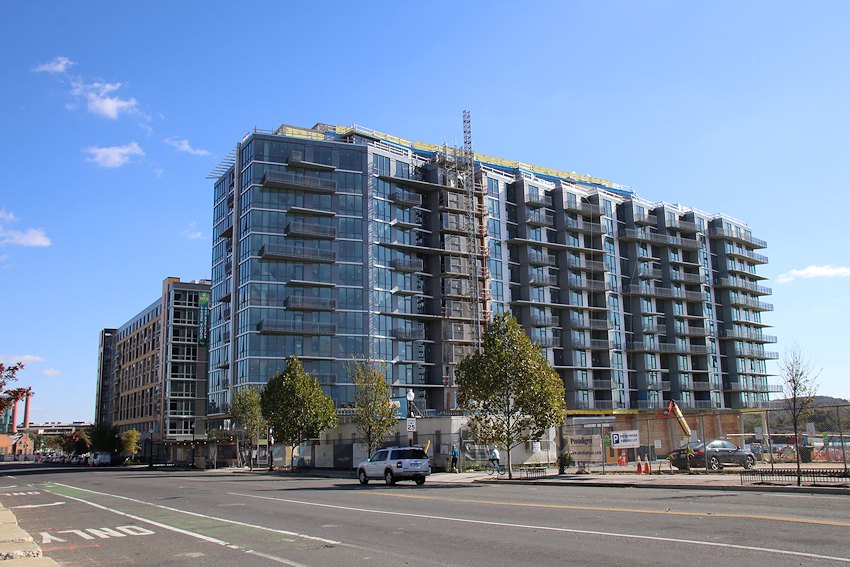 Nov. 3, 2019 - And more or less the same location, with the first two phases of the RiverFront redevelopment front and center.
The Maren, Sliding from to February 2006 to May 2019
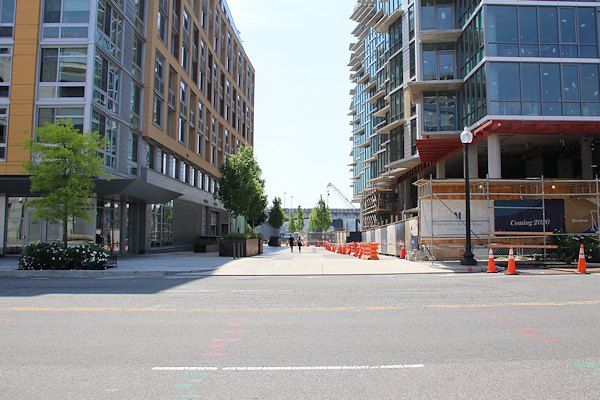
Looking across Potomac Avenue at what was then its intersection at Half Street, first when the land was a concrete plant and now the current view.
Browse More Sliders
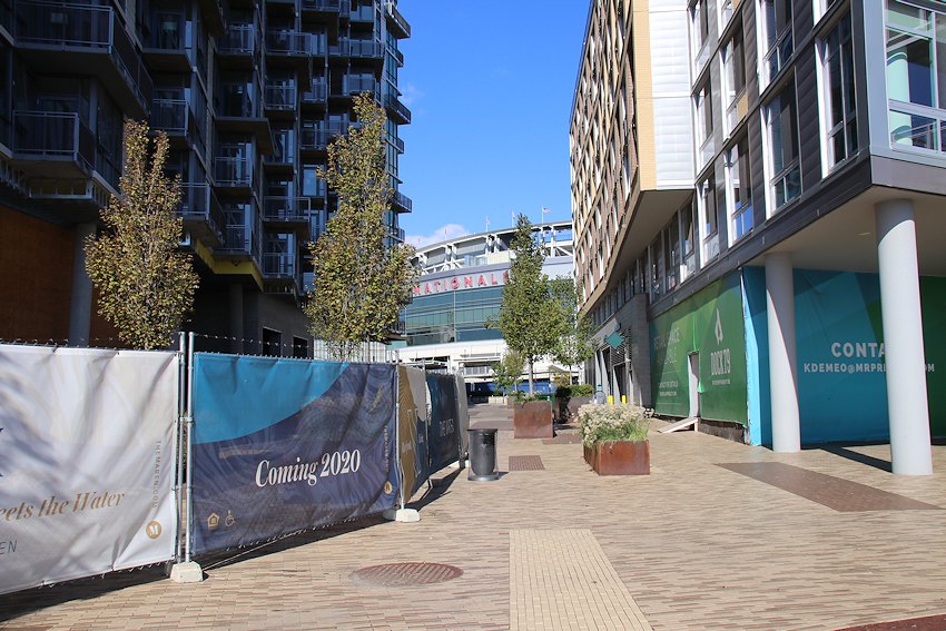 Nov. 3, 2019 - Florida Rock Alley isn't quite an alley yet, but it is already a pedestrian and vehicular passageway. It is also where the shared bikes for residents of Dock 79 are parked.
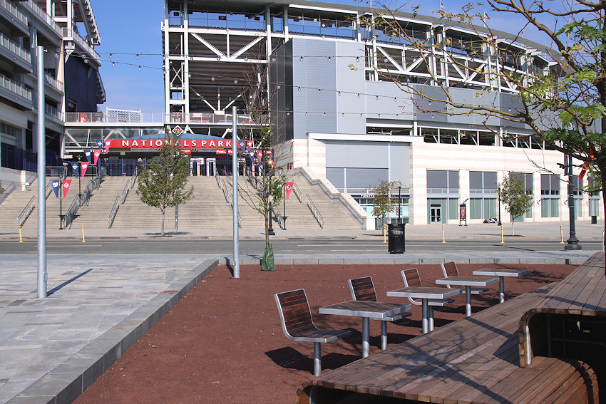
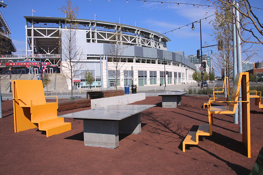
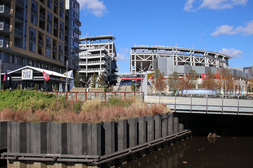 Nov. 3, 2019 - A look at the plaza on the site's eastern edge, where both the Salt Line and the Dacha Beer Garden liven up the proceedings, especially on game days. (But not on Sundays at 10:30 am, when this photo was taken.)
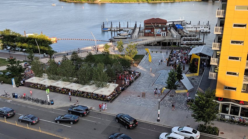 June 22, 2019 - The reverse view of the plaza as seen from Nationals Park, to prove that the proceedings are indeed livened up on game days.
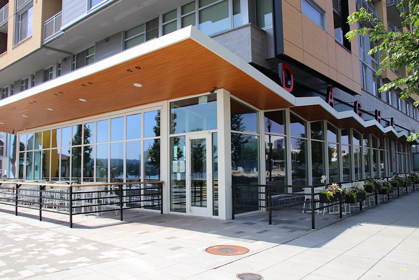
May 19, 2019 - Dacha, with both an interior space and a large beer garden on the adjoining plaza, opened in April 2019.

May 19, 2019 - The aforementioned plaza. Yes, it's blurry--I took it from a bike.
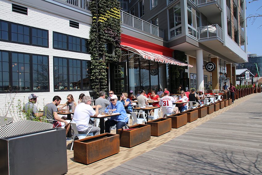
April 14, 2018 - Dock 79 welcomed All-Purpose Pizzeria in April, 2018, and it didn't take long for Nats fans to find it.
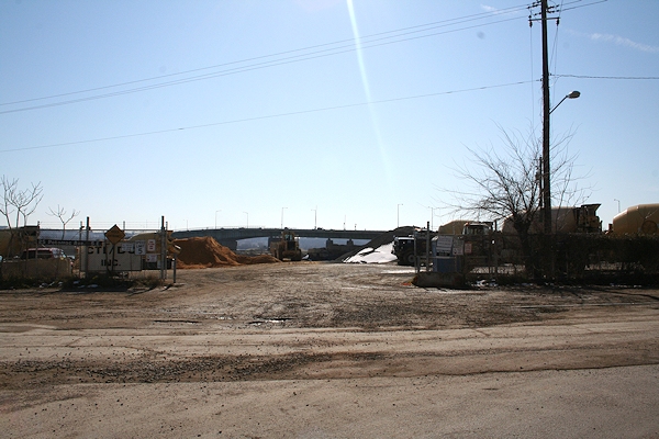
August 2005 - The "Florida Rock" property as seen from the Frederick Douglass Bridge in August 2005. 

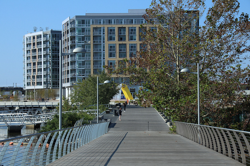
May 19, 2019 - The same view more than a decade later, with Dock 79 completed, the Maren topped out, and with something else kind of different, too.
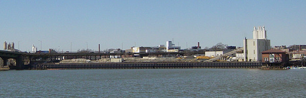
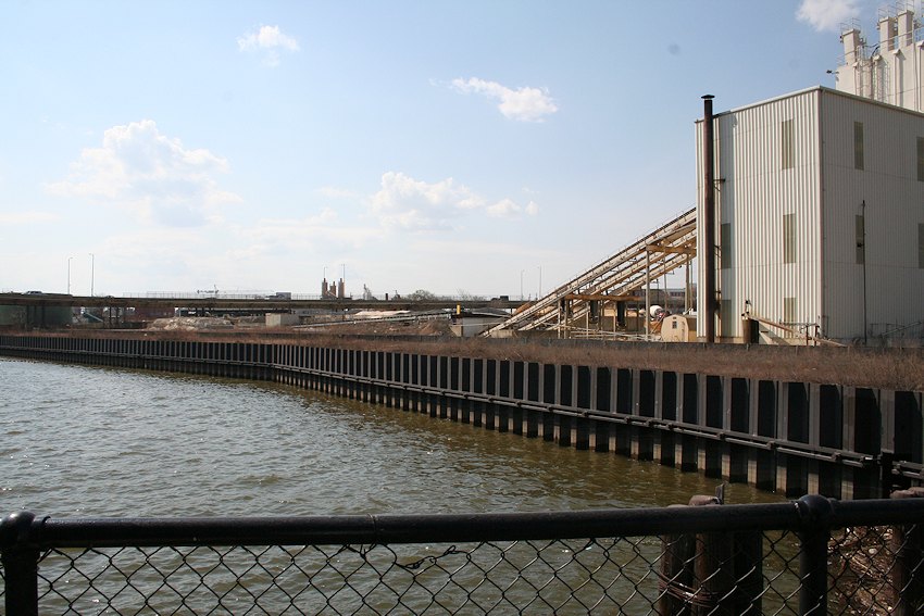
March 2005 - Looking at the RiverFront property from across the Anacostia River, at Poplar Point; the riverfront bulkhead marks the property's boundaries.
March 23, 2019 - The same view, 15 years later.
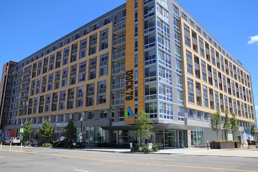
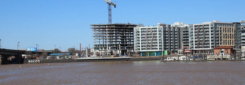
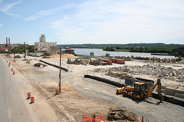
August 6, 2017 - Dock 79, completed, seen here from Potomac Avenue, SE.
July 16, 2016 - The planned four phases of the RiverFront redevelopment, with Phase I's Dock 79 completed and Phase 2 expected to begin construction in 2018. Note that the two latter phases are dependent on the demolition of the existing Douglass Bridge.
Oct. 16, 2016 - The original public plaza's built-in tables, which were replaced in early 2019 by the Dacha beer garden.
Oct. 16, 2016 - Another view of the original plaza.
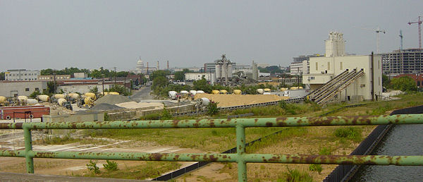
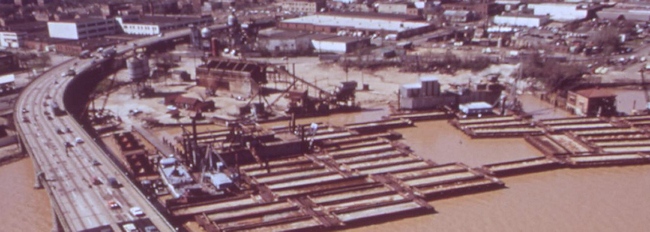
June 2008 - The Florida Rock site, as seen from the southeast viewing platform at Nationals Park in June 2008. The concrete plant eventually closed, and the tower was demolished in late 2011.
June 22, 2019 - A not-panoramic shot of the same location, with Dock 79 finished and the Maren under construction.
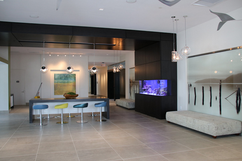
August 18, 2016 - The Dock 79 lobby, not long after the first residents began moving in. For more interior photos, see this gallery.
Dock 79, Sliding from to January 2008 to June 2017
At 1st Street and Potomac Avenue, SE, the old concrete plant known as Florida Rock stood until November 2011. Now, the Dock 79 apartment building construction looms over what will be a new public plaza connected to Diamond Teague Park.
Browse More Sliders
Oct. 16, 2016 - The same view nearly ten years later, with Dock 79 and the plaza completed.
Nov. 25, 2011 - My last shot of the Florida Rock concrete tower, taken from the new Yards/Teague connector bridge just as demolition was getting underway. The Anacostia Riverwalk Trail will continue into and all along the RiverFront site. (11/25/11)
April 16, 2016 - And the same view more than years later, with Dock 79 nearing completion.
A blurry overhead view of what we now call the Florida Rock site, taken in April 1973. From the National Archives. (4/1973)
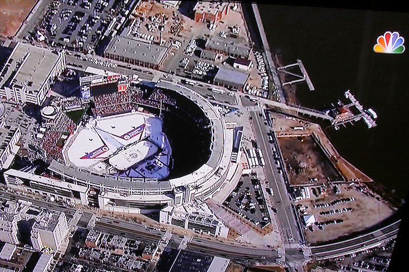
Jan. 1, 2015 - The TV coverage of the NHL Winter Classic at Nationals Park helpfully provided this overhead view of the footprint for current construction, at right.
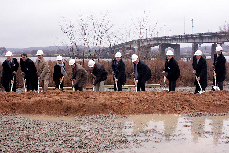
Dec. 9, 2014 - The ceremonial groundbreaking for the Phase 1 apartment building was held in a cold rain, but there was no shortage of VIPs wielding shovels. (See more photos from the event.)
Looking eastward on Potomac Avenue from the Frederick Douglass Bridge viaduct in April 2006, a little more than a year before the overpass was demolished; RiverFront lines the entire right/south side of the street. (04/06)
A very similar view to the one at left, but focused more on the RiverFront property itself, just after its fences were taken down to prepare for the pre-ballpark widening of Potomac Avenue. (07/07)
Note: The renderings below are from the designs approved for the site in 2008. However, in 2011, the site's developers began the process of returning to the Zoning Commission to seek approvals for changes to the site's design, with a new architect. So the renderings you see here are, for now, merely interesting for a general sense of the site and for historical purposes.
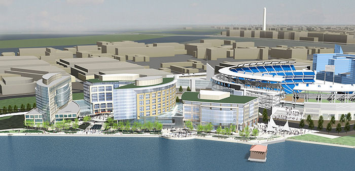
A January 2008 rendering of the 5.8-acre, four-building RiverFront project, as seen from the Anacostia River, with Nationals Park a strong presence just to its northeast. A hotel, two office buildings, a residential building, a riverfront esplanade, a glass-enclosed retail galleria, and a public plaza are all parts of this 1.1-million-square-foot proposal. This site map shows the January 2008 revised design and layout, with the Nationals ballpark to the north, and to the left/west the eventual revised configuration of South Capitol Street (running in a traffic oval at the foot of a new Frederick Douglass Bridge).
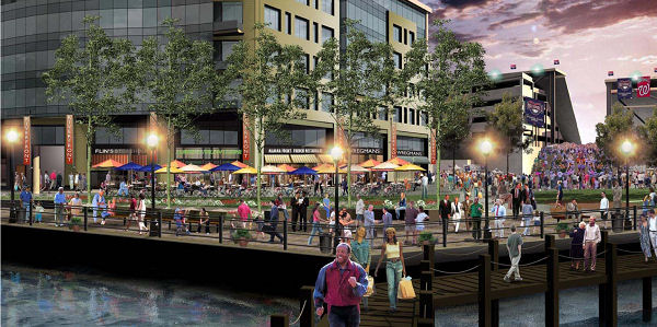
A January 2008 rendering of the eastern edge of the project, looking from Diamond Teague Park and Piers back toward the public plaza and the grand staircase of the ballpark.
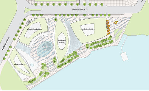
Working from right to left, here are some additional details:
A public plaza on the far eastern edge of the project would complement Diamond Teague Park on its eastern side, helping to pull stadium-goers to the Anacostia riverfront and the Riverwalk esplanade.
The eastern office building would be smaller than in previous designs, but would have much more ground-floor retail.
To the west of the east office building would be "Potomac Quay", highlighted by a glass-enclosed 365-day-a-year galleria-type atrium. There would be ground-floor retail on both sides of the quay, and also a two-story destination restaurant on the south end of the Quay; a "watercourse" with fountains would run into and through the atrium.
The residential, hotel, and west office buildings are now curved around the "Piazza Cascade", where an oval drive connecting the lobbies of the three buildings surrounds a large water feature.
The Riverwalk and Esplanade remain unchanged from previous designs, with a depth of no less than 75 feet and with a bike path separated from the pedestrian areas.
Construction of the project's eastern end (the eastern office building with ground-floor retail, the public plaza, and perhaps the glass-enclosed galleria) is slated to be first, with zoning approvals having been finally received (after 10 years of winding through the system) in 2008. Phase II would be the 160-unit residential building, and at the same time the underground parking and loading for the rest of the project would be built. Phase III would be the western office building, followed by the Phase IV hotel. The final two phases could not start until the new Frederick Douglass Bridge is built, since the old bridge is on the western edge of the RiverFront property.
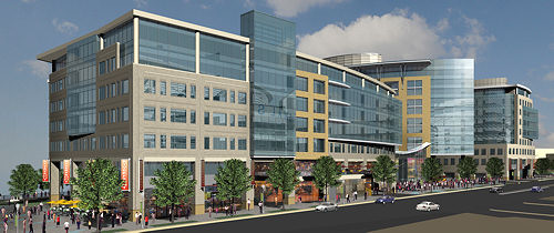
A December 2007 rendering, looking west on Potomac Avenue from First Street, showing RiverFront's northern side, facing the ballpark. The building at left is the east office building, which would be RiverFront's first phase of construction. The plaza at far left would flow into the city's planned Diamond Teague Park. The rendering also shows the ground-floor retail planned for all spaces along Potomac Avenue.
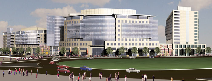
A January 2008 rendering showing the western end of the development, which will border a new large traffic oval at the intersection of South Capitol Street and Potomac Avenue, when the new Douglass Bridge has been built to the south of the current one, which will be demolished. The westernmost portion of RiverFront in fact can't be built until the new Douglass Bridge is done and the old one removed, because the old bridge sits on part of the development's footprint. From left in this rendering you see the east office building, a sliver of the residential building, the west office building prominently at center, and the hotel at far right.
Latest News
November 7, 2019
Catching Up on Digging and Skeletoning, Fall 2019 Edition
January 10, 2019
Construction Update: Welcoming Newbies and Checking Out Faces
September 5, 2018
Long-Distance Tidbit Catchup
June 21, 2018
June Construction Update 3: Holes in the Ground
April 18, 2018
Wednesday Om Nom Nom Tidbits: Oath, Truckeroo, Five Guys
March 7, 2017
Open Thread, For a Spell