|
| |||||||||||||||||||


|
Please note that JDLand is no longer being updated.
peek >>
Near Southeast DC Past News Items: Sep 04, 2015
- Full Neighborhood Development MapThere's a lot more than just the projects listed here. See the complete map of completed, underway, and proposed projects all across the neighborhood.
- What's New This YearA quick look at what's arrived or been announced since the end of the 2018 baseball season.
- Food Options, Now and Coming SoonThere's now plenty of food options in the neighborhood. Click to see what's here, and what's coming.
![-]()
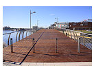
- Anacostia RiverwalkA bridge between Teague and Yards Parks is part of the planned 20-mile Anacostia Riverwalk multi-use trail along the east and west banks of the Anacostia River.
![-]()
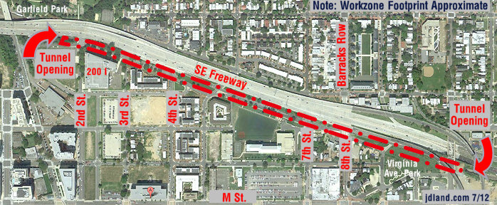
- Virginia Ave. Tunnel ExpansionConstruction underway in 2015 to expand the 106-year-old tunnel to allow for a second track and double-height cars. Expected completion 2018.
![-]()
- Rail and Bus Times
Get real time data for the Navy Yard subway, Circulator, Bikeshare, and bus lines, plus additional transit information. - Rail and Bus Times
Get real time data for the Navy Yard subway, Circulator, Bikeshare, and bus lines, plus additional transit information. - Canal ParkThree-block park on the site of the old Washington Canal. Construction begun in spring 2011, opened Nov. 16, 2012.
![-]()
- Nationals Park21-acre site, 41,000-seat ballpark, construction begun May 2006, Opening Day March 30, 2008.
![-]()
- Washington Navy YardHeadquarters of the Naval District Washington, established in 1799.
![-]()
- Yards Park5.5-acre park on the banks of the Anacostia. First phase completed September 2010.
![-]()
- Van Ness Elementary SchoolDC Public School, closed in 2006, but reopening in stages beginning in 2015.
![-]()
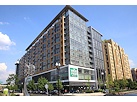
- Agora/Whole Foods336-unit apartment building at 800 New Jersey Ave., SE. Construction begun June 2014, move-ins underway early 2018. Whole Foods expected to open in late 2018.
![-]()
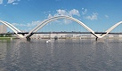
- New Douglass BridgeConstruction underway in early 2018 on the replacement for the current South Capitol Street Bridge. Completion expected in 2021.
![-]()
- 1221 Van290-unit residential building with 26,000 sf retail. Underway late 2015, completed early 2018.
- NAB HQ/AvidianNew headquarters for National Association of Broadcasters, along with a 163-unit condo building. Construction underway early 2017.
- Yards/Parcel O Residential ProjectsThe Bower, a 138-unit condo building by PN Hoffman, and The Guild, a 190-unit rental building by Forest City on the southeast corner of 4th and Tingey. Underway fall 2016, delivery 2018.
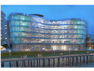
- New DC Water HQA wrap-around six-story addition to the existing O Street Pumping Station. Construction underway in 2016, with completion in 2018.
- The Harlow/Square 769N AptsMixed-income rental building with 176 units, including 36 public housing units. Underway early 2017, delivery 2019.
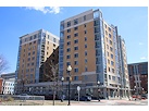
- West Half Residential420-unit project with 65,000 sf retail. Construction underway spring 2017.
![-]()
- Novel South Capitol/2 I St.530ish-unit apartment building in two phases, on old McDonald's site. Construction underway early 2017, completed summer 2019.
![Novel South Capitol]()
- 1250 Half/Envy310 rental units at 1250, 123 condos at Envy, 60,000 square feet of retail. Underway spring 2017.
![-]()
- Parc Riverside Phase II314ish-unit residential building at 1010 Half St., SE, by Toll Bros. Construction underway summer 2017.
![-]()
- 99 M StreetA 224,000-square-foot office building by Skanska for the corner of 1st and M. Underway fall 2015, substantially complete summer 2018. Circa and an unnamed sibling restaurant announced tenants.
![-]()
- The Garrett375-unit rental building at 2nd and I with 13,000 sq ft retail. Construction underway late fall 2017.
![-]()
- Yards/The Estate Apts. and Thompson Hotel270-unit rental building and 227-room Thompson Hotel, with 20,000 sq ft retail total. Construction underway fall 2017.
![-]()
- Meridian on First275-unit residential building, by Paradigm. Construction underway early 2018.
![-]()
- The Maren/71 Potomac264-unit residential building with 12,500 sq ft retail, underway spring 2018. Phase 2 of RiverFront on the Anacostia development.
![-]()
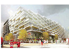
- DC Crossing/Square 696Block bought in 2016 by Tishman Speyer, with plans for 800 apartment units and 44,000 square feet of retail in two phases. Digging underway April 2018.
![DC Crossing]()
- One Hill South Phase 2300ish-unit unnamed sibling building at South Capitol and I. Work underway summer 2018.
![One Hill South Phase 2]()
- New DDOT HQ/250 MNew headquarters for the District Department of Transportation. Underway early 2019.
![New DDOT HQ]()
- 37 L Street Condos11-story, 74-unit condo building west of Half St. Underway early 2019.
![37 L Condos]()
- CSX East Residential/Hotel225ish-unit AC Marriott and two residential buildings planned. Digging underway late summer 2019.
![CSX East Residential/Hotel]()
- 1000 South Capitol Residential224-unit apartment building by Lerner. Underway fall 2019.
![1000 South Capitol Residential]()
- Capper Seniors 2.0Reconstruction of the 160-unit building for low-income seniors that was destroyed by fire in 2018.
![1000 South Capitol Residential]()
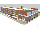
- Chemonics HQNew 285,000-sq-ft office building with 14,000 sq ft of retail. Expected delivery 2021.
![1000 South Capitol Residential]()

2 Blog Posts
If you'd like to go back in time this holiday weekend, here are a few options for you.
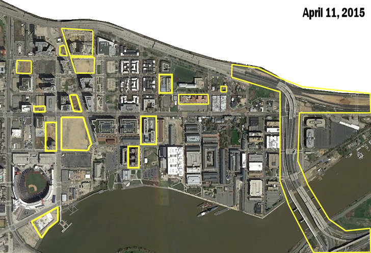 * FROM FAR ABOVE, 2015: With thanks to reader Maelstrom for the heads up, I've added Google's new satellite view of the neighborhood from April 11, 2015 to my Images From Above page, which displays annotated images first from 1949 then every few years from 1988 to the present, showing the changing landscape of Near Southeast.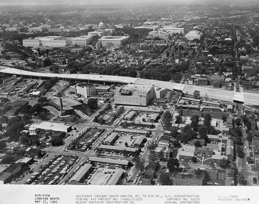

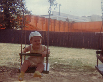 Of course, if you want to see what the construction of the Southeast Freeway looked like from ground level in about 1964, I can once again go to the well to show you this photo of my brother on the swings at Garfield Park, with the new freeway looming (and the former Washington Star building at 225 Virginia, now better known as the renovated 200 I, at rear). There's also the brief snippet of Super 8 film my grandmother took in 1969 from the tennis courts at South Capitol and I, where she panned across the freeway vista. (I'm the one burning rubber on the tricycle.)
* FROM FAR ABOVE, 2015: With thanks to reader Maelstrom for the heads up, I've added Google's new satellite view of the neighborhood from April 11, 2015 to my Images From Above page, which displays annotated images first from 1949 then every few years from 1988 to the present, showing the changing landscape of Near Southeast. This From Above page allows you to choose certain photos to compare, and now you can also click them to pop them up, easily toggling between them for better comparisons. (The new pop-up option also now means I need to do a better job of cropping and matching the photos, but not today.)
This particular shot marks the changes since the October 2012, and there's a pile of them, as you can see by the yellow highlights, since it was taken just as excavation had gotten underway at four sites and work was well underway at quite a few others. (The 2017 image should be a beaut!)
* FROM NEAR ABOVE, 1965: DDOT has a cool Tumblr where they post long-ago photos of the city from their archives, and recently they tossed me a bone with two helicopter (?) shots of the construction of the Southeast/Southwest Freeway taken in 1965, one of which shows the northern portion of Near Southeast, including the building on the site where the Park Chelsea and 800 New Jersey are being built, that I looked at for years from the freeway but never took my own photos of before it was demolished around 2000. (WAAAAAH) I hope they don't mind my reproducing them here, and adding them to my Historic Photos page.
Of course, if you want to see what the construction of the Southeast Freeway looked like from ground level in about 1964, I can once again go to the well to show you this photo of my brother on the swings at Garfield Park, with the new freeway looming (and the former Washington Star building at 225 Virginia, now better known as the renovated 200 I, at rear). There's also the brief snippet of Super 8 film my grandmother took in 1969 from the tennis courts at South Capitol and I, where she panned across the freeway vista. (I'm the one burning rubber on the tricycle.)And if that makes you want even more of a peek into the past , I can again point you to the series of posts my dad wrote for JDLand of what life on the Hill was like in the 1960s, with more photos and home movies.
|
Comments (5)
More posts:
Rearview Mirror
|
If I've told you about the latest below-ground happenings, and the latest above-ground happenings, I might as well come full circle and mention a few things happening right at ground level.

 Meanwhile, a few blocks to the north, a lovely sidewalk was laid down recently on the south side of the new one-block stretch of I Street between 2nd and New Jersey, which remains fenced off while WC Smith continues work on its Park Chelsea and 800 New Jersey apartment buildings.
First, at the large open space along 1st Street south of M that I've taken to calling Spooky Park in honor of the former inhabitants, the beginnings of the new foot paths through what will eventually be green space on the northern end of the block are in evidence, as is the new parking lot in the southwest corner, closest to the ballpark. (Not quite so obvious at the moment is that the southeast corner, at New Jersey and Tingey, is slated to be the new home for the trapeze school.)
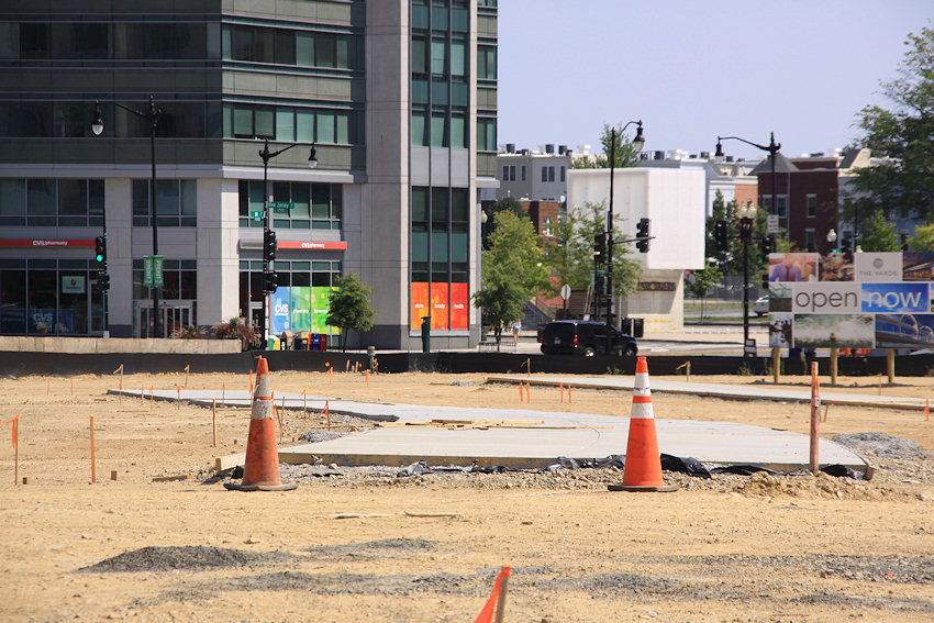
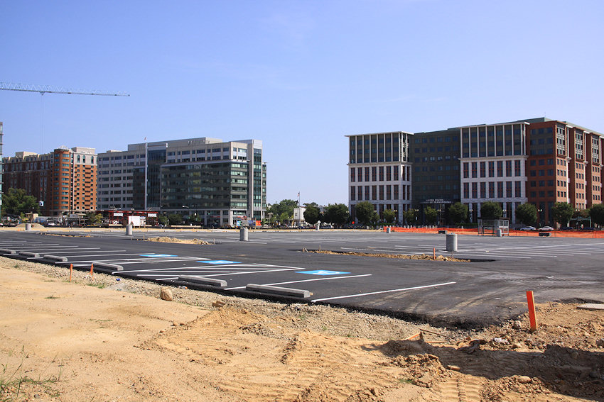
These spaces are temporary uses for the site, which is expected to eventually be where the bulk of The Yards's office space inventory will be situated, perhaps as much as 1.5 million square feet.
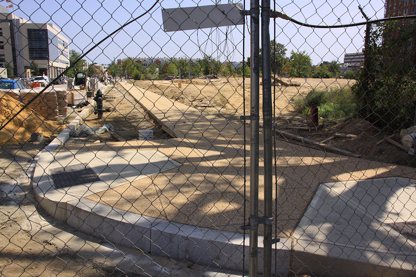 Meanwhile, a few blocks to the north, a lovely sidewalk was laid down recently on the south side of the new one-block stretch of I Street between 2nd and New Jersey, which remains fenced off while WC Smith continues work on its Park Chelsea and 800 New Jersey apartment buildings.
 Wouldn't it be keen if this lovely sidewalk could be opened for pedestrians and cyclists even while waiting for the stretch of road to come open? Especially for, say, all those neighborhood bloggers who are getting really tired of having to walk down to K Street and then back up to I Street while being tormented with the view of a fenced-off cut-through? Who will think of them??
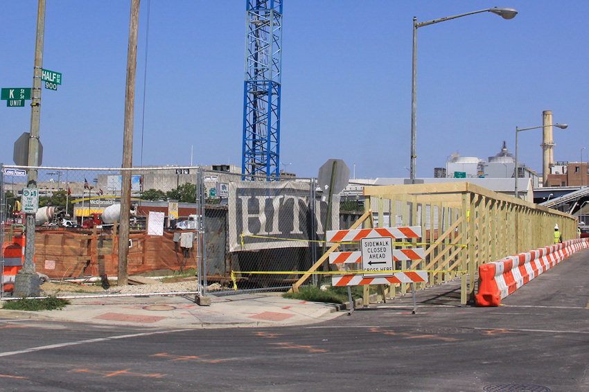
Finally, it's nice to see a covered walkway being built along the Half Street frontage of the 909 Half Mystery Building construction site. Wouldn't it be keen if one could also be built on the north side, along I Street? (Dock 79 also gets props for its new covered walkway along Potomac Avenue, one I'm sure will be used by tens of people each week, but rules are rules.)
|
Comments (0)
More posts:
Pedestrian/Cycling Issues, Parcel A/Yards
|