
|
| |||||||||||||||||||

|
Please note that JDLand is no longer being updated.
peek >>
Near Southeast DC Past News Items: Traffic Issues
- Full Neighborhood Development MapThere's a lot more than just the projects listed here. See the complete map of completed, underway, and proposed projects all across the neighborhood.
- What's New This YearA quick look at what's arrived or been announced since the end of the 2018 baseball season.
- Food Options, Now and Coming SoonThere's now plenty of food options in the neighborhood. Click to see what's here, and what's coming.
![-]()
- Anacostia RiverwalkA bridge between Teague and Yards Parks is part of the planned 20-mile Anacostia Riverwalk multi-use trail along the east and west banks of the Anacostia River.
![-]()
- Virginia Ave. Tunnel ExpansionConstruction underway in 2015 to expand the 106-year-old tunnel to allow for a second track and double-height cars. Expected completion 2018.
![-]()
- Rail and Bus Times
Get real time data for the Navy Yard subway, Circulator, Bikeshare, and bus lines, plus additional transit information. - Rail and Bus Times
Get real time data for the Navy Yard subway, Circulator, Bikeshare, and bus lines, plus additional transit information. - Canal ParkThree-block park on the site of the old Washington Canal. Construction begun in spring 2011, opened Nov. 16, 2012.
![-]()
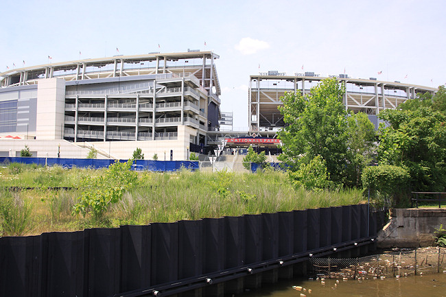
- Nationals Park21-acre site, 41,000-seat ballpark, construction begun May 2006, Opening Day March 30, 2008.
![-]()
- Washington Navy YardHeadquarters of the Naval District Washington, established in 1799.
![-]()
- Yards Park5.5-acre park on the banks of the Anacostia. First phase completed September 2010.
![-]()
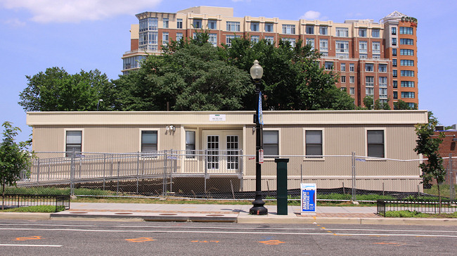
- Van Ness Elementary SchoolDC Public School, closed in 2006, but reopening in stages beginning in 2015.
![-]()
- Agora/Whole Foods336-unit apartment building at 800 New Jersey Ave., SE. Construction begun June 2014, move-ins underway early 2018. Whole Foods expected to open in late 2018.
![-]()
- New Douglass BridgeConstruction underway in early 2018 on the replacement for the current South Capitol Street Bridge. Completion expected in 2021.
![-]()
- 1221 Van290-unit residential building with 26,000 sf retail. Underway late 2015, completed early 2018.

- NAB HQ/AvidianNew headquarters for National Association of Broadcasters, along with a 163-unit condo building. Construction underway early 2017.

- Yards/Parcel O Residential ProjectsThe Bower, a 138-unit condo building by PN Hoffman, and The Guild, a 190-unit rental building by Forest City on the southeast corner of 4th and Tingey. Underway fall 2016, delivery 2018.

- New DC Water HQA wrap-around six-story addition to the existing O Street Pumping Station. Construction underway in 2016, with completion in 2018.

- The Harlow/Square 769N AptsMixed-income rental building with 176 units, including 36 public housing units. Underway early 2017, delivery 2019.

- West Half Residential420-unit project with 65,000 sf retail. Construction underway spring 2017.
![-]()
- Novel South Capitol/2 I St.530ish-unit apartment building in two phases, on old McDonald's site. Construction underway early 2017, completed summer 2019.
![Novel South Capitol]()
- 1250 Half/Envy310 rental units at 1250, 123 condos at Envy, 60,000 square feet of retail. Underway spring 2017.
![-]()
- Parc Riverside Phase II314ish-unit residential building at 1010 Half St., SE, by Toll Bros. Construction underway summer 2017.
![-]()
- 99 M StreetA 224,000-square-foot office building by Skanska for the corner of 1st and M. Underway fall 2015, substantially complete summer 2018. Circa and an unnamed sibling restaurant announced tenants.
![-]()
- The Garrett375-unit rental building at 2nd and I with 13,000 sq ft retail. Construction underway late fall 2017.
![-]()
- Yards/The Estate Apts. and Thompson Hotel270-unit rental building and 227-room Thompson Hotel, with 20,000 sq ft retail total. Construction underway fall 2017.
![-]()
- Meridian on First275-unit residential building, by Paradigm. Construction underway early 2018.
![-]()
- The Maren/71 Potomac264-unit residential building with 12,500 sq ft retail, underway spring 2018. Phase 2 of RiverFront on the Anacostia development.
![-]()
- DC Crossing/Square 696Block bought in 2016 by Tishman Speyer, with plans for 800 apartment units and 44,000 square feet of retail in two phases. Digging underway April 2018.
![DC Crossing]()
- One Hill South Phase 2300ish-unit unnamed sibling building at South Capitol and I. Work underway summer 2018.
![One Hill South Phase 2]()
- New DDOT HQ/250 MNew headquarters for the District Department of Transportation. Underway early 2019.
![New DDOT HQ]()
- 37 L Street Condos11-story, 74-unit condo building west of Half St. Underway early 2019.
![37 L Condos]()
- CSX East Residential/Hotel225ish-unit AC Marriott and two residential buildings planned. Digging underway late summer 2019.
![CSX East Residential/Hotel]()
- 1000 South Capitol Residential224-unit apartment building by Lerner. Underway fall 2019.
![1000 South Capitol Residential]()
- Capper Seniors 2.0Reconstruction of the 160-unit building for low-income seniors that was destroyed by fire in 2018.
![1000 South Capitol Residential]()
- Chemonics HQNew 285,000-sq-ft office building with 14,000 sq ft of retail. Expected delivery 2021.
![1000 South Capitol Residential]()


251 Blog Posts Since 2003
Go to Page: 1 | 2 | 3 | 4 | 5 | 6 | 7 | 8 | 9 | 10 ... 26
Search JDLand Blog Posts by Date or Category
Go to Page: 1 | 2 | 3 | 4 | 5 | 6 | 7 | 8 | 9 | 10 ... 26
Search JDLand Blog Posts by Date or Category
 * M STREET CLOSURE: DDOT has put out the word that M Street SE between 8th and 11th will be closed on Saturday, Dec. 13 from 6 am to 9 pm, weather permitting, to complete final surface paving and striping between 10th and 11th.
 * CSX OUTREACH: There may be a lawsuit pending, but that hasn't stopped CSX from giving their Virginia Avenue Tunnel web site a big makeover, and also rebranding the existing Twitter account as @VATNews. The web site has all sorts of new sections and documents, though I would imagine Opinions Differ in some quarters about the contents.
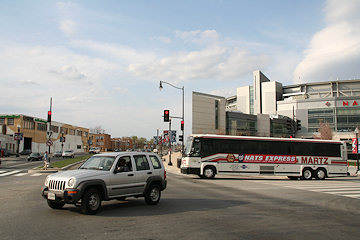
* METRO PAYMENT PILOT: Navy Yard-Ballpark is one of the Metro stations that's part of WMATA's Payment Pilot program, testing out the "secure fare payment system of the future" that will allow the use of NFC-equipped credit cards and smartphones. So, if you've seen a shiny new fare gate being installed at the station lately, this is why. The program is expected to start in January, and you can still apply to be a tester
* BOATHOUSE EXPANSION: (Boats are transportation, right?) The Hill Rag reports that there are plans underway to renovate facilities along Boathouse Row, the stretch of marinas and buildings along the west side of the Anacostia between the 11th Street and Pennsylvania Avenue bridges. The Historic Anacostia Boating Association outlined for ANC 6B last month a proposed facility with a 228-slip marina, a pier for water taxis, and a boat ramp, along with other outdoor activity space. Fundraising is apparently now underway.
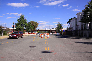
(And of course I'm sure you already read my post from yesterday about the Circulator's planned extension of the Navy Yard route into Southwest.)
|
Comments (1)
|
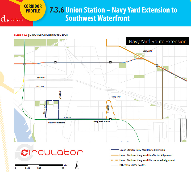 This week DDOT released its Final Circulator Development Plan, which among many other items calls for the extension of the Union Station-Navy Yard route along M Street to the Southwest Waterfront, sometime in the next two years, a plan that already has funding from the DC Council.
I asked about the timeframe for the new service, and DDOT informed me that it is proposed for the summer or early fall of 2015, pending the receipt of new buses, which have already been ordered and are expected to arrive in late spring or early summer.
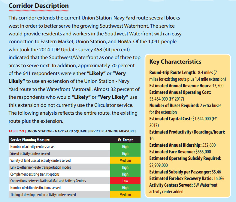
Of the 1,041 people who took this year's survey, 44 percent identified the Southwest Waterfront as one of three top areas to which Circulator service should expand. This page from the report gives additional metrics on the proposed expanded route.
The plan also calls for a "Union Station-Navy Yard Schedule and Span Pilot Study," that would provide additional evening and weekend service to see if ridership demand and the increasing population around the Navy Yard Metro station supports making the changes long-term. DDOT tells me that this study is expected to begin in the first half of 2015. Currently the route runs until 7 pm weekdays in winter months, and 9 pm in the summer months along with Saturday service and extended evening/Sunday service for Nationals games.
 However, the report also recognizes that this line "in particular suffers from severe congestion around Union Station" and that DDOT is pursuing options to reroute this line.
One other nugget very deep in the 128-page report is that down the road, if and when the Convention Center/Southwest Waterfront line is reestablished, "additional analysis should be conducted to determine the potential of extending the Convention Center-Southwest route to the Navy Yard in lieu of extending the Union Station-Navy Yard route to Southwest."
Other service expansions on tap to appear between now and FY 2017 include the new National Mall route, a new National Cathedral-McPherson Square route, and three additional extensions: the Potomac Avenue-Skyline route to Congress Heights, the Union Station-Georgetown route to the Cathedral, and the Dupont-Georgetown-Rosslyn route to U Street and Howard University. In the distant future (FY2021-FY2024) there could possibly be a Dupont-Southwest Waterfront route.
Read the full plan for more detail than you probably ever wanted about the service and the expansion plans across the city, or just scan the Executive Summary if you're lazy. And if you want to receive updates without having to wait for me to get around to telling you, you can sign up for the DC Circulator Newsletter.
|
Comments (7)
More posts:
circulator, Traffic Issues
|
 A community meeting is on tap for Thursday (tomorrow), Dec. 11, to discuss the future Southeast Blvd., specifically the ideas emerging from the neighborhood study currently being spearheaded by ANC 6B, the Office of Planning, and DDOT.
The meeting is from 7 to 9 pm at Friendship Chamberlain Elementary School, 1345 Potomac Ave., SE, across from the Jenkins Row Harris Teeter.
Councilmember Tommy Wells will be there, and will be part of the discussion on how to best integrate into the neighborhood this road that will run from Barney Circle to the new intersection at 11th Street, SE, along the path of the old sunken portion of the Southeast Freeway.
A "temporary" version of the road is opening in early 2015, and residents have been concerned both about this becoming the de facto new version of the road, a feeling that came on the heels of the original new designs put forth by DDOT, that were basically replacing an old freeway with a new freeway, albeit it one that has a stoplight at 11th Street rather than just a free-and-clear approach to the Southeast Freeway. After those designs were released, with a push from Wells, the Office of Planning stepped in to help shepherd a neighborhood study--initial design concepts were unveiled back in August, and this week's meeting is to continue the process of refining the possibilities.
(And I am well aware that I have completely failed at keeping up with photographs of that area of 11th and of the work underway on the temporary road. All of the construction there, and the futzing with the traffic flow configuration of 11th Street while work continues around it, have made me very cranky about going over there to take pictures. Maybe this will finally spur me.)
|
Comments (4)
More posts:
meetings, Southeast Blvd., Traffic Issues
|
The now-empty lot where Spooky Building 213 used to stand looked plenty big as demolition progressed, but in the past few weeks the old iron-and-brick fence has come down as well, and now the block looks gargantuan. (As well it should--someday it will be three separate blocks, with three different buildings.)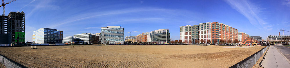
Plus, if you stand in the middle of the south end of the block these days, you get one heck of a panoramic view of the new Near Southeast, as evidenced by the eight (!) photos stitched together to create this image.
From this spot, you can see almost so many of the buildings that have gone up in the neighborhood since 2000--the now-topped-out Hampton Inn, 55 M, 1015 Half, 80 M, Velocity, 100 M, the almost-bricked Park Chelsea, Capitol Hill Tower/Courtyard by Marriott, 1100 New Jersey, USDOT, the Boilermaker Shops, Twelve12, the Foundry Lofts, and even the tower crane for the soon-to-sprout Arris. (I'm kicking myself for not swinging enough to get some portion of the ballpark.)
Before long, the interim phase of this location should start to appear--a public park on the north end, a parking lot in the southwest corner, and a spot in the southeast corner at New Jersey and Tingey for the Trapeze School, if they desire it.
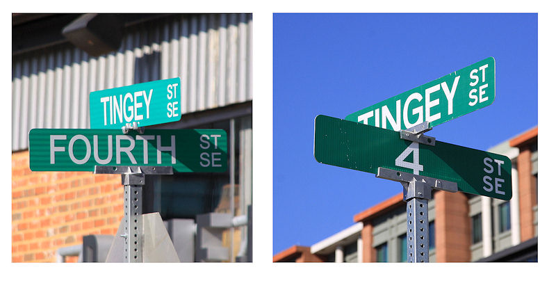
Now, for my next item--anyone who accuses me of going overboard on minutiae probably should stop reading here. But for the rest of you, here's a little item from the intersection of 4th and Tingey, where street signs have recently appeared (left). But, then look a little more closely.....
Are we supposed to be voting? Or perhaps it's like A/B testing for web sites, with DDOT trying to determine which one will leave drivers less bewildered as to their location....
Snark aside, my photo archive indicates that the west-side "Fourth" sign was put up sometime in late summer, with the east-side "4" sign appearing within the past month or so. The numeric version is in fact DDOT's current style (ick), so perhaps this was a corrective measure of sorts.
(And, be forewarned, I took a lot of photos on Saturday. Much more to come.)
|
Comments (4)
More posts:
Development News, Traffic Issues, Parcel A/Yards
|
 There's been a lot of weekend closures along 11th Street SE in the past few years, thanks to the 11th Street Bridges project, but this upcoming one is probably a little more disruptive than the others:
"As part of the 11th Street Bridge project, the District Department of Transportation (DDOT) will close the intersection of 11th Street, and M Street, SE from 6:00 AM to 9:00 PM on both Saturday, November 1, 2014 and Sunday, November 2, 2014.
"The westbound I-695 (Southeast/Southwest Freeway) exit ramp to M Street, SE and the on-ramp to southbound I-295/northbound DC 295 at M Street, SE will also be closed during these times.
"The closures will allow crews to complete milling operations at the intersection in preparation for final paving and striping.
"During the intersection closures, temporary signs and traffic control measures will be in place to alert and guide the traveling public around the work zone."
{emphasis mine, along with some improved paragraph breaks. Here's the official release.}
It also would seem to mean that, for all intents and purposes, use of the 11th Street Local bridge will be hampered considerably as well, since it's pretty much required that vehicles use 11th and M to get to or from that bridge.
The wording also telegraphs that there will be another closure still to come for the actual paving, which DDOT tells me has not yet been scheduled.
This also means that my plans to do a big post about all the changes along 11th Street north of M using photos that are now three weeks old will probably just wait until after this work is done.
UPDATE: So, perhaps DDOT's use of the phrase "close the intersection" is a bit of overkill--in an exchange of e-mails trying to pin down the ability to access the 11th Street Local bridge, I was told that the milling operation will be staged such that traffic can be routed "around the work."
I'd still stay away if at all possible.
|
Comments (0)
More posts:
11th Street Bridges, Traffic Issues
|
 I'm not sure how many people made this afternoon's meeting on the SE/SW Transportation Improvement Study (I sure didn't thanks to that 4 pm start time), but apparently there is a web site devoted to the project, and the meeting materials are posted there: seswdc.com.
This study is actually an Environmental Assessment, meaning there are very specific structures and steps that DDOT will be following.
Its stated purpose is "to develop a premium transit system that improves transportation capacity, connectivity, mobility, and safety through an integrated, multimodal transportation corridor" across Near Southeast, Southwest, and the Anacostia Historic District.
Also, the study is to address "east-west transportation needs between the Southeast and Southwest Washington communities of Anacostia and the Waterfront."
 One tidbit in the materials that may be news to people: If streetcars are chosen as the area's "premium transit mode," there will be a need for storage and/or maintenance, and so this Environmental Assessment "will review and analyze potential sites for a Streetcar facility."
 Eight potential sites meeting the initial minimum requirements have been identified: three near M Street, SW, three at Buzzard Point, and two along 7th Street, SE, including, believe it or not, the Blue Castle, aka the Navy Yard Car Barn, where streetcars were stored and maintained during the many years they ran through the city before being shut down in the early 1960s.
A second public meeting is expected in early 2015, with the draft Environmental Assessment and associated public hearing in spring and the final document late in the year.
(Thanks to Josh Hart for the heads up about the web site, and no thanks to DDOT, who didn't mention it in their releases about the meeting. BAH!)
|
Comments (14)
More posts:
Pedestrian/Cycling Issues, meetings, Traffic Issues
|
 From DDOT: On Wednesday, Oct. 22, DDOT and the Federal Highway Administration will be holding a public meeting to discuss the Southeast/Southwest Transportation Improvement Study and Environmental Assessment, which is actually now a formal NEPA study (hence the presence of FHWA).
 Officially, "The purpose of the study is to develop a premium transit system that improves transportation capacity, connectivity, mobility, and safety."
This is an off-shoot of the first M Street SE/SW study from 2011 and 2012 as well as the subsequent Special Events transportation study that was completed earlier this year. In other words, the study after the study after the study.
The meeting will be held at at Van Ness Elementary at 4 pm (! - I asked if that was a typo, and was told no). DDOT's announcement of the meeting says that "the public will be provided an opportunity to discuss the transportation issues and potential solutions that will be addressed in the study."
 ANC 6B commissioners Brian Flahaven and Kirsten Oldenburg have both written about a new batch of design concepts for Southeast Blvd., the planned stretch of road between 11th Street SE and Barney Circle where the sunken far eastern portion of the Southeast Freeway used to run.
Almost a year ago, DDOT presented five designs for the new road that basically, as Flahaven puts it, "replaced the freeway with ... a freeway completely separated from the neighborhood grid." The designs were not well received, and with a push from councilmember Tommy Wells, the Office of Planning stepped in to conduct a "rapid response" study of the neighborhood and the project. And on Aug. 4, these new designs were unveiled at a public meeting.
The boards show both two-lane and four-lane designs for the road, some with direct access to the Anacostia Waterfront and extension of the street grid to the boulevard, some without. The Office of Planning now plans to take community feedback--which apparently was considerably more positive this time around--and move forward with three final concepts that can be presented to the community and to DDOT this fall.
However, it also turns out that DDOT is planning to go ahead and reopen this stretch of road by the end of the year, with the traffic flowing through the new signalized intersection on 11th Street SE where the exit ramp from the Southeast Freeway recently opened. Oldenburg describes what she see as the "major implications" of this move: "First, this freeway segment becomes the No Build option in the study. Second, in my view, it will take the pressure off city officials to get the NEPA study completed in a timely manner, hopefully, incorporating some of the fresh ideas generated by the OP study."
Flahaven is urging residents to contact Mayor Gray and council members with their thoughts on this.
|
Comments (11)
More posts:
Southeast Blvd., Traffic Issues
|
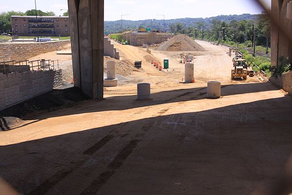
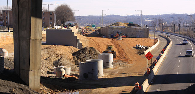
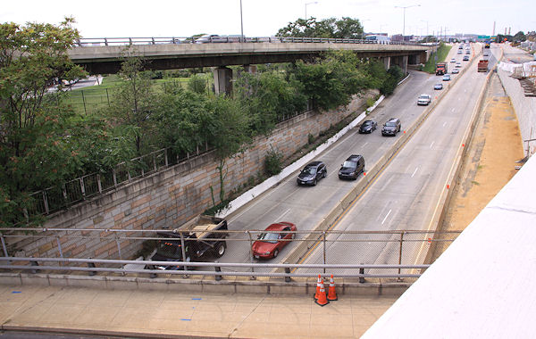
Despite it being four weeks after the fact, JDLand's strict operating requirements still dictate that I document the new exit ramp to 11th Street SE from eastbound I-695. 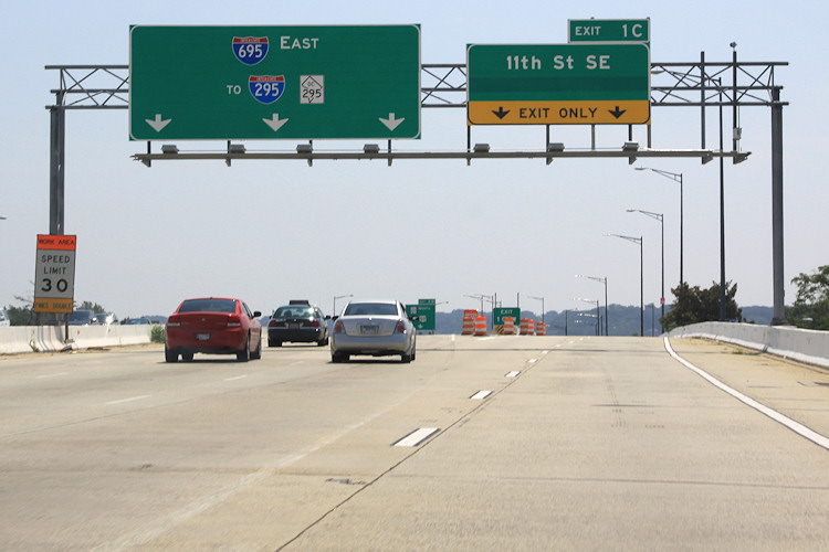 The view driving east on the Southeast Freeway (which is now I-695, if you haven't gotten the memo). If you always get off at or before the 6th Street SE exit, this may be an unfamiliar vista to you. The left lanes head toward the outbound 11th Street Bridges, while the right two lanes are the new movement that didn't exist before this whole project got underway. (And is that hidden part of the 11th Street sign maybe an eventual pointer to Southeast Blvd.?)
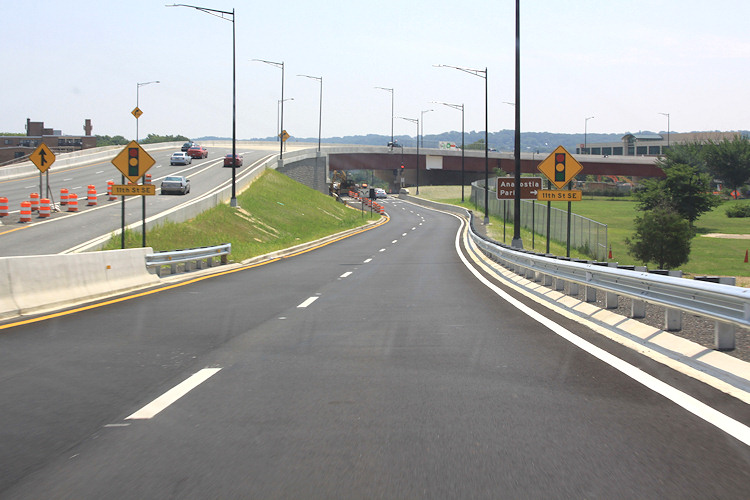 Behold, the new ramp! You also get to see the two new flyovers at left that have been built as part of this project, which has been underway since 2009. Sneaking up in between is the new on-ramp from 8th Street SE, which opened not long ago. At right is Virginia Avenue Park. Note also the sign pointing toward Anacostia Park--this would take you down 11th to the new local bridge and to the park that-a-way.
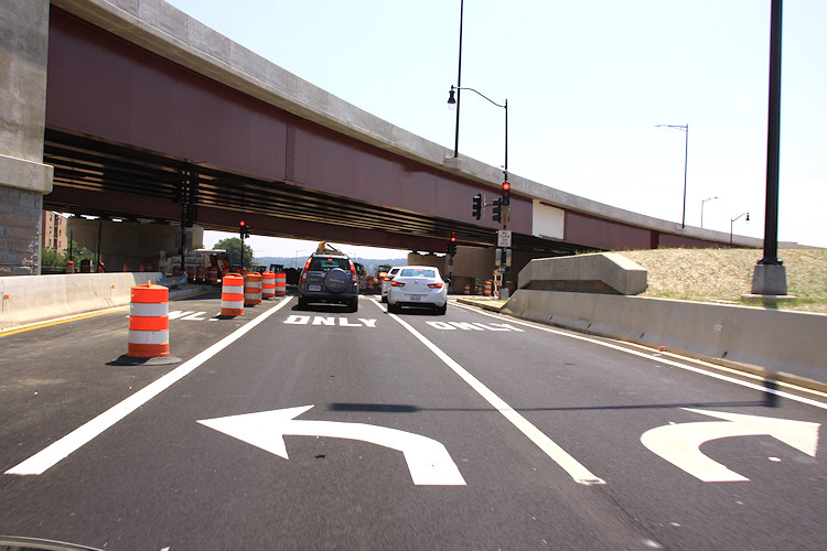 And now you come to the intersection at 11th. Turning left takes you north toward Pennsylvania Avenue and Lincoln Park, while turning right takes you to M Street, the Navy Yard, and the local bridge. Note the blocked-off third lane that is striped for left turns as well--I assume there will come a time when the middle lane will be for traffic continuing straight on Southeast Blvd.
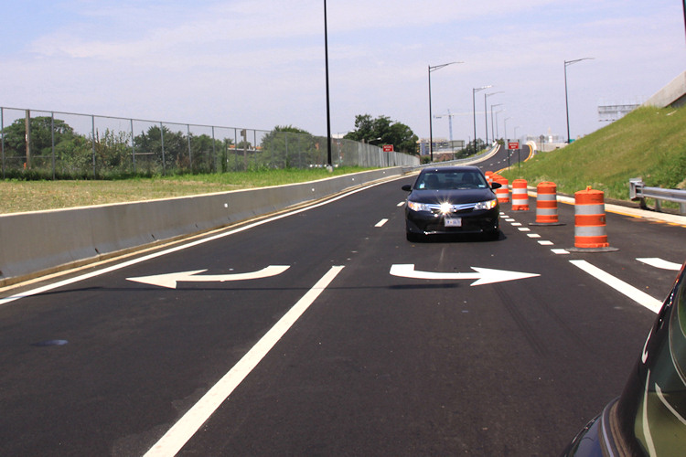 Wrapping up our little journey, here's a quick look backward at the road just traveled.
With thanks to Mr. JDLand for chauffeuring, here's what it's like to venture along this new route, if you haven't done it. (And sure, I could have Vined it, or YouTubed it, or whatever, but what fun would that be?)
The view driving east on the Southeast Freeway (which is now I-695, if you haven't gotten the memo). If you always get off at or before the 6th Street SE exit, this may be an unfamiliar vista to you. The left lanes head toward the outbound 11th Street Bridges, while the right two lanes are the new movement that didn't exist before this whole project got underway. (And is that hidden part of the 11th Street sign maybe an eventual pointer to Southeast Blvd.?)Behold, the new ramp! You also get to see the two new flyovers at left that have been built as part of this project, which has been underway since 2009. Sneaking up in between is the new on-ramp from 8th Street SE, which opened not long ago. At right is Virginia Avenue Park. Note also the sign pointing toward Anacostia Park--this would take you down 11th to the new local bridge and to the park that-a-way.And now you come to the intersection at 11th. Turning left takes you north toward Pennsylvania Avenue and Lincoln Park, while turning right takes you to M Street, the Navy Yard, and the local bridge. Note the blocked-off third lane that is striped for left turns as well--I assume there will come a time when the middle lane will be for traffic continuing straight on Southeast Blvd. Wrapping up our little journey, here's a quick look backward at the road just traveled. Need a reminder of what this spot used to look like? Remember the phrase "sunken freeway"? Here's a reminder, from street level and from above.


And, because I am a complete nutcase (which we already knew), here is a bunch of photos--strung together as a slideshow--that I took just as the 11th Street Bridges project was getting underway in early 2010, showing what it used to be like to drive across the Anacostia on that route. Apologies for the dirty windshield.
(I know, my archive just gets more and more alarming.)
|
Comments (2)
More posts:
11th Street Bridges, Southeast Blvd., Traffic Issues
|
First off, you may have noticed that Saturday was a lovely day. The neighborhood's waterfront was most definitely in use: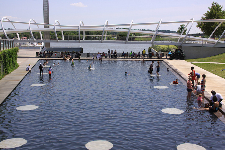
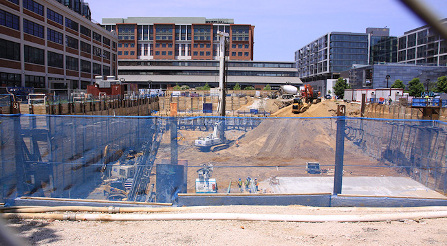
Not far away, at the Yards' Parcel N, concrete has appeared in the large hole in the ground (left), meaning that the digging down is almost over, and the rising up should start before too long (its tower crane permit application was approved not too long ago). And in a totally different illustration of progress (right), the sales-trailer-to-be for the River Parc apartment project appears to now be in its proper place.
(I wanted to get a photograph of the outdoor patio signage at the soon-to-arrive Ice Cream Jubilee at the Lumber Shed, but the hordes standing in line on Saturday to get into the Jazz Fest completely blocked the view.)
I recorded the current state of the Florida Rock site across from the ballpark {insert Logan's Run reference here}, because the developers have now filed applications for both sheeting and building permits for the site's first-phase apartment building. This doesn't necessarily mean the project is close to getting started, but it deprives me of my snarky "they haven't even applied for their permits yet" response whenever someone mentions that it might get underway soon.
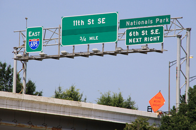
Finally, I present to you official evidence of the new 11th Street SE exit from the freeway, which I'm doing mainly as a mea culpa for not having gotten over there to photograph the ramp and environs, and to hopefully shame myself into action.
I also deserve additional shaming, or at least parallel shaming, for not yet documenting that the Southeast Freeway signage I have griped about for years has been fixed.
|
Comments (3)
|
251 Posts:
Go to Page: 1 | 2 | 3 | 4 | 5 | 6 | 7 | 8 | 9 | 10 ... 26
Search JDLand Blog Posts by Date or Category
Go to Page: 1 | 2 | 3 | 4 | 5 | 6 | 7 | 8 | 9 | 10 ... 26
Search JDLand Blog Posts by Date or Category