
|
| |||||||||||||||||||

|
Please note that JDLand is no longer being updated.
peek >>
Near Southeast DC Past News Items: Traffic Issues
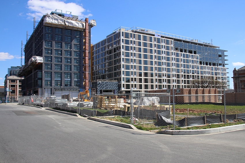
- Full Neighborhood Development MapThere's a lot more than just the projects listed here. See the complete map of completed, underway, and proposed projects all across the neighborhood.
- What's New This YearA quick look at what's arrived or been announced since the end of the 2018 baseball season.
- Food Options, Now and Coming SoonThere's now plenty of food options in the neighborhood. Click to see what's here, and what's coming.
![-]()
- Anacostia RiverwalkA bridge between Teague and Yards Parks is part of the planned 20-mile Anacostia Riverwalk multi-use trail along the east and west banks of the Anacostia River.
![-]()
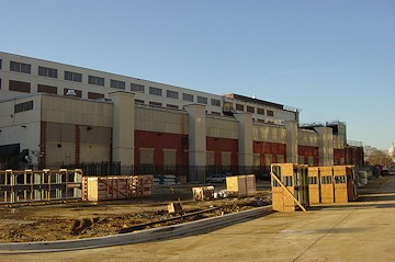
- Virginia Ave. Tunnel ExpansionConstruction underway in 2015 to expand the 106-year-old tunnel to allow for a second track and double-height cars. Expected completion 2018.
![-]()
- Rail and Bus Times
Get real time data for the Navy Yard subway, Circulator, Bikeshare, and bus lines, plus additional transit information. - Rail and Bus Times
Get real time data for the Navy Yard subway, Circulator, Bikeshare, and bus lines, plus additional transit information. - Canal ParkThree-block park on the site of the old Washington Canal. Construction begun in spring 2011, opened Nov. 16, 2012.
![-]()
- Nationals Park21-acre site, 41,000-seat ballpark, construction begun May 2006, Opening Day March 30, 2008.
![-]()
- Washington Navy YardHeadquarters of the Naval District Washington, established in 1799.
![-]()
- Yards Park5.5-acre park on the banks of the Anacostia. First phase completed September 2010.
![-]()
- Van Ness Elementary SchoolDC Public School, closed in 2006, but reopening in stages beginning in 2015.
![-]()
- Agora/Whole Foods336-unit apartment building at 800 New Jersey Ave., SE. Construction begun June 2014, move-ins underway early 2018. Whole Foods expected to open in late 2018.
![-]()
- New Douglass BridgeConstruction underway in early 2018 on the replacement for the current South Capitol Street Bridge. Completion expected in 2021.
![-]()
- 1221 Van290-unit residential building with 26,000 sf retail. Underway late 2015, completed early 2018.

- NAB HQ/AvidianNew headquarters for National Association of Broadcasters, along with a 163-unit condo building. Construction underway early 2017.

- Yards/Parcel O Residential ProjectsThe Bower, a 138-unit condo building by PN Hoffman, and The Guild, a 190-unit rental building by Forest City on the southeast corner of 4th and Tingey. Underway fall 2016, delivery 2018.

- New DC Water HQA wrap-around six-story addition to the existing O Street Pumping Station. Construction underway in 2016, with completion in 2018.

- The Harlow/Square 769N AptsMixed-income rental building with 176 units, including 36 public housing units. Underway early 2017, delivery 2019.

- West Half Residential420-unit project with 65,000 sf retail. Construction underway spring 2017.
![-]()
- Novel South Capitol/2 I St.530ish-unit apartment building in two phases, on old McDonald's site. Construction underway early 2017, completed summer 2019.
![Novel South Capitol]()
- 1250 Half/Envy310 rental units at 1250, 123 condos at Envy, 60,000 square feet of retail. Underway spring 2017.
![-]()
- Parc Riverside Phase II314ish-unit residential building at 1010 Half St., SE, by Toll Bros. Construction underway summer 2017.
![-]()
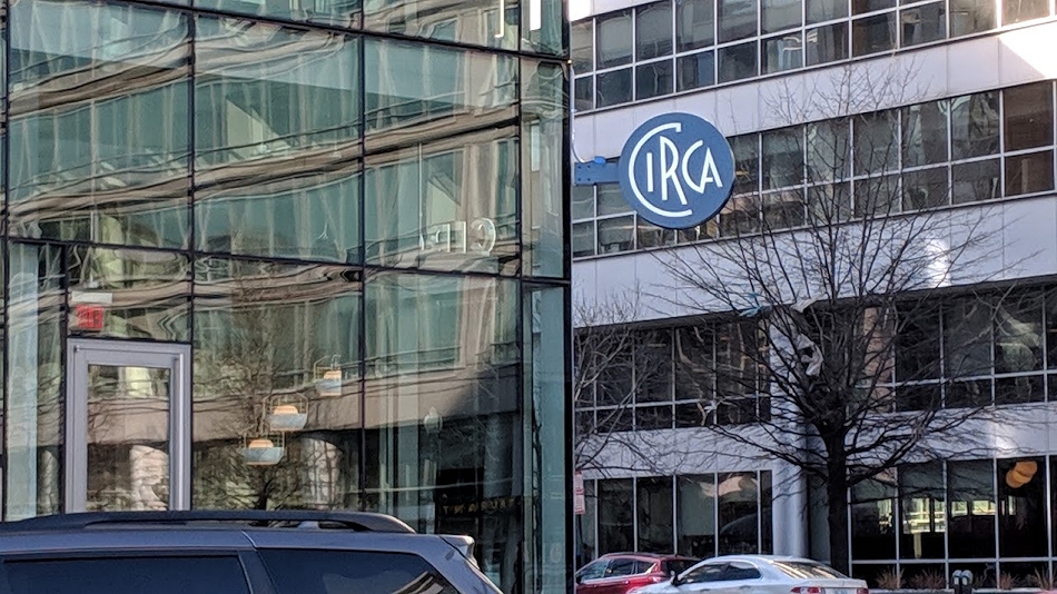
- 99 M StreetA 224,000-square-foot office building by Skanska for the corner of 1st and M. Underway fall 2015, substantially complete summer 2018. Circa and an unnamed sibling restaurant announced tenants.
![-]()
- The Garrett375-unit rental building at 2nd and I with 13,000 sq ft retail. Construction underway late fall 2017.
![-]()
- Yards/The Estate Apts. and Thompson Hotel270-unit rental building and 227-room Thompson Hotel, with 20,000 sq ft retail total. Construction underway fall 2017.
![-]()
- Meridian on First275-unit residential building, by Paradigm. Construction underway early 2018.
![-]()
- The Maren/71 Potomac264-unit residential building with 12,500 sq ft retail, underway spring 2018. Phase 2 of RiverFront on the Anacostia development.
![-]()
- DC Crossing/Square 696Block bought in 2016 by Tishman Speyer, with plans for 800 apartment units and 44,000 square feet of retail in two phases. Digging underway April 2018.
![DC Crossing]()
- One Hill South Phase 2300ish-unit unnamed sibling building at South Capitol and I. Work underway summer 2018.
![One Hill South Phase 2]()
- New DDOT HQ/250 MNew headquarters for the District Department of Transportation. Underway early 2019.
![New DDOT HQ]()
- 37 L Street Condos11-story, 74-unit condo building west of Half St. Underway early 2019.
![37 L Condos]()
- CSX East Residential/Hotel225ish-unit AC Marriott and two residential buildings planned. Digging underway late summer 2019.
![CSX East Residential/Hotel]()
- 1000 South Capitol Residential224-unit apartment building by Lerner. Underway fall 2019.
![1000 South Capitol Residential]()
- Capper Seniors 2.0Reconstruction of the 160-unit building for low-income seniors that was destroyed by fire in 2018.
![1000 South Capitol Residential]()
- Chemonics HQNew 285,000-sq-ft office building with 14,000 sq ft of retail. Expected delivery 2021.
![1000 South Capitol Residential]()


251 Blog Posts Since 2003
Go to Page: 1 | 2 | 3 | 4 | 5 | 6 | 7 | 8 | 9 | 10 ... 26
Search JDLand Blog Posts by Date or Category
Go to Page: 1 | 2 | 3 | 4 | 5 | 6 | 7 | 8 | 9 | 10 ... 26
Search JDLand Blog Posts by Date or Category
A few morsels:
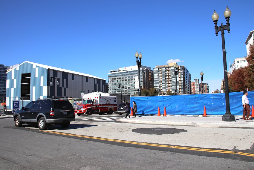
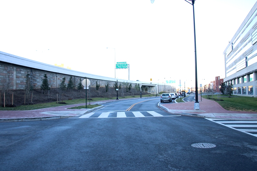
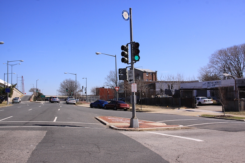
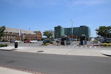
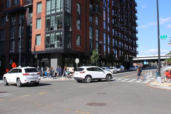 * NJ & I: ANC 6D07 commissioner Edward Daniels put out the word on Facebook this week that "after numerous emails, walk-throughs, and (personal) hours spent watching the intersection from Slipstream, DDOT has finally responded and are working on a design and construction plan to install a traffic light at the intersection of New Jersey Ave & I Street SE." It's still a ways off, but there's no doubt that this intersection is a busy one and in need of some containment. (Wish I had a better picture to illustrate, but I usually try my best to let roads clear before I click the shutter. Which is not easy at New Jersey and I.)
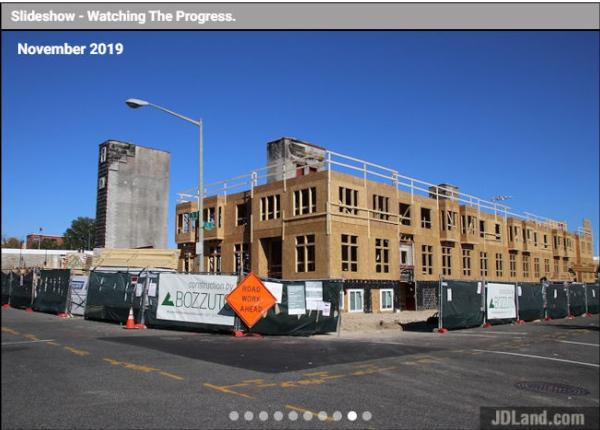 * SLIDESHOWS: I got on a bit of a tear and finally figured out how to more easily create a "representative" photo slideshow for projects, using larger photos to illustrate a project's progress from before to after, without completely rebuilding the existing small-image'd photo archive. (Not much space in my brain for this level of creativity for, oh, the past 10 years or so.) You can see these on pages for active projects, like Capper Seniors 2.0 (which is a good example, since the slideshow captures the rise and fall and rise) and others on the homepage map. I'm going to work my way through older projects, which will take some time. This also means that it's going to be much quicker to update the project pages when I take new photos, since I've been manually adding the large photos each time I go out. Kind of wish I had figured this out a few years ago, when this crazy stretch of new construction was getting started, but, like I said, I've had a lot on my mind. You'll also note that there are mini-slideshows showing up randomly on the JDLand home page, as well as the sliders (which remain a very labor-intensive activity). I imagine some day I will redo the photo archive in larger versions, but not this week.
 * NJ & I: ANC 6D07 commissioner Edward Daniels put out the word on Facebook this week that "after numerous emails, walk-throughs, and (personal) hours spent watching the intersection from Slipstream, DDOT has finally responded and are working on a design and construction plan to install a traffic light at the intersection of New Jersey Ave & I Street SE." It's still a ways off, but there's no doubt that this intersection is a busy one and in need of some containment. (Wish I had a better picture to illustrate, but I usually try my best to let roads clear before I click the shutter. Which is not easy at New Jersey and I.)
* BID ANNUAL REPORT: It's time once again for the Capitol Riverfront BID's annual report, which has all sorts of information about the neighborhood's progress, but I think it's worth highlighting some of the numbers. The BID estimates there are now 11,200 residents in 7,100 residential units, 78 restaurants, 44 shops and services, two grocery stores, and two professional sports stadiums (alas, the BID mucks with my statistics by also having Buzzard Point in its boundaries). I'm so old I remember a brief period when the resident count was about 300, if that.
* BRIDGE LATEST: The progress on the arches keeps right on going, and if you want to know more about the new Douglass Bridge, the winter newsletter is available for your perusal.
* SLIDESHOWS: I got on a bit of a tear and finally figured out how to more easily create a "representative" photo slideshow for projects, using larger photos to illustrate a project's progress from before to after, without completely rebuilding the existing small-image'd photo archive. (Not much space in my brain for this level of creativity for, oh, the past 10 years or so.) You can see these on pages for active projects, like Capper Seniors 2.0 (which is a good example, since the slideshow captures the rise and fall and rise) and others on the homepage map. I'm going to work my way through older projects, which will take some time. This also means that it's going to be much quicker to update the project pages when I take new photos, since I've been manually adding the large photos each time I go out. Kind of wish I had figured this out a few years ago, when this crazy stretch of new construction was getting started, but, like I said, I've had a lot on my mind. You'll also note that there are mini-slideshows showing up randomly on the JDLand home page, as well as the sliders (which remain a very labor-intensive activity). I imagine some day I will redo the photo archive in larger versions, but not this week.|
Comments (13)
|
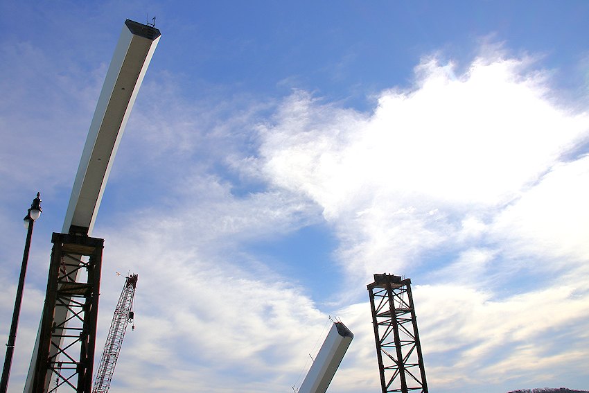
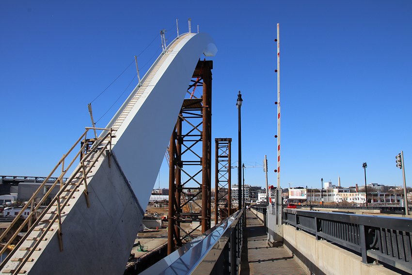
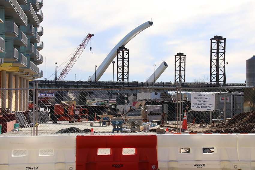
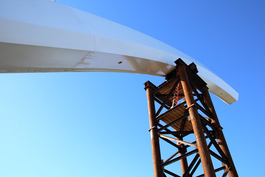
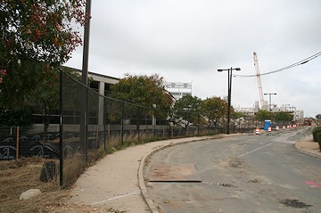
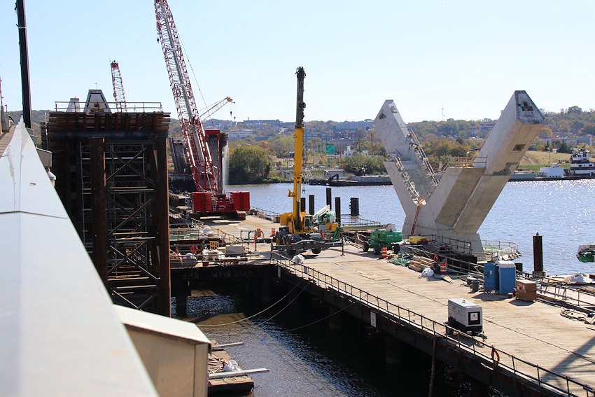
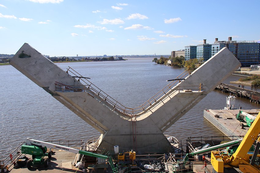
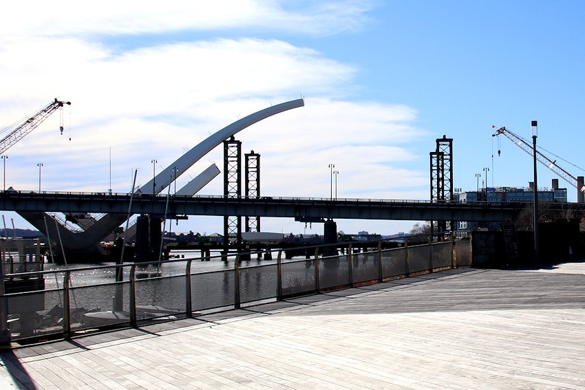 The new Frederick Douglass Bridge has been under construction for not quite 11 months, but the showy phase of the project has now arrived, as the beginnings of what will be its signature arches sprouted up within the past few weeks.
 Anyone who walks along the Anacostia, or spends time across the way at Buzzard Point, or drives on South Capitol Street south of P, has been watching the progress of the three sets of arches, but of course the JDLand camera wanted to officially document this new stage.
For the record, it's not just from the Riverwalk that these arches will be visible--I caught of glimpse of them from the intersection of at 3rd and I Streets, SE, and I wouldn't be surprised to have the bridge be visible from multiple other locations as it is completed, since the bridge crosses the Anacostia at a southwesterly angle.
As 2020 marches on, the work on the two traffic ovals will get underway, and in fact there is a fence up across the First Base Gate promenade that I think bears some resemblance to where the northeast edge of the oval will eventually be.
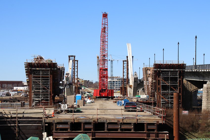
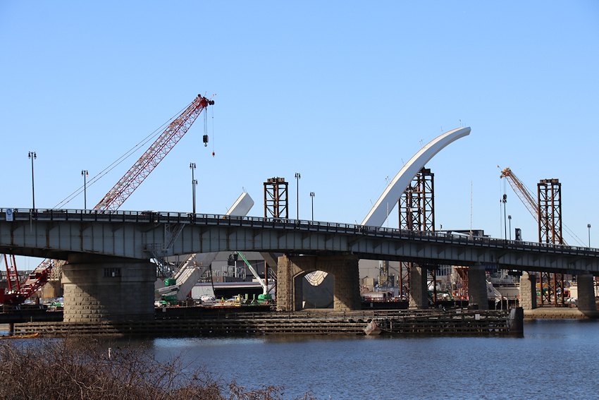
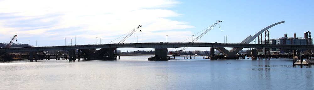
Completion is expected in 2021.
|
Comments (15)
More posts:
Douglass Bridge, Traffic Issues
|
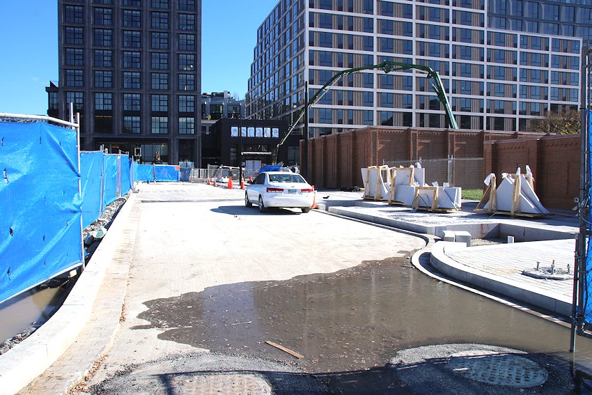
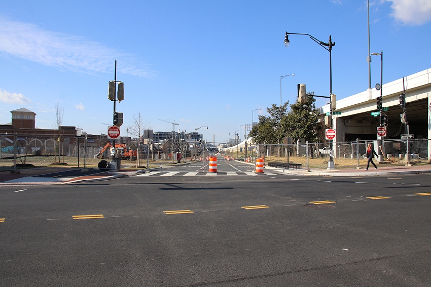
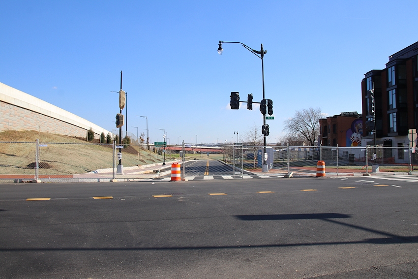
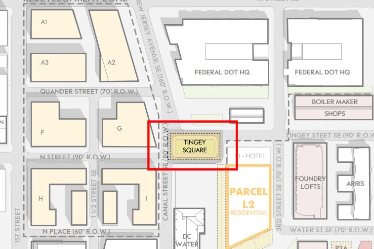 My last post talked about a new oval coming to South Capitol Street, and now the geometric tour of the neighborhood moves onto a new square, specifically Tingey Square, which is part of the reconstruction of the intersection(s) of New Jersey and Tingey and N Streets. Oh, and now there's Canal Street, too. And a new 2nd Street. (And a new Quander Street, but we're not talking about that right now.)
Tingey Square will be a green space/park-like outpost in the midst of what is becoming a lot of concrete, especially with the Chemonics HQ now underway on the west side of the intersection, and a residential building on the south side of N in the near-term pipeline as well.
And of course I had to dig through my archives to find on-high photos from multiple angles showing the progression of the intersection of New Jersey and Tingey, starting in 2004, before there even was an intersection (it arrived in early 2007), then in 2012, and then 2015. You can see how N flowing into Tingey was originally only slightly off-center, before becoming the double-curve once New Jersey Avenue was completed.
For more visualization assistance, here are two graphics from various zoning filings, with the first one overlaying the new design on top of existing roadways.
Most traffic will rarely go around the square, as both Tingey Street and the west side of the square (now Canal Street) will remain two-way. But it will allow traffic to arrive at the entrances of the new Thompson Hotel and Estate apartment buildings on the new stub of 2nd Street (which turns into a pedestrian walk down to the Yards Park). I of course can provide illustrations of the nearly completed south side of the square, and the new east side by the Thompson/Estate duo:
As for the new Canal Street, it is really only a one-block public street, as it heads behind the fences of DC Water once it crosses N Street. But a new sidewalk has been completed and given streetlights outside the fences, and the walk should eventually be open for the non-DC Water public.

If you've wandered through this sizable intersection lately (like, say, to go to the WORLD SERIES), you've seen a lot of work underway, some of which you may not really even realize is all that different. But New Jersey has been narrowed and given a bend westward, and the traffic flow from N Street to Tingey is no longer via a curve, but an actual intersection. Here you can compare the wide wide pedestrian crossing in 2013 with the new building-out of the northeast corner to straighten the road.
And I have to admit that these new rights-of-way sent me waaaaaay down the photo archive rabbit hole, to reclassify a lot photos taken over the years, some of which you can now see in the archive pages for Canal and Tingey or Canal and N. Here's a few, though even when you pop them up they'll still be small:

|
Comments (3)
|
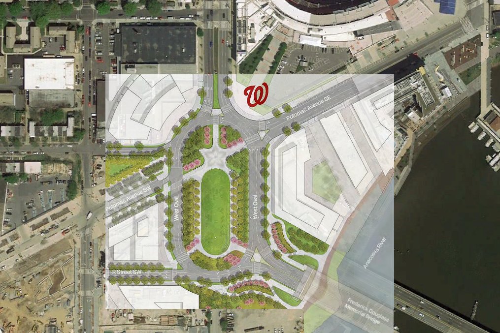 Let's talk ovals. Well, one oval in particular, which is the oval that is going to be built on the western side of the new Frederick Douglass Memorial Bridge, that big construction project you're seeing immediately downriver of the existing bridge.
As I've been taking pictures of the intersection of South Capitol and Potomac as it is currently configured, I've been having a hard time visualizing how it will change when the bridge and traffic oval are completed, and so even though I'm sure at some point DDOT has created an overlay exactly like this one, I decided to make one myself that's a little larger. (If you want a clean version of the current satellite view to better compare with, here's Google Maps.)
As you can see, the new bridge will not be arriving at the exact southern end of the oval, but instead more on the south-southeast edge. And the South Capitol-Potomac "intersection" does not split the oval in half. The northeastern part of the oval will chop off a bit of the large plaza at the approach to the Nats Park Home Plate Gate, and you can also see why some buildings near the current intersection have been demolished in the past year.
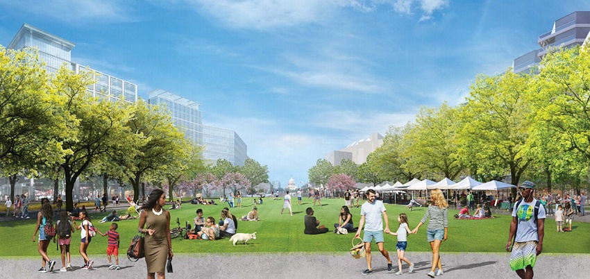
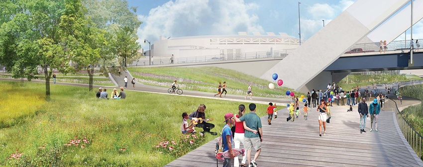
Here are some renderings showing what the view could look like up South Capitol from the oval, and also how the Anacostia Riverwalk will run under the bridge to allow for pedestrian/cyclist movement to and from Southeast and Southwest without having to navigate the oval's traffic crossings.
This oval (and also the one on the bridge's eastern side, which is outside the JDLand Coverage Area) are going to be a big deal when they arrive, and my guess is that there will be considerable squawking from all sides at first. But they are coming--and I'm almost as fascinated with this part of the project as I am with the new bridge itself.
Speaking of which, I went up there and took some pictures today.

If you want to know more, there's my project page, or the voluminous official site, NewFrederickDouglassBridge.com. It's all supposed to be completed by the end of 2021, but We Shall See. (And if you want to know more about the changes that are on the boards for the rest of South Capitol Street north of P, try my South Capitol Street page.)
|
Comments (10)
More posts:
Pedestrian/Cycling Issues, riverwalk, South Capitol St., Douglass Bridge, Traffic Issues
|
Giving the commentariat a fresh thread (and tidbit delivery system!) and also enshrining a few items that readers may have missed while sweltering through August:
 * MAIALINO: The Union Square Hospitality outpost at the new Thompson Hotel at 3rd and Tingey is going to be Maialino Mare, a "Roman style trattoria." (Eater DC)
* MAIALINO: The Union Square Hospitality outpost at the new Thompson Hotel at 3rd and Tingey is going to be Maialino Mare, a "Roman style trattoria." (Eater DC)
* TINGEY SQUARE: Via Twitter, it looks like the construction of the long-planned Tingey Square at the intersection of New Jersey and Tingey is underway.
* GREYSTAR: Via Twitter, evidence that work is apparently gearing up at the Greystar project on the old CSX site west of New Jersey and immediately south of the freeway. Here's my post from a few months ago on the plans.
* PROTECTED LANES: Via Twitter (sensing a theme?), after much (much!) discussion of the perpetual vehicle occupation of the 1st Street bike lanes, both sides of the 1200 block are now separated and protected.
* BOXING: 9Round fitness kickboxing is coming to the Insignia on M building at New Jersey and M.
* BRIG: The Brig beer garden at 8th and L SE is one of the first three bars to apply for a sports betting liquor license.
|
Comments (43)
More posts:
1111 New Jersey/Insignia on M, 861nj, 9round, The Brig Beer Garden, Pedestrian/Cycling Issues, Development News, Restaurants/Nightlife, maialino, thompson, Traffic Issues, The Yards, Thompson Hotel/Estate Apts./Yards
|
 It's the summer doldrums, when not only is there not really much news, but even when there is, I can't summon energy from my heat-depleted body to do much about it. But here are a few, plus a fresh new thread for the on-the-ball JDLand commentariat to keep chatting about the latest goings on.
* SHILLING OPEN: It took a while, but the Shilling Canning Company, a "modern mid-Atlantic restaurant." is now open at 360 Water Street, SE, in the ground floor of Arris across from Ice Cream Jubilee. Here's the Washingtonian and Eater pieces on the latest addition to the neighborhood's culinary lineup.
* UPS STORE: Longtime JDLand reader @202FSUNole passed along this shot yesterday of a "UPS Store Coming Soon" sign in the space previously occupied by Capital One on New Jersey between L and M, making it the neighborhood's first shipping store.
* POPLAR POINT RAMP CLOSING: The ramp that leads from Poplar Point and the Anacostia Riverwalk Trail up to the northbound side of South Capitol Street and the Douglass Bridge is being closed as of July 21, DDOT has announced. It's not clear yet whether this means the side path will be closed as well.
* THE KELVIN: When it's this hot, it's particularly apropos to pass along the news that the apartment project at 1250 Half Street (the rental sibling to Envy condos) has been named The Kelvin.
|
Comments (58)
More posts:
1100nj, 1250 Half St., Restaurants/Nightlife, Retail, South Capitol St., Douglass Bridge, Traffic Issues, upsstore, The Yards, Arris/Parcel N/Yards
|
 Foodie news is the main focus in this roundup:
* CIRCA OPEN, EL BEBE SOON: The neighborhood's newest restaurant opened on Monday, with Circa finally arriving on the southwest corner of 1st and M Streets, SE, not quite 3 1/2 years after it was first announced. As for now, it's open daily at 4 pm. And its sibling El Bebe is coming Any Minute Now.
* MEYER TO THOMPSON: The Thompson Hotel at 3rd and Tingey is still under construction, but the Post's Tom Sietsema reported in his chat last week that uber restaurateur Danny Meyer (he of Shake Shack, Gramercy Tavern, and more) will be opening a "full-service restaurant and rooftop bar" in the hotel sometime in 2020. There aren't many details (not even a chef), but this will be a project that will garner a lot of interest.
* ALBI POPUP: If you are looking forward to Albi, which is bringing a "contemporary vision of Middle Eastern cooking as soon through the lens of Modern American techniques and Mid-Atlantic ingredients" to the Bower at 4th and Tingey in "early summer" 2019, there is a two-day "pop up" of "preview dinners" on March 3 and 4. Reservations now available, with prices set at $85 per person, plus optional wine pairings for $35.
And in non-food news:
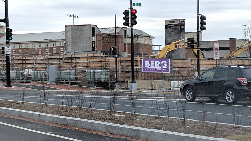 * CAPPER SENIORS GONE: The first building I watched be built is now the first building I've watched be both built and demolished, though the concrete stairwells and elevator shafts remain and await the building that will replace the structure destroyed by fire last year. This makes for a sad entry #182 in my Demolished Buildings gallery.
* VOTE FOR MOVIES: Time once again to make your preferences known in the Capitol Riverfront BID's 2019 Outdoor Movie Series poll. Voting ends March 4.
* PILE DRIVING: That pounding you heard in your head on Saturday morning wasn't your hangover, it's the start of Saturday pile driving as part of the new Douglass Bridge construction. The approved hours are from 9 am to 7 pm. (And, while I'm speaking of it, a shout-out to the NFDMB folks, who are doing a nice job of outreach with a very complete web site and social media offerings.)
* LOWER 8TH STREET STUFF: ANC 6B commission Kirsten Oldenburg reported in her latest newsletter about some changes to traffic flow near 8th and Virginia, now that the tunnel is completed: "The 800 block of Virginia Avenue and the 900 block of 9th Street SE are now two-way streets and the 1000 block of 9th Street SE between L and M Streets will join them as a two-way street but awaits adjustments to the traffic signal at 9th and M SE. The 800 block of L Street is to become two-way (instead of one way westbound). Pedestrian crossings markings will be added to the 9th & Potomac Avenue SE and 10th & Potomac Avenue SE intersections. " She also says she is in the process of asking DDOT for a traffic calming study of the 8th and L intersection (i.e., where the Brig is).
|
Comments (4)
More posts:
99m, Capitol Riverfront BID, Capper Seniors/900 5th St., circa, Restaurants/Nightlife, Douglass Bridge, thompson, Traffic Issues, ushg, Thompson Hotel/Estate Apts./Yards
|
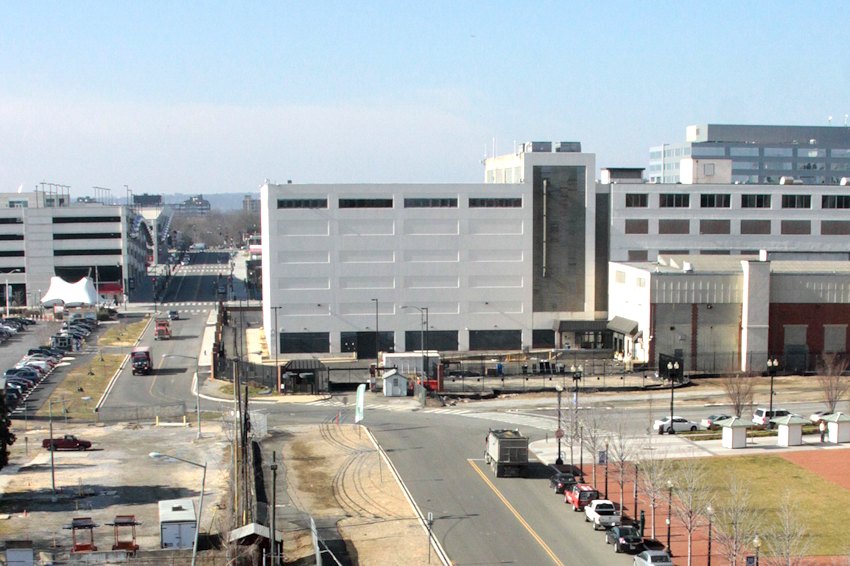
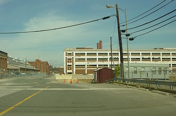
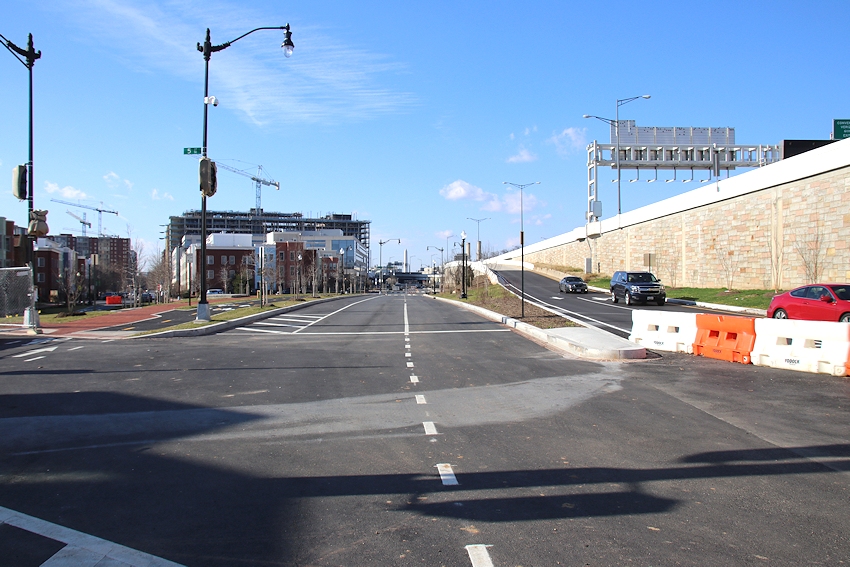
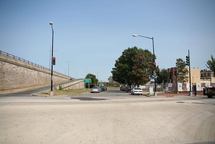
 I will be the first to admit that I did not do a very good job tracking the progress of the Virginia Avenue Tunnel construction. Even putting aside the fact that most of it happened underground, it just came at a rotten time in my life and was too large a footprint for me to ever really feel like I could do it justice. So of course instead of trying my best anyway, I just kind of gave up. Oops.
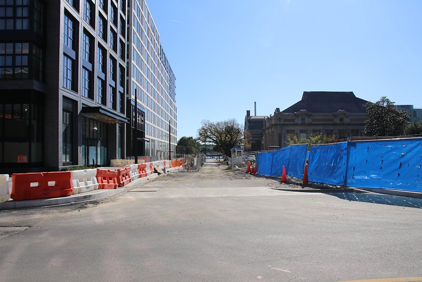
But, while the expansion of the original tunnel and the construction of the second track tunnel are both now complete, and now it is just streetscape work standing between impatient drivers* and the reopening of the avenue east of 4th, there is a part of the project where I can think I can provide a service, and that is looking at the actual changes in Virginia Avenue itself since digging started in spring 2015.
Yes, we're going to take a tour of the road. You might be surprised at how much it has changed.
Let's start at 2nd and Virginia, which in the pre-project days was a weird intersection between 2nd and the functional Virginia Avenue to the east along with the incomplete H Street and closed-off Virginia Avenue to the east. It never saw much traffic but was large and oddly configured for a spot with so little use. These are two before-and-after sets, first looking north-northwestward, and then eastward (sorry for the crappy current shots):
Remembering that you can click to enlarge these photos and then page through them, you'll see how this 2nd-H-Virginia intersection was extremely wide and mainly focused on the flow of traffic along Virginia Avenue, which became superfluous when in the early 2000s it was decided to close Virginia from this spot out to South Capitol (because of security concerns with its location right by the Capitol Power Plant). In the new version, there are big sidewalk bulb-outs, shinking the amount of asphalt and making it easier for pedestrians to cross the street, which comes in handy for the hordes marching toward Whole Foods in the next block.
As we continue east on Virginia, there isn't much of a change in the 300 block's footprint, other than the creation of bulb-outs to narrow the sidewalk width while still allowing mid-block parking on both sides.
But there's definitely a few changes where Virginia heads east across 4th Street:

The street is now closer to the freeway, and on a straight line toward the intersection with 5th Street. The wide bend from 4th Street is gone, meaning that hopefully cars turning left from 4th onto Virginia will now have to slow down to navigate the intersection. There's also now parking on the south side of the street, which mainly serves to add back in the few parking spaces that disappeared now that I Street no longer bends into Virginia east of 4th. I don't have an "after" photo, but you can see what it used to do here, and also see how Virginia had to bend northward to get to the intersection with 5th.
The intersection at 5th (which becomes 6th as you go north under the freeway) has always been ugly, so ugly that I never came up with a good standard way of photographing it, which means my before pictures aren't always helpful. But in this comparison shot looking west, you can see how Virginia is now a straight shot coming from 4th to 5th. You can also see that the street and ramp from 695 are much closer, and the grading has been changed as well,
Turning around and looking eastward on Virginia at 5th, you can see how much the traffic flow has been altered:

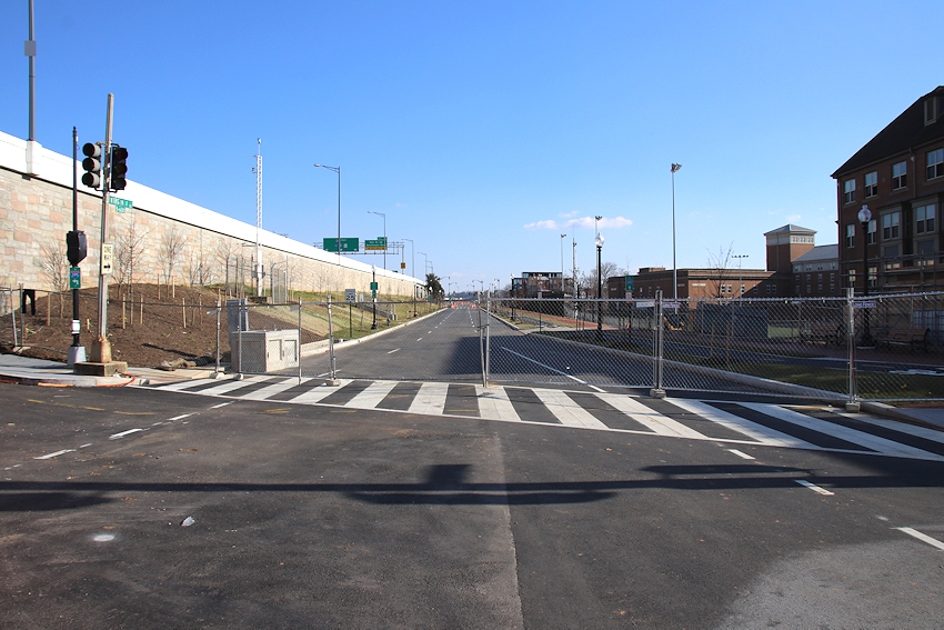
Before, the freeway traffic used to continue on Virginia via the lanes to the left, and the traffic from Virginia and those turning onto Virginia from 5th used the merging lanes to the right. And there was a lovely median separating them, making it a long trek for pedestrians from the north side of Virginia to the south side. Now, as you can mostly see (sorry about the shadows), it's more like a regular intersection, except that from what I can tell the drivers in the middle lanes from Virginia and the ramp will have a wide middle lane to handle their merging as they go east. Will have to see how the ramp lanes are striped--will the left ramp lane be left-turn only? Or left/straight, and the right ramp lane straight, as it used to be? We Shall See.
Now we get to 7th Street, which doesn't really look that different except that the diagonal stub of K Street just to the south is now gone, again making it easier for pedestrians on the east side of 7th to get north of Virginia.
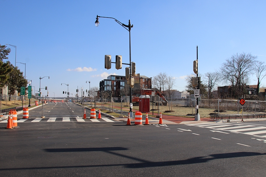
Now we have reached 8th Street, the end of my little tour. First turning back to look westward, you'll see that the lanes no longer split, once again making it easier for pedestrians to get across:

When you look eastward across 8th, you'll see a big change (the departure of the on-ramp to 695), but that happened in 2013. As I'm sure you remember.
I imagine the blocks east of 4th Street will open Any Minute Now, since they are all now striped and lamped and lighted and curbed. Then we can find out how it all works when actual pedestrians, drivers, bicyclists, scooterists, and the like get a hold of it.
It was a long 3 1/2 years to get to this point, but these photos indicate--even more than I realized--that CSX did not just tear Virginia Avenue up, dig a tunnel, and plop the old street right back down on top of the new tunnel.
* I'll do a tour of the new bike side path another time.
|
Comments (24)
More posts:
CSX/Virginia Ave. Tunnel, Traffic Issues
|
And now some of increasingly old tidbits:
* ALBI/MAXWELL: Washingtonian reports news of two restaurants coming to the Yards in 2019: Albi, a "modern American eatery inspired by {chef Michael Lee Rafidi's} Middle Eastern and Mid-Atlantic roots," and another branch of Shaw's "oenophile haven," the wine bar Maxwell. The JDLand commentariat has analyzed the situation and are positing that the new garage door-style panels on the 4th Street side of the Bower might be the home for these ventures.
* CHEMONICS: Not a restaurant, but Washington Business Journal reports behind its paywall that Chemonics, a USAID contractor among other things, is close to a deal to move its 1,200-person headquarters from near Farragut West to Yards Parcel A Yards Parcel G (updated 1/2/19 with the correct location--oops). This northern portion of Spooky Park has long been planned to be Class A office space--as for the rest of the block, I wrote a few weeks ago about the plans for residential along N Street and the new streets coming. This new office building would be north of the hotly awaited Quander Street. (h/t commenter Westnorth)
* SQUARE 696 UNMASKED? With thanks to commenter CL85, we may have our first look at what is coming to Square 696, the block just about out of the ground on the south side of I Street between Half and 1st. (If Clark pulls it down, here is the rendering.) This is going to be an 818-unit residential project spanning the entire block when both phases are complete in 2022. (It sounds like they are going to build the "structure and skin" of the entire project, but will first complete the eastern tower before moving to the interior work of the western tower.)
* NEW BIKESHARE STATION: If you haven't stumbled across it yet, there is now a 19-dock CaBi station on 4th Street SE just north of M (alongside the new Sprint store and kitty corner from Teeter).
* NEW ANC COMMISSIONERS: In local local local election results, ANC 6D07 (the seat left open by Meredith Fascett's retirement) has been won by Edward Daniels, while in 6D02 Anna Forgie clobbered incumbent Cara Lee Shockley.
|
Comments (54)
More posts:
albi, ANC News, Pedestrian/Cycling Issues, Restaurants/Nightlife, maxwell, meetings, Square 696 Residential, Traffic Issues, yardsparcelg, Bower Condos/Guild Apts/Yards
|
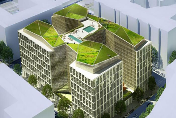
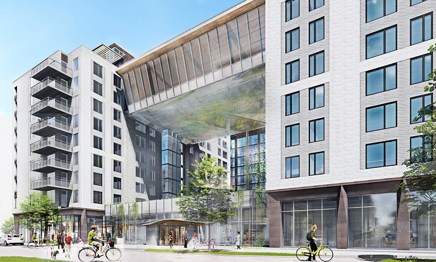
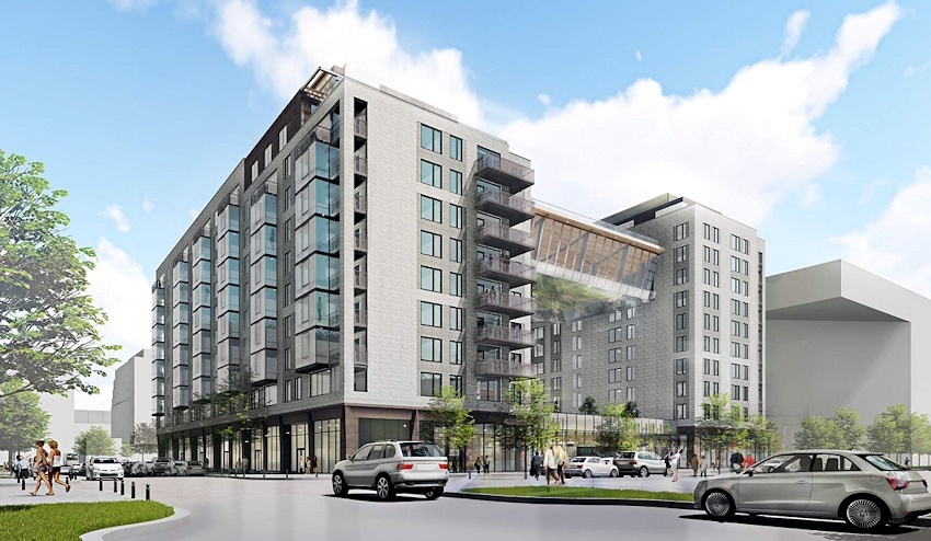 Now that everyone (meaning me) has recovered from The Great Grocery Store Opening of 2018, we can turn our attention to the newest project to head into the zoning approvals fun factory: a 348-unit apartment building by Forest City on "Yards Parcel I," which is on the south side of N Street west of New Jersey.
 If you're having trouble envisioning this location, it's the eastern portion of the big parking lot on the south side of N. (The rendering above is looking toward the southeast from N Street's north-side parking lot, like this.)
The most striking part of the building's design is the "one-story double-height bridge" that runs across the courtyard at the 8th of the building's 11 floors, and which would have the building's pool on top of it.
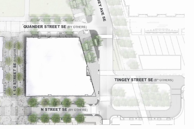
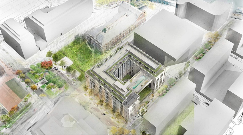
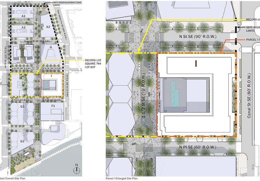 The bridge and the open courtyard will both face "1 1/2 Street," the new "spine" of Yards West that will run from M Street to Diamond Teague Park. It will be pedestrian-only from M south to the reconstituted Quander Street, and then will be a "shared curbless street" down to its terminus by Diamond Teague Park. You might need your magnifying glass even after clicking on it to enlarge it, but the image at right shows the full Yards West site plan on the left, and a zoom-in on the new Parcel I footprint at right.
(A tidbit of note in the zoning filing mentions that 1 1/2 Street would lead south from M Street "and a potential additional entrance to the Navy Yard Metrorail station.")
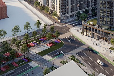
Here's some additional renderings, showing the bridge, and 1 1/2 Street, and even the planned Tingey Square at the current intersection of New Jersey, N, and Tingey.
The zoning filing says that Forest City expects to build out much of the new Yards West street grid beginning next year: which includes the two-block segment of Quander Street between 1st and New Jersey and the "curbless street" portion of 1 1/2 Street between Quander and N Place (the little alley-like street south of the big parking lot and north of the DC Water brick building).
The new building would also have about 13,600 square feet of retail, and two levels of underground parking with 243 spaces.
You can see a couple more images on my new Yards Parcel I page, though I imagine that 1 1/2 Street will eventually get its own page.
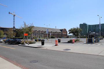
In the meantime, here's what the intersection of 1 1/2 and N looks like now, to further help you place it.
(Yes, I have 1 1/2 Street already set up in my Photo Archive, if you want to see the full before-and-afters. Though I guess I'd better add Quander Street now, too.)
The zoning hearing is not yet scheduled, and so there's no firm start date for construction of the building as yet.
PS: Don't blame me about "1 1/2 Street."
|
Comments (73)
|
251 Posts:
Go to Page: 1 | 2 | 3 | 4 | 5 | 6 | 7 | 8 | 9 | 10 ... 26
Search JDLand Blog Posts by Date or Category
Go to Page: 1 | 2 | 3 | 4 | 5 | 6 | 7 | 8 | 9 | 10 ... 26
Search JDLand Blog Posts by Date or Category