
|
| |||||||||||||||||||

|
Please note that JDLand is no longer being updated.
peek >>
Near Southeast DC Past News Items: South Capitol St.
|
See JDLand's South Capitol St. Project Page
for Photos, History, and Details |
- Full Neighborhood Development MapThere's a lot more than just the projects listed here. See the complete map of completed, underway, and proposed projects all across the neighborhood.
- What's New This YearA quick look at what's arrived or been announced since the end of the 2018 baseball season.
- Food Options, Now and Coming SoonThere's now plenty of food options in the neighborhood. Click to see what's here, and what's coming.
![-]()
- Anacostia RiverwalkA bridge between Teague and Yards Parks is part of the planned 20-mile Anacostia Riverwalk multi-use trail along the east and west banks of the Anacostia River.
![-]()
- Virginia Ave. Tunnel ExpansionConstruction underway in 2015 to expand the 106-year-old tunnel to allow for a second track and double-height cars. Expected completion 2018.
![-]()
- Rail and Bus Times
Get real time data for the Navy Yard subway, Circulator, Bikeshare, and bus lines, plus additional transit information. - Rail and Bus Times
Get real time data for the Navy Yard subway, Circulator, Bikeshare, and bus lines, plus additional transit information. - Canal ParkThree-block park on the site of the old Washington Canal. Construction begun in spring 2011, opened Nov. 16, 2012.
![-]()
- Nationals Park21-acre site, 41,000-seat ballpark, construction begun May 2006, Opening Day March 30, 2008.
![-]()
- Washington Navy YardHeadquarters of the Naval District Washington, established in 1799.
![-]()
- Yards Park5.5-acre park on the banks of the Anacostia. First phase completed September 2010.
![-]()
- Van Ness Elementary SchoolDC Public School, closed in 2006, but reopening in stages beginning in 2015.
![-]()
- Agora/Whole Foods336-unit apartment building at 800 New Jersey Ave., SE. Construction begun June 2014, move-ins underway early 2018. Whole Foods expected to open in late 2018.
![-]()
- New Douglass BridgeConstruction underway in early 2018 on the replacement for the current South Capitol Street Bridge. Completion expected in 2021.
![-]()
- 1221 Van290-unit residential building with 26,000 sf retail. Underway late 2015, completed early 2018.

- NAB HQ/AvidianNew headquarters for National Association of Broadcasters, along with a 163-unit condo building. Construction underway early 2017.

- Yards/Parcel O Residential ProjectsThe Bower, a 138-unit condo building by PN Hoffman, and The Guild, a 190-unit rental building by Forest City on the southeast corner of 4th and Tingey. Underway fall 2016, delivery 2018.

- New DC Water HQA wrap-around six-story addition to the existing O Street Pumping Station. Construction underway in 2016, with completion in 2018.

- The Harlow/Square 769N AptsMixed-income rental building with 176 units, including 36 public housing units. Underway early 2017, delivery 2019.

- West Half Residential420-unit project with 65,000 sf retail. Construction underway spring 2017.
![-]()
- Novel South Capitol/2 I St.530ish-unit apartment building in two phases, on old McDonald's site. Construction underway early 2017, completed summer 2019.
![Novel South Capitol]()
- 1250 Half/Envy310 rental units at 1250, 123 condos at Envy, 60,000 square feet of retail. Underway spring 2017.
![-]()
- Parc Riverside Phase II314ish-unit residential building at 1010 Half St., SE, by Toll Bros. Construction underway summer 2017.
![-]()
- 99 M StreetA 224,000-square-foot office building by Skanska for the corner of 1st and M. Underway fall 2015, substantially complete summer 2018. Circa and an unnamed sibling restaurant announced tenants.
![-]()
- The Garrett375-unit rental building at 2nd and I with 13,000 sq ft retail. Construction underway late fall 2017.
![-]()
- Yards/The Estate Apts. and Thompson Hotel270-unit rental building and 227-room Thompson Hotel, with 20,000 sq ft retail total. Construction underway fall 2017.
![-]()
- Meridian on First275-unit residential building, by Paradigm. Construction underway early 2018.
![-]()
- The Maren/71 Potomac264-unit residential building with 12,500 sq ft retail, underway spring 2018. Phase 2 of RiverFront on the Anacostia development.
![-]()
- DC Crossing/Square 696Block bought in 2016 by Tishman Speyer, with plans for 800 apartment units and 44,000 square feet of retail in two phases. Digging underway April 2018.
![DC Crossing]()
- One Hill South Phase 2300ish-unit unnamed sibling building at South Capitol and I. Work underway summer 2018.
![One Hill South Phase 2]()
- New DDOT HQ/250 MNew headquarters for the District Department of Transportation. Underway early 2019.
![New DDOT HQ]()
- 37 L Street Condos11-story, 74-unit condo building west of Half St. Underway early 2019.
![37 L Condos]()
- CSX East Residential/Hotel225ish-unit AC Marriott and two residential buildings planned. Digging underway late summer 2019.
![CSX East Residential/Hotel]()
- 1000 South Capitol Residential224-unit apartment building by Lerner. Underway fall 2019.
![1000 South Capitol Residential]()
- Capper Seniors 2.0Reconstruction of the 160-unit building for low-income seniors that was destroyed by fire in 2018.
![1000 South Capitol Residential]()
- Chemonics HQNew 285,000-sq-ft office building with 14,000 sq ft of retail. Expected delivery 2021.
![1000 South Capitol Residential]()


246 Blog Posts Since 2003
Go to Page: 1 | 2 | 3 | 4 | 5 | 6 | 7 | 8 | 9 | 10 ... 25
Search JDLand Blog Posts by Date or Category
Go to Page: 1 | 2 | 3 | 4 | 5 | 6 | 7 | 8 | 9 | 10 ... 25
Search JDLand Blog Posts by Date or Category
Many moons ago, I decided that the written-in-stone boundaries of JDLand coverage stop where the Southeast quadrant stops--in the middle of the South Capitol Street median. (This was also written into the peace agreement negotiated with SWill.) 

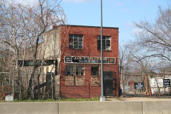
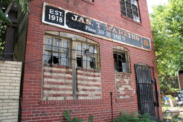
But I can't completely ignore the recent news that Ronald D. Paul Cos. has now bought 31,000 square feet of land south of N Street, directly across from the Nats Park, and just north of Camden's 1325 South Capitol apartment building.
And while WBJ says the company "is in no rush to build," according to SWill this is part of a joint venture with Altus Realty Partners to build 1319 South Capitol, a 250-unit building that could get underway in 2016.
The rendering below is paired with a photo of mine from 2013 from a strikingly similar angle:
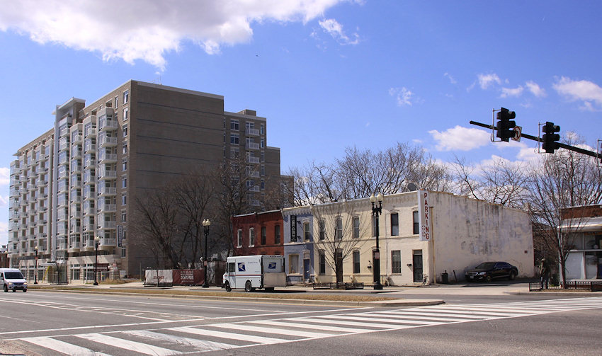
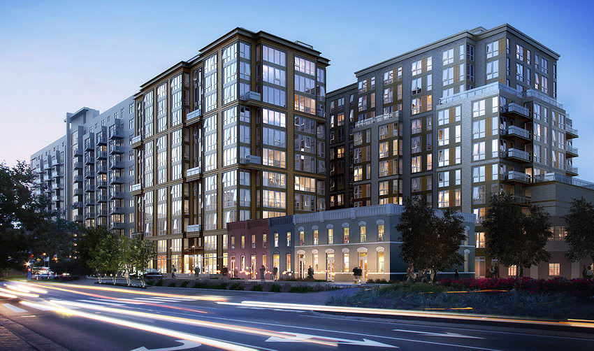
As seen in the drawing, the new building is designed to for an L shape around the existing rowhouses on South Capitol.
The project will need to go through zoning hearings since that stretch of South Capitol St. SW is covered by the Capitol Gateway Overlay.
This tidbit also gives me an excuse to post photos of the Jas. T. Warring building (Est. 1918!) building that used to be on the site until it disappeared sometime in 2008 or early 2009.


|
Comments (2)
More posts:
1319southcap, Development News, South Capitol St.
|
 The process to build a new Douglass Bridge hasn't exactly been moving at lightning speed, but nevertheless an important milestone has been reached: on August 14 it was announced that "the Federal Highway Administration (FHWA) approved the Supplemental Final Environmental Impact Statement (SFEIS) and issued a Record of Decision (ROD) for the South Capitol Street Corridor Project—both indicating federal approval of the project."
And with $587 million in DC's budget already earmarked for the project, DDOT can move forward with the next big step: choosing the design-build team, presumably from among the "final four" bidders identified back in February 2014, a process that is scheduled to be completed by the end of 2016.
The current Douglass Bridge is now 66 years old, and has been classified as "functionally obsolete." DDOT says that if it is not replaced "within the next five years, the bridge would require an estimated $110 million in major rehabilitation work and would need to be closed for more than a year."
(And, maybe I'm just getting older and turning into even more of a fraidy cat, but holy moly is the traffic making the current bridge vibrate like crazy when you walk the pedestrian path. I just don't remember it moving that much even six months ago. Which perhaps might explain this bit of crumbling I saw on Saturday.)
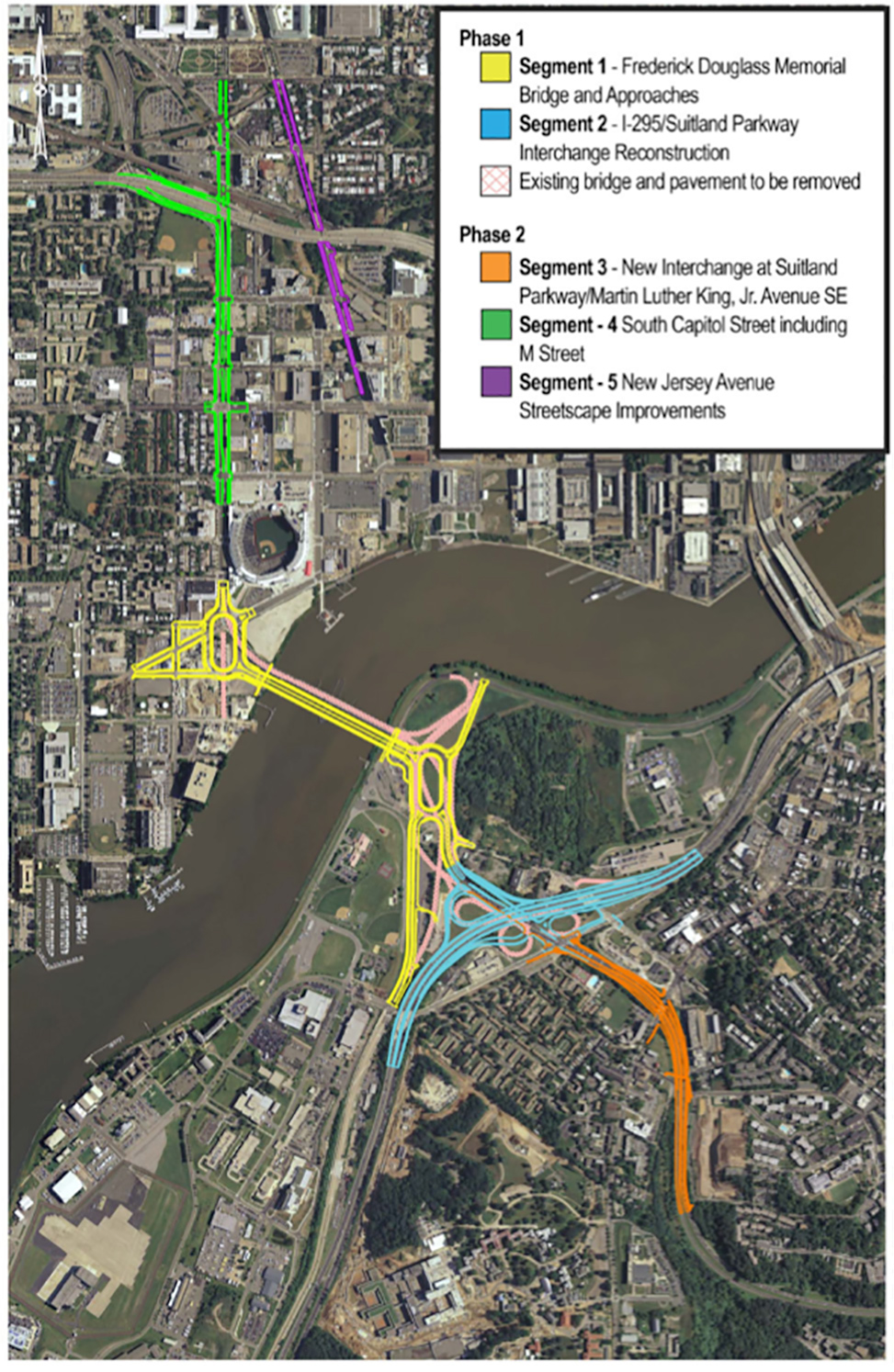
This is now at least my 120th post on the bridge and the plans to replace it, so I'll go with a very quick summary (this post from last December is a good catch-up option). As you can see in the pilfered-from-DDOT graphic above, the new bridge will run immediately parallel and downriver of the existing bridge, with two new large traffic ovals on its approaches. There will also be a much-needed reconstruction of the I-295/Suitland Parkway interchange.
The eventual second phase of this overall "South Capitol Street Corridor Project" will be streetscape improvements to the north end of the street, similar to the spiffening that the blocks from N to Potomac received back in 2007 that give the street more of an "urban boulevard" feel. This will include a full redesign of the M Street intersection and a reconfiguration of South Capitol's interchange with I-395.
 The full Request for Proposals is expected to be released in the spring of 2016.
While waiting for the new bridge to arrive, I may have to put out calls for volunteers willing to let me tether myself to them when I need to take pictures from the existing bridge, because otherwise the authorities will probably have to respond to calls of an old lady frozen in place on the pedestrian path, holding a camera but too terrified to move.
|
Comments (8)
More posts:
South Capitol St., Douglass Bridge
|
 Some brief links, because I think I've used up my allotment of words over the past few weeks, but also because the continuing web site problems have just utterly worn me down. (Reminder: if you get a 503 Service Unavailable error, or the site is loading but with all sorts of formatting problems, just count to 10--or maybe 20--and reload. They are supposedly investigating, but I may have to be committed before they manage to fix it.)
* RAMP CLOSURE SATURDAY: The ramp from M Street at 11th to the outbound 11th Street freeway bridge will be closed for "pavement striping modifications" on Saturday, April 11, from 7 am until 5 pm. The local bridge will be the detour. (DDOT)
* NO HOLIDAY FOR METERS: If you are thinking that you can park for free in metered street spaces near Nats Park on game days that fall on Sundays and holidays, you would be wrong. (DDOT)
* DOUGLASS BRIDGE $$$: Mayor Bowser's proposed FY16 budget includes $512.7 million for the new Douglass Bridge. (WBJ)
* BEST BAR BLUEJACKET: Esquire's "Best Bars in America" visited Bluejacket, among other spots, calling it the "Willy Wonka of beer breweries." (HillNow)
* FAIRGROUNDS LAMENT: "The Fairgrounds is a dying breed of the Nats fan experience." (WaPo)
* BREAKING ICE CREAM NEWS: Ice Cream Jubilee has added "Chocolate Matzo Crack," "Fig, Port, & Goat Cheese," and "Cherries Jubilee" as springtime flavors. And milkshakes!
|
Comments (11)
|
* SOUTH CAPITOL SPEED CAMERAS: MPD has announced the latest batch of speed camera deployments, and it includes South Capitol Street between O Street and Potomac Avenue--alongside Nationals Park and just north of the Douglass Bridge--in both directions. "The 30 day educational phase, or 'warning period', will commence on or about March 23, 2015. During this period, violators will receive warning citations. After the 30 day warning period, MPD will begin issuing live moving citations to violators."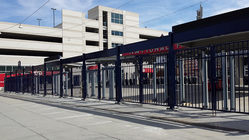 * NATS PARK MAGNETOMETERS: There was a media event on Monday to unveil the new magnetometers at all entrances to Nats Park. (I'll note that this sign about the procedures will probably not be met with glee.) I wasn't at the event, but I did get my own shot on Sunday of the new installations at the Center Field Gate, as you see at right. The new security screening procedures will be in place starting with the April 4 exhibition game against the Yankees. Arrive early! (WaPo)
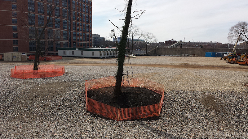 * PEEKING AT CSX: At right is a shot of the now-cleared area just south of the freeway and behind the 70 and 100 Capitol Yards apartment buildings. This work has had hearts aflutter that there could be some new development coming there, but it is actually just CSX clearing its considerable tract of land as prep work continues for the Virginia Avenue Tunnel.
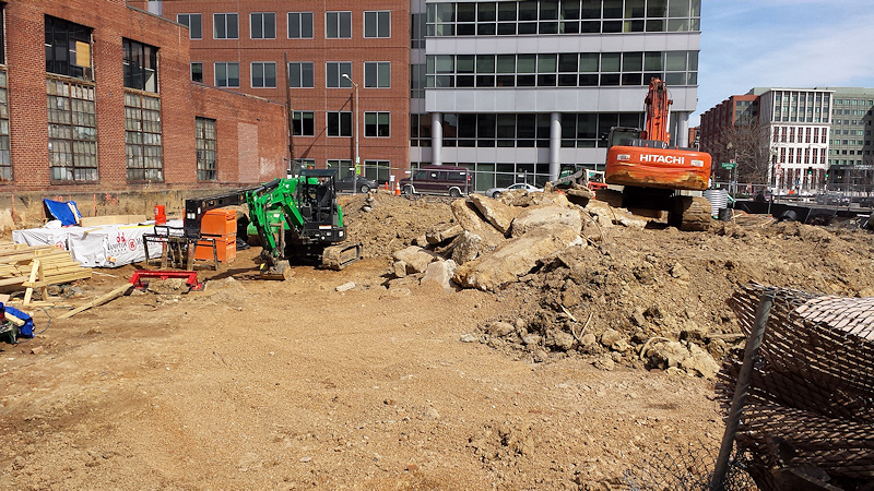

* NATS PARK MAGNETOMETERS: There was a media event on Monday to unveil the new magnetometers at all entrances to Nats Park. (I'll note that this sign about the procedures will probably not be met with glee.) I wasn't at the event, but I did get my own shot on Sunday of the new installations at the Center Field Gate, as you see at right. The new security screening procedures will be in place starting with the April 4 exhibition game against the Yankees. Arrive early! (WaPo)* US-NY CIRCULATOR CHANGE: "From 3/29, catch the Union Station bus to Navy Yard only at Mass Ave and Columbus Cir 1st & 2nd St stops discontinued." (@DCCirculator; more here)
* YARDS PARK WORK: "We're almost ready for Splash Season! Please 'pardon our dust' as we prepare the water features and basin. We'll update here when finished!" (@YardsPark)
* PEEKING AT CSX: At right is a shot of the now-cleared area just south of the freeway and behind the 70 and 100 Capitol Yards apartment buildings. This work has had hearts aflutter that there could be some new development coming there, but it is actually just CSX clearing its considerable tract of land as prep work continues for the Virginia Avenue Tunnel. * PEEKING AT EVERYTHING ELSE: I'm going to have to recalibrate my normal mission to over-document projects in blog posts, given the breadth of work underway in the neighborhood. That said, I can't pass up a quick sharing of the cellphone photos I took Sunday afternoon while peeking through fences at the Homewood Suites, 82 I, Hampton Inn/Ballpark Square, and 909 Half sites. (Click all to enlarge.)
It would have been even better if I had included the other holes in the ground, at 1111 New Jersey, 800 New Jersey, and Florida Rock, but I failed.
|
Comments (6)
|
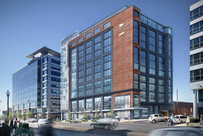 * HOMEWOOD SUITES: The planned 195-room Homewood Suites hotel on the northeast corner of Half and M streets SE now has an approved shoring/sheeting/excavation permit, which means they can start digging whenever the mood strikes. (Foundation and above-grade permits are still in process.) Now the question is, which project with okayed excavation permits will get in the ground first--Homewood or Ballpark Square (which has its own 170-room hotel with an as-yet-unnamed operator, alongside a 325-unit residential building)?
* FITNESS FAIR: On Wednesday, Jan. 28, VIDA Fitness will be hosting a free "Fitness Fair" from 5 to 7 pm at all six of its locations, including Tingey Street, with information about the programs and classes available as well as "complimentary fitness consultations, health screenings and nutritional counseling."
* 1244 SOUTH CAPITOL: I have been remiss in not mentioning sooner that JBG's designs for a 290-unit residential building on the northeast corner of South Capitol and N received a 5-0 final action vote from the Zoning Commission earlier this month. The building, just north of Nats Parking Lot B on the old BP Amoco site, will also have 26,000 square feet of retail. Next step: the building permit gauntlet.
* SOUTH CAPITOL STREET MEETING: I didn't make it to last week's meeting on the latest plans for the new Douglass Bridge and other South Capitol Street improvements, but here are the presentation slides and display boards.
* MONTADITOS'ED: Mr. JDLand is within striking distance of completing his quest to eat all of the sandwich offerings on the 100 Montaditos menu. (You really have to admire the man's commitment.) It's looking like Thursday (Jan. 29) at lunchtime may be when he crosses the finish line, if anyone wants to be there with me to toast his accomplishment. I'll update with actual times here and on Twitter. (And yes, the blog about the quest is only at #45.)
|
Comments (3)
|
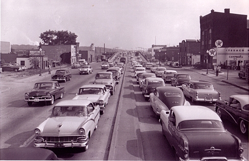
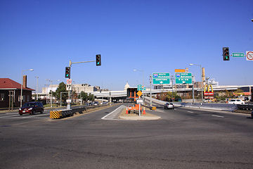
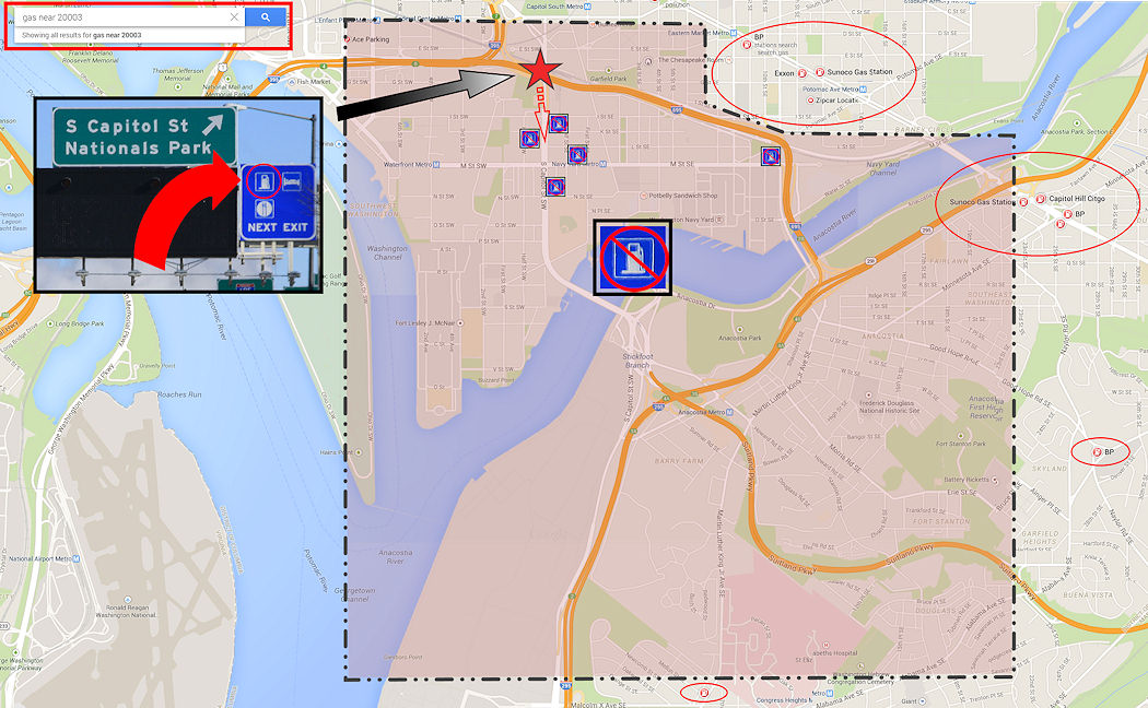 As you approach the South Capitol Street exit on the Southwest Freeway, there's a small blue sign overhead, dwarfed by its siblings and probably all but invisible to everyday users of the highway.
 It's a Gas - Food - Lodging sign, ubiquitous across this great land of ours and often a very (VERY) welcome sight, when the gas gauge has fallen below the Empty line and panic has begun setting in.
And while regulations generally say that an establishment can be located within three miles of the exit in order to allow for such a sign to be posted, in urban settings stressed low-fuel drivers have some level of expectation that when they get to the end of the ramp they will be greeted with at least one gas station within view, or a sign pointing where to go to find it and how far it will be.
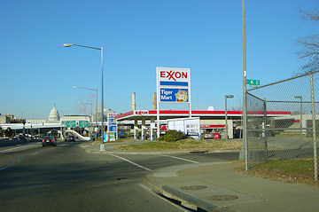
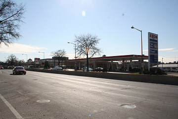
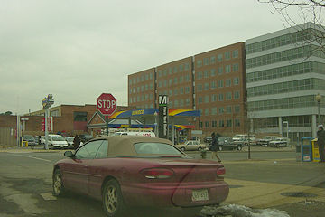
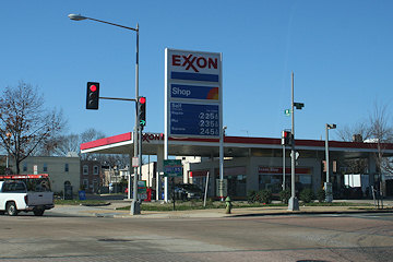
Up until about nine years ago, that's exactly what would happen when taking the South Capitol exit. There were Exxons on the east side of the street (at I) and the west side (at K). There was a BP Amoco station at N, plus a Sunoco at Half and M and another Exxon at 11th and M if one wanted to stray a little or a lot.
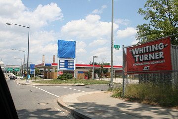 But then they started to close, and were all gone by 2008, though I will note that not a single one of those sites has been developed as of now.
So, if you are a desperate driver looking for gas, and you see that sign, and you start to head south on South Capitol Street, where is the first gas station you'd come across? You'd have to be smartphone-equipped to find your way 3.4 miles to the King Gas Station on Martin Luther King Jr. Avenue, just north of the intersection with Malcolm X Avenue.
But more likely you'd stay on the Suitland Parkway, and perhaps your Spidey Sense might then lead you north on Alabama Avenue to the BP at the intersection with Alabama, Naylor, and Good Hope Roads, 4.6 miles away from your exit.
Chances are though that you'd follow the Suitland Parkway until you are alerted otherwise. There's no signs as far as Google Street View shows for stations at Naylor Road (4.8 miles) and Silver Hill Road (6.3 miles), though the stations at the latter can probably be seen once you passed the exits, launching just the sort of in-car recriminations that end up being the highlight of so many car trips.
Eventually you end up at a T-intersection with Rt. 4/Pennsylvania Avenue, where if you are lucky--and clearly you aren't--you will guess that you should turn left, and be rewarded with a BP about a mile later, a total of 14.1 miles and God knows how many minutes since you exited the Southwest Freeway.
If instead you decide to keep heading forward in your same general direction, you could be all the way to the Sunoco in Lothian before you at last find your station, though of course you would totally have run out of gas somewhere during the 19.7-mile divorce-inducing trek.
The reality is that Pennsylvania Avenue SE is a frantic driver's best bet from the South Capitol Street exit, either by getting back on 695, heading across the 11th Street Bridge, and then going north on DC-295 to the Sunoco at the Pennsylvania Avenue interchange (2.7 miles), or by getting yourself north of the freeway and then taking a pick of the stations at 9th, 12th, or 13th (we're just going to ignore the Platinum-Coated Exxon at 4th and Pennsylvania), all of which are 1.5 miles-ish from the exit.
Residents figure these things out, so there's not the same scenario of needing gas, seeing a sign, and expecting a relatively simple path to a fill-up. And it's not exactly a news flash that gas stations are becoming increasingly scarce in the downtown core.
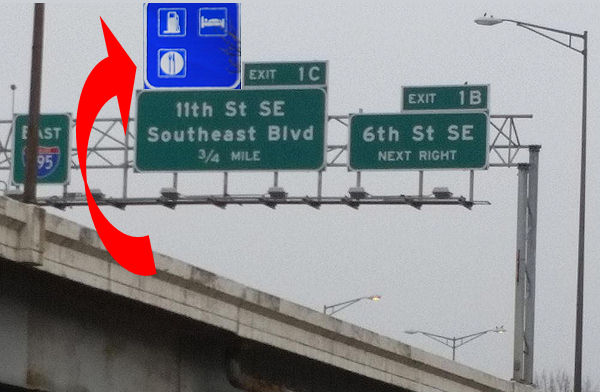 But maybe this poor blue sign could be moved to the spiffy newish 11th Street/Southeast Blvd. exit.
Ditto on all of this for the similar blue signs pointing drivers coming south out of the 3rd Street Tunnel to the South Capitol Street exit.
(And to think that this was originally just going to be nothing more than a snarky tweet of the photo of the blue sign!)
|
Comments (9)
More posts:
South Capitol St., Traffic Issues
|
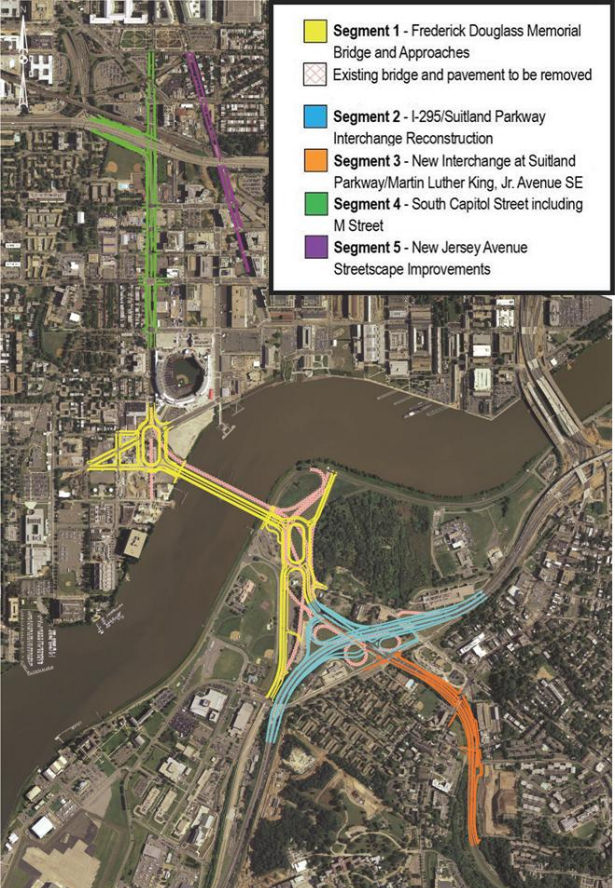
 If you are looking for some light Christmas reading, you can sit down by the fireplace with all 335 pages (plus appendices!) of the newest revision to the plans for reconfiguring much of South Capitol Street, including the construction of a new Frederick Douglass Bridge.
This document, technically known as the Supplemental Draft Environmental Impact Statement (SDEIS), describes the new "revised preferred alternative" (RPA) design that tweaks the original preferred alternative in the Final EIS released back in 2011.
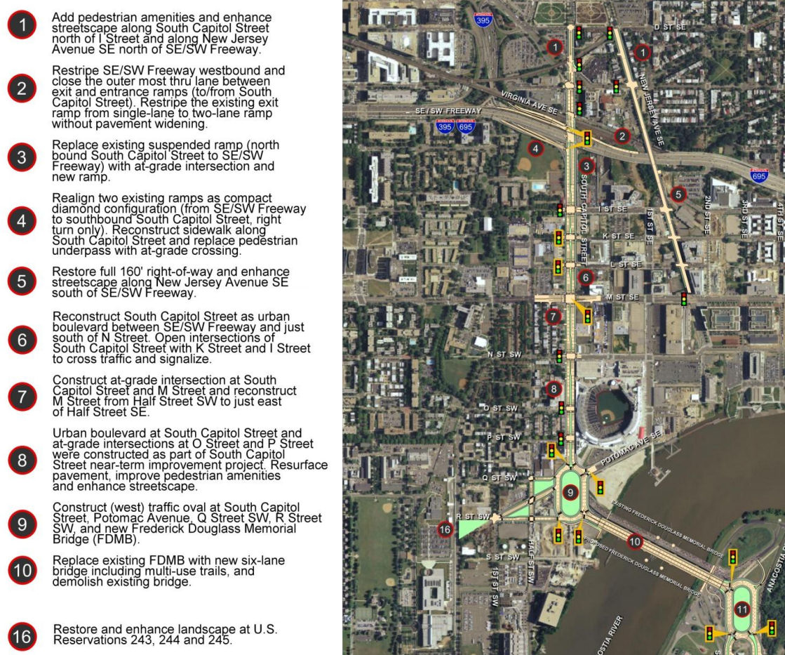
The bullet points for what the project plans are north/west of the Anacostia River are in the graphic at right (click to enlarge). The changes in this new RPA include:
* Changing the design of the bridge from a moveable span to a fixed-span bridge, which would save approximately $140 million in construction costs;
* Shifting the orientation of the new Douglass Bridge to an alignment parallel to the existing bridge, 30 feet down river, which avoids the need and lengthy process to acquire some land from Joint Base Anacostia-Bolling as well as a number of expensive relocation and reconstruction issues that a new alignment avoids (see page 2-91 of the SDEIS for details);
* A slight reduction of the size of the traffic oval on the western side (at Potomac Avenue):
* Replacing the previously designed circle on the eastern approach with an oval, located entirely in the DDOT right-of-way;
* And several other changes on the east side of the project that I will leave to others to discuss in detail. (See page ES-6 of the SDEIS.)
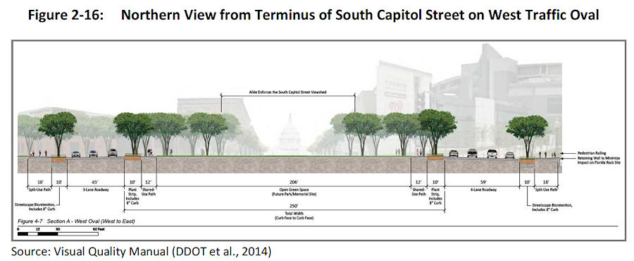 The initial design of the ovals and of the bridge itself were met with some consternation during this revision process. The SDEIS notes that in response to these concerns, DDOT has created a "Visual Quality Manual" for the project, which identifies design goals that are to "reflect the vision of providing a grand urban boulevard, which will be a gateway into the nation's capital, an iconic symbol of the District's aspirations in the 21st century, and a catalyst to revitalize local neighborhoods and the Anacostia Waterfront." (page 2-26).
 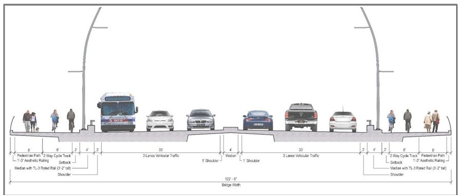 As for the bridge itself, the version in this RPA will support three travel lanes in each direction, along with 18 feet of bicycle and pedestrian paths on *both* sides of the bridge--an 8-foot lane for pedestrians and a 10-foot birdirectional bike path. (Enlarge the image at right to see that I'm not lying about the bike/ped stuff.)
And the design of the bridge is to "make its primary aesthetic impact through its position (alignment), and the shape and sizes of its structural elements" and is to " aesthetically appear to be part of a continuous urban corridor." This includes the avoidance of "using elements, solely for aesthetic effect, which do not contribute to the support of the bridge." (page 2-28)
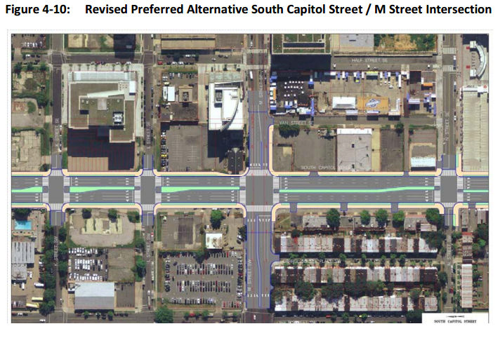
Plans for the reconfiguration of South Capitol Street as a "grand urban boulevard" have all along called for changing the intersection of South Capitol and M streets to an "at-grade intersection" (page 4-79), which would also mean that K and L would have signalized four-way intersections with South Capitol, unlike today. The wide median seen south of N would be established on the north end of the street as well, now all the way to D Street SE in the RPA. Also changing in this new plan are a few new left-turn options at I Street SE/SW and L Street SE.
 Revisions have also been made to the ramps from South Capitol Street to I-395 and I-695, but the basics from the original plans remain, most notably the demolition of the existing suspended ramp from northbound South Capitol to the SE/SW Freeway.
Even with the revisions made to cut the costs of the new Douglass Bridge, this isn't a cheap project. The five phases together are anticipated to cost over $1 billion, with Segment 1, including the new bridge and traffic ovals, estimated at $480 million. The "grand boulevard"-izing of South Capitol Street is estimated at $153 million, and planned streetscape improvements to New Jersey Avenue between D and M streets SE at $42 million, plus another $358 million in east-of-the-river improvements (page 2-11).
Worn out yet? I sure am! (I've mostly lost track of how much of this is truly even "new" news at this point.) But perhaps you can regain your strength by Jan. 22, 2015, when the public meeting on this SDEIS will be held from 6:30 to 8:30 pm at Matthews Memorial Baptist Church Fellowship Hall, 2616 Martin Luther King Ave., SE. The public comment period is running until Feb. 2. DDOT is also still amidst the design/build proposal process, with proposals expected sometime in the spring.
The SouthCapitolEIS.com web site is now focused mainly on this SDEIS, of which clearly I've just scratched the surface; you can slog through my piles of posts on all of this over the years for the historical rundown.
UPDATE: Here's the WashCycle take on the latest plans, from a bike/ped perspective.
|
Comments (5)
More posts:
Pedestrian/Cycling Issues, meetings, M Street, South Capitol St., Douglass Bridge, Traffic Issues
|
Goodness, these piled up all of a sudden. Let's start with the food and drink-related items:
* Strolling by the long-in-the-works Willie's Brew and 'Que at the Boilermaker Shops over the weekend, I saw that flat screen TVs are now up on the walls. I imagine they are dreaming of being open by Opening Day.
* Ice Cream Jubilee at the Lumber Shed now has its tenant layout permit approved, so work should be underway there.
* Tom Sietsema had good things to say about Osteria Morini.
* PoPville reports that Hill Country's attempts to open a temporary location on Tingey Plaza behind USDOT haven't worked out.
And, on the non-digestible front:
* SWill reports on ANC 6D's newest commissioner, Stacy Cloyd, who is filling the 6D02 vacancy left by Ed Kaminski. A resident of Southwest, Stacy will also be representing areas east of South Capitol, including Velocity, Capitol Hill Tower, and Nats Park (and River Parc, before long).
* DDOT has released its draft Request for Proposals to the short-list finalists for the first two phases of the South Capitol Street project, which include building the new bridge and also rebuilding the interchange of I-295 and the Suitland Parkway.
* The new owners of the lot at South Capitol and N just north of Nats Park have withdrawn the pending zoning case for the site, which predated the property's recent sale. The previous ownership group had long been working on an office project, but in its withdrawal letter 1244 South Capitol Residential LLC says it is "studying development of the property for residential uses," and that it plans "to submit a new application for Capitol Gateway review in the near future."
* Outside the boundaries, but Near Southeast residents may still be interested in the looming start of the huge Wharf project on the Southwest Waterfront, with a ceremonial groundbreaking scheduled for March 19. Here's the Post's story on the new development, along with a photo gallery (which might seem to have a somewhat familiar style) of the current waterfront, before it's gone.
|
Comments (1)
More posts:
1221 Van, ANC News, Boilermaker Shops/Yards, Restaurants/Nightlife, icecreamjubilee, morini, South Capitol St., Douglass Bridge, willies, The Yards, zoning
|
* CSX NEAR: The Kojo Nnamdi Show hosted on Monday a roundtable on the Virginia Avenue Tunnel project, with David Garber and others. You can listen to it here.
* CSX FAR: Heads will explode, but I will pass along that CSX's J&L Tunnel Modification project has recently won two engineering awards. What is this tunnel? "The J&L Tunnel was constructed in the 1880s as part of the Pittsburgh & Lake Erie Railroad to allow trains to run beneath the former J&L Steel Company’s Pittsburgh Works Southside facility." And what was the project? CSX "increased the vertical clearance of a 130-year-old tunnel running through Pittsburgh’s SouthSide Works, a mixed-use residential and commercial development. CSX worked closely with public officials, local businesses and residents to minimize noise and disruption during construction. Upon completion of the tunnel work, CSX restored trees and plantings, and invested in landscaping improvements that left the overlying Tunnel Park a more usable recreational space."
* HAMPTON: The building permit has been approved for the 168-room Hampton Inn just north of Nats Park. (The shoring permit was approved back in December.)
* THE MASTER PLAN: DDOT has officially released its update to the Anacostia Waterfront Initiative Master Plan. This covers projects like the new Douglass Bridge and South Capitol Street makeover, the Barney Circle/Southeast Boulevard redo, the M Street SE/SW transportation study, the Anacostia Riverwalk Trail, and all other manner of projects and studies for infrastructure updates and improvements in the area. (Though, at 194 pages, maybe the Executive Summary will be a good place to start.) If I were a good blogger, I'd write a big in-depth entry about this, but, well, we know the answer to that these days....
* POLITICS: The Post grades the recent Southwest/Near Southeast Mayoral Forum, and the Hill Rag looks closely at the Ward 6 council race. Primary day is now less than a month away, on April 1. And note that tonight (March 4) there is a forum with the candiates at 7 pm at Westminster Church at 400 I St. SW, and there will be a Ward 6 candidate forum on education issues on Thursday, March 6, at 6:30 pm at Stuart-Hobson Middle School.
* DE-W'ED: Have you noticed that the Curly Ws are gone from various freeway signs? Here's why.
* PASTOR MILLS: Unfortunately, a sad piece of news to mention is that Karen Mills, pastor of the St. Paul's church at 4th and I SE, passed away on Feb. 21. I only met her a few times, but she was a very welcoming and pleasant presence, and condolences go out to her family, friends, and members of the church.
Anything else catching peoples' eyes?
|
Comments (8)
More posts:
CSX/Virginia Ave. Tunnel, hamptoninn, M Street, politics, Southeast Blvd., South Capitol St., Douglass Bridge, Traffic Issues
|
A looming snowstorm will always divert my attention, but before the flakes fly, here's a few tidbits: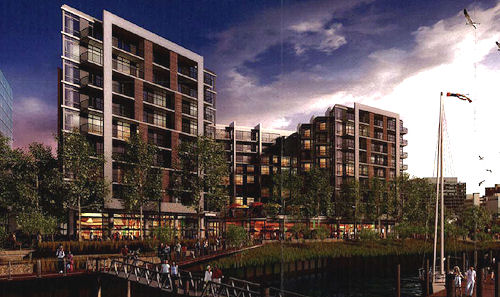 * I was not there, but the developers of the Florida Rock site apparently told Monday's ANC 6D meeting that they are looking at a June start of construction for the project's first phase, a 350-unit residential building. However, no building permit applications have been filed yet, with one reason being the need for some curb cut approvals, which the ANC voted to support. So, We Shall See.
* I was not there, but the developers of the Florida Rock site apparently told Monday's ANC 6D meeting that they are looking at a June start of construction for the project's first phase, a 350-unit residential building. However, no building permit applications have been filed yet, with one reason being the need for some curb cut approvals, which the ANC voted to support. So, We Shall See.* SWill reports that a developer is in the planning stages for a 260-unit apartment building on South Capitol Street across from Nationals Park, just north of the Camden building that opened last year. There are older rowhomes on the north end of the block, some or all of which could be incorporated into the project in some way. However, this is technically outside of my boundaries, so other than snapping photos of what will come, I'll be leaving this to Will to cover.
* I feel like I've already mentioned this, but in case I haven't, a raze permit has been filed for St. Matthew's Baptist Church on the southwest corner of New Jersey and L, to make way for Donohoe's 1111 New Jersey residential project. UPDATE: And commenter Alan below adds the tidbit that the church's message board out front now says "Looking for our perfect home."
* Washingtonian had very good things to say about Osteria Morini, while the Post's Tom Sietsema waxes saltily on Agua 301.
|
Comments (7)
More posts:
1111 New Jersey/Insignia on M, agua301, Development News, Florida Rock, morini, South Capitol St., Square 743N
|
246 Posts:
Go to Page: 1 | 2 | 3 | 4 | 5 | 6 | 7 | 8 | 9 | 10 ... 25
Search JDLand Blog Posts by Date or Category
Go to Page: 1 | 2 | 3 | 4 | 5 | 6 | 7 | 8 | 9 | 10 ... 25
Search JDLand Blog Posts by Date or Category