
|
| |||||||||||||||||||

|
Please note that JDLand is no longer being updated.
peek >>
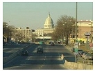
Near Southeast DC Past News Items: South Capitol St.
|
See JDLand's South Capitol St. Project Page
for Photos, History, and Details |
- Full Neighborhood Development MapThere's a lot more than just the projects listed here. See the complete map of completed, underway, and proposed projects all across the neighborhood.
- What's New This YearA quick look at what's arrived or been announced since the end of the 2018 baseball season.
- Food Options, Now and Coming SoonThere's now plenty of food options in the neighborhood. Click to see what's here, and what's coming.
![-]()
- Anacostia RiverwalkA bridge between Teague and Yards Parks is part of the planned 20-mile Anacostia Riverwalk multi-use trail along the east and west banks of the Anacostia River.
![-]()
- Virginia Ave. Tunnel ExpansionConstruction underway in 2015 to expand the 106-year-old tunnel to allow for a second track and double-height cars. Expected completion 2018.
![-]()
- Rail and Bus Times
Get real time data for the Navy Yard subway, Circulator, Bikeshare, and bus lines, plus additional transit information. - Rail and Bus Times
Get real time data for the Navy Yard subway, Circulator, Bikeshare, and bus lines, plus additional transit information. - Canal ParkThree-block park on the site of the old Washington Canal. Construction begun in spring 2011, opened Nov. 16, 2012.
![-]()
- Nationals Park21-acre site, 41,000-seat ballpark, construction begun May 2006, Opening Day March 30, 2008.
![-]()
- Washington Navy YardHeadquarters of the Naval District Washington, established in 1799.
![-]()
- Yards Park5.5-acre park on the banks of the Anacostia. First phase completed September 2010.
![-]()
- Van Ness Elementary SchoolDC Public School, closed in 2006, but reopening in stages beginning in 2015.
![-]()
- Agora/Whole Foods336-unit apartment building at 800 New Jersey Ave., SE. Construction begun June 2014, move-ins underway early 2018. Whole Foods expected to open in late 2018.
![-]()
- New Douglass BridgeConstruction underway in early 2018 on the replacement for the current South Capitol Street Bridge. Completion expected in 2021.
![-]()
- 1221 Van290-unit residential building with 26,000 sf retail. Underway late 2015, completed early 2018.

- NAB HQ/AvidianNew headquarters for National Association of Broadcasters, along with a 163-unit condo building. Construction underway early 2017.

- Yards/Parcel O Residential ProjectsThe Bower, a 138-unit condo building by PN Hoffman, and The Guild, a 190-unit rental building by Forest City on the southeast corner of 4th and Tingey. Underway fall 2016, delivery 2018.

- New DC Water HQA wrap-around six-story addition to the existing O Street Pumping Station. Construction underway in 2016, with completion in 2018.

- The Harlow/Square 769N AptsMixed-income rental building with 176 units, including 36 public housing units. Underway early 2017, delivery 2019.

- West Half Residential420-unit project with 65,000 sf retail. Construction underway spring 2017.
![-]()
- Novel South Capitol/2 I St.530ish-unit apartment building in two phases, on old McDonald's site. Construction underway early 2017, completed summer 2019.
![Novel South Capitol]()
- 1250 Half/Envy310 rental units at 1250, 123 condos at Envy, 60,000 square feet of retail. Underway spring 2017.
![-]()
- Parc Riverside Phase II314ish-unit residential building at 1010 Half St., SE, by Toll Bros. Construction underway summer 2017.
![-]()
- 99 M StreetA 224,000-square-foot office building by Skanska for the corner of 1st and M. Underway fall 2015, substantially complete summer 2018. Circa and an unnamed sibling restaurant announced tenants.
![-]()
- The Garrett375-unit rental building at 2nd and I with 13,000 sq ft retail. Construction underway late fall 2017.
![-]()
- Yards/The Estate Apts. and Thompson Hotel270-unit rental building and 227-room Thompson Hotel, with 20,000 sq ft retail total. Construction underway fall 2017.
![-]()
- Meridian on First275-unit residential building, by Paradigm. Construction underway early 2018.
![-]()
- The Maren/71 Potomac264-unit residential building with 12,500 sq ft retail, underway spring 2018. Phase 2 of RiverFront on the Anacostia development.
![-]()
- DC Crossing/Square 696Block bought in 2016 by Tishman Speyer, with plans for 800 apartment units and 44,000 square feet of retail in two phases. Digging underway April 2018.
![DC Crossing]()
- One Hill South Phase 2300ish-unit unnamed sibling building at South Capitol and I. Work underway summer 2018.
![One Hill South Phase 2]()
- New DDOT HQ/250 MNew headquarters for the District Department of Transportation. Underway early 2019.
![New DDOT HQ]()
- 37 L Street Condos11-story, 74-unit condo building west of Half St. Underway early 2019.
![37 L Condos]()
- CSX East Residential/Hotel225ish-unit AC Marriott and two residential buildings planned. Digging underway late summer 2019.
![CSX East Residential/Hotel]()
- 1000 South Capitol Residential224-unit apartment building by Lerner. Underway fall 2019.
![1000 South Capitol Residential]()
- Capper Seniors 2.0Reconstruction of the 160-unit building for low-income seniors that was destroyed by fire in 2018.
![1000 South Capitol Residential]()
- Chemonics HQNew 285,000-sq-ft office building with 14,000 sq ft of retail. Expected delivery 2021.
![1000 South Capitol Residential]()


246 Blog Posts Since 2003
Go to Page: 1 | ... 5 | 6 | 7 | 8 | 9 | 10 | 11 | 12 | 13 ... 25
Search JDLand Blog Posts by Date or Category
Go to Page: 1 | ... 5 | 6 | 7 | 8 | 9 | 10 | 11 | 12 | 13 ... 25
Search JDLand Blog Posts by Date or Category
The Draft Environmental Impact Statement that describes two alternatives for reconfiguring South Capitol Street from just south of Firth Sterling Avenue north to I-395 has now been released, and is available online: there's the compact executive summary for folks who just want the basics, or the full shebang, with 80-plus chapters, appendices, and reports. Note that this draft EIS does not include a final choice for the design of the new Douglass Bridge that would be built to the southwest of the current bridge, though that decision will be made with the final EIS. (I'm a fan of the arched bascule design, because I'm old school.) There's no way I'm going to try to provide a comprehensive overview of what this project is envisioning, so here's some bullet points:
* For Near Southeast, both build alternatives would reconfigure the intersection with the SE/SW Freeway, replacing the existing ramp that begins at I Street with an at-grade intersection underneath the freeway that would have two left-turn lanes to a new ramp. With the removal of the existing ramp to I-395, the intersection and South Capitol and I would also be reconfigured. Also included in this project would be streetscape improvements to New Jersey Avenue, with two travel lanes and two parking lanes and much wider tree-lined sidewalks.
* The main differences between the alternatives for this northern stretch of South Capitol Street are the intersections with Potomac Avenue and with M Street. At Potomac Avenue, there would be either a reconfigured signalized intersection or a large traffic oval connecting South Capitol, Potomac, Q Street, and the new Douglass Bridge. At M Street, a decision will be made between keeping the current underpass for north/south traffic or replacing it with an at-grade intersection. And, in the second build alternative, the K and L street intersections would be opened to cross traffic. There are also many changes planned for South Capitol Street and the Suitland Parkway south of the Douglass Bridge, which are spelled out in the Alternatives section if you're interested. (I'm waiting for a reply from DDOT about whether portions of each build alternative can be chosen a la carte to create a final alternative. UPDATE: As was the case with the 11th Street Bridges EIS, the final plans can indeed take some portions of one alternative and some from the other. So it's possible, as an example, that the traffic oval from alternative #2 could be chosen, but the unchanged M Street intersection from alternative #1 could be chosen, too.
* Depending on which alternatives and which bridge design is chosen, the Draft EIS puts the estimated costs for this project at anywhere between $508 million and $781 million. Flyers given out at the Anacostia Waterfront Community Fair last month indicated that construction on the new Douglass Bridge could begin in 2010, with completion in 2015. The Draft EIS doesn't seem to lay out any timeline for completion of the entire South Capitol Street project.
There are two public meetings planned to discuss the Draft EIS: on March 4 at Birney Elementary School, 2501 Martin Luther King Jr., Ave., SE, and on March 5 at Amidon Elementary School, 401 I St., SW. Both will run from 6:30 to 8:30 pm. The public comment period ends on March 31, and methods for submitting your comments are spelled out on the report site. You can also see print versions of the Draft EIS at a number of local libraries in the area.
|
Comments (0)
More posts:
South Capitol St., Douglass Bridge, Traffic Issues
|
At the Anacostia Waterfront Community Fair a few weeks back, I picked up a card that indicated South Capitol Street Draft Environmental Impact Statement (which is centered around the construction of a new Douglass Bridge) would be released on Feb. 8. So, all last week, I kept checking in at southcapitoleis.com just to see if the site had been updated or if there were any "Coming Soon" announcements. Nada. Imagine my surprise, then, when on Saturday I received a brochure via snail mail (how wonderfully old school!) announcing the the EIS would be released on Feb. 15, with the two public meetings pushed to March 4 and 5, and the deadline for public comment moved to March 31. The web site still makes no mention of the impending release, though you can see the two build alternatives being evaluated. More about this when the draft is actually released.
|
Comments (0)
More posts:
South Capitol St., Douglass Bridge, Traffic Issues
|
Lots of ballpark and other news stories today:
* In case you missed it, last night I posted about the Feb. 9 and Feb. 21 job fairs for part-time and seasonal work at the ballpark.
* Velocity has sold 21 units since opening its sales center in November, according to this press release touting the development as the "fastest-selling new condominium project in the District of Columbia, and one of the strongest sellers in the entire National Capital Area."
* Coverage of Kwame Brown's hearing on the noose incident at the ballpark is available from The Post, ABC7, and NBC4. You can watch the hearing here once it's posted, and read Brown's press release on the hearing.
* The Laborers' International Union of North America, a major supporter of the ballpark's Project Labor Agreement, issued a report saying it should be a model for future projects in the city, and that more than $12 million has been injected into DC neighborhoods thanks to stadium paychecks to local workers. LIUNA says that 72 percent of all apprenticeship hours have been performed by District residents, while 87 percent of all new apprentices are from the District. (The report also touts the ballpark as being on-time and on-budget, though perhaps that budget part refers to the actual construction and not the land acquisiton costs, which have definitely gone over budget.) Reports on the union's numbers are on Tim Lemke's blog and at the Post and ABC7.
* The media apparently got brought in to see the scoreboard on Wednesday, and NBC4 has a piece on it (ABC7 mentions it in its labor piece.)
* Washington Times columnist Tony Knott rails about neighbors of the ballpark who are "coming up with apocalyptic visions" about the 41,000 "Ken and Barbies" coming from the suburbs to the ballpark, writing that urban dwellers who initially are drawn to a city's walking distance to services and entertainment turn against the "crush of humanity", "eventually endeavor to transform their stretch of the urban jungle into the Shenandoah Valley."
* Ballpark and Beyond in today's District Extra is a roundup of short takes from around Near Southeast, including the closing of Domino's and the demolitions on First Street, the Blue Castle's debut on Facebook, Gifford's ice cream coming to the ballpark, and Chocolate City, the documentary about former Capper/Carrollsburg residents and gentrification in Washington.
* Dear Leader picked to throw out the first pitch? (Hint: it's not the Dear Leader you might be thinking of, and it's SATIRE, people.)
This afternoon's Anacostia Waterfront Community Fair appeared to be very well attended, at least during the 90 minutes or so I was there. (Even Marion Barry showed up.) There were three long tables of displays and information from city agencies, commercial developers, and non-profit organizations, and Near Southeast was well-represented--JPI, Velocity, Monument Half Street, Williams C. Smith (250 M Street), Forest City (Capper/Carrollsburg, The Yards), the Anacostia Community Boathouse Association, and the ballpark all had people on hand. (There was also plenty of swag--hope you didn't miss out on your DC WASA lanyard!)
Two news items I came across:
* First, confirmation that 250 M Street will start construction in either late spring or early summer, although they don't yet have any office or retail tenants to announce.
* Second, the Draft Environmental Impact Statement for South Capitol Street (including a new Frederick Douglass Bridge) is going to be released on February 8, with a public comment period to follow. There are two build alternatives that would reconstruct South Capitol Street and the Suitland Parkway (and its interchange with I-295), but neither has been identified yet as a "preferred" alternative. (No design from the four options for a new Douglass Bridge has been chosen yet, either.) There will be public meetings in late February about the Draft EIS, and the web site will be updated soon with information on the draft. I'll write more about this when the Draft EIS is officially released, but it's this study that will decide whether a big traffic oval is built at South Capitol and Potomac, and whether the South Capitol/M interchange could be reconfigured into an "at-grade" intersection (i.e., no more tunnel).
I should have asked about the status of the reconfiguration of the 11th Street Bridges now that that EIS is complete, but I could never get close enough to the table to talk to anyone. (See update below.)
Other developments such as the Southwest Waterfront and Hill East had displays as well, but since my brain can't process anything outside of my borders, you'll have to hunt down information on those projects elsewhere.
UPDATE: I'm finally looking through the pile of flyers I picked up, and here's a few timelines in the official brochure for the event (they're called "targeted schedules", so best not to pen them in just yet):
* Douglass Bridge Replacement: Begin construction Spring 2010, complete in Winter 2015.
* 11th Street Bridges Replacement: Begin construction Spring 2009, no completion date listed.
Also, the 500,000-sq-ft office building by Forest City at the site of the old Capper Seniors building at 600 M has a Spring 2009 start date in one of Forest City's flyers. The other Yards start/completion dates in the brochures are on target with what I've written about previously (see my Yards Phase I page for details).
|
Comments (0)
More posts:
11th Street Bridges, 250 M/New DDOT HQ, 600 M/Square 882/Old Capper Seniors, Boathouse Row, M Street, South Capitol St., Douglass Bridge, Traffic Issues, The Yards
|
Reminding everyone that tomorrow (Sat. Jan. 26) from 1 to 5 pm is the Anacostia Waterfront Community Fair, which will "provide information to residents about the billions of dollars worth of development and transportation projects underway along the Anacostia Waterfront. [...] District government staff, developers, public officials and non-profit partners will be ready to discuss the status in developing and planning of highly anticipated projects including Hill East Waterfront, the Anacostia Riverwalk, Poplar Point, replacement of the 11th Street Bridges, The Yards and the replacement of the Frederick Douglass Memorial Bridge."
The event will be at St. Coletta's, 1901 Independence Avenue, SE, which is next to RFK, and across the street from the entrance to the Stadium-Armory Metro station. I don't know what the parking situation will be. Questions should probably go to DDOT at (202) 673-6813.
Yes, I'll be there, roaming around desperately hunting for new tidbits, so say hi if you see me--I'll be the rapidly aging redhead in glasses. (That should narrow it down.)
|
Comments (0)
|
Thanks to sharp-eyed reader E. for the tip that there's now a sign on the Domino's at South Capitol and M that says they are "moving" to 1500 Pennsylvania Avenue. Monument Realty owns the land--I haven't heard of any plans for developing it (it's a pretty small spot), but perhaps a few stadium parking spaces could be squeezed in. I'm checking to see what might be transpiring....
UPDATE: Monument has told me that they are indeed "currently negotiating a parking deal for the property." Note that it's not a done deal. It's an 8,000-square-foot lot, if anyone's interested in doing the calculations of how many spaces could possibly be placed there (if the Domino's building were demolished).
And I just called the Domino's (because, ahem, I know the number by heart) and they said they're closing Monday (Jan. 28). And really, they're not moving to 15th and Pennsylvania, because that's an already existing Domino's location. The number is (202) 546-3030 if you need to update your speed dial.
Back on Friday, WTOP posted "Soccer Stadium at Poplar Point Could Help Nats Parking," which will warm the heart of commenters and others who are starting to agitate for the idea of using Poplar Point for parking, and perhaps even building a pedestrian bridge across the Anacostia between there and the ballpark. City Council chair Vincent Gray is quoted as floating the idea: "You could park over at Poplar Point, come across a pedestrian bridge, or otherwise be transported the short distance to the baseball stadium." Of course, it would need to be a really *high* pedestrian bridge, to allow for naval traffic along the river (remember, the Douglass Bridge is a drawbridge). There's already a newly revamped pedestrian walkway on the Douglass Bridge that now makes it a lot less nail-biting to walk over, but it's a pretty long walk.
|
Comments (0)
|
DDOT has sent out a release (not yet online) advising that the stoplights on South Capitol Street at O and P (alongside the ballpark) are about to be activated. "Both signals went into 'flash' mode last Tuesday to alert motorists and pedestrians of their imminent arrival. The signals are scheduled to move into full-color operation mode on or about Tuesday, January 22, 2008. The new signals will enhance pedestrian safety and will be coordinated with neighboring signals. The new signals will also allow intersecting traffic to navigate safely." I haven't been by to see if the entrances to O and P from South Capitol were opened this week and, if not, if the activation of these signals means that they will be....
|
Comments (0)
More posts:
South Capitol St.
|
At Monday night's ANC 6D meeting, Monument Realty presented its request for the ANC's support in closing a 2,417-square-foot alley that runs between South Capitol and Van streets not far north of N Street. This alley is north of the now-closed BP Amoco and south of what is now a WMATA employee parking lot on land owned by Monument (there used to be a neon yellow bungalow there, until late 2006). Christy Shiker of Holland & Knight told the commissioners that the Amoco property--which faces the ballpark's western parking garage--is too small to develop on its own, but with the alley closed and the lots combined, Monument would build a 130-foot-high residential building with approximately 150 to 200 units plus 14,000 square feet of ground-floor (or perhaps two-story) retail. Monument is not committing at this time to pursuing LEED certification for this building.
Shiker then described the community benefits package that Monument was offering to the ANC in return for the loss of this public space, including a $50,000 contribution to the community fund, the retail, First Source employment preferences, and an affordable housing component that would match whatever is called for whenever the city's Inclusionary Zoning mandates are finally hammered out. Monument would also work toward agreements on ANC6D resident preferences, to be determined with the ANC at a later date.
This became a sticking point, with Commissioner David Sobelsohn concerned about giving the ANC's support for this project merely on promises to make agreements later. Shiker pointed out that Monument has made these agreements before for their other Ballpark District projects, and also that the ANC will have another crack at the project when down the road it undergoes its mandatory Capitol Gateway Overlay Review. But Sobelsohn still felt that the ANC was being handed a "take it or leave it" proposition.
An audience member asked if Monument would be planning to build a temporary parking lot if the alley closing is approved, but Shiker said that Monument's goal is to develop the land, that they "want a building, not a parking lot." (Though one must admit that that is some pretty plum stadium-parking territory.) There were also questions about the Public Space Storage building just to the north (echoing my WTDW entry from last week), but Monument's representatives said that they didn't think the storage company would be moving.
Commissioner Bob Siegel moved to support the alley closing with further negotiations on the proposed benefits package as the project proceeds, but the ANC voted 2-2-1 and so the resolution did not pass.
The alley closing bill is B17-0552, and Shiker told the ANC that she expected a public hearing in late February, with perhaps council action in March or April. No date for actual construction of the project was mentioned.
Coming tomorrow--a recap of the Florida Rock portion of the ANC meeting, though you don't have to wait until then to see the latest project renderings that were presented. But my long-winded summary of what was said during the meeting will have to wait a bit longer.
|
Comments (0)
More posts:
1221 Van, ANC News, Metro/WMATA, Monument Valley/Half St., Monument/South Capitol St., zoning
|
Just announced is an upcoming Anacostia Waterfront Community Fair, presented by the city on Saturday, January 26 from 1 to 5 pm, "to provide information to residents about the billions of dollars worth of development and transportation projects underway along the Anacostia Waterfront. [...] District government staff, developers, public officials and non-profit partners will be ready to discuss the status in developing and planning of highly anticipated projects including Hill East Waterfront, the Anacostia Riverwalk, Poplar Point, replacement of the 11th Street Bridges, The Yards and the replacement of the Frederick Douglass Memorial Bridge." (It's like JDLand.com come to life!)
Also: "The Information Fair will allow residents, business owners and interested parties to review, discuss, question and comment on these and other projects which are under construction and/or study."
The event will be at St. Coletta's, which is across the street from the entrance to the Stadium-Armory Metro station.
UPDATED to add the link to the announcement.
|
Comments (0)
|
246 Posts:
Go to Page: 1 | ... 5 | 6 | 7 | 8 | 9 | 10 | 11 | 12 | 13 ... 25
Search JDLand Blog Posts by Date or Category
Go to Page: 1 | ... 5 | 6 | 7 | 8 | 9 | 10 | 11 | 12 | 13 ... 25
Search JDLand Blog Posts by Date or Category