
|
| |||||||||||||||||||

|
Please note that JDLand is no longer being updated.
peek >>
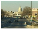
Near Southeast DC Past News Items: South Capitol St.
|
See JDLand's South Capitol St. Project Page
for Photos, History, and Details |
- Full Neighborhood Development MapThere's a lot more than just the projects listed here. See the complete map of completed, underway, and proposed projects all across the neighborhood.
- What's New This YearA quick look at what's arrived or been announced since the end of the 2018 baseball season.
- Food Options, Now and Coming SoonThere's now plenty of food options in the neighborhood. Click to see what's here, and what's coming.
![-]()
- Anacostia RiverwalkA bridge between Teague and Yards Parks is part of the planned 20-mile Anacostia Riverwalk multi-use trail along the east and west banks of the Anacostia River.
![-]()
- Virginia Ave. Tunnel ExpansionConstruction underway in 2015 to expand the 106-year-old tunnel to allow for a second track and double-height cars. Expected completion 2018.
![-]()
- Rail and Bus Times
Get real time data for the Navy Yard subway, Circulator, Bikeshare, and bus lines, plus additional transit information. - Rail and Bus Times
Get real time data for the Navy Yard subway, Circulator, Bikeshare, and bus lines, plus additional transit information. - Canal ParkThree-block park on the site of the old Washington Canal. Construction begun in spring 2011, opened Nov. 16, 2012.
![-]()
- Nationals Park21-acre site, 41,000-seat ballpark, construction begun May 2006, Opening Day March 30, 2008.
![-]()
- Washington Navy YardHeadquarters of the Naval District Washington, established in 1799.
![-]()
- Yards Park5.5-acre park on the banks of the Anacostia. First phase completed September 2010.
![-]()
- Van Ness Elementary SchoolDC Public School, closed in 2006, but reopening in stages beginning in 2015.
![-]()
- Agora/Whole Foods336-unit apartment building at 800 New Jersey Ave., SE. Construction begun June 2014, move-ins underway early 2018. Whole Foods expected to open in late 2018.
![-]()
- New Douglass BridgeConstruction underway in early 2018 on the replacement for the current South Capitol Street Bridge. Completion expected in 2021.
![-]()
- 1221 Van290-unit residential building with 26,000 sf retail. Underway late 2015, completed early 2018.

- NAB HQ/AvidianNew headquarters for National Association of Broadcasters, along with a 163-unit condo building. Construction underway early 2017.

- Yards/Parcel O Residential ProjectsThe Bower, a 138-unit condo building by PN Hoffman, and The Guild, a 190-unit rental building by Forest City on the southeast corner of 4th and Tingey. Underway fall 2016, delivery 2018.

- New DC Water HQA wrap-around six-story addition to the existing O Street Pumping Station. Construction underway in 2016, with completion in 2018.

- The Harlow/Square 769N AptsMixed-income rental building with 176 units, including 36 public housing units. Underway early 2017, delivery 2019.

- West Half Residential420-unit project with 65,000 sf retail. Construction underway spring 2017.
![-]()
- Novel South Capitol/2 I St.530ish-unit apartment building in two phases, on old McDonald's site. Construction underway early 2017, completed summer 2019.
![Novel South Capitol]()
- 1250 Half/Envy310 rental units at 1250, 123 condos at Envy, 60,000 square feet of retail. Underway spring 2017.
![-]()
- Parc Riverside Phase II314ish-unit residential building at 1010 Half St., SE, by Toll Bros. Construction underway summer 2017.
![-]()
- 99 M StreetA 224,000-square-foot office building by Skanska for the corner of 1st and M. Underway fall 2015, substantially complete summer 2018. Circa and an unnamed sibling restaurant announced tenants.
![-]()
- The Garrett375-unit rental building at 2nd and I with 13,000 sq ft retail. Construction underway late fall 2017.
![-]()
- Yards/The Estate Apts. and Thompson Hotel270-unit rental building and 227-room Thompson Hotel, with 20,000 sq ft retail total. Construction underway fall 2017.
![-]()
- Meridian on First275-unit residential building, by Paradigm. Construction underway early 2018.
![-]()
- The Maren/71 Potomac264-unit residential building with 12,500 sq ft retail, underway spring 2018. Phase 2 of RiverFront on the Anacostia development.
![-]()
- DC Crossing/Square 696Block bought in 2016 by Tishman Speyer, with plans for 800 apartment units and 44,000 square feet of retail in two phases. Digging underway April 2018.
![DC Crossing]()
- One Hill South Phase 2300ish-unit unnamed sibling building at South Capitol and I. Work underway summer 2018.
![One Hill South Phase 2]()
- New DDOT HQ/250 MNew headquarters for the District Department of Transportation. Underway early 2019.
![New DDOT HQ]()
- 37 L Street Condos11-story, 74-unit condo building west of Half St. Underway early 2019.
![37 L Condos]()
- CSX East Residential/Hotel225ish-unit AC Marriott and two residential buildings planned. Digging underway late summer 2019.
![CSX East Residential/Hotel]()
- 1000 South Capitol Residential224-unit apartment building by Lerner. Underway fall 2019.
![1000 South Capitol Residential]()
- Capper Seniors 2.0Reconstruction of the 160-unit building for low-income seniors that was destroyed by fire in 2018.
![1000 South Capitol Residential]()
- Chemonics HQNew 285,000-sq-ft office building with 14,000 sq ft of retail. Expected delivery 2021.
![1000 South Capitol Residential]()


246 Blog Posts Since 2003
Go to Page: 1 | ... 6 | 7 | 8 | 9 | 10 | 11 | 12 | 13 | 14 ... 25
Search JDLand Blog Posts by Date or Category
Go to Page: 1 | ... 6 | 7 | 8 | 9 | 10 | 11 | 12 | 13 | 14 ... 25
Search JDLand Blog Posts by Date or Category
DDOT has cancelled plans to close two outbound lanes on the Douglass Bridge from 7 am to 5 pm on Saturday and Sunday (Nov. 3 and 4). So now you can take a weekend jaunt and buzz the new South Capitol Street and its renovated bridge without backups!
|
More posts:
Douglass Bridge, Traffic Issues
|
I've confirmed that demolition is scheduled to begin on Monday (Oct. 29) on the northwest corner of South Capitol and O, where Camden Development is preparing to build the 276-unit 1345 South Capitol Street apartment building. Construction of the building itself will probably start in latelatelate2007 or 2008. (h/t to DCMud) And note that it has indeed changed its address to 1345 from 1325, because the city wouldn't give them 1325.
|
More posts:
1325sc, South Capitol St.
|
For months now, I've been dreading this part of 2007, when so many projects would be underway--and it turns out I was right to be worried. Goodness gracious, tons and tons of photos were needed to keep to my perfectionist mandate, but at last I've gotten them up on the site, even though it's pretty much taken a week to get every shot I wanted. For your perusing pleasure:
*The Stadium Exterior Construction Gallery is more updated than it's been in nearly three months, though N Street was unavailable to me this weekend thanks to lots of digging going on. The photos on that page, as well as on the expanded galleries of views along Potomac Avenue, South Capitol, and from the ballpark's viewing platform at First and Potomac show not only the progress on the stadium but also on the streetscape improvements. Sidewalks, curbs, and streetlamps continue to be installed--and the stoplights along South Capitol are gearing up as well (it looks like the P Street light that's now flashing yellow is going to get turned on pretty soon).
* 70 I Street and Onyx are just about topped out, while their siblings 100 I and 100 M aren't far behind. In fact, progress at 70 I is outpacing me so much that within the five days since I took photos of its western side, the bricking of that wall has begun, and is already reaching the second floor in some spots. There's some nice long-distance shots of these projects, from the freeway and the ballpark, highlighting how much the skyline has changed in just a few short weeks.
* Velocity's three-story-deep hole is now getting a concrete floor, which means vertical construction is starting before long. (The crane arrived within the past few days.) And Monument's 55 M Street office building (where the Navy Yard Metro west entrance is being expanded) is poking up above street level, with the first concrete pillars poured along M Street. And it's been hard to get any photos of the work at The Yards, but I finally snagged a few from up on high.
* Plus there's the shots from the top of 20 M Street this morning, including a few panoramic views across Southwest.
If you don't want to plow through all those links above, you can see all the new photos on one page, though it's just a touch overwhelming. (Yes, even I know it's overwhelming.) But the project links above (and their expanded archives) are really worth it, because the scope of the changes is now so amazing. So click on a  or two to watch the progression.
or two to watch the progression.And now I will rest myself and my camera for a while. Hope you enjoy the photos.
|
More posts:
100 M, 20 M, 55 M St., 70/100 I, jpi, Monument Valley/Half St., Onyx, South Capitol St., Douglass Bridge, Square 743N, Nationals Park, The Yards
|
The Post's Dr. Gridlock has a blog entry today about the work that continues on the Douglass Bridge: "Out of sight below the deck, in a big box-like area of pale gray steel, workers are riveting new bolts into place while either refurbishing or replacing aging parts of the structure across the Anacostia River. Aside from making the whole thing look better as a southern gateway to central Washington, the work will extend the life of the bridge until it can be replaced by a new structure the city plans to build right nearby." DDOT hopes to wrap up the work on the bridge, and on the streetscape improvements to South Capitol, Potomac, First, and I, by February.
|
More posts:
South Capitol St., Douglass Bridge, Traffic Issues
|
Thursday's Washington Times has a piece on the continuing push to expand the boundaries of the Mall, and mentions legislation that Eleanor Holmes Norton introduced yesterday, describing it as envisioning "redrawing East Potomac Park, Banneker Overlook, the grounds of RFK Stadium, the Kennedy Center Plaza and the new South Capitol gateway as sites that would be defined as part of the Mall. All of them could host monuments and museums that various groups ask to be put on the Mall." The bill, H.R. 3880 (text not yet available) would "authorize the National Capital Planning Commission to designate and modify the boundaries of the National Mall area in the District of Columbia reserved for the location of commemorative works of preeminent historical and lasting significance".
This appears to be an outgrowth of the soon-to-be-released National Capital Framework Plan, a joint effort between NCPC and the Commission on Fine Arts, described thusly: "By showing how to create new destinations for cultural attractions throughout the city and improve the connections among them, the Framework Plan will provide a comprehensive approach to easing demand for construction on the National Mall while creating lively urban spaces throughout the city." (The Framework Plan itself is an outgrowth of the 1997 Extending the Legacy framework plan, which also begat the 2001 Memorials and Museums Master Plan.) But, as the Times says, "Local support is building to expand the Mall but the federal legislation it would require is more elusive." So don't look for new memorials popping up at the foot of South Capitol Street next week.
|
More posts:
South Capitol St.
|
Another few days' worth of lane closures on the Douglass Bridge this weekend, this time the outbound/southbound lanes, according to a DDOT press release. The outbound lanes of the bridge will be closed beginning on Friday, October 12 at 9 p.m. until as late as Monday, October 15 at 4 a.m. They're working on the swing span area in the middle of the bridge, repairing the steel framing. And apparently they're expecting the work on the bridge and the accompanying streetscape improvements to South Capitol Street to continue through February.
UPDATED to add link to press release.
|
More posts:
Douglass Bridge, Traffic Issues
|
(Boy, I really want to ignore this, since 99 percent of it falls outside my cast-in-stone boundaries, but it's a slow day, so....) Tomorrow (Oct. 10) there's a Public Information Meeting about the 14th Street Bridge Corridor Environmental Impact Statement Study. Quoting: "The purpose of this study is to identify actions that can reduce congestion, enhance safety, and improve traffic operations in the 14th Street Bridge corridor." They're looking for congestion and safety solutions and ideas, and also are looking for ways to make the "existing corridor work more efficiently." The scope of the study area runs along I-395 from just east of South Capitol Street all the way to Glebe Road, and east to Route 1 in Virginia and south to M Street in Southwest. See the flyer for additional details. It's from 6:30 to 8:30 pm at Amidon Elementary School, 401 I Street, SW.
UPDATED because I can't read a calendar. Tomorrow is the 10th.
|
More posts:
South Capitol St.
|
While the worst of the Douglass Bridge Extreme Makeover pain is now over, there's still some work to be done, and this weekend the inbound lanes of the Douglass Bridge will be closed starting Friday, Sept. 29 at 9 pm, until as late as Monday, Oct. 1 at 4 am. Here's the DDOT press release with details. Quote: "The second phase of construction includes additional work on the swing span area of the bridge and streetscape improvements along South Capitol Street. Upgrades include new environmentally sensitive lighting, pedestrian access improvements such as handicap ramps, pedestrian traffic signals and new sidewalks. Resurfacing work will also take place this weekend on the inbound lanes on South Capitol Street up to N Street."
|
More posts:
Douglass Bridge, Traffic Issues
|
My Ballpark and Beyond column in today's District Extra covers the new historic streetscape photos in DDOT's nascent online archive (the print version of the column displays the 1957 South Capitol Street photo with a current one taken from the same location, as I've done on my South Capitol Street page) and the various upcoming council meetings covering Near Southeast-related issues such as Canal Park and the MPD move/not-move to 225 Virginia Avenue.
|
More posts:
225 Virginia/Old Post Plant/200 I, Canal Park, South Capitol St.
|
The District Department of Transporation recently added 25 more images to its online Historical Photo Archives from locations throughout the city, including two dandy Near Southeast shots. One is from 1949, showing M Street at about 10th Street, looking east (before the 11th Street Bridge flyovers were built). The other is of South Capitol Street, just south of N, looking south toward what was at that point the new Douglass Bridge, circa 1957. (Amazingly, it was taken from almost the exact same spot that I've been using for my South-Cap-south-of-N photos since 2005--it looks a little different now.) There's a couple buildings in the 1957 photo that are still in existence today, although one of them will be demolished soon to make way for 1325 South Capitol Street. But I'm surprised to see that the U-Haul building at P Street was once a Lansburgh's department store (you can click on the photos on the DDOT site for high-res versions, which allow you to see the detail of the buildings much better).
Needless to say, I've added these shots to my Near Southeast Historic Photos page (in chronological order); hopefully DDOT will post some more gems as time goes on.
|
More posts:
M Street, South Capitol St.
|
246 Posts:
Go to Page: 1 | ... 6 | 7 | 8 | 9 | 10 | 11 | 12 | 13 | 14 ... 25
Search JDLand Blog Posts by Date or Category
Go to Page: 1 | ... 6 | 7 | 8 | 9 | 10 | 11 | 12 | 13 | 14 ... 25
Search JDLand Blog Posts by Date or Category