
|
| |||||||||||||||||||

|
Please note that JDLand is no longer being updated.
peek >>
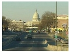
Near Southeast DC Past News Items: South Capitol St.
|
See JDLand's South Capitol St. Project Page
for Photos, History, and Details |
- Full Neighborhood Development MapThere's a lot more than just the projects listed here. See the complete map of completed, underway, and proposed projects all across the neighborhood.
- What's New This YearA quick look at what's arrived or been announced since the end of the 2018 baseball season.
- Food Options, Now and Coming SoonThere's now plenty of food options in the neighborhood. Click to see what's here, and what's coming.
![-]()
- Anacostia RiverwalkA bridge between Teague and Yards Parks is part of the planned 20-mile Anacostia Riverwalk multi-use trail along the east and west banks of the Anacostia River.
![-]()
- Virginia Ave. Tunnel ExpansionConstruction underway in 2015 to expand the 106-year-old tunnel to allow for a second track and double-height cars. Expected completion 2018.
![-]()
- Rail and Bus Times
Get real time data for the Navy Yard subway, Circulator, Bikeshare, and bus lines, plus additional transit information. - Rail and Bus Times
Get real time data for the Navy Yard subway, Circulator, Bikeshare, and bus lines, plus additional transit information. - Canal ParkThree-block park on the site of the old Washington Canal. Construction begun in spring 2011, opened Nov. 16, 2012.
![-]()
- Nationals Park21-acre site, 41,000-seat ballpark, construction begun May 2006, Opening Day March 30, 2008.
![-]()
- Washington Navy YardHeadquarters of the Naval District Washington, established in 1799.
![-]()
- Yards Park5.5-acre park on the banks of the Anacostia. First phase completed September 2010.
![-]()
- Van Ness Elementary SchoolDC Public School, closed in 2006, but reopening in stages beginning in 2015.
![-]()
- Agora/Whole Foods336-unit apartment building at 800 New Jersey Ave., SE. Construction begun June 2014, move-ins underway early 2018. Whole Foods expected to open in late 2018.
![-]()
- New Douglass BridgeConstruction underway in early 2018 on the replacement for the current South Capitol Street Bridge. Completion expected in 2021.
![-]()
- 1221 Van290-unit residential building with 26,000 sf retail. Underway late 2015, completed early 2018.

- NAB HQ/AvidianNew headquarters for National Association of Broadcasters, along with a 163-unit condo building. Construction underway early 2017.

- Yards/Parcel O Residential ProjectsThe Bower, a 138-unit condo building by PN Hoffman, and The Guild, a 190-unit rental building by Forest City on the southeast corner of 4th and Tingey. Underway fall 2016, delivery 2018.

- New DC Water HQA wrap-around six-story addition to the existing O Street Pumping Station. Construction underway in 2016, with completion in 2018.

- The Harlow/Square 769N AptsMixed-income rental building with 176 units, including 36 public housing units. Underway early 2017, delivery 2019.

- West Half Residential420-unit project with 65,000 sf retail. Construction underway spring 2017.
![-]()
- Novel South Capitol/2 I St.530ish-unit apartment building in two phases, on old McDonald's site. Construction underway early 2017, completed summer 2019.
![Novel South Capitol]()
- 1250 Half/Envy310 rental units at 1250, 123 condos at Envy, 60,000 square feet of retail. Underway spring 2017.
![-]()
- Parc Riverside Phase II314ish-unit residential building at 1010 Half St., SE, by Toll Bros. Construction underway summer 2017.
![-]()
- 99 M StreetA 224,000-square-foot office building by Skanska for the corner of 1st and M. Underway fall 2015, substantially complete summer 2018. Circa and an unnamed sibling restaurant announced tenants.
![-]()
- The Garrett375-unit rental building at 2nd and I with 13,000 sq ft retail. Construction underway late fall 2017.
![-]()
- Yards/The Estate Apts. and Thompson Hotel270-unit rental building and 227-room Thompson Hotel, with 20,000 sq ft retail total. Construction underway fall 2017.
![-]()
- Meridian on First275-unit residential building, by Paradigm. Construction underway early 2018.
![-]()
- The Maren/71 Potomac264-unit residential building with 12,500 sq ft retail, underway spring 2018. Phase 2 of RiverFront on the Anacostia development.
![-]()
- DC Crossing/Square 696Block bought in 2016 by Tishman Speyer, with plans for 800 apartment units and 44,000 square feet of retail in two phases. Digging underway April 2018.
![DC Crossing]()
- One Hill South Phase 2300ish-unit unnamed sibling building at South Capitol and I. Work underway summer 2018.
![One Hill South Phase 2]()
- New DDOT HQ/250 MNew headquarters for the District Department of Transportation. Underway early 2019.
![New DDOT HQ]()
- 37 L Street Condos11-story, 74-unit condo building west of Half St. Underway early 2019.
![37 L Condos]()
- CSX East Residential/Hotel225ish-unit AC Marriott and two residential buildings planned. Digging underway late summer 2019.
![CSX East Residential/Hotel]()
- 1000 South Capitol Residential224-unit apartment building by Lerner. Underway fall 2019.
![1000 South Capitol Residential]()
- Capper Seniors 2.0Reconstruction of the 160-unit building for low-income seniors that was destroyed by fire in 2018.
![1000 South Capitol Residential]()
- Chemonics HQNew 285,000-sq-ft office building with 14,000 sq ft of retail. Expected delivery 2021.
![1000 South Capitol Residential]()


246 Blog Posts Since 2003
Go to Page: 1 | ... 5 | 6 | 7 | 8 | 9 | 10 | 11 | 12 | 13 ... 25
Search JDLand Blog Posts by Date or Category
Go to Page: 1 | ... 5 | 6 | 7 | 8 | 9 | 10 | 11 | 12 | 13 ... 25
Search JDLand Blog Posts by Date or Category
Tomorrow night (Feb. 22), the DC Zoning Commission is having a public hearing on Case 06-41, a Capitol Gateway Overlay Review for 1325 South Capitol Street, the planned 244-unit residential building at South Capitol and O streets SW, right across from the ballpark. The ZC hearing is available via live webcast. Apparently this project was presented at the Feb. 12 ANC 6D meeting, but since the ANC for four of the last five months has been unable or unwilling to send out its agendas before the meetings or post them on their web site (check out those dates!), I wasn't able to post a heads up that this project was going to be discussed.
On the other hand, the agenda has already been released for the Feb. 28 Anacostia Waterfront Corporation Public Board Meeting, where one of the main items will be a presentation and public comments on the AWC's Draft Environmental Standards, and also a presentation on their new Workforce Intermediary Services. See the agenda for time and place and how to participate.
|
|
Today's DC Register has published the final version of the text amendment (case 05-10) to the Capitol Gateway Overlay District zoning regulations that has been winding through the process since early 2005. From the order: "The amendments place limits on density transferred through combined deployments, extend the Zoning Commission review and approval process and design guidelines to additional properties within the boundaries of the Capitol Gateway ("GC") Overlay, and establish preferred retail and entertainment use requirements and regulations along First and Half Streets S.E. within the area. In addition, the rules impose, within the Overlay, a 15-foot setback and a 1:1 upper story step-back above a height of 110 feet for buildings fronting South Capitol Street; an upper stories set-back for building[s] fronting Half Street S.E.; and a 1:1 upper story step-back above a height of 110 feet for buildings fronting Potomave Avenue S.E. and S.W. The rules also provide for referral to the National Capital Planning Commission of all applications for the review of buildings and uses on lots that abut South Capitol Street." Whew! The CG Overlay has yet to be posted in its entirety on the Zoning Commission web site (see that "Reserved" for Chapter 11?), but in the interim I've cobbled together the various ZC orders and other documents (we're still waiting on the publication of the final order for ZC case 06-25, which extended the CG Overlay boundary across South Capitol Street) into a single sleep-inducing document. You can also read my explanatory treatise from a few months back on this Overlay and its companion, the Southeast Federal Center Overlay.
You would think that a new Environmental Impact Statement of the 14th Street Bridge Corridor would be outside of my Near Southeast scope, but they managed to sneak the boundary area just past South Capitol Street. So, it becomes another study I will grudgingly pay attention to, along with the South Capitol Street EIS and the 11th Street Bridges EIS (both of which have gone reeeeeal quiet lately, with the 11th Street Bridges EIS having missed its release deadline of Fall 2006). See this flyer for information on the 14th Street Bridge Corridor public workshops, on Feb. 27 at Amidon Elementary in Southwest and Feb. 28 in Arlington.
And speaking of Boundary Creep, the Washington Business Journal reported last week that the Office of Planning has "has initiated a major effort to expand the boundaries of the traditional office and entertainment areas, creating a planning zone called Center City. The initiative more than doubles the area traditionally considered downtown by adding the North of Massachusetts Avenue area (NoMa) as well as the Southeast and Southwest waterfronts. Another objective is to provide better links to tie the traditional downtown zone with emerging business and entertainment districts, the waterfront and the National Mall. Center City will be promoted as a waterfront city with nearly half of its boundary defined by the Potomac and Anacostia rivers." You can see the OP's Center City page for more details about this project, which I am admittedly giving short shrift here (I figure there will be plenty more items to come). Who'd a thunk it--it turns out Near Southeast is DOWNTOWN, baby!
|
More posts:
11th Street Bridges, South Capitol St.
|
A reminder from DDOT: "As part of ongoing improvements to the Frederick Douglass Memorial Bridge (sometimes referred to as the South Capitol Street Bridge), the District Department of Transportation (DDOT) will continue periodic off-peak bridge maintenance repairs on Friday February 9, 2007. [View a map of weekend detours] Following the morning rush hour this Friday, DDOT will temporarily close the northbound (inbound) lanes on the Frederick Douglass Memorial Bridge. Inbound bridge drivers will be directed to follow signed detours on Interstate 295 North to the 11th Street Bridge--providing direct access into the District. The northbound (inbound) lanes will be closed beginning on Friday, February 9 at 10 am until as late as Monday, February 12 at 4 am. All lanes will be reopened in time for the Monday morning rush hour." This is all leading up to: "During the July-August closure, the northernmost portion of the bridge will be lowered to become an at-grade roadway with a new intersection at South Capitol Street and Potomac Avenue. Nearly three blocks of elevated roadway--which currently act as a barrier to access across South Capitol Street--will be removed and replaced with at-grade intersections that will help knit the neighborhood together. Additional improvements will occur such as paving and painting the entire bridge." You can also keep track of when the upcoming closures are on my Calendar of Events.
|
More posts:
South Capitol St., Douglass Bridge, Traffic Issues
|
Saturday was a picture-perfect day, so I attempted to take some perfect pictures. (Not sure I succeeded, but oh well.) I've updated the Stadium Construction Gallery from the usual vantage points, and took some additional photos of South Capitol Street and the areas near the portions of the Douglass Bridge scheduled to be demolished this summer--and thanks to the inbound lanes being closed, I was able to take some shots that normally would require snapping them from a moving car, since I prefer not to execute deathwish darts into traffic (I do however send my thanks to the concerned motorist driving southbound who started honking hysterically at the site of me climbing over the kneewall into the closed traffic lanes).
I've also been making a slow slog through the online Near Southeast Photo Archive, trying to make sure that all angles of intersections are well-represented, so I shot a lot of 3rd Street vistas today; if you're so inclined, take a wander through the 3rd and 4th Street archives (just click on the map to choose an intersection) to see these updates, and also note that you can now see my shots along Tingey Street and from across the Anacostia River looking north as well, to see what lurks behind the DOT HQ. Over the coming weeks I'll be working on doing the same for more streets.
Normally at this point I'd send you through a list of the pages where I've posted new photos, and tell you to look for the ubiquitous  icon, but thanks to the Photo Archive app, I can now easily display all pictures I took and posted today. You'll see intersections and directions underlined, if you want to see all the photos in the archive of that location, just click on the link.
icon, but thanks to the Photo Archive app, I can now easily display all pictures I took and posted today. You'll see intersections and directions underlined, if you want to see all the photos in the archive of that location, just click on the link.
|
More posts:
South Capitol St., Douglass Bridge, Nationals Park
|
Within the past week, two of the unoccupied buildings in the blocks just north the stadium site were demolished: 1236 South Capitol, that funky neon-yellow bungalow sandwiched between the BP gas station and the Public Storage Building, and 1201 Cushing, a little white ramshackle building behind a wooden fence that you would never have seen unless you ventured down Cushing south of M. (In fact, *I* had never seen it until late last year.) The South Capitol Street site is being cleared so that the WMATA employee parking lot that was just moved a few hundred feet south from next to the Navy Yard Metro Half Street entrance can be relocated again (see my entry about this from back in November). The Cushing lot is the first demolition as the land gets cleared for Monument Realty's Half Street mixed-use project (55 M Street et al). These have now been added to the top of my Demolished Builings Gallery; and if you scroll down the page a good ways, you'll see two additional  icons. First, I realized that I needed to include the little building demolished sometime in 2005 that was attached to the west side of Nation; then, while browsing through my photos, I found out that not only had the empty lot on the west side of the Good N Plenty carryout at Half and N contained a rowhouse within the relatively recent past, but that I actually had one photo of it, so it's added to the Gallery now as well. I imagine the Demolished Buildings page is going to get a pretty good workout over the next few weeks. UPDATE: Fixed the bad Demolished Buildings Gallery link. Oops.
icons. First, I realized that I needed to include the little building demolished sometime in 2005 that was attached to the west side of Nation; then, while browsing through my photos, I found out that not only had the empty lot on the west side of the Good N Plenty carryout at Half and N contained a rowhouse within the relatively recent past, but that I actually had one photo of it, so it's added to the Gallery now as well. I imagine the Demolished Buildings page is going to get a pretty good workout over the next few weeks. UPDATE: Fixed the bad Demolished Buildings Gallery link. Oops.
|
|
Today's Post has a big cool graphic showing exactly how the Frederick Douglass Bridge is going to get renovated this summer, with 800 feet of the South Capitol Street viaduct being demolished completely north of Potomac Avenue and another 580 feet of the bridge lowered so that the bridge meets street level at Potomac Avenue instead of O Street. It also shows that there will be new stop lights on South Capitol at Potomac Avenue and at N Street, and pedestrian-activated lights at O and P streets. The graphic (make sure to look at it, it really is well done) accompanies an article about the bridge's renovation. And remember, the northbound (inbound) lanes of the bridge will be closed starting this Friday at 10 am until Monday the 29th at 4 am. And plan your summer vacation to coincide with July and August, when the bridge will be closed entirely for the lowering. And here are some additional views of the portions of the bridge that will be demolished and lowered. (And I'm realizing I'd better create a Bridge Makeover page to pull these all together in one place!)
UPDATE: Yeah, a new page to track the Bridge Makeover, that's a really good idea.
UPDATE II: Here's DDOT's press release on the rehabilitation of the Douglass Bridge, along with a map of this weekend's detours.
|
More posts:
South Capitol St., Douglass Bridge, Traffic Issues
|
From Thursday's Post: "District officials acknowledged yesterday that the city will have to pay more than $18 million to upgrade streets near the Washington Nationals' new stadium, and some council members said the expenditure would push spending on the ballpark beyond the council's $611 million cap. [...] The commission's chief executive, Allen Y. Lew, said that though the stadium is proceeding on schedule for an April 2008 opening, the budget does not include money to handle transportation planning at the 41,000-seat ballpark. Team officials have said smooth access for up to 9,000 motorists driving to each game is critical to the success of the ballpark, along the Anacostia River near the Navy Yard and South Capitol Street." DDOT said in an interview that it has budgeted $18.4 million to widen and repave roads, repair cubs, add traffic lights and signs and plant trees near the ballpark, and that that money was allocated as part of planned upgrade work to the South Capitol Street corridor before the stadium was awarded to Near Southeast in September 2004. All this of course brings the curtain up on yet another round of DC Council Ballpark Kabuki Theater, with anti-stadium forces yammering about the cap being exceeded while pro-stadium forces contending that this doesn't violate the cap. Perhaps they'd prefer to spend Opening Day digging tour buses out of monster potholes on an un-upgraded South Capitol Street.
And, since I'm talking stadium cost cap, I'll finally mention this Examiner article from three weeks ago (Save it for a slow day, I told myself--HAH!) that a deal has now been struck to put artwork on display at the stadium after all, without violating The Sacred Cap (see my entry on the original story from December).
|
More posts:
South Capitol St., Nationals Park
|
Dr. Gridlock's Get There blog has an entry about the upcoming work on the South Capitol Street/Frederick Douglass Bridge, confirming that as expected the bridge will be closed in July and August to demolish the existing viaduct between Potomac Avenue and O Street, so that drivers coming off the bridge will arrive at street level three blocks further south than they now do. This will give South Capitol Street a much nicer appearance, and will mean that the new Nationals ballpark won't have an ancient bridge ramp rubbing up against its western facade (right now at O Street the viaduct is not much more than about 20 feet from the edge of the stadium). There will also be new signals at some of the intersections. The blog post also mentions the first of the weekend closures of the bridge coming up this weekend, with the inbound lanes closing between 10 am Friday and 4 am Monday, detouring traffic to the 11th Street Bridges. (But alas, the demolishing of the viaduct will take with it two of my favorite stadium photo perches, though at least by summer most of the exterior work should be completed.) UPDATE: Here's a short piece from WTOP about the plans for the bridge.
|
More posts:
South Capitol St., Douglass Bridge, Traffic Issues
|
From DDOT:
"As part of ongoing improvements to the Frederick Douglass Bridge (sometimes referred to as the South Capitol Street Bridge), the District Department of Transportation (DDOT) will perform periodic off-peak bridge maintenance repairs beginning Friday, January 26, 2007.
"These periodic weekend repairs include expansion joint replacement and under-the-bridge steel repair work. Work will also involve painting and replacing handrails and installation of new lighting.
"Due to the nature of these repairs, DDOT will temporarily close the northbound/inbound lanes starting at 10 am on January 26. The lanes will reopen on Monday, January 29 by 4 am--in time for morning rush hour. During the closure, inbound drivers will follow signed detours on I-295 North to the 11th Street Bridge providing direct access into the District.
"DDOT encourages the use of Metro as a transportation alternative. Pedestrian and bike access will remain on the bridge during the weekend closures. All closures may be subject to change and are weather permitting. In the event of inclement weather, lane closures will be rescheduled to the following weekend."
|
More posts:
South Capitol St., Douglass Bridge, Traffic Issues
|
246 Posts:
Go to Page: 1 | ... 5 | 6 | 7 | 8 | 9 | 10 | 11 | 12 | 13 ... 25
Search JDLand Blog Posts by Date or Category
Go to Page: 1 | ... 5 | 6 | 7 | 8 | 9 | 10 | 11 | 12 | 13 ... 25
Search JDLand Blog Posts by Date or Category