
|
| |||||||||||||||||||

|
Please note that JDLand is no longer being updated.
peek >>
Near Southeast DC Past News Items: photos
- Full Neighborhood Development MapThere's a lot more than just the projects listed here. See the complete map of completed, underway, and proposed projects all across the neighborhood.
- What's New This YearA quick look at what's arrived or been announced since the end of the 2018 baseball season.
- Food Options, Now and Coming SoonThere's now plenty of food options in the neighborhood. Click to see what's here, and what's coming.
![-]()
- Anacostia RiverwalkA bridge between Teague and Yards Parks is part of the planned 20-mile Anacostia Riverwalk multi-use trail along the east and west banks of the Anacostia River.
![-]()
- Virginia Ave. Tunnel ExpansionConstruction underway in 2015 to expand the 106-year-old tunnel to allow for a second track and double-height cars. Expected completion 2018.
![-]()
- Rail and Bus Times
Get real time data for the Navy Yard subway, Circulator, Bikeshare, and bus lines, plus additional transit information. - Rail and Bus Times
Get real time data for the Navy Yard subway, Circulator, Bikeshare, and bus lines, plus additional transit information. - Canal ParkThree-block park on the site of the old Washington Canal. Construction begun in spring 2011, opened Nov. 16, 2012.
![-]()
- Nationals Park21-acre site, 41,000-seat ballpark, construction begun May 2006, Opening Day March 30, 2008.
![-]()
- Washington Navy YardHeadquarters of the Naval District Washington, established in 1799.
![-]()
- Yards Park5.5-acre park on the banks of the Anacostia. First phase completed September 2010.
![-]()
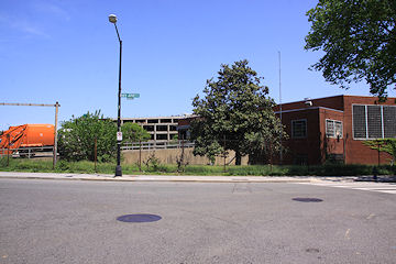
- Van Ness Elementary SchoolDC Public School, closed in 2006, but reopening in stages beginning in 2015.
![-]()
- Agora/Whole Foods336-unit apartment building at 800 New Jersey Ave., SE. Construction begun June 2014, move-ins underway early 2018. Whole Foods expected to open in late 2018.
![-]()
- New Douglass BridgeConstruction underway in early 2018 on the replacement for the current South Capitol Street Bridge. Completion expected in 2021.
![-]()
- 1221 Van290-unit residential building with 26,000 sf retail. Underway late 2015, completed early 2018.

- NAB HQ/AvidianNew headquarters for National Association of Broadcasters, along with a 163-unit condo building. Construction underway early 2017.

- Yards/Parcel O Residential ProjectsThe Bower, a 138-unit condo building by PN Hoffman, and The Guild, a 190-unit rental building by Forest City on the southeast corner of 4th and Tingey. Underway fall 2016, delivery 2018.

- New DC Water HQA wrap-around six-story addition to the existing O Street Pumping Station. Construction underway in 2016, with completion in 2018.

- The Harlow/Square 769N AptsMixed-income rental building with 176 units, including 36 public housing units. Underway early 2017, delivery 2019.

- West Half Residential420-unit project with 65,000 sf retail. Construction underway spring 2017.
![-]()
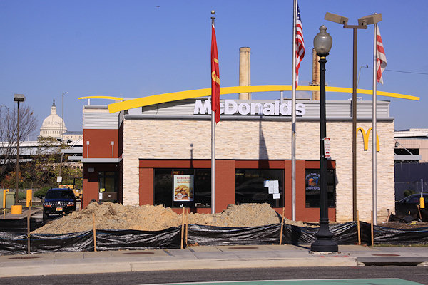
- Novel South Capitol/2 I St.530ish-unit apartment building in two phases, on old McDonald's site. Construction underway early 2017, completed summer 2019.
![Novel South Capitol]()
- 1250 Half/Envy310 rental units at 1250, 123 condos at Envy, 60,000 square feet of retail. Underway spring 2017.
![-]()
- Parc Riverside Phase II314ish-unit residential building at 1010 Half St., SE, by Toll Bros. Construction underway summer 2017.
![-]()
- 99 M StreetA 224,000-square-foot office building by Skanska for the corner of 1st and M. Underway fall 2015, substantially complete summer 2018. Circa and an unnamed sibling restaurant announced tenants.
![-]()
- The Garrett375-unit rental building at 2nd and I with 13,000 sq ft retail. Construction underway late fall 2017.
![-]()
- Yards/The Estate Apts. and Thompson Hotel270-unit rental building and 227-room Thompson Hotel, with 20,000 sq ft retail total. Construction underway fall 2017.
![-]()
- Meridian on First275-unit residential building, by Paradigm. Construction underway early 2018.
![-]()
- The Maren/71 Potomac264-unit residential building with 12,500 sq ft retail, underway spring 2018. Phase 2 of RiverFront on the Anacostia development.
![-]()
- DC Crossing/Square 696Block bought in 2016 by Tishman Speyer, with plans for 800 apartment units and 44,000 square feet of retail in two phases. Digging underway April 2018.
![DC Crossing]()
- One Hill South Phase 2300ish-unit unnamed sibling building at South Capitol and I. Work underway summer 2018.
![One Hill South Phase 2]()
- New DDOT HQ/250 MNew headquarters for the District Department of Transportation. Underway early 2019.
![New DDOT HQ]()
- 37 L Street Condos11-story, 74-unit condo building west of Half St. Underway early 2019.
![37 L Condos]()
- CSX East Residential/Hotel225ish-unit AC Marriott and two residential buildings planned. Digging underway late summer 2019.
![CSX East Residential/Hotel]()
- 1000 South Capitol Residential224-unit apartment building by Lerner. Underway fall 2019.
![1000 South Capitol Residential]()
- Capper Seniors 2.0Reconstruction of the 160-unit building for low-income seniors that was destroyed by fire in 2018.
![1000 South Capitol Residential]()
- Chemonics HQNew 285,000-sq-ft office building with 14,000 sq ft of retail. Expected delivery 2021.
![1000 South Capitol Residential]()


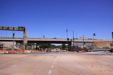
 The showiest demolition in the neighborhood in years is coming to an end, and while I haven't been able to document it in the obsessive-compulsive way I would have liked, I did manage to make it to 11th Street this weekend to see the gator tail-like final remnants of the old flyover to the outbound 11th Street Bridges before it completely comes down.
At the same time, I was able to check out the progress on the filling-in of the sunken eastern portion of the Southeast Freeway to build Southeast Blvd., and dang if they haven't already piled the dirt up so that 11th Street is now level with the "land" just to its west.
Needless to say, I had to create a photo gallery of the remants and the progress, where you'll also see that work is speeding along on the new flyover to the outbound I-695 bridge.


But I wasn't just interested in the tearing down and filling in, so I continued down to O Street, where not only is the 11th Street Local Bridge inching ever closer to getting all of its lanes and pedestrian path opened, but the new asphalt Anacostia Riverwalk Trail path to the river has been laid, which also takes you to the spiffy new landing just completed by the riverside. And from that landing you can see the spiffy new overlooks that reach out onto the old bridge piers from the new local bridge. (For the record, I could have easily sidestepped the construction barrels and ventured onto the overlooks, but I am a good little citizen.)
Lots of images of the new trail, the landing, the bridge, and the surroundings are in a second new photo gallery.


 If these two galleries aren't enough, you might take some time to browse my before-and-afters all the way down 11th Street, from the freeway to L to M to N to O to the river, as nearly four years of construction have altered the vistas from a maze of flyovers and embankments to, well, a completely different maze of flyovers and embankments. (But the new flyovers are a little lower on the horizon, at least.)
I also checked out the other projects that are in various stages these days, from Twelve12 to the Lumber Shed to the leafed-out and fountain-ed Canal Park to the hole in the ground that will be the Park Chelsea.
There's new pictures on each of those pages, but I also couldn't help myself and pulled together a third photo gallery, with photos from those spots and a few others that were particularly photogenic on a particularly photogenic day. (It even includes my very first visit to the footprint of one of the neighborhood's most central locations. Where might that be?)


[A postscript: I truly think Sunday was the most perfect day for taking pictures in the 10-plus years I've been wandering the neighborhood, with the achingly clear deep blue sky perfectly matched with the late-May sun strength and positions. I ended up walking more than eight miles in three separate treks, and came home with a smidge more than 1,000 photos, about 300 of which are now in my photo archive.]
|
Comments (3)
More posts:
11th Street Bridges, Lumber Shed/Yards, photos, riverwalk, Southeast Blvd., The Yards, Parcel A/Yards, Twelve12/Teeter/Yards
|
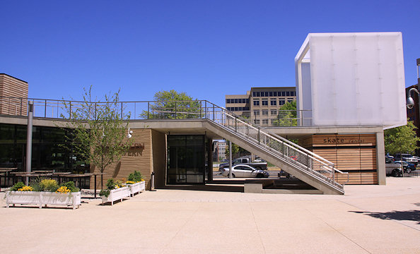
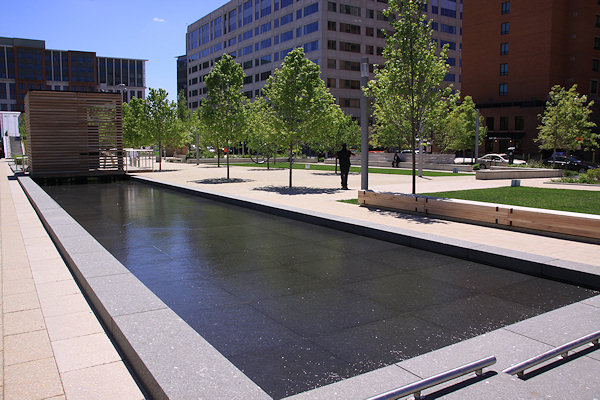 When last I wandered around Canal Park with my camera, it was cold. And brown. (But skateable!) With Thursday's gorgeous weather surprisingly managing to win a tough battle against my inherent laziness, I took a far warmer and greener walk, and updated my Canal Park page with some springeriffic images.
 And, if you really want to see how the three blocks along 2nd Street SE between I and M have changed in the past decade, I invite you to scroll through the many before and afters in my Canal Park Expanded Photo Archive. After all, with my work at the park pretty much done, this might be the last time I have the excuse to make you look at numerous photos of school buses and overgrowth.
Speaking of the buses, I do have one "new" before-and-after I can't resist highlighting.
First, October 14, 2006:
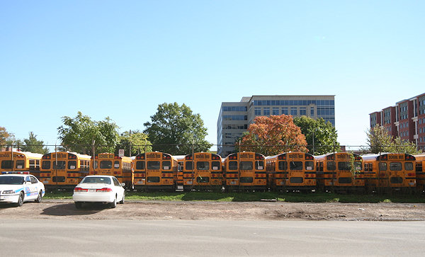
And the same location, May 2, 2013:
|
Comments (11)
More posts:
Canal Park, photos
|
I wandered around on Thursday, it was sunny, I had my camera in hand, etc., etc., yadda yadda yadda. 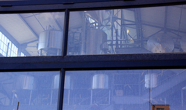
Some items of note (click photos to embiggen):
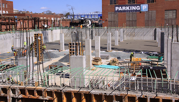
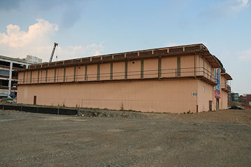
On your left, hard-to-get evidence of the ongoing work at Bluejacket at the Boilermaker Shops. They've covered up all the eye-level windows, but peeking through the (dirty!) glass above the large door on 4th shows the fermenters now installed on the mezzanine level.
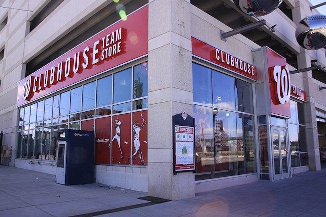
At right, my first viewing of the renovated Team Store at Nationals Park's Center Field Gate.
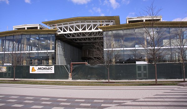
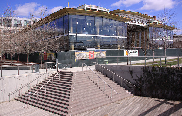
Below, the Lumber Shed in the sun.
Agua 301's space is to the left, and Osteria Morini's is to the right. (On the ground floor.)
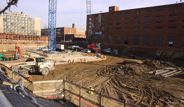
And, everyone's dream come true, a parking garage being born:
Of course, it's actually the parking garage that will be underneath the Harris Teeter in the Twelve12 apartment building at 4th and M, so it's probably allowed. If you want even more photos of rebar and concrete, my Twelve12 page has them.
|
Comments (9)
More posts:
Bluejacket, Boilermaker Shops/Yards, Lumber Shed/Yards, photos, Nationals Park, The Yards, Twelve12/Teeter/Yards
|
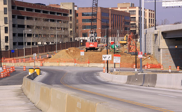
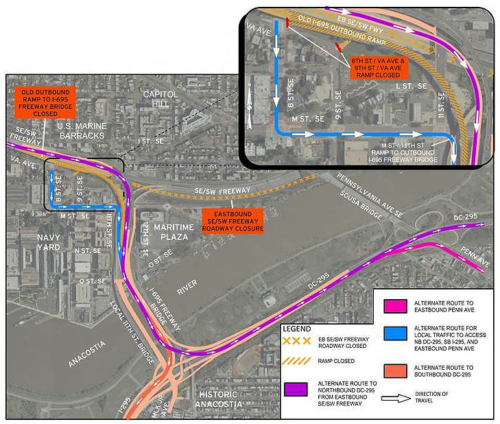 As I wrote a few days back, the portion of the Southeast Freeway between 8th Street SE and Pennsylvania Avenue will be fully closed after the evening rush hour on Thursday, Jan. 31, to both begin work on the new Southeast Blvd. and to demolish the existing outbound flyover ramp and replace it with a new three-lane one.
One thing I didn't mention in that post is that, with these closures Thursday, both the 8th Street SE on-ramp to the outbound I-695 freeway bridge and the 9th Street ramp toward Pennsylvania Avenue will be closed.
As the helpful graphic at right from DDOT shows, if you're wanting to get on I-695 outbound, you'll need to use the ramp on the southeast corner of 11th and M.
Since this closure now makes the Southeast Blvd. project truly seem underway, I've been spurred into an unexpected burst of action, and have created a Southeast Blvd. project page, separate from my recently refreshed 11th Street Bridges page. Right now it's mainly drawings, "before photos," and links to my previous posts on the project, but I will keep it updated throughout the expected 18-to-20-month span of construction:
I also threw together a new 11th Street Bridges Progress Photo Gallery with some new shots from this past weekend, when I traipsed around N and O streets and up on the local bridge for the first time in way too long.

And now I think my guilt over some long-neglected photos is assuaged, at least for a little while.
|
Comments (9)
|
Some quick shots from today of the other projects underway at the Yards, in case a new dry cleaners just isn't exciting enough for you.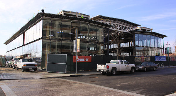
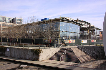
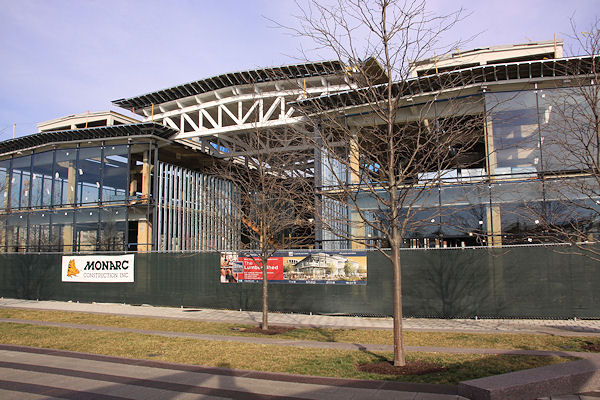
The new exterior glass is now almost completely on the Lumber Shed at the Yards Park, where Osteria Morini and Agua 301 are slated to be tenants when it opens later this year (along with Forest City Washington on the second floor):
A before-and-after that can't possibly be resisted:
Facing the Anacostia:
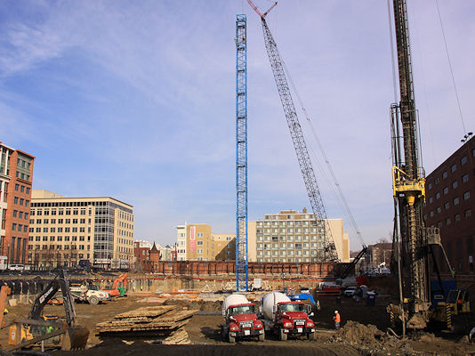
Meanwhile, over at the Twelve12 apartment building project on 4th Street (more popularly known as the Harris Teeter/Vida Fitness building), the progress isn't quite as showy, unless you're a construction nerd and you know what the arrival of a tower crane means:
Yes, it means that vertical construction is not far off. The building is expected to be completed in 2014. And in case you want one more shot of the hole in the ground:
See the project pages for the Lumber Shed and Twelve12 for renderings and additional details.
|
Comments (16)
More posts:
Restaurants/Nightlife, Lumber Shed/Yards, photos, Retail, The Yards, Twelve12/Teeter/Yards
|
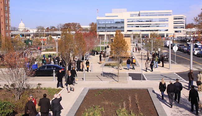
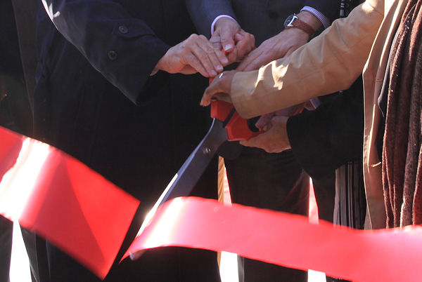 I've been to a fair number of ribbon cuttings over the past decade, and I have to say that Friday's opening of Canal Park seemed to be infused with a level of excitement and joy that I don't think I've seen at any of the others.
 While getting Nationals Park open in 2008 was a triumph of speed and scale, the 13-year journey of the three-block park at the heart of Near Southeast required so many hands and so much patience and resulted in a space with which the stakeholders are clearly thrilled that it shouldn't really be a surprise that on a gorgeously crisp late fall day so many attendees were walking around with what Tommy Wells described as "a huge smile on their face."
The speakers standing at a podium in the center block's small pavilion ran through the list of names and agencies that brought the park to fruition, starting with developer William C. Smith, whose CEO Chris Smith started the long drive to build the park, creating the Canal Park Development Association back in 2000. Then there was money from the federal government and the DC government, additional dollars and much support from the DC Housing Authority, work by OLIN landscape architects and STUDIOS architecture to design the park with innovative sustainable development and storm water management components (and a skating rink!). Props were given for the hiring of Housing Authority residents for 15 of the park's 25 part-time jobs.The Capitol Riverfront BID and the DC Commission on the Arts and Humanities also took bows for their parts in the park's creation (and future).
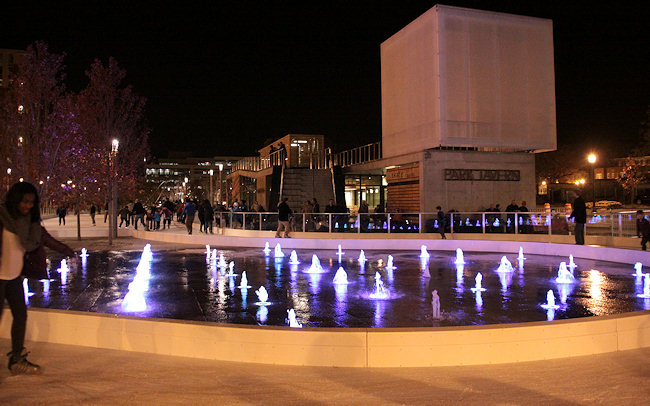
 After the speeches, the festivities moved to the skating rink, where the ribbon was cut and Mayor Gray drove the Zamboni, and then the public laced up its skates and got out on the ice. And they kept skating, well into the night. (And I have no doubt there will be big crowds at the rink and park today as well.) For all the happiness seen in the park's founders about getting it finally opened, I saw equal measures of surprise and cheer that so many residents and neighborhood office workers had come to the opening, had stayed through the long speechifying, and now were skating and strolling.
I've joked that I sure have been saying the word "finally" a lot lately--the trash transfer station is finally demolished, Kruba Thai is finally open, Gordon Biersch finally admitted they're coming to 100 M, Vida Fitness is finally announced, Capitol Quarter is finally finished.... But it's the "finally" of Canal Park opening that hit me more than I expected, perhaps similarly to all those happy stakeholders.
I took a lot of photos of fenced-off schoolbuses in the early years, posted a lot of renderings (some for the park's first design that never materialized), and bugged a lot of people to find out the latest. It was, after all, one of the few projects that was already in planning when I started tracking Near Southeast in early 2003, along with the Capper redevelopment and Capitol Hill Tower.

And now the park is open (with the Park Tavern restaurant to follow "within a few weeks"), and everybody can enjoy it. Finally!
Hope you'll check out my photo galleries of the park, yesterday's ceremonies, and the park's opening night, along with my expanded gallery of before-and-afters from around the park (with some that I still need to fill in, oops). And you can also see coverage from the Post, NBC4, and WJLA. And the lineup of today's events and other details on the park's official web site. And tell us what you think of the park.
|
Comments (5)
More posts:
Canal Park, Events, photos
|
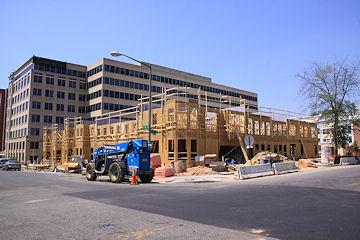
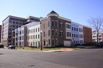
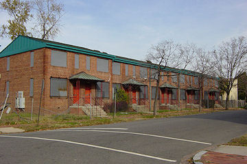
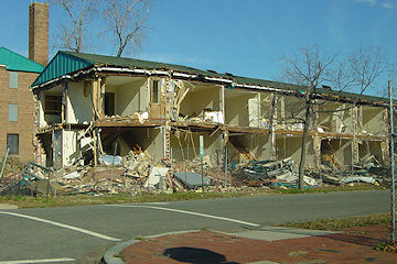
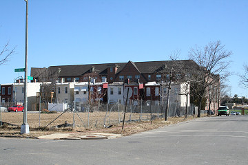
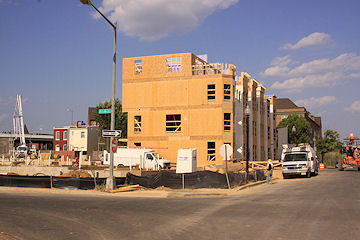
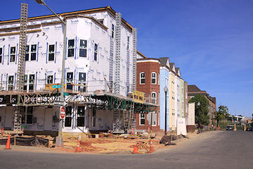
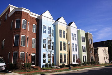
For close to 10 years, there has almost always been something going on to photograph between 5th, 3rd, L, and Virginia. Between 2003 and 2007 there was the boarding up and demolishing of the old Capper/Carrollsburg dwellings and the construction of the two new Capper apartment buildings. Then, in 2008, work finally began on Capitol Quarter's mixed-income townhouses, starting at 5th and L and working northward then back southward.
And now, as 2012 comes to a close, the final batch of homes, on the south side of L between 3rd and 4th, have been completed, and with the photos I took Sunday, my work in the Capitol Quarter blocks is done.
There will be more to come at Capper--apartment buildings are still to be built on the empty lots between 2nd and 3rd, and on the trash transfer site, and at the old Capper Seniors site at 7th and L, plus office buildings at 250 M and 600 M--but until those get underway (timelines all currently unannounced), my days of traipsing around the old Capper footprint with camera in hand are at an end.
I've taken more than 5,000 photos of just this portion of Near Southeast, and while not all of them are on the web site, if you go to the Photo Archive map and click on a star or use the search form, you can follow the progression I've witnessed at the 14 Capitol Quarter intersections (such as the one above, showing the southwest corner of 4th and L from 2006 to 2012, and the one below, showing the northeast corner of 4th and K from 2004 to 2009).
The photos, of course, mostly just track the physical change, and don't really reflect how these blocks now have so much more foot traffic, so many more strollers, and so many more bikes (and so many more shades of pastels on the buildings!). The photos probably do hint at the, ahem, shift in demographics from a nearly 100 percent public housing community to a mixed-income area that includes some of those previous public housing residents alongside newcomers who've paid close to $1 million for their new homes, which probably still elicits a grumble here or there, though that's also an on-going discussion across the city, not specific just to Near Southeast.
But for those of us who saw what this area south of the freeway had looked like for so many years, there can still be moments of wonder that this redevelopment actually happened. It's been amazing to watch, and I'm so glad I got to see it up close from start to finish.
|
Comments (16)
More posts:
Capper, Capitol Quarter, photos
|
Never let it be said that I have completely abandoned my mission. 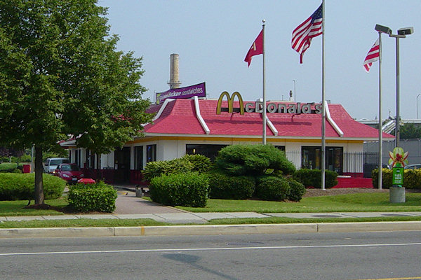
South Capitol and I Streets, SE. At left, August 14, 2005; at right, November 11, 2012.
Thank you, drive through.
|
Comments (3)
|
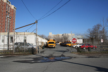
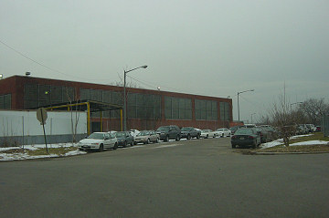
After many weeks of teasing, it's now pretty safe to say that the old trash transfer building at 900 New Jersey Ave. SE is really getting demolished. Click to embiggen: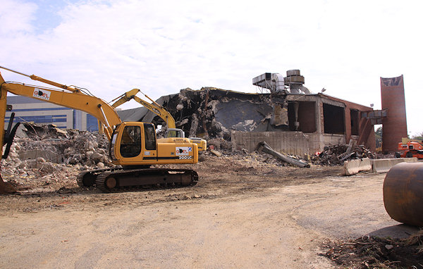
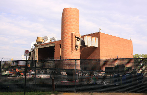
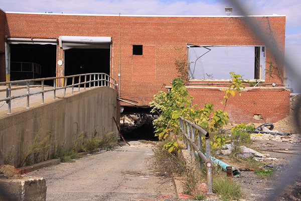
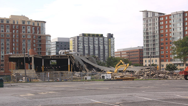
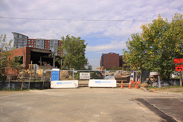
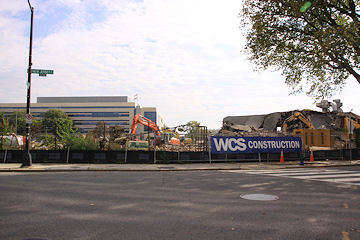
And some before-and-nows show that the eventual new block of I Street between 2nd and New Jersey is starting to be more than just a dream:
If you haven't been following along, this site spent much of the 1900s as a trash transfer station, before the DC Department of Public Works turned it into an operations area for heavy trucks and plows. The block to the north is going to be developed by William C. Smith, starting with the Park Chelsea apartment building, once some deep (deep!) utilities running below the site get relocated. The block between I and K is part of the Capper/Carrollsburg Hope VI redevelopment footprint, and is slated to eventually have a large mixed-income apartment building, though no announcements have been made of when that might actually happen.
I think it's also now safe to declare it Demolished Building #170 since 2003.
|
Comments (7)
More posts:
Trash Transfer Site/DPW, photos
|
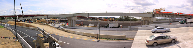
There's a lot going on over yonder at 11th Street these days, as the initial 11th Street Bridges project continues toward its expected completion next year while the now-funded Phase 2 work is starting to get underway.
I was able to arrange a tour last week (thank you, bridge folks!), and have put together a photo gallery of the most interesting shots.
However, there's a lot going on and so I'm going to break out some of the information here as well. (But go look at the gallery too!)
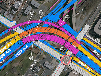
 New Ramps from/to 11th Street Local Bridge
By the end of the month (or maybe even by the end of the week), two new ramps on the 11th Street Local Bridge will open, providing access to southbound I-295 from the local bridge and to the local bridge from northbound DC-295. There are signalized intersections at both ramps, with turns allowed in each direction. And, once construction is finished to make 11th Street two-way from O Street northward, commuters driving north on 295 will be able to use the new ramp to the local bridge to then arrive directly at the Navy Yard's entrance gate at 11th and N.
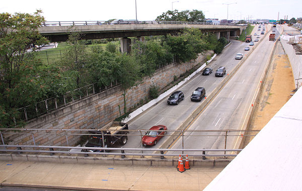
 Southeast Blvd., and Outbound Freeway Traffic
This week saw the first of the lane closures that within a few months will signal the end of the SE Freeway east of 8th Street. Once all lanes are closed, traffic taking the old two-lane flyover to outbound I-695 will be temporarily routed onto the completed-but-not-opened inbound flyover connecting I-695 and I-395. This will allow for the razing of the old outbound flyover, and construction of a new three-lane flyover in the gap between the old and new ones. The filling of the old sunken freeway will also begin, for the new at-grade Southeast Blvd.
 Old Outbound Bridge Demolition
The old outbound 11th Street Bridge is now little more than a bunch of old girders, which are starting to be removed. Soon, all that will be left will be the river piers, though two of those will be used to create viewing platforms that will be accessed via walkways from the new 11th Street Local pedestrian path. (And can be reused if anyone ever decides to pony up the millions needed to create the 11th Street Recreation Bridge.) In the meantime, work continues on the downriver edge of the new local bridge, to get it to its full four-lane-plus-ped-path width.
But there's more than just these items and photos. There's photos of the under-construction ramp that in about three months will take traffic from outbound I-695 to northbound DC-295, plus the big piles of dirt waiting to be used to fill in the eastern part of the Southeast Freeway, and the work on the ramp from 11th Street to westbound I-395, and more. So go look at the entire gallery. (I've also incorporated some of the new photos into my 11th Street Bridges project page, to go with the before-and-afters.) I also wrote in more detail about the Phase 2 projects a few months back.


|
Comments (6)
|