
|
| |||||||||||||||||||

|
Please note that JDLand is no longer being updated.
peek >>
Near Southeast DC Past News Items: photos
- Full Neighborhood Development MapThere's a lot more than just the projects listed here. See the complete map of completed, underway, and proposed projects all across the neighborhood.
- What's New This YearA quick look at what's arrived or been announced since the end of the 2018 baseball season.
- Food Options, Now and Coming SoonThere's now plenty of food options in the neighborhood. Click to see what's here, and what's coming.
![-]()
- Anacostia RiverwalkA bridge between Teague and Yards Parks is part of the planned 20-mile Anacostia Riverwalk multi-use trail along the east and west banks of the Anacostia River.
![-]()
- Virginia Ave. Tunnel ExpansionConstruction underway in 2015 to expand the 106-year-old tunnel to allow for a second track and double-height cars. Expected completion 2018.
![-]()
- Rail and Bus Times
Get real time data for the Navy Yard subway, Circulator, Bikeshare, and bus lines, plus additional transit information. - Rail and Bus Times
Get real time data for the Navy Yard subway, Circulator, Bikeshare, and bus lines, plus additional transit information. - Canal ParkThree-block park on the site of the old Washington Canal. Construction begun in spring 2011, opened Nov. 16, 2012.
![-]()
- Nationals Park21-acre site, 41,000-seat ballpark, construction begun May 2006, Opening Day March 30, 2008.
![-]()
- Washington Navy YardHeadquarters of the Naval District Washington, established in 1799.
![-]()
- Yards Park5.5-acre park on the banks of the Anacostia. First phase completed September 2010.
![-]()
- Van Ness Elementary SchoolDC Public School, closed in 2006, but reopening in stages beginning in 2015.
![-]()
- Agora/Whole Foods336-unit apartment building at 800 New Jersey Ave., SE. Construction begun June 2014, move-ins underway early 2018. Whole Foods expected to open in late 2018.
![-]()
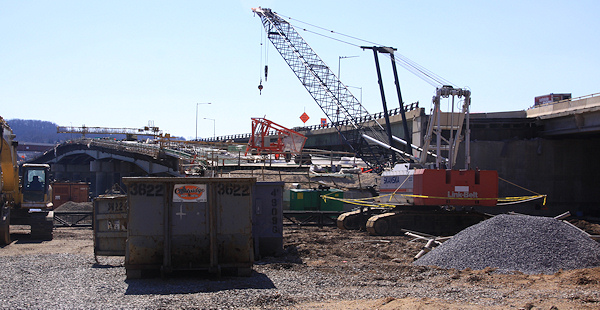
- New Douglass BridgeConstruction underway in early 2018 on the replacement for the current South Capitol Street Bridge. Completion expected in 2021.
![-]()
- 1221 Van290-unit residential building with 26,000 sf retail. Underway late 2015, completed early 2018.

- NAB HQ/AvidianNew headquarters for National Association of Broadcasters, along with a 163-unit condo building. Construction underway early 2017.

- Yards/Parcel O Residential ProjectsThe Bower, a 138-unit condo building by PN Hoffman, and The Guild, a 190-unit rental building by Forest City on the southeast corner of 4th and Tingey. Underway fall 2016, delivery 2018.

- New DC Water HQA wrap-around six-story addition to the existing O Street Pumping Station. Construction underway in 2016, with completion in 2018.

- The Harlow/Square 769N AptsMixed-income rental building with 176 units, including 36 public housing units. Underway early 2017, delivery 2019.

- West Half Residential420-unit project with 65,000 sf retail. Construction underway spring 2017.
![-]()
- Novel South Capitol/2 I St.530ish-unit apartment building in two phases, on old McDonald's site. Construction underway early 2017, completed summer 2019.
![Novel South Capitol]()
- 1250 Half/Envy310 rental units at 1250, 123 condos at Envy, 60,000 square feet of retail. Underway spring 2017.
![-]()
- Parc Riverside Phase II314ish-unit residential building at 1010 Half St., SE, by Toll Bros. Construction underway summer 2017.
![-]()
- 99 M StreetA 224,000-square-foot office building by Skanska for the corner of 1st and M. Underway fall 2015, substantially complete summer 2018. Circa and an unnamed sibling restaurant announced tenants.
![-]()
- The Garrett375-unit rental building at 2nd and I with 13,000 sq ft retail. Construction underway late fall 2017.
![-]()
- Yards/The Estate Apts. and Thompson Hotel270-unit rental building and 227-room Thompson Hotel, with 20,000 sq ft retail total. Construction underway fall 2017.
![-]()
- Meridian on First275-unit residential building, by Paradigm. Construction underway early 2018.
![-]()
- The Maren/71 Potomac264-unit residential building with 12,500 sq ft retail, underway spring 2018. Phase 2 of RiverFront on the Anacostia development.
![-]()
- DC Crossing/Square 696Block bought in 2016 by Tishman Speyer, with plans for 800 apartment units and 44,000 square feet of retail in two phases. Digging underway April 2018.
![DC Crossing]()
- One Hill South Phase 2300ish-unit unnamed sibling building at South Capitol and I. Work underway summer 2018.
![One Hill South Phase 2]()
- New DDOT HQ/250 MNew headquarters for the District Department of Transportation. Underway early 2019.
![New DDOT HQ]()
- 37 L Street Condos11-story, 74-unit condo building west of Half St. Underway early 2019.
![37 L Condos]()
- CSX East Residential/Hotel225ish-unit AC Marriott and two residential buildings planned. Digging underway late summer 2019.
![CSX East Residential/Hotel]()
- 1000 South Capitol Residential224-unit apartment building by Lerner. Underway fall 2019.
![1000 South Capitol Residential]()
- Capper Seniors 2.0Reconstruction of the 160-unit building for low-income seniors that was destroyed by fire in 2018.
![1000 South Capitol Residential]()
- Chemonics HQNew 285,000-sq-ft office building with 14,000 sq ft of retail. Expected delivery 2021.
![1000 South Capitol Residential]()


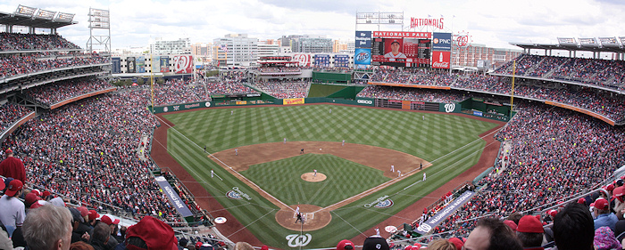
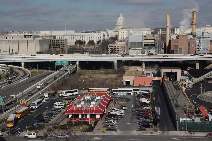
While much of my time on Opening Day each year is spent racing around getting pictures of the festivities, it's equally important to me as the first time after a multi-month lull that I can go to the various viewpoints on the upper deck and get updated photographs of how the ballpark's immediate surroundings have changed.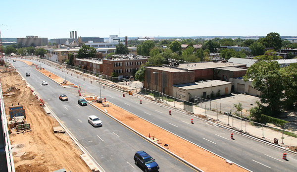
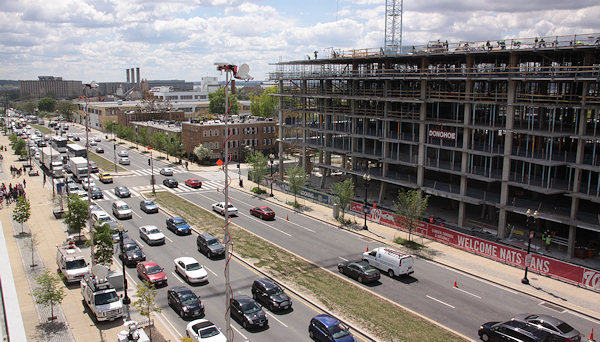
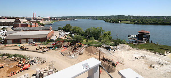
On the ballpark's western side, overlooking South Capitol Street, there's now the Camden South Capitol apartment building rising out of the ground, more than four years after the lot was cleared in preparation for construction. While technically this new 244-unit building is outside of my boundaries, I've taken enough photos of the western side of South Capitol Street over the years to maintain a pseudo-project page, where you can get the basics on the development and some before-and-afters but where I'm not going overboard in documenting the building's arrival. The photos above were taken from the ballpark's northwest viewing platform, and you can see the other images I've taken from that perch since my first visit there in September 2007.
If you want some additional views to the west, I have a series of before-and-afters from the small opening at O Street near the elevators, including these looking straight out O:
Meanwhile, on the ballpark's south side, there's two changes since last summer worth getting photos of: the completed Riverwalk bridge between Diamond Teague Park and the Yards Park, and the clearing of the Florida Rock site. And, since my 2007 "before" shots are from the time that Potomac Avenue and First Street were being reconstructed, and long before the waterfront started getting spiffed up, the transformation is pretty striking, though you can tell that I had my wide-angle lens in 2007 but had to settle for stitched-together images this time:
You can browse my many variations of these before-and-after Anacostia River views, both to the southeast and to the southwest. And, note at the top of these pages the links to other "on high" photographs from various rooftops around the neighborhood.
(PS: Apologies for the site's extended outage on Thursday--a botched move by my hosting company to upgrade the hardware of my shared server resulted in what to you was a nearly seven-hour outage but to me was the equivalent of a couple of ice ages.)
|
Comments (0)
|
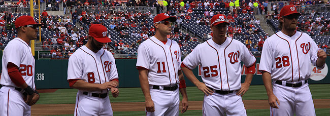
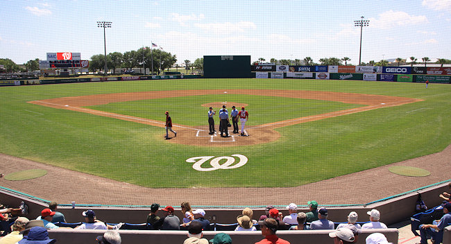
It was a little more difficult than it looked like it would be (and had a bit of a crazy finish), but the Nats got a win for their sold-out 2012 Home Opener, winning 3-2 in the 10th thanks to a wild pitch.
It's not hard in this world of social media to find photos from Opening Day, but that doesn't mean I can pass up the opportunity to post my own, for those of you who weren't there (or even if you were).
I have two galleries for you browse through: my shots from around the stadium (both looking inside and looking out), along with images from the opening ceremonies. (I leave the photos of the game itself to others.) And now I think I shall take a bit of a breather!
|
Comments (5)
More posts:
photos, Nationals Park
|
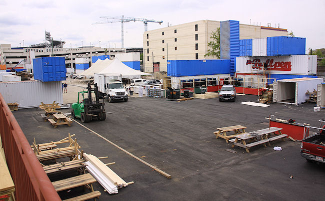
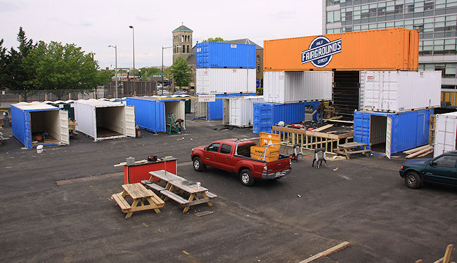
This morning I got a quick tour of the inside of the new Fairgrounds space just north of Nationals Park this morning, where the work is buzzing along to get the area ready for Thursday's Nats home opener at 1:05 pm. I talked with Bo Blair of Georgetown Events, and these are the tidbits he passed along:
* The Fairgrounds will open by 11:30 am, with about two-thirds of the footprint being used.
* There will be 10 to 12 food trucks on site.
* Three bands will play throughout the day.
 * Ten or so vendors will be set up within the containers on the north end of the block.
Blair expects to keep the larger area of the site open through Sunday (since there are games each day), at which point probably only the main area on the north end of the block (the old Das Bullpen) will be open daily until crowds pick up as the weather (and the team?) improves.
If you haven't been following along, check out my post about the new venture from when it first came to light back in February. The north end is expected to be open daily through the end of the baseball season, while the larger area will open up for bigger events (such as Truckeroo, and the DC Challenge on April 28).
In the meantime, check out the photos, while keeping in mind that it's still kind of messy, and the overcast skies weren't exactly conducive to images that "pop."
UPDATE: The lineup of food trucks: @bbqbusdc @bigcheesetruck @curbsidecupcake @DCEmpanadas @TaKorean @LobstertruckDC @TheFicelle @gofishtruckdc @Sinplicity1 @Dougthefooddude and @surfsidetruckdc. And Fairgrounds's Facebook page says these will be among the vendors: "[B]aseball inspired painters, photography, cool clothes, even baby clothes, crafts from around the world, handmade jewelry, soaps, and great produce, popcorn and pickles! in the farm stand by Half Street."
|
Comments (3)
More posts:
West Half St., Fairgrounds/Bullpen, photos
|
Because of a need to burn off some calories before digging into my "Reeseter's Bunny" (milk chocolate-coated peanut butter bunny, which the label says is four servings [ha!] at 180 calories per), I did my usual wanderings this morning to grab updated photos around, Capper, 200 I, Canal Park, and the Boilermaker Shops. Alas, I did not hide any Easter eggs in any of these shots, nor did I find any.
 I also enjoyed being watched very closely by a USDOT security guard with a clipboard as I took photos of the park's progress from the south side of M Street. "What are you taking photos of?" she finally asked, trying to sound stern. "Stuff," I replied, as I smiled and kept walking.
The framing and Tyvek-ing is underway on 3rd Street south of L, in the shadow of the 300 M Street office building, as Capitol Quarter continues its march toward completion. I also took a lot of photos of other CQ Phase II blocks, so spend some time in the Capitol Quarter Phase 2 Expanded Photo Archive (and scroll down a bit) to hop through the many (many!) before-and-afters.
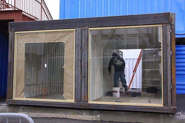
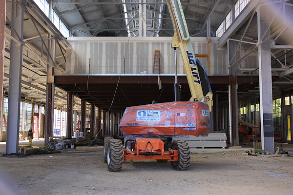
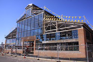
Then there's the Boilermaker Shops at the Yards, where some work was being done even on Easter Sunday. The walling off the interior space for the different tenants has begun, with the studs visible--and some drywall has even gone in on the mezzanine level, as seen at right, in a view from 4th Street, through what will be the Bluejacket space.
The work is on-going at Canal Park, but continues to not be terribly exciting from a photographic standpoint, unless you're wowed by images of new curbs. But the Canal Park Expanded Photo Archive can take you for a walk around the park's perimeter to see the current views, if you don't see it every day. (I also like my barbed wire shot [above right], the result of desperation after being without photos from the east side of 2nd and L for a very long time now. But, no, I didn't jump the fence.)
I also enjoyed being watched very closely by a USDOT security guard with a clipboard as I took photos of the park's progress from the south side of M Street. "What are you taking photos of?" she finally asked, trying to sound stern. "Stuff," I replied, as I smiled and kept walking.There's also updated shots from 225 Virginia/200 I (seen at right), with the landscaping now starting to go in.
If you want to see today's entire batch (213 of 'em), here they are, remembering to click the fun little  icon if you want to see the entire range of photos for a certain location. If you want even more new-ish pictures, here's photos I took around 1st and Half Streets on Tuesday, to get the Fairgrounds exterior into the official archive.
icon if you want to see the entire range of photos for a certain location. If you want even more new-ish pictures, here's photos I took around 1st and Half Streets on Tuesday, to get the Fairgrounds exterior into the official archive.Now I need to go find that peanut butter bunny. I think I earned it.
|
Comments (7)
More posts:
225 Virginia/Old Post Plant/200 I, Boilermaker Shops/Yards, Canal Park, Capper, Capitol Quarter, photos, photos, The Yards
|
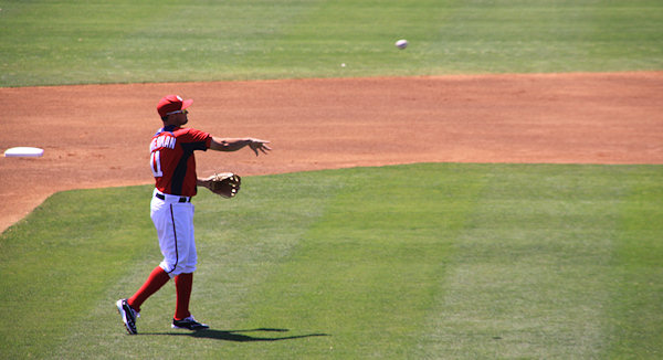
I had an opportunity on Monday to make a trip to Viera for my first-ever Spring Training game, to see the Nationals beat the Houston Astros, 7-4. While sitting in the warm Florida sun for a few hours watching baseball was the top priority, I did arrive with camera in hand, and so couldn't pass up the opportunity to take a bunch of pictures of the Nats' other stadium.
So, here are two photo galleries that might be of interest: looking around Space Coast Stadium, and action photos from the Nats-Astros game.
The Nats will be back at their real ballpark one week from today, for an exhibition game on April 3 against the Boston Red Sox. The home opener is now just a smidge over two weeks away, on April 12 against the Cincinnati Reds.
|
Comments (4)
More posts:
photos, Nationals Park
|
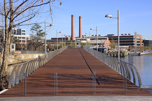
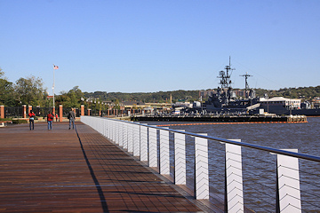
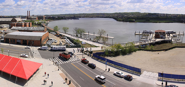
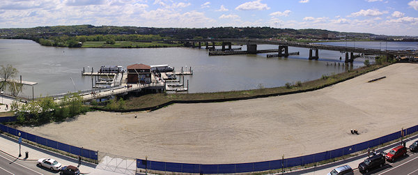
What a gorgeous spring day we appear to have on tap today! Wouldn't it be a lovely day for a nice stroll along a riverfront? Near Southeast, Southwest, and Capitol Hill denizens (plus a lot of the #bikedc crowd) are familiar with the neighborhood's portion of the Anacostia Riverwalk Trail, but now that the bridge between the Yards Park and Diamond Teague Park is complete, giving the main portion of the trail a connection to Nationals Park, non-residents should get a reminder to experience what is a path unlike any other in Washington. 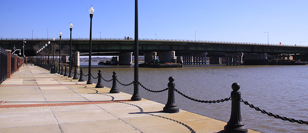
So I've put together a new page covering the Anacostia Riverwalk Trail (Near Southeast Portion) that acts as a sort of virtual walk along the river, from 1st Street SE to the 11th Street Bridges and a little beyond. (If I weren't so lazy, I'd take on the entire trail, but maybe later.) There's also a few before-and-afters to remind people of how far the trail has come in a relatively short time.
A lot of the photos on this new page may be familiar from my other project pages, but I think it was worth it to give this amenity its own home. And there should be some updates over the next few months as the 11th Street Local bridge is opened and the work begins on the portion of the trail that runs beneath the bridges, not to mention the paths on the new bridge itself that will make for an even easier link to the trail's eastern side that runs through Anacostia Park. And I'll try to get some newer photos of the section from 11th Street to the Sousa Bridge, and perhaps beyond.
In the meantime, browse the photos or, even better, get down there and take a walk.
Take a gorgeous Sunday, add an obsessive-compulsive need to document all the change underway, and what do you get? Nearly eight miles of walking and a shameful number of new photos.
 Embarrassingly, I haven't had a camera in hand on the Navy Yard's portion of the Anacostia Riverwalk since 2004. (I'm always worried they're going to toss me in the brig as a security threat, especially after a run-in a few years back where I was chased down by both a gate sentry and the DC police after taking photos of the Hull Street gate from across M Street.) But I pushed forward yesterday and got a bunch of new shots that I've added to my Navy Yard page, taking care to demonstrate to the many security cameras that I was photographing the river and not the installation. (Don't miss the especially cool before-and-after of the gate to the Yards Park.)
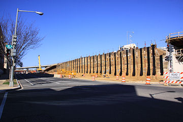
The Foundry Lofts building is all but done, with only the retail spaces left to be built out, so I took a bunch of "after" photos that will probably last for a while. But that new Potbelly sign sure stands out! I also pressed my nose against the glass to peek inside the sandwich shop's space--it sure doesn't look far from opening.
Embarrassingly, I haven't had a camera in hand on the Navy Yard's portion of the Anacostia Riverwalk since 2004. (I'm always worried they're going to toss me in the brig as a security threat, especially after a run-in a few years back where I was chased down by both a gate sentry and the DC police after taking photos of the Hull Street gate from across M Street.) But I pushed forward yesterday and got a bunch of new shots that I've added to my Navy Yard page, taking care to demonstrate to the many security cameras that I was photographing the river and not the installation. (Don't miss the especially cool before-and-after of the gate to the Yards Park.) I will probably be creating a separate Riverwalk page before too long, but not today.
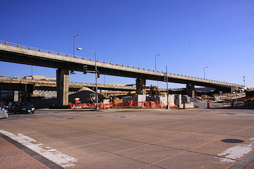
Along 11th Street at N and M, photos are more notable for what's not there anymore, as the demolition of the embankment for the old outbound RFK ramp is done, and the path of the new ramp from M Street for traffic headed to the outbound 11th Street Bridges freeway traffic becomes more obvious. Also see this picture of the work on the 11th Street Local bridge, showing the demolition of part of the old outbound bridge approach, which has to be done before the new local bridge can hook up with 11th Street. (You can see it as well in my O Street before-and-afters, if you figure out what to look for.) Check my 11th Street Bridges photo page for more images.
Then there's Canal Park, where I mainly took some new photos of the pavilion under construction near M Street, since photos of digging and ground work don't quite rise to the level of "interesting." I also hit most of the angles for the Boilermaker Shops, as well as for Capitol Quarter Phase II, where the security guard expressed concern about my actions (I need a laminated Photography Approved card or something). And I wandered the 225 Virginia/200 I perimeter.
If you're a glutton for punishment, you can browse the 267 pictures from this trek that are now in my Photo Archive, using the links to see before-and-afters.
links to see before-and-afters.|
Comments (5)
More posts:
11th Street Bridges, 225 Virginia/Old Post Plant/200 I, Boilermaker Shops/Yards, Canal Park, Capper, Capitol Quarter, Foundry Lofts/Yards, Navy Yard, photos, riverwalk, The Yards
|
I usually just toss these out only on Twitter every so often, but after sneaking a peek at my February 10, 2007 photo gallery (thanks to that "This Day In Near Southeast History" box on the JDLand home page), I thought that it merited an actual blog post.
Early 2007 is the optimum time for seeing the last vestiges of the old neighborhood west of New Jersey Avenue juxtaposed with the stampede of new construction. There's a lot of "holes in the sky" where we're now used to seeing 70/100 I, 909 New Jersey, Onyx, 100 M, 55 M, Velocity, and 1015 Half.
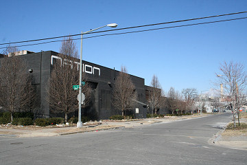
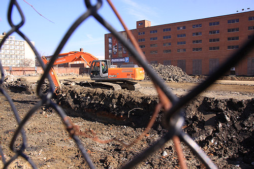
And there was this big project underway south of N Street:
There's even images that surprise me, like seeing the South Capitol Street viaduct again (it was demolished five months later). And, of course, Normandie Liquors still stood alone.
Over the next four months, demolition would clear 25 buildings directly north of the ballpark, including all of the remaining night clubs from the neighborhood's old days (Wet, Edge, Club 55, the Nexus Gold Club, and Nation). Construction would begin on 55 M and Velocity, and 70/100 I, Onyx, and 100 M would come out of the ground. And the US Department of Transportation opened.
There's a lot going on in the neighborhood once again these days, but it'll never be anything like 2007 and 2008. So check out both pages of the gallery, and prepare to be amazed! (Or not.)
UPDATE: It might also be interesting to look at my gallery from one year later, Feb. 10, 2008, to really get a sense of how much things changed in 12 months.
|
Comments (2)
More posts:
photos, Rearview Mirror
|
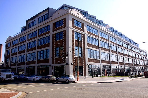

When last I visited the Foundry Lofts, it was about a month before the first residents moved in. I took a pile of photos, but while model units were furnished, a lot of the shared spaces were still being worked on. So I finally made a return visit this week to see all the finishing touches on the interior courtyard, lobby, community room, etc. And I took one or two photographs, of course.
The leasing office tells me that the 170-unit building is now about 65 percent leased and 40 percent occupied, and construction on the non-retail spaces is not far from 100 percent completion. The four priciest units--the corner penthouses, which were announced with rents in the $4,500 range--are all taken. And the two eateries in the ground floor--Potbelly and Kruba Thai and Sushi--have their building permits and are working toward opening within 90 days.
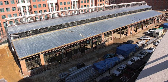 Also, because I can't walk past the Boilermaker Shops without taking pictures, I added a few new shots to that page, including the panorama at right that I got from one of the Foundry Loft patios.
As if this all isn't exciting enough, here's a first terribly not exciting photo of the excavation underway at the 1212 4th/Teeter site a block east of the Foundry Lofts and across the street from Boilermaker.
Plus, since I had to walk down 4th Street to get to all of this, I snapped some shots of the continuing Capitol Quarter progress at K and L.
|
Comments (1)
|
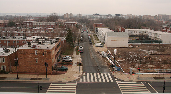
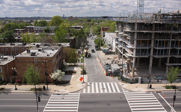
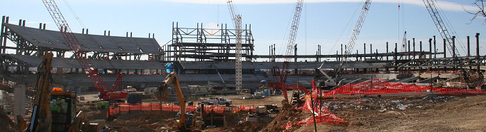
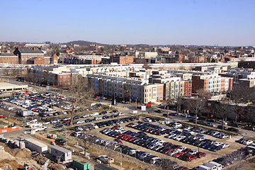
 From ground level, it's not especially easy to see (or photograph) the current state of Canal Park's construction--lots of fences, equipment, and bad winter sunlight, and the only above-ground action is hard to photograph through cyclone fencing. But on Thursday I got to see the progress from higher up, where not only is it easier to get a good overview of the site, but you can now see the outline on the southern block of both the plaza *and the ice rink*. (Shadows still wreaked some havoc, alas.) I added a number of these images to my Canal Park progress page, for your perusal.
As I worked on these, I got to thinking about some photos from high up in 1100 New Jersey many moons ago, when the surrounding landscape looked very different. A few have been sprinkled throughout the site, but I was a little embarrassed to find out I'd never put them in my Overhead Photos Archive, which has now been rectified, and you can see them here. They are from September 2004, so most of the old Capper buildings are still visible, and the USDOT and Capitol Hill Tower lots are just holes in the ground. (And there's one cool view of the buildings at the Yards that sure won't ever be replicated.) I paired them with shots from Thursday where possible.
Then I remembered all the photos I took from the top floor of 1015 Half Street during the BID's annual meeting last week (there were a bunch besides just the "majestic" one). Not exactly a trip down memory lane, but they're now posted as well.
At this point, with a deep breath, I ventured into the folder where I've been dumping my rooftop/on-high photos "to deal with later," and found:
 * A series of strangely blue pictures I took from the roof deck at Onyx in October 2008, just as the building was opening;
* Shots from 100 M Street taken at the BID's annual meeting on a dreary day in December 2008; and
* Photos from 55 M taken during the kick-off for Artomatic in May 2009. (Nyaah, nyaah, National Geospatial Intelligence Agency, I was taking pictures of you!)
For those of you who live and work in the "high-rise" buildings in the neighborhood, many of these views won't be anything exciting, and given the lack of new projects on the west end of the neighborhood, not really much has changed since the 2008-2009 shots. But now they're in the Permanent Collection, to be paired with more photos down the road someday.
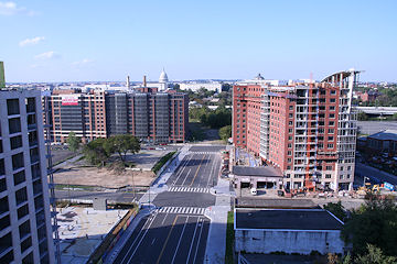
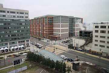
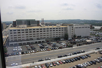
If you haven't wandered through the overhead archive before, there's a ton of other photos, including the pictures from atop the Courtyard by Marriott taken from 2006-2010 that really highlight the demolition-and-construction that happened west of New Jersey Avenue. There's also a series of images taken from the roof of the old Capper Seniors building right before it was demolished in 2007, plus all manner of pictures of the waterfront taken from the ballpark's southeast viewing platform starting in 2007 (which I can't wait to update in a few months). And other locations, too.
Hope you find them enjoyable, especially on a Friday afternoon when you might happen to be looking for something to do other than work.
|
Comments (0)
More posts:
Canal Park, photos
|