
|
| |||||||||||||||||||

|
Please note that JDLand is no longer being updated.
peek >>
Near Southeast DC Past News Items: Pedestrian/Cycling Issues
- Full Neighborhood Development MapThere's a lot more than just the projects listed here. See the complete map of completed, underway, and proposed projects all across the neighborhood.
- What's New This YearA quick look at what's arrived or been announced since the end of the 2018 baseball season.
- Food Options, Now and Coming SoonThere's now plenty of food options in the neighborhood. Click to see what's here, and what's coming.
![-]()
- Anacostia RiverwalkA bridge between Teague and Yards Parks is part of the planned 20-mile Anacostia Riverwalk multi-use trail along the east and west banks of the Anacostia River.
![-]()
- Virginia Ave. Tunnel ExpansionConstruction underway in 2015 to expand the 106-year-old tunnel to allow for a second track and double-height cars. Expected completion 2018.
![-]()
- Rail and Bus Times
Get real time data for the Navy Yard subway, Circulator, Bikeshare, and bus lines, plus additional transit information. - Rail and Bus Times
Get real time data for the Navy Yard subway, Circulator, Bikeshare, and bus lines, plus additional transit information. - Canal ParkThree-block park on the site of the old Washington Canal. Construction begun in spring 2011, opened Nov. 16, 2012.
![-]()
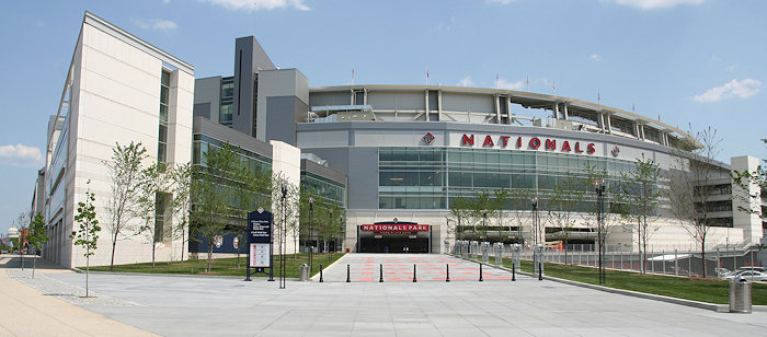
- Nationals Park21-acre site, 41,000-seat ballpark, construction begun May 2006, Opening Day March 30, 2008.
![-]()
- Washington Navy YardHeadquarters of the Naval District Washington, established in 1799.
![-]()
- Yards Park5.5-acre park on the banks of the Anacostia. First phase completed September 2010.
![-]()
- Van Ness Elementary SchoolDC Public School, closed in 2006, but reopening in stages beginning in 2015.
![-]()
- Agora/Whole Foods336-unit apartment building at 800 New Jersey Ave., SE. Construction begun June 2014, move-ins underway early 2018. Whole Foods expected to open in late 2018.
![-]()
- New Douglass BridgeConstruction underway in early 2018 on the replacement for the current South Capitol Street Bridge. Completion expected in 2021.
![-]()
- 1221 Van290-unit residential building with 26,000 sf retail. Underway late 2015, completed early 2018.

- NAB HQ/AvidianNew headquarters for National Association of Broadcasters, along with a 163-unit condo building. Construction underway early 2017.

- Yards/Parcel O Residential ProjectsThe Bower, a 138-unit condo building by PN Hoffman, and The Guild, a 190-unit rental building by Forest City on the southeast corner of 4th and Tingey. Underway fall 2016, delivery 2018.

- New DC Water HQA wrap-around six-story addition to the existing O Street Pumping Station. Construction underway in 2016, with completion in 2018.

- The Harlow/Square 769N AptsMixed-income rental building with 176 units, including 36 public housing units. Underway early 2017, delivery 2019.

- West Half Residential420-unit project with 65,000 sf retail. Construction underway spring 2017.
![-]()
- Novel South Capitol/2 I St.530ish-unit apartment building in two phases, on old McDonald's site. Construction underway early 2017, completed summer 2019.
![Novel South Capitol]()
- 1250 Half/Envy310 rental units at 1250, 123 condos at Envy, 60,000 square feet of retail. Underway spring 2017.
![-]()
- Parc Riverside Phase II314ish-unit residential building at 1010 Half St., SE, by Toll Bros. Construction underway summer 2017.
![-]()
- 99 M StreetA 224,000-square-foot office building by Skanska for the corner of 1st and M. Underway fall 2015, substantially complete summer 2018. Circa and an unnamed sibling restaurant announced tenants.
![-]()
- The Garrett375-unit rental building at 2nd and I with 13,000 sq ft retail. Construction underway late fall 2017.
![-]()
- Yards/The Estate Apts. and Thompson Hotel270-unit rental building and 227-room Thompson Hotel, with 20,000 sq ft retail total. Construction underway fall 2017.
![-]()
- Meridian on First275-unit residential building, by Paradigm. Construction underway early 2018.
![-]()
- The Maren/71 Potomac264-unit residential building with 12,500 sq ft retail, underway spring 2018. Phase 2 of RiverFront on the Anacostia development.
![-]()
- DC Crossing/Square 696Block bought in 2016 by Tishman Speyer, with plans for 800 apartment units and 44,000 square feet of retail in two phases. Digging underway April 2018.
![DC Crossing]()
- One Hill South Phase 2300ish-unit unnamed sibling building at South Capitol and I. Work underway summer 2018.
![One Hill South Phase 2]()
- New DDOT HQ/250 MNew headquarters for the District Department of Transportation. Underway early 2019.
![New DDOT HQ]()
- 37 L Street Condos11-story, 74-unit condo building west of Half St. Underway early 2019.
![37 L Condos]()
- CSX East Residential/Hotel225ish-unit AC Marriott and two residential buildings planned. Digging underway late summer 2019.
![CSX East Residential/Hotel]()
- 1000 South Capitol Residential224-unit apartment building by Lerner. Underway fall 2019.
![1000 South Capitol Residential]()
- Capper Seniors 2.0Reconstruction of the 160-unit building for low-income seniors that was destroyed by fire in 2018.
![1000 South Capitol Residential]()
- Chemonics HQNew 285,000-sq-ft office building with 14,000 sq ft of retail. Expected delivery 2021.
![1000 South Capitol Residential]()


The final agenda is now out for Thursday's meeting of the National Capital Planning Commission, and contained in it is a long document setting out the commission staff's recommendations for a vote on the design of the 11th Street Bridges.
For anyone interested in the bridges as a driver, bicyclist, pedestrian, water recreationist, neighbor, or construction enthusiast, it's a worthwhile read (even at 26 pages). To cut to the chase, the staff is recommending that the commission "comment favorably" on the designs for the bridges, even though the designs are still in the very early stages, and there's very little new in this document that we didn't see in the EIS or other releases. There's even mention of how the city's Comprehensive Plan envisions the eventual dismantling of the Southeast-Southwest Freeway, but that the new bridges are needed until the time comes that I-395 comes down (i.e., far past the date I shuffle off this mortal coil).
However, they are not at all happy with DDOT's decision to choose a streetcar system with overhead wires, and the document goes into detail on how this works against federal interests, as well as listing what non-overhead-wire streetcar options exist out there (none in the US so far). Their conclusions (page 22):
"Recommends that DDOT not include streetcar system components for overhead wires as part of the 11th Street Bridge project and that DDOT prepare an environmental impact statement for its proposed District wide streetcar system that examines potential impacts on the L'Enfant City and Georgetown and that includes an analysis of propulsion systems that do not require the use of overhead wires.
"Advises DDOT that the Commission does not support a streetcar system with overhead wires because it supports the unobstructed views to important landmarks along the city's streets and avenues that are integral to the District's unique character and result from the long-standing federal statutory prohibition against using overhead wires in Washington City (the L'Enfant City) and Georgetown.
"Encourages DDOT to pursue alternative propulsion technologies for the proposed streetcar system that do not require overhead wires in accordance with its January 24, 2008 commitment to include dual vehicle propulsion requirements in a solicitation package for the development and implementation of the broader streetcar system beyond the Anacostia and H Street/Benning Road corridors."
The commission meeting when this recommendation will be voted on is Thursday (Sept. 3) at 12:30 pm.
|
Comments (0)
|
Between it being Friday and the sun finally being out, I bet everyone's feeling a bit better today. Maybe even Biking to Work! So, a few tidbits:
* The latest Capitol Riverfront BID newsletter is out, with a few items of note. First off, there's a new "branding" campaign going on--"Be Out Front." Look for signs promoting "Front Yard," "Front Office," "Front Door," "Store Front," etc. And they'll soon be launching an equally rebranded web site.
Also, the current estimated population within the BID is 1,584 residents; the newsletter says that there are now more than 2,000 residential units, more than half of which are leased/sold and occupied.
The newsletter also gives the Bullpen's official opening date as May 15, and also mentions that the weekly Tuesday farmer's market at USDOT is now underway, and that the weekly Wednesday lunchtime concerts start on May 20.
* The agenda for Monday's ANC 6D meeting is out (hopefully it'll show up online before the meeting itself), and the only Near Southeast item is a presentation by Michael Stevens of the BID--kind of a BID 101 tutorial for the ANC commissioners. Otherwise, it's voting on marathons, bus stops, after-school programs, and also an announcement of a "Southwest Night" at Ft. McNair on July 1. The meeting is at 6th and M streets, SW, at 7 pm. (Maybe next month it'll finally move to the new digs at the new 1D police station at the former Bowen Elementary.)
* The Examiner reports that the 2010 federal budget includes $15 million for "Southeast Federal Center remediation." There's certainly been piles of environmental cleanup there over the years (not surprising when it used to be blocks and blocks of munitions factories).
* EYA has spiffed up its web site a bit--their Capitol Quarter page is worth a visit if you haven't checked it out before.
|
Comments (0)
More posts:
West Half St., ANC News, Capitol Riverfront BID, Pedestrian/Cycling Issues, Fairgrounds/Bullpen, Capper, Capitol Quarter, US Dept. of Transportation HQ, Restaurants/Nightlife, meetings, Nationals Park
|
As we near the one-year anniversary of the opening of Nationals Park, here's a few recent items worth noting:
* (h/t to reader J) May 15 is Bike to Work Day, and the Washington Area Byclist Association has chosen the ballpark as one of the "pit stops," which will "offer breakfast, entertainment, dynamic speakers and chances to win bicycles and other prizes." And free t-shirts, too! See the web site for more details.
* Last week the ballpark was named one of the thirteen most significant projects of 2008 by the Associated General Contractors of America, all recognized "for their complexity, innovation, success and ultimately, for their significance to the construction community and the nation at large."
* The ballpark also recently was named a winner of of the 2008 "Beyond Green" High-Performance Building Awards from the Sustainable Buildings Industry Council, in a ceremony on Capitol Hill where case studies of the winners were presented; here's the slides about the ballpark, with lots of detail about the various designs and aspects that make the stadium "America's Greenest Ballpark," as well as the first sports facility in the U.S. to be LEED certified.
|
Comments (0)
More posts:
Pedestrian/Cycling Issues, Nationals Park
|
* The Examiner writes about the Washington Area Bicyclists Association's look last week at the crosswalks and curbs at the US Department of Transportation HQ, which WABA says are not ADA compliant: "An inspection of the area Friday found security bollards blocking curb ramps, bus shelters with virtually no sidewalk access, and multispace parking meters inaccessible to people in wheelchairs. Also, several crosswalks at non-signalized intersections feed into curbs with no access ramp[.]" DDOT says that the crosswalk at Second and M is not supposed to be used anymore (since there is a fully compliant crosswalk just to the west at New Jersey Avenue) and will be sending crews to take away the crosswalk marks.
* City Paper continues its saturation coverage of the Positive Nature youth program at 1017 New Jersey with video from Saturday's rally. The organization is trying to stave off eviction thanks to the huge increase in its property taxes.
* WAMU has posted the audio of its piece on last week's rededication of the Douglass Bridge. The city's Cable 16 channel should be adding it to its lineup soon. You can watch the press conference on the new on-street parking regulations near the ballpark in the meantime.
|
Comments (0)
More posts:
Pedestrian/Cycling Issues, US Dept. of Transportation HQ, New Jersey Ave., parking, Douglass Bridge, Nationals Park
|
A project is underway to design and create a "Connector Path" between Garfield Park just north of the Southeast Freeway and the to-be-constructed Canal Park in Near Southeast one block south of the freeway, with the goal of improving "the bicycle and pedestrian passage under the Southeast Freeway at 2nd Street, SE; making this linkage into a functional and attractive route between Capitol Hill and Near Southeast." There's a web site now online for information about this project, and on October 23 there will be a design workshop for those interested in participating in the process. It will be at St. Peter's Catholic Church (Social Hall), 128 2nd St., SE, from 6 to 9 pm.
UPDATE, 10/1: The date on this workshop has been changed to October 24. Same time, same place.
|
More posts:
Pedestrian/Cycling Issues, Canal Park
|
On Monday (May 7), DDOT is having a media briefing to announce that construction has begun on the Anacostia Riverwalk Trail. This is the first phase, and so doesn't actually include the planned portion of the trail through Near Southeast (from the 11th Street Bridges to the Frederick Douglass Bridge)--according to the AWC page and a meeting AWC held a few weeks back, I believe what's now being constructed is Phase I, the trail on the west side of the Anacostia from the Navy Yard to the National Arboretum. Phase 2 will be on the east side of the river, from Poplar Point to Pennsylvania Avenue, and Phase 3 (the Near Southeast portion) is probably looking at a 2010 date (when the Waterfront Park at the Yards is completed, and they can build the pedestrian bridge to link that park to Diamond Teague Park and Florida Rock.
UPDATE, May 7: A post-briefing press release says that the section of the Riverwalk now under construction is a two-mile stretch that will run from the Navy Yard east to Benning Road. There's also a link to a fact sheet on the trail (albeit from June 2006) that has a map of the planned trail and other information. And here's a WTOP piece on the new section.
|
More posts:
11th Street Bridges, Anacostia Waterfront Corp., Pedestrian/Cycling Issues, East of 11th Street, Florida Rock, Navy Yard, riverwalk, Teague Park, The Yards
|