
|
| |||||||||||||||||||

|
Please note that JDLand is no longer being updated.
peek >>
Near Southeast DC Past News Items
- Full Neighborhood Development MapThere's a lot more than just the projects listed here. See the complete map of completed, underway, and proposed projects all across the neighborhood.
- What's New This YearA quick look at what's arrived or been announced since the end of the 2018 baseball season.
- Food Options, Now and Coming SoonThere's now plenty of food options in the neighborhood. Click to see what's here, and what's coming.
![-]()
- Anacostia RiverwalkA bridge between Teague and Yards Parks is part of the planned 20-mile Anacostia Riverwalk multi-use trail along the east and west banks of the Anacostia River.
![-]()
- Virginia Ave. Tunnel ExpansionConstruction underway in 2015 to expand the 106-year-old tunnel to allow for a second track and double-height cars. Expected completion 2018.
![-]()
- Rail and Bus Times
Get real time data for the Navy Yard subway, Circulator, Bikeshare, and bus lines, plus additional transit information. - Rail and Bus Times
Get real time data for the Navy Yard subway, Circulator, Bikeshare, and bus lines, plus additional transit information. - Canal ParkThree-block park on the site of the old Washington Canal. Construction begun in spring 2011, opened Nov. 16, 2012.
![-]()
- Nationals Park21-acre site, 41,000-seat ballpark, construction begun May 2006, Opening Day March 30, 2008.
![-]()
- Washington Navy YardHeadquarters of the Naval District Washington, established in 1799.
![-]()
- Yards Park5.5-acre park on the banks of the Anacostia. First phase completed September 2010.
![-]()
- Van Ness Elementary SchoolDC Public School, closed in 2006, but reopening in stages beginning in 2015.
![-]()
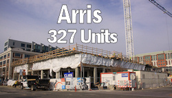
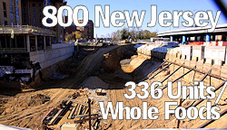
- Agora/Whole Foods336-unit apartment building at 800 New Jersey Ave., SE. Construction begun June 2014, move-ins underway early 2018. Whole Foods expected to open in late 2018.
![-]()
- New Douglass BridgeConstruction underway in early 2018 on the replacement for the current South Capitol Street Bridge. Completion expected in 2021.
![-]()
- 1221 Van290-unit residential building with 26,000 sf retail. Underway late 2015, completed early 2018.

- NAB HQ/AvidianNew headquarters for National Association of Broadcasters, along with a 163-unit condo building. Construction underway early 2017.

- Yards/Parcel O Residential ProjectsThe Bower, a 138-unit condo building by PN Hoffman, and The Guild, a 190-unit rental building by Forest City on the southeast corner of 4th and Tingey. Underway fall 2016, delivery 2018.

- New DC Water HQA wrap-around six-story addition to the existing O Street Pumping Station. Construction underway in 2016, with completion in 2018.

- The Harlow/Square 769N AptsMixed-income rental building with 176 units, including 36 public housing units. Underway early 2017, delivery 2019.

- West Half Residential420-unit project with 65,000 sf retail. Construction underway spring 2017.
![-]()
- Novel South Capitol/2 I St.530ish-unit apartment building in two phases, on old McDonald's site. Construction underway early 2017, completed summer 2019.
![Novel South Capitol]()
- 1250 Half/Envy310 rental units at 1250, 123 condos at Envy, 60,000 square feet of retail. Underway spring 2017.
![-]()
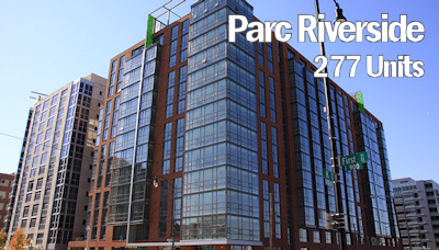
- Parc Riverside Phase II314ish-unit residential building at 1010 Half St., SE, by Toll Bros. Construction underway summer 2017.
![-]()
- 99 M StreetA 224,000-square-foot office building by Skanska for the corner of 1st and M. Underway fall 2015, substantially complete summer 2018. Circa and an unnamed sibling restaurant announced tenants.
![-]()
- The Garrett375-unit rental building at 2nd and I with 13,000 sq ft retail. Construction underway late fall 2017.
![-]()
- Yards/The Estate Apts. and Thompson Hotel270-unit rental building and 227-room Thompson Hotel, with 20,000 sq ft retail total. Construction underway fall 2017.
![-]()
- Meridian on First275-unit residential building, by Paradigm. Construction underway early 2018.
![-]()
- The Maren/71 Potomac264-unit residential building with 12,500 sq ft retail, underway spring 2018. Phase 2 of RiverFront on the Anacostia development.
![-]()
- DC Crossing/Square 696Block bought in 2016 by Tishman Speyer, with plans for 800 apartment units and 44,000 square feet of retail in two phases. Digging underway April 2018.
![DC Crossing]()
- One Hill South Phase 2300ish-unit unnamed sibling building at South Capitol and I. Work underway summer 2018.
![One Hill South Phase 2]()
- New DDOT HQ/250 MNew headquarters for the District Department of Transportation. Underway early 2019.
![New DDOT HQ]()
- 37 L Street Condos11-story, 74-unit condo building west of Half St. Underway early 2019.
![37 L Condos]()
- CSX East Residential/Hotel225ish-unit AC Marriott and two residential buildings planned. Digging underway late summer 2019.
![CSX East Residential/Hotel]()
- 1000 South Capitol Residential224-unit apartment building by Lerner. Underway fall 2019.
![1000 South Capitol Residential]()
- Capper Seniors 2.0Reconstruction of the 160-unit building for low-income seniors that was destroyed by fire in 2018.
![1000 South Capitol Residential]()
- Chemonics HQNew 285,000-sq-ft office building with 14,000 sq ft of retail. Expected delivery 2021.
![1000 South Capitol Residential]()


3238 Blog Posts Since 2003
Go to Page: 1 | 2 | 3 | 4 | 5 | 6 | 7 | 8 | 9 | 10 ... 324
Search JDLand Blog Posts by Date or Category
Go to Page: 1 | 2 | 3 | 4 | 5 | 6 | 7 | 8 | 9 | 10 ... 324
Search JDLand Blog Posts by Date or Category
 It's almost that time, with the NHL Winter Classic's puck drop now less than 48 hours away, at 1 pm on Thursday, Jan. 1 at Nationals Park. (Check out the webcam to watch as preparations inside the stadium are rushed to completion.)
While tickets aren't easy to come by without a sizeable wad of cash, there will be events around the neighborhood where the both lucky ticket holders and unlucky ticket unholders can congregate before, during, and after the game.
* OFFICIAL FAN FESTIVAL: As mentioned previously, the official SPECTATOR PLAZA PRESENTED BY GEICO will be set up at the Fairgrounds at Half and M streets, SE, from 9 am until 1 pm, with all manner of attractions, prizes, food, music, and purchasing opportunities.
* ROCK THE RIVERFRONT: Starting at 10 am and running until 7 pm, Canal Park will celebrate the Winter Classic with its own free "Rock the Riverfront" festival, with CBS radio station 106.7 The Fan broadcasting live from the roof of the Park Tavern before and after the game. There will be live music, beer from DC Brau, food, ice skating (natch), former Caps players (including Dave Christian), and more. And the game will be broadcast on multiple TV screens.
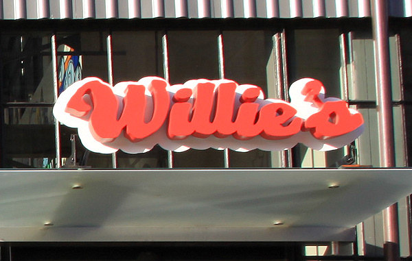
* OTHER VENUES: Willie's will open at 8:30 am, the Big Stick at 9 am, Bluejacket at 10 am, Justin's Cafe at 11, and Biersch at 1 pm (because of a private event earlier in the day)--the Post's Going Out Guide has more on what these places will be offering. And of course my Food Options map gives you the complete lineup of eateries and drinkeries in the area.
* CAPS MASS: St, Vincent de Paul church at South Capitol and M SE is providing a special Winter Classic Caps Mass at 11:30 am.
* BIKESHARE: (ADDED) There's going to be a corral from 11:30 am until 30 minutes after the game at the dock at 1st and N SE.
And now, the buzz-kill items:
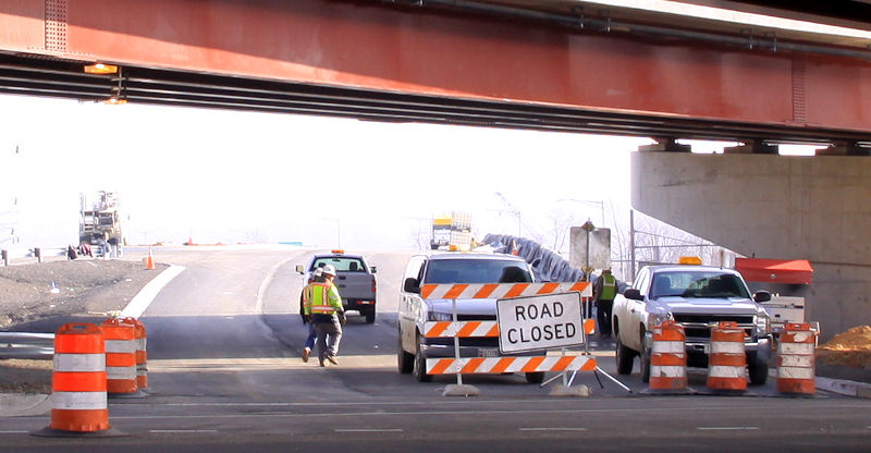
* ROAD CLOSURES: MPD has announced road closures from 8:30 am until approximately 6:30 pm, including Potomac Avenue south of the ballpark, 1st Street south of M, N Street from South Capitol to Tingey, and Half, Van, and Cushing (?) between M and N.
* PARKING: Even though it will be New Year's Day, don't be thinking you can park free and clear on the streets in the neighborhood: DPW has announced that residential parking restrictions will be enforced. My map of close-by parking lots should be relatively accurate in terms of locations, though probably not prices. UPDATE: However, apparently meters will not be enforced.
Finally, if you are desperate for not-necessarily-hockey-related outdoor festivities but can't wait until Thursday:
* NOON YARDS EVE: On Wednesday, Dec. 31, from 10 am to 1 pm there's the free Noon Yards Eve. Billed as "a fun daytime New Year's Eve celebration for the family and children," it will feature a big countdown and balloon drop at noon, along with lots of activities for the kids and a "trackless train ride" through Yards Park.
|
Comments (0)
More posts:
Events, winterclassic
|
Trying to narrate what's gone on progress-wise in 2014 in Near Southeast/Capitol Riverfront/Navy Yard Territory/Near Capitol Ballpark River Yards would require a torrent of words that would be too over the top even for me, so I've decided to go visual.


Quite simply, here's the lineup of restaurants and retail offerings that opened east of South Capitol and south of the Southeast Freeway since January 1, 2014:
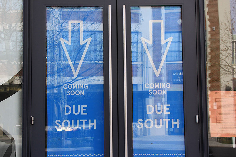
Coming in 2015, assuming all goes well? Banfield Pet Hospital at 4th and Tingey is the only retail offering announced, but in terms of food, there's The Brig beer garden at 8th and L, the Navy Yard Oyster Company and Due South at the Lumber Shed, Bonchon at 1015 Half Street, and Scarlet Oak at 909 New Jersey. Plus CBS Radio. And maybe Nicoletta? I would also imagine there will be some things we haven't heard about yet.
You can see full list and locations of all the neighborhood's eateries on my Near Southeast Food Options map.
And here is the year in big buildings and holes in the ground.
|
Comments (14)
More posts:
Restaurants/Nightlife, Retail
|
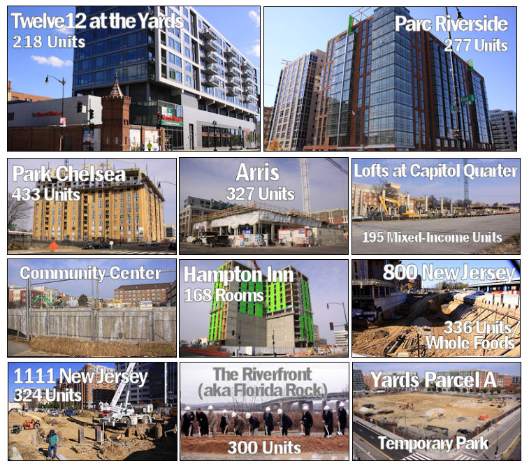
I'm trying a visual approach to rounding up the goings-on in 2014 (see my 2014 Year in Review: Restaurants and Retail post as well), but I'm not sure quite how to replicate it when it comes to the mammoth rundown of everything that has happened from a development standpoint this year in Near Southeast/Capitol Riverfront/Navy Yard Territory/Near Capitol Ballpark River Yards. 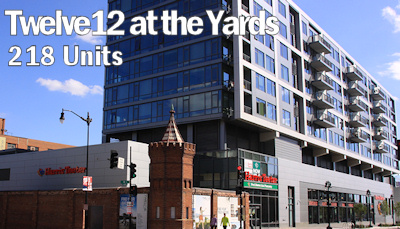

But I'm giving it a shot, and at least you can quickly see the current state of all of them. Click to go to the project pages.
Completed/All-But Completed
Vertical (or About to Be)
Just Getting Underway
And we should also use this space to bid a final farewell to Spooky Building 213, which came down (sloooooowly) to make way for Forest City's "Parcel A" plans:
What big buildings are looking to be starting in 2015? More residential at New Jersey and I, a Homewood Suites hotel at Half and M, hotel/residential/retail on 1st Street (and maybe its office component, too). Late in the year, there could perhaps be the start of the first condo project at the Yards and a movie theater. And who knows what else.....
|
Comments (2)
More posts:
Development News
|
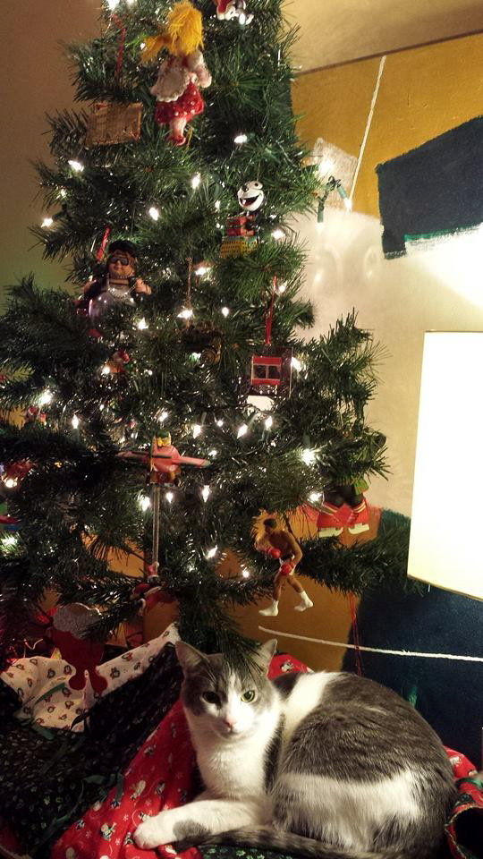 Cleaning out the tidbit hopper with some new and not-quite-so-new items of note. I imagine posting will be light in the next few days, but you never know.
 And so a Happy Holidays to all, from the entire staff of JDLand.com! Including from George, pictured at right.
* MOVIE THEATER LATEST: I mentioned this on Twitter last week, and appended it to my post on the subject, but I've heard kvetching from certain quarters that I did not specifically post anew that last week the DC Council passed the emergency versions of bills that among other things declare portions of the DC Water site at 1st and O as "surplus." This will allow the process of Forest City developing its movie theater there to move forward another step.
* VAN NESS KINDERGARTEN: I have been embarrassingly slow to report that earlier this month DCPS made known its decision that Van Ness Elementary will open next year with two kindergarten classes (in addition to PK-3 and PK-4). There will be 15 out-of-bounds spaces in these classes. The school system also released this FAQ about Van Ness's opening if you are just catching up.
* 100 M STREET SOLD: GlobeSt.com reports that Lionstone Investments and Hermes Real Estate have purchased the 100 M Street SE office building, with a source "pinpointing the purchase price at $78.9 million, or $324 per square foot." The building originally went up for sale back in 2012. This is the Gordon Biersch building, for those of you who don't look at address signs.
* METRO BALLGAME USE: WMATA's "PlanItMetro" blog took a deep dive into ridership patterns on Nationals game days at the Navy Yard-Ballpark and Capitol South stations. "Carrying an average of 11,000 riders to every Nationals home game, Metrorail maintained a 34% mode share to Nationals park in the 2014 season." There's also a good discussion of what the numbers may mean in the comments of this Greater Greater Washington post (along with chit-chat about the new Southeast Blvd.).
|
Comments (1)
More posts:
100 M, Development News, Metro/WMATA, Van Ness Elementary, DC Water (WASA), The Yards at DC Water
|
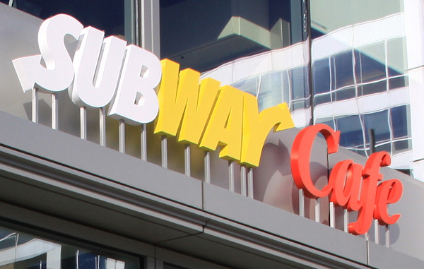
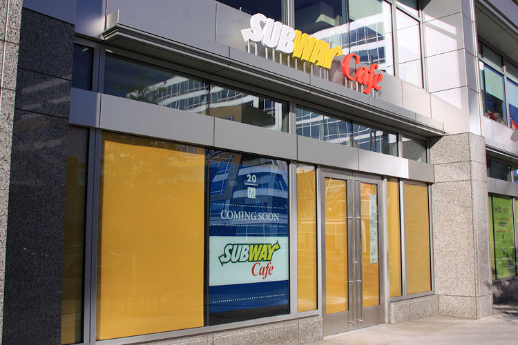 Reports from folks involved with 20 M Street say that the new Subway Cafe restaurant opened this morning at 10 am.
This is the "office building-oriented concept" from the company, with a full Subway menu but with a coffee-shop vibe, meaning that there's big cushy seats and premium caffeinated beverages in addition to the sandwiches.
If these reports are indeed true, has anyone ventured in?
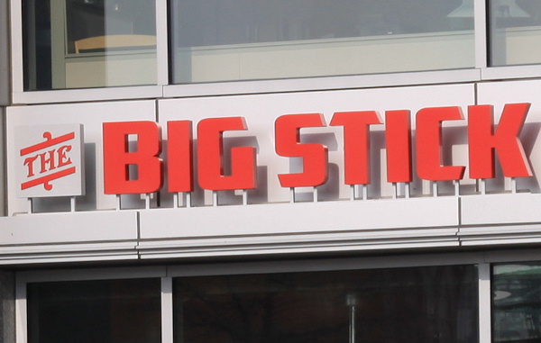
This is in the same building where The Big Stick opened last week. It is on the northwest corner of Half and M streets, SE, kitty corner from the west entrance of the Navy Yard Metro station and one block north of Nats Park.
|
Comments (2)
|
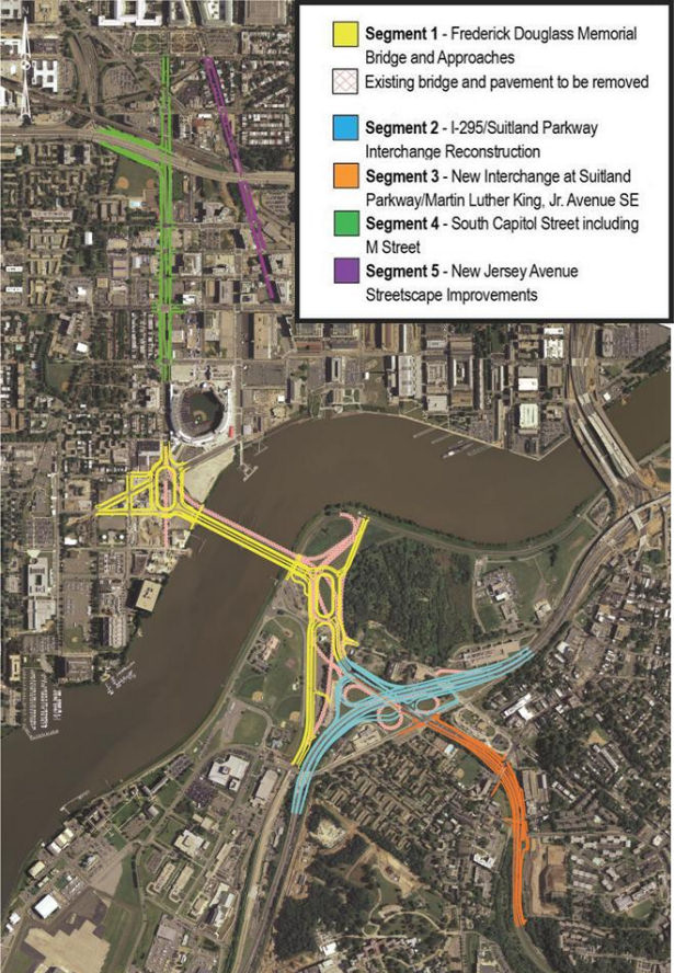
 If you are looking for some light Christmas reading, you can sit down by the fireplace with all 335 pages (plus appendices!) of the newest revision to the plans for reconfiguring much of South Capitol Street, including the construction of a new Frederick Douglass Bridge.
This document, technically known as the Supplemental Draft Environmental Impact Statement (SDEIS), describes the new "revised preferred alternative" (RPA) design that tweaks the original preferred alternative in the Final EIS released back in 2011.
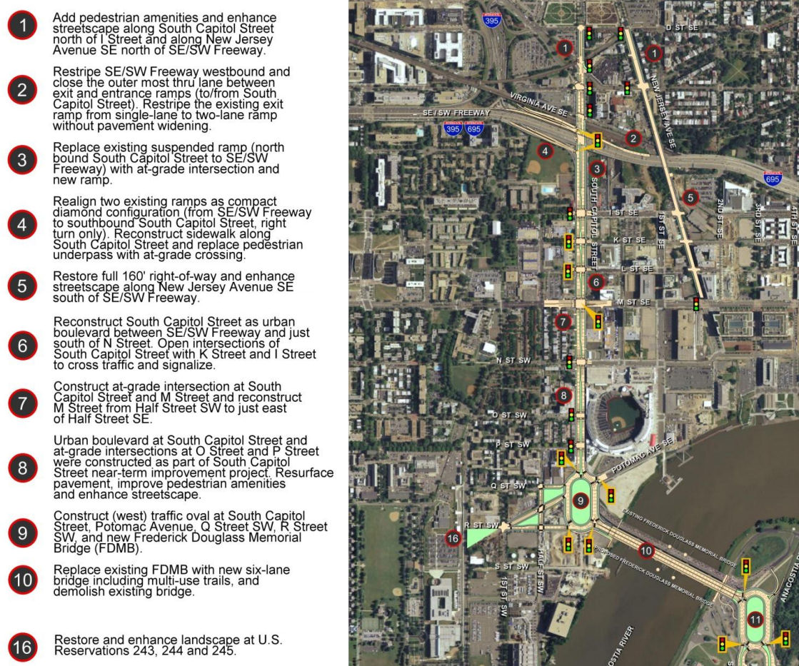
The bullet points for what the project plans are north/west of the Anacostia River are in the graphic at right (click to enlarge). The changes in this new RPA include:
* Changing the design of the bridge from a moveable span to a fixed-span bridge, which would save approximately $140 million in construction costs;
* Shifting the orientation of the new Douglass Bridge to an alignment parallel to the existing bridge, 30 feet down river, which avoids the need and lengthy process to acquire some land from Joint Base Anacostia-Bolling as well as a number of expensive relocation and reconstruction issues that a new alignment avoids (see page 2-91 of the SDEIS for details);
* A slight reduction of the size of the traffic oval on the western side (at Potomac Avenue):
* Replacing the previously designed circle on the eastern approach with an oval, located entirely in the DDOT right-of-way;
* And several other changes on the east side of the project that I will leave to others to discuss in detail. (See page ES-6 of the SDEIS.)
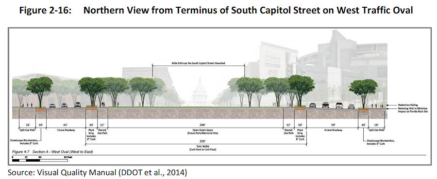 The initial design of the ovals and of the bridge itself were met with some consternation during this revision process. The SDEIS notes that in response to these concerns, DDOT has created a "Visual Quality Manual" for the project, which identifies design goals that are to "reflect the vision of providing a grand urban boulevard, which will be a gateway into the nation's capital, an iconic symbol of the District's aspirations in the 21st century, and a catalyst to revitalize local neighborhoods and the Anacostia Waterfront." (page 2-26).
 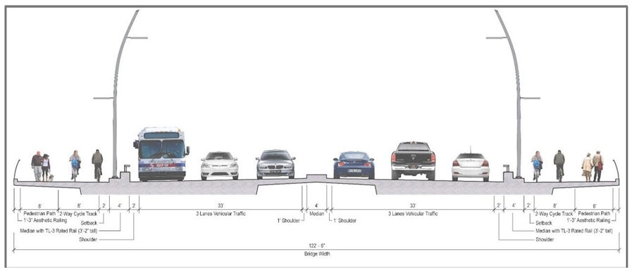 As for the bridge itself, the version in this RPA will support three travel lanes in each direction, along with 18 feet of bicycle and pedestrian paths on *both* sides of the bridge--an 8-foot lane for pedestrians and a 10-foot birdirectional bike path. (Enlarge the image at right to see that I'm not lying about the bike/ped stuff.)
And the design of the bridge is to "make its primary aesthetic impact through its position (alignment), and the shape and sizes of its structural elements" and is to " aesthetically appear to be part of a continuous urban corridor." This includes the avoidance of "using elements, solely for aesthetic effect, which do not contribute to the support of the bridge." (page 2-28)
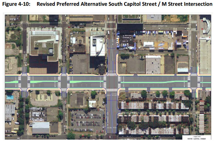
Plans for the reconfiguration of South Capitol Street as a "grand urban boulevard" have all along called for changing the intersection of South Capitol and M streets to an "at-grade intersection" (page 4-79), which would also mean that K and L would have signalized four-way intersections with South Capitol, unlike today. The wide median seen south of N would be established on the north end of the street as well, now all the way to D Street SE in the RPA. Also changing in this new plan are a few new left-turn options at I Street SE/SW and L Street SE.
 Revisions have also been made to the ramps from South Capitol Street to I-395 and I-695, but the basics from the original plans remain, most notably the demolition of the existing suspended ramp from northbound South Capitol to the SE/SW Freeway.
Even with the revisions made to cut the costs of the new Douglass Bridge, this isn't a cheap project. The five phases together are anticipated to cost over $1 billion, with Segment 1, including the new bridge and traffic ovals, estimated at $480 million. The "grand boulevard"-izing of South Capitol Street is estimated at $153 million, and planned streetscape improvements to New Jersey Avenue between D and M streets SE at $42 million, plus another $358 million in east-of-the-river improvements (page 2-11).
Worn out yet? I sure am! (I've mostly lost track of how much of this is truly even "new" news at this point.) But perhaps you can regain your strength by Jan. 22, 2015, when the public meeting on this SDEIS will be held from 6:30 to 8:30 pm at Matthews Memorial Baptist Church Fellowship Hall, 2616 Martin Luther King Ave., SE. The public comment period is running until Feb. 2. DDOT is also still amidst the design/build proposal process, with proposals expected sometime in the spring.
The SouthCapitolEIS.com web site is now focused mainly on this SDEIS, of which clearly I've just scratched the surface; you can slog through my piles of posts on all of this over the years for the historical rundown.
UPDATE: Here's the WashCycle take on the latest plans, from a bike/ped perspective.
|
Comments (5)
More posts:
Pedestrian/Cycling Issues, meetings, M Street, South Capitol St., Douglass Bridge, Traffic Issues
|
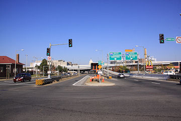
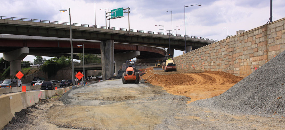
 DDOT announced that today (Dec. 22) they have opened Southeast Blvd. between 11th St. SE and Pennsylvania Avenue at Barney Circle.
Considering it looked like this nine days ago, the pedal must have been put to the metal.
Anyone want to report from there? I'll be interested to see how the signalized section at 11th Street handles the presumed new influx of east/west traffic.
The planning project to come up with concepts for how the road could look and function in the future continues.
UPDATE, 9:15 PM: Dark? Rainy? What a perfect time to try out a new road! I was coming home a little while ago on the SW/SE Freeway from Virginia, so decided to follow them there new signs for "Southeast Blvd."
I crossed 11th Street at the bottom of the exit ramp from the SE Freeway, then drove east on the new road to the light/merge at Pennsylvania Avenue just before the Sousa Bridge, where I'd still be sitting if I hadn't decided to finally run the light after waiting and waiting and waiting. (The stretch of road that continues eastward under Barney Circle is not reopened, though there is line striping for a lane to eventually head that way, it's just blocked off.)
Then, after a fun reversing of course that involved doubling back via DC-295 and two of the new ramps to and from 11th Street SE/MLK Blvd., I went westward on Pennsylvania Avenue and took the exit "To I-395." That goes under Barney Circle as it used to, and eventually I returned to 11th Street SE at the new signalized intersection where I could have chosen to go straight to get onto the westbound SE Freeway.
Impressions? Hard to tell in the rain. The MC Dean folks were out working on the signals, there's still a lot of cleanup work going on in the median, and a lot of heavy construction work is still in evidence on the eastern end by Barney Circle.
But if the city wants to rake in the dough, they'll set up speed cameras to enforce the SPEED LIMIT 30 signs that I LOL'ed at as I drove past them. Call it a "Boulevard" or call it a limited-access divided highway, but it is not a streetscape that screams 30 MPH.
(Photos will have to wait until the sun is actually out.)
UPDATE, 12/23: Via my very poorly paid stringer (Mr. JDLand), one shot of the now-uncovered signage for Southeast Blvd. eastbound on I-695/SE Freeway.
|
Comments (0)
More posts:
Southeast Blvd., Traffic Issues
|
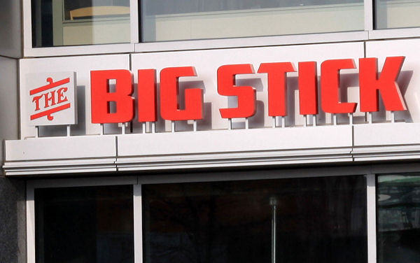 Word has filtered my way that Justin Ross's new venture The Big Stick is opening for business at 5 pm today, Dec. 18, in the ground floor of 20 M Street on the northwest corner of Half and M, SE.
 Justin tells me that it will be a limited menu for the first few days, and of course there's always some kinks to be worked out, but open is open. As we've found out, the menu will be centered around a beer-and-sausages lineup, with other European-type offerings as well.
Believe it or not, this is the first new (non-temporary) retail establishment to open on Half Street, SE since the revival of Near Southeast began in the late 1990s. If you had told me when the announcement of the site choice for Nats Park was made in September 2004 that it would take a decade to see the opening of just one restaurant on Half Street, well, it's fair to say I would not have believed you.
If you go, give a report in the comments.
|
Comments (7)
|
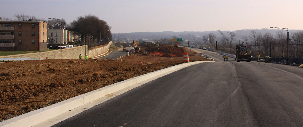
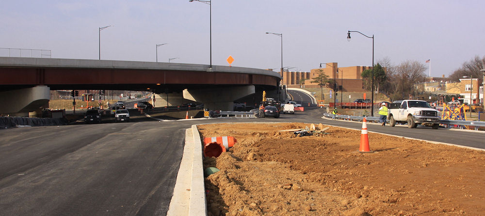
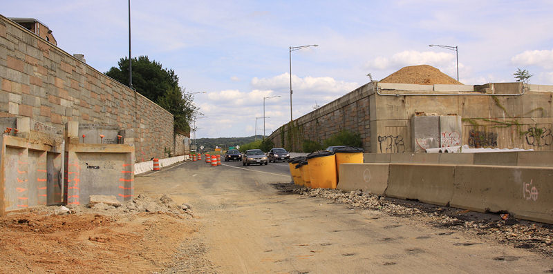
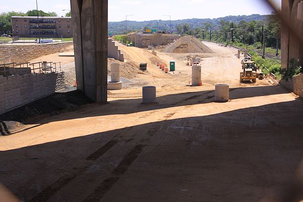
 I finally got my lazy self over to 11th Street with my camera this past weekend, and got quite the view of the soon-to-arrive Southeast Blvd., the reconstituted road between Barney Circle and 11th Street that runs along the path of the old sunken east end of the Southeast Freeway.
 A kind official, taking a wild guess at who that old lady shooting photos of construction might possibly be, guided me in for a quick peek over the crest of the hill, eastward toward Barney Circle:
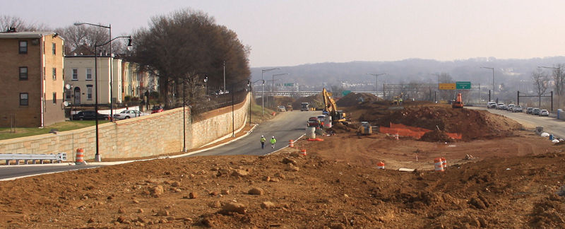
The new road will be two lanes in each direction, separated by a fair amount of non-road area, as you can see. At the new signalized intersection with 11th Street, the lanes align with the new ramps to and from the Southeast Freeway. Here's what the approach to 11th Street looked like in 2012, when the freeway still ran beneath 11th, along with the similar-but-higher-up view now. (Click to enlarge, and use the massive freeway pylons and flyover to orient yourself, especially in terms of the vertical change.)
As I have written about previously, there has been a fair amount of consternation over this road, both in terms of what some people feel is a rush to get it reopened along with much unhappiness when DDOT unveiled its initial concepts for the road's long-term design. The Office of Planning has since been working on a new set of designs to better meet a goal of reintegrating this area with the surrounding neighborhood, and last week there was a public meeting to go over these concepts, seen below and laid out in detail in the presentation slides.
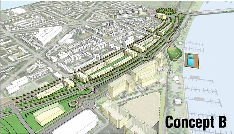
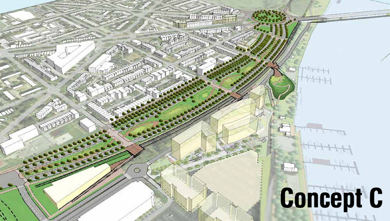
When comparing these concepts to the road about to open, you can see that the general layout of the traffic lanes and available space are the same, though Concept B has just one lane in each direction just one new two-lane boulevard heading eastward while A and C have two lanes in each direction (UPDATED to fix how B is characterized). (And bike lanes! There are bike lanes!) However, all three would build up the boulevard so that it would become level with L Street, and would then allow 13th, 14th, and 15th streets to intersect with the boulevard for both vehicular and pedestrian traffic.
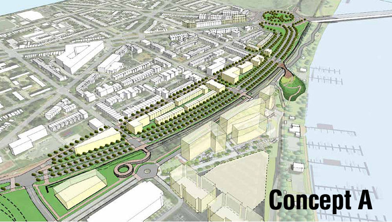
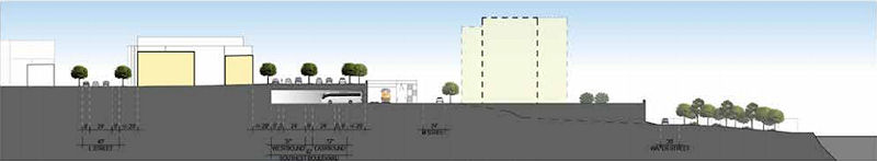 At right is a side view showing the proposed elevation for Concept A, running from L Street at left over to the train tracks and then down to the river.The CSX train tracks that run to the right of the road's footprints prevent further connection of these streets to M Street and the river, but there could be pedestrian bridges built to bring people across the tracks. (Note that all three concepts show the position of the planned 1333 M Street residential project just south of the boulevard.)
 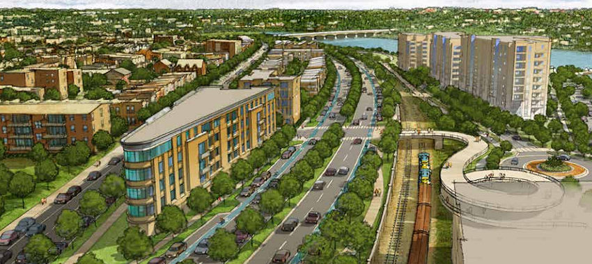 Two of the designs call for development within the huge median, either of low-rise multi-family buildings or townhouses or some combination thereof (at right is a rendering of the Concept A vision). The third design leaves it as a wide-open park space. And two of the three plans show the parking beneath the boulevard for buses that seems to be a requirement from DDOT's point of view.
I'm not going to go into great detail about what was said at the meeting--you can browse the presentation slides and read Capitol Hill Corner's report, which includes the many concerns of nearby residents, especially the ones who don't have much interest in connecting L, 13th, 14th, and 15th to this road.
At this stage, these truly are just concepts. There would next need to be a feasibility study/traffic flow analysis done by DDOT, an undertaking that has no timetable. There is also the issue of this land having been turned over to the city by the feds with the requirement that it be used for "transportation purposes," which raises questions about whether plopping residential buildings in the middle of it all would be an issue.
In the meantime, the new version of this road should open early in 2015.
Here's one more before-and-almost-after, looking eastward from down in the depths back in 2012 (left) and then an expanded version of the current view. Use the apartment building and retaining wall at left to orient. The embankment in the median in the "before" photo is the remnant of the ramps from the old 11th Street Bridges to and from RFK.
|
Comments (6)
More posts:
Southeast Blvd., Traffic Issues
|
 A press release today gives official details on the SPECTATOR PLAZA PRESENTED BY GEICO that is going to be set up at the Fairgrounds on Half Street during the hours leading up to the NHL Winter Classic® at Nats Park on Thursday, Jan. 1.
From 9 am until 1 pm, the Fairgrounds "will transform into a hockey and entertainment festival" with "live musical performances, interactive hockey-themed attractions, prizes and giveaways, food and beverages and retail tents with an extensive selection of of officially licensed 2015 Bridgestone NHL Winter Classic® merchandise and collectibles."
The event's sponsors are definitely pulling out all stops for the Fairgrounds offerings. I started to include the highlights, but I got worn out at the length and breadth--so read the press release to find out what is being offered by Bridgestone, GEICO, Reebok-CCM, Oscar Mayer, Honda, Enterprise, McDonald's, Miller-Coors, York Heating and Air Conditioning, Ticketmaster, AMP, and various other NHL-related offerings.
It's all free and open to the public. And then there's the game itself, between the Caps and the Blackhawks, at 1 pm.
|
Comments (4)
More posts:
winterclassic
|
 I could blather on in some kind of forced introduction about how the weatherman sold my camera and me a bill of goods this weekend ("mostly sunny," eh?), and how the low sun and weak light and wispy clouds made for less-than-stellar images, but instead let's just jump in.
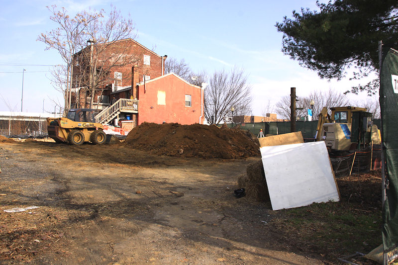
We'll start with the photo at right, which shockingly reveals that dirt is actually being moved on the northwest corner of 8th and L, where the beer garden now known as The Brig has been planned for such a long time. Clearly work is in the very early stages, but that's a nice change from no progress at all. It's supposed to open in the spring.
Continuing the tour....
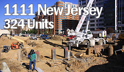
Digging continues at the 1111 New Jersey apartment project (above left), with the shoring at far left helping to give a sense of how far down they've gotten so far. (Spoiler: they have a long ways left to go.) And at the Capper Community Center Building House (above right), the foundation on the south end of the site along L Street is now a pretty sizeable structure.
It's hard to get a decent shot of the Lofts at Capitol Quarter construction, because the building is so long, though the wide open space of Nats Lot W helps. Vertical construction continues at the far east end, at 7th Street, while the western end waits its turn. Here's a big version of the latest image, to make it easier to see. (But remember, you can click on all photos to pop up larger versions.)
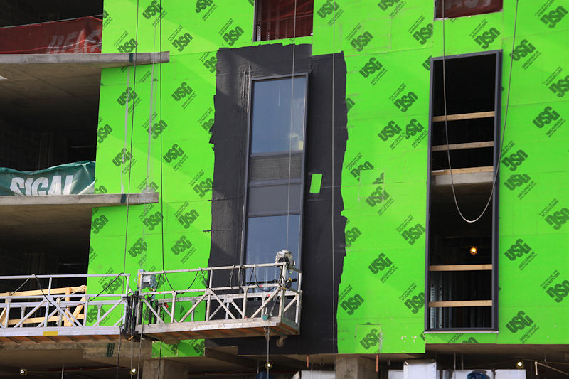
From there I wandered to the Yards (after rejoicing that the Hull Street Gate to the Navy Yard was closed, so I was able to take photos of the Lofts construction without hassle). The Arris apartment building is now getting its second floor, from south to north, as seen in the below left shot from the corner of 4th and Water. And a different sort of progress is visible a few feet away, in the windows of the northwest corner of the Lumber Shed.
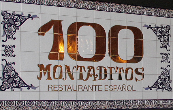
Not pictured is the lunch stop I made at 100 Montaditos, mainly to watch Mr. JDLand's continued march through the menu.
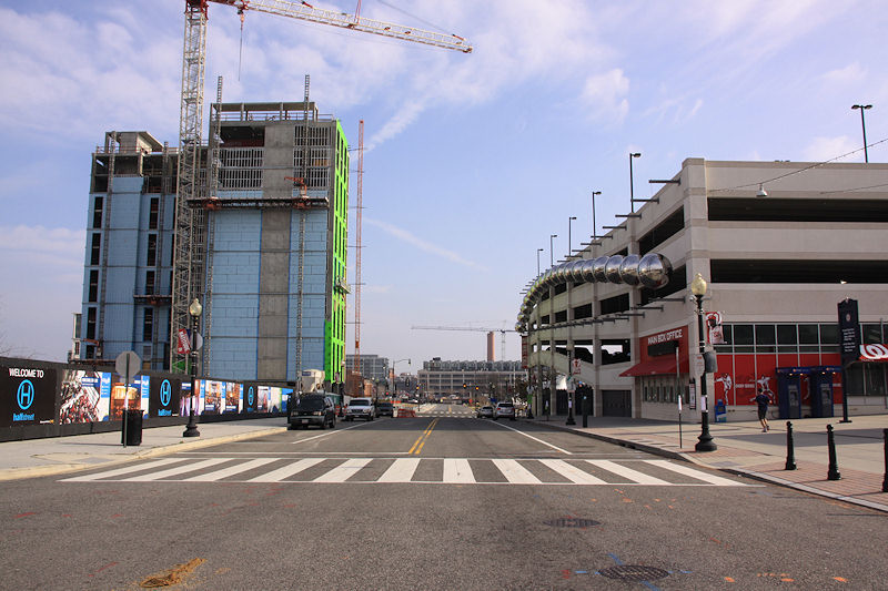

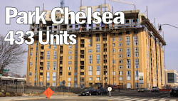
Meanwhile, the Hampton Inn at 1st and N (above left) continues to stand all but alone (I find myself thinking of it as Near Southeast's grain elevator). I also think I managed to capture a construction milestone when I spied its first installed windows. And, up at New Jersey and I, the Masonry Marathon continues at the Park Chelsea (above right), though it does look like that phase may not last too much longer.
There's one other batch of progress photos I took on Saturday, but you're just going to have to wait a bit longer for those.
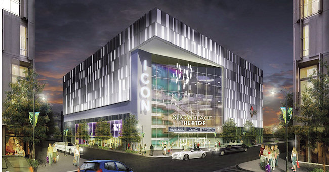 A DC council hearing on Thursday afternoon shed some light on the current status of Forest City's planned 16-screen luxury movie theater on property near 1st and O Streets, SE, a development which has been stalled for nearly a year during the hunt for a suitable location to move a portion of the DC Water operations currently housed at the site.
The good news for those tapping their toes waiting for the project to get started is that city officials testified that land is under contract in Prince George's County that would house DC Water's fleet operations, and the sale is expected to close in the first quarter of 2015.
While the fleet ops footprint at 125 O Street does not perfectly match the theater footprint, it was indicated that between the Prince George's site, the rest of the O Street site, and a potential interim site controlled by Forest City nearby, there would be the ability to shuffle DC Water's needs enough to clear the way for construction of the theater, which Forest City wants to get started by the end of 2015. (Apparently there is a looming end-of-2017 deadline in the letter of intent with Kerasotes Showsplace Theaters to get the project completed.)
So, assuming that the purchase of the PG County property takes place, and assuming that the DC Council approves the emergency legislation to declare the DC Water site as surplus, and assuming that there are no hitches in the move of DC Water's fleet operations, the theater may in fact be inching toward getting underway. (Though that's a lot of "assuming," especially when dealing with municipal government--but at least the fleet operations move already has its funding.)
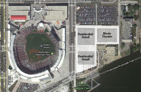 However, the horizon isn't quite so clear when it comes to getting DC Water off two additional parcels on the site, where Forest City plans 600 residential units in two buildings along with 35,000 square feet of ground-floor retail. The agency's customer care and sewer services operations currently located there need to be moved somewhere within the city limits, and these days there are precious few industrial-type locations to choose from.
 A suitable location has been identified, and it just so happens to be the trash transfer station on W Street in Brentwood that has long been a thorn in the side of residents. However, talks between the city administrator and the station's owner apparently didn't get very far, and so Ward 5 councilmember Kenyan McDuffie has (again) submitted a bill to authorize the use of eminent domain to take control of the site if city officials feel that no agreement can be reached. (At-large councilmember and former Ward 5 rep Vincent Orange, in attendance at the hearing, spent much time warning about possible litigation over such a move, how long that would tie things up, how the lack of spelled-out funding for the acquisition of the site could tie things up, what a bad idea it is to not be planning non-industrial development for the site, etc. etc.)
In other words, the theater portion of the project seems to be lurching towards being a "go," but the residential/retail phase still needs a lot of massaging.
The emergency legislation should come up for a vote at next week's council session.
(And I'll note, as I always do, that DC Water will not be completely departing the site--the main pumping station in its historic structure certainly isn't going anywhere, and the agency is working on plans to move its headquarters into new construction on top of the O Street Pumping Station building on the southeast portion of the property.)
|
Comments (2)
More posts:
Development News, The Yards at DC Water
|
 * M STREET CLOSURE: DDOT has put out the word that M Street SE between 8th and 11th will be closed on Saturday, Dec. 13 from 6 am to 9 pm, weather permitting, to complete final surface paving and striping between 10th and 11th.
 * CSX OUTREACH: There may be a lawsuit pending, but that hasn't stopped CSX from giving their Virginia Avenue Tunnel web site a big makeover, and also rebranding the existing Twitter account as @VATNews. The web site has all sorts of new sections and documents, though I would imagine Opinions Differ in some quarters about the contents.
* METRO PAYMENT PILOT: Navy Yard-Ballpark is one of the Metro stations that's part of WMATA's Payment Pilot program, testing out the "secure fare payment system of the future" that will allow the use of NFC-equipped credit cards and smartphones. So, if you've seen a shiny new fare gate being installed at the station lately, this is why. The program is expected to start in January, and you can still apply to be a tester
* BOATHOUSE EXPANSION: (Boats are transportation, right?) The Hill Rag reports that there are plans underway to renovate facilities along Boathouse Row, the stretch of marinas and buildings along the west side of the Anacostia between the 11th Street and Pennsylvania Avenue bridges. The Historic Anacostia Boating Association outlined for ANC 6B last month a proposed facility with a 228-slip marina, a pier for water taxis, and a boat ramp, along with other outdoor activity space. Fundraising is apparently now underway.
(And of course I'm sure you already read my post from yesterday about the Circulator's planned extension of the Navy Yard route into Southwest.)
|
Comments (1)
|
 We're well into the holiday season, and there are some events this weekend that may be of interest, in between your hall-decking and jolly-making.
PARCEL MARKET: From Friday, Dec. 12 through Sunday, Dec. 14, Canal Park will be the home of the Parcel Market, with a large tent showcasing offerings from independent vendors, a food area, live music from local artists, and an "interactive art installation." Wares for sale will range from fashion to jewelry and accessories to "home enhancements" to other gifts. Food will include offerings from Bluejacket, Ice Cream Jubilee, Dirty South Deli, Undone Chocolate, Teeny Pie, and Maketto. The market runs from 5 to 9 pm on Friday, Dec. 12, noon to 9 pm on Saturday, Dec. 13, and noon to 5 pm on Sunday, Dec. 14. See the web site for more information.
TRUCK MARKET: If you want more pop-up holiday marketing options, the Yards is having its Fashion Truck Market this weekend as well, from 11 am to 6 pm each day in front of VIDA at 4th and Tingey, SE. Trucks expected to be in attendance include Urban Pearl, Tin Lizzy, Street Boutique, Strut Truck, Charm City Mobile Boutique, The Pink Armoire, and Go Go Retread.
SANTA PHOTOS: The Waterfront Church is holding a "Pictures with Santa" event on Friday, Dec. 12, from 5 to 9 pm at the Courtyard by Marriott at 140 L St., SE. Each family will receive one 5x7 photo and a digital copy by e-mail, and there will also be cookies, hot cocoa, stories with the seldom seen Mrs. Claus, and more. See the Facebook event page for more details.
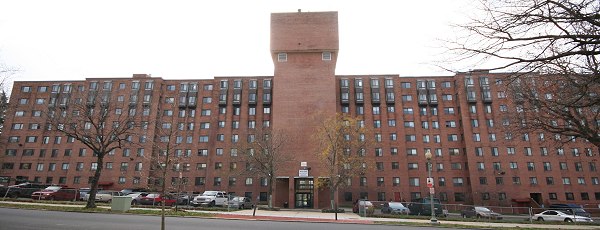
CAROLING: A resident with the urge to sing has organized an evening of neighborhood caroling on Saturday, Dec. 13, beginning at 4 pm, first visiting the Capper Seniors building at 5th and Virginia and then roaming the Capitol Quarter townhouses before ending up at the Canal Park ice rink by 6 pm. All levels of singing are welcome, Santa hats are encourged, and the lineup will include "inclusive, multicultural holiday tunes." See the Facebook page for more. Bonus points for not calling it wassailing!
SKATE AND SING: If the first batch of Saturday caroling isn't enough, you can then stay at Canal Park for their "Skate and Sing" from 6 to 7 pm.
(The photo shows a subset of my beloved set of Rudolph characters.)
|
Comments (0)
More posts:
Canal Park, Events
|
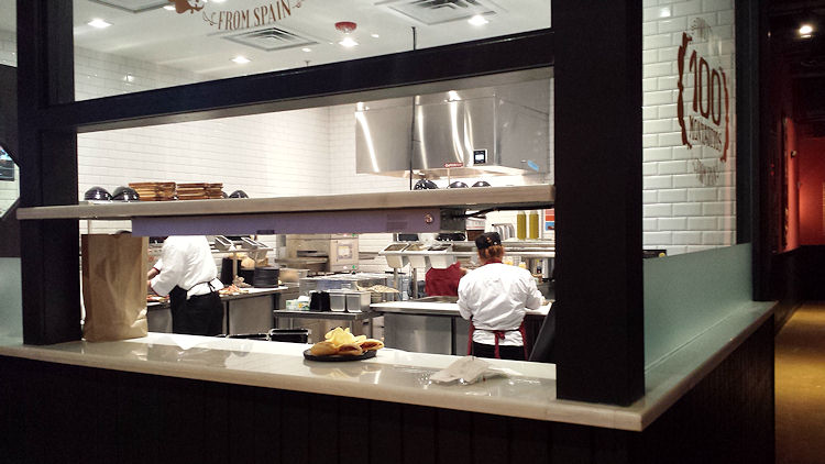
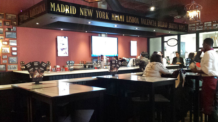
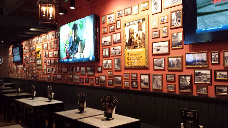
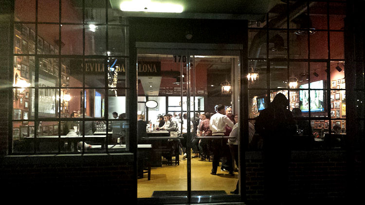
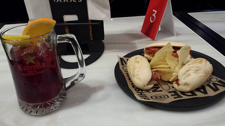 It's mere hours until the official opening of 100 Montaditos at the Boilermaker Shops in the Yards, but a lucky few (including myself) have gotten the chance this evening to step inside, check out the atmosphere, and sample the menu.
As part of its Grand Opening, there will be a "Dollarmania" promotion from Thursday through Sunday, Dec. 14, with all Montaditos sandwiches selling for $1. There will also be $2 beers and sangria and $3 premium beer and wine during the restaurant's first 100 days.
(In case you are wondering, at left is a sample of the Classic Sangria, along with sandwiches 07, 10, and 63.)
It will be open daily from 11 am to 10 pm.
If you are wondering about the whole "Montadito" thing, it is a small warm roll with options for a wide variety of ingredients, making it easy to eat in the very Spanish way of tasting lots of different recipes. But there's more than just the sandwiches on the menu, including salads, appetizers, and other Spanish items.
While I do not fancy myself a food critic, I will venture to say that the bread does indeed appear to be a highlight.
I did not have the Official JDLand Camera in hand, so these blurry cellphone shots will have to do until you visit yourself. And chances are you will run into Mr. JDLand, who is strategizing his approach to trying all 100 Montaditos.
|
Comments (11)
More posts:
100montaditos, Restaurants/Nightlife
|
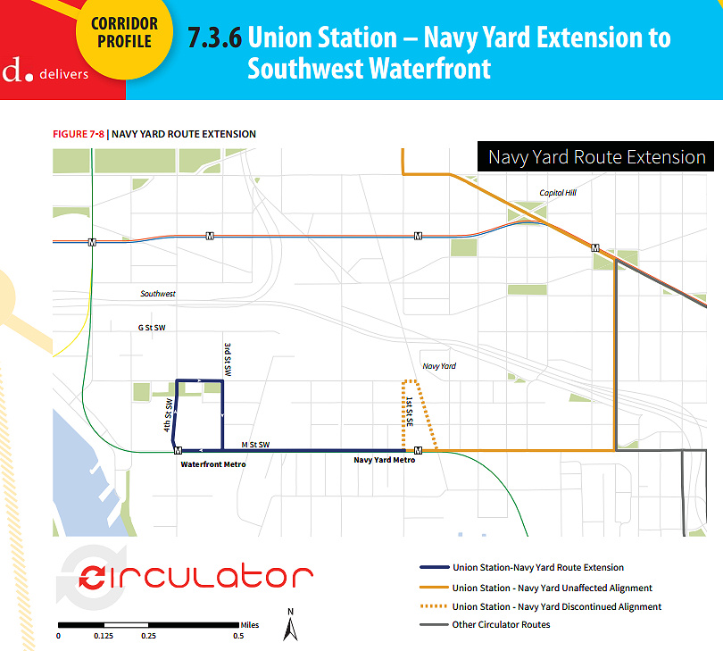 This week DDOT released its Final Circulator Development Plan, which among many other items calls for the extension of the Union Station-Navy Yard route along M Street to the Southwest Waterfront, sometime in the next two years, a plan that already has funding from the DC Council.
I asked about the timeframe for the new service, and DDOT informed me that it is proposed for the summer or early fall of 2015, pending the receipt of new buses, which have already been ordered and are expected to arrive in late spring or early summer.
Of the 1,041 people who took this year's survey, 44 percent identified the Southwest Waterfront as one of three top areas to which Circulator service should expand. This page from the report gives additional metrics on the proposed expanded route.
The plan also calls for a "Union Station-Navy Yard Schedule and Span Pilot Study," that would provide additional evening and weekend service to see if ridership demand and the increasing population around the Navy Yard Metro station supports making the changes long-term. DDOT tells me that this study is expected to begin in the first half of 2015. Currently the route runs until 7 pm weekdays in winter months, and 9 pm in the summer months along with Saturday service and extended evening/Sunday service for Nationals games.
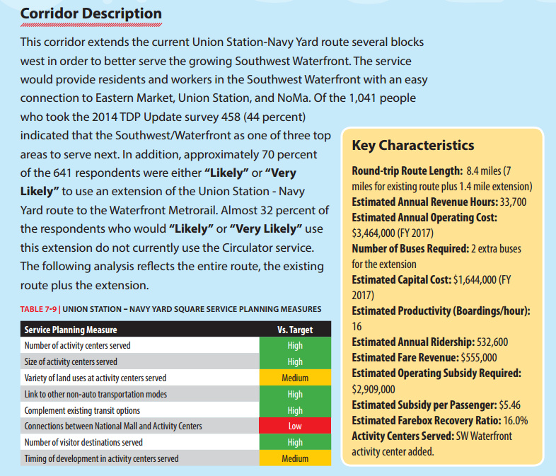 However, the report also recognizes that this line "in particular suffers from severe congestion around Union Station" and that DDOT is pursuing options to reroute this line.
One other nugget very deep in the 128-page report is that down the road, if and when the Convention Center/Southwest Waterfront line is reestablished, "additional analysis should be conducted to determine the potential of extending the Convention Center-Southwest route to the Navy Yard in lieu of extending the Union Station-Navy Yard route to Southwest."
Other service expansions on tap to appear between now and FY 2017 include the new National Mall route, a new National Cathedral-McPherson Square route, and three additional extensions: the Potomac Avenue-Skyline route to Congress Heights, the Union Station-Georgetown route to the Cathedral, and the Dupont-Georgetown-Rosslyn route to U Street and Howard University. In the distant future (FY2021-FY2024) there could possibly be a Dupont-Southwest Waterfront route.
Read the full plan for more detail than you probably ever wanted about the service and the expansion plans across the city, or just scan the Executive Summary if you're lazy. And if you want to receive updates without having to wait for me to get around to telling you, you can sign up for the DC Circulator Newsletter.
|
Comments (7)
More posts:
circulator, Traffic Issues
|
 A community meeting is on tap for Thursday (tomorrow), Dec. 11, to discuss the future Southeast Blvd., specifically the ideas emerging from the neighborhood study currently being spearheaded by ANC 6B, the Office of Planning, and DDOT.
The meeting is from 7 to 9 pm at Friendship Chamberlain Elementary School, 1345 Potomac Ave., SE, across from the Jenkins Row Harris Teeter.
Councilmember Tommy Wells will be there, and will be part of the discussion on how to best integrate into the neighborhood this road that will run from Barney Circle to the new intersection at 11th Street, SE, along the path of the old sunken portion of the Southeast Freeway.
A "temporary" version of the road is opening in early 2015, and residents have been concerned both about this becoming the de facto new version of the road, a feeling that came on the heels of the original new designs put forth by DDOT, that were basically replacing an old freeway with a new freeway, albeit it one that has a stoplight at 11th Street rather than just a free-and-clear approach to the Southeast Freeway. After those designs were released, with a push from Wells, the Office of Planning stepped in to help shepherd a neighborhood study--initial design concepts were unveiled back in August, and this week's meeting is to continue the process of refining the possibilities.
(And I am well aware that I have completely failed at keeping up with photographs of that area of 11th and of the work underway on the temporary road. All of the construction there, and the futzing with the traffic flow configuration of 11th Street while work continues around it, have made me very cranky about going over there to take pictures. Maybe this will finally spur me.)
|
Comments (4)
|
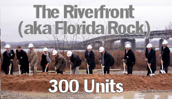
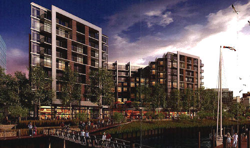
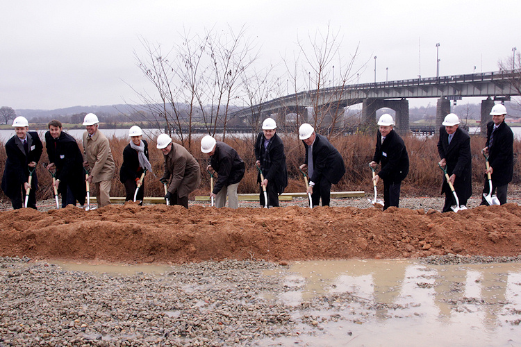 When you schedule an event for December, you have to be prepared for Mother Nature to be uncooperative, but a cold rain didn't stop the ceremonial groundbreaking for The Riverfront, the 300-unit apartment building that's the first phase of the redevelopment of the Florida Rock site on the west bank of the Anacostia River next to Nationals Park. (Unlike a lot of these events, this one actually came after the real breaking of ground, which started last month.)
The theme throughout the remarks by MRP Realty's Frederick Rothmeijer and David deVilliers of Florida Rock Properties was one of relief. Rothmeijer spoke of the trials of getting this phase--originally planned as an office building--approved by the Zoning Commission after MRP joined the project in 2011, and even mentioned Commissioner Michael Turnbull's broadsides about the design and the "four red doors" originally facing the ballpark (which was probably one of the most memorable diatribes I've seen in my years of watching these proceedings).
 FRP's deVilliers was even more relieved, as well he should be--he spoke of his initial discussions with the Office of Planning about redeveloping the site, which occured in 1994--a mere 20 years from there to construction! (I came in at about the halfway point, and have probably spent more time writing about the zoning ins and outs of this project than any other.)
Soon it was time to leave the warm, dry tent for The Flinging of the Dirt, and there were a lot of people with shovels in hand, as you can see above (and that's not even the full lineup).
It was not a prime day for photography, but I still have thrown together a quick gallery of shots from the day, including a few showing the current progress of the site footprint. It also occurred to me that this was the first time I've been inside the fences at the site--and it quickly becomes even more obvious than I already thought that this is one prime piece of riverfront property. And my Riverfront/Florida Rock project page has more renderings and photos, including nice ones from when the sun is actually out.
|
Comments (0)
More posts:
Development News, Florida Rock
|
 More notes about buildings and food:
* BANFIELD: The sign is now up, and "early 2015" looks on track for the Banfield Pet Hospital at Twelve12 on Tingey Street in the Yards.
* 82 I: The lot has been cleared of cars, a new fence has been put up and construction-related signage ("Hard Hats Required") has appeared on the northwest corner of New Jersey and I, where Graystar's 234-unit residential building appears to be ready to get underway the second its shoring/excavation permit comes through.
* FLORIDA ROCKIN': Excavation permits for the first phase of Florida Rock's redevelopment were approved a few weeks ago (hence the beginning of earth-moving), and as of Friday there's now an approved permit for the nine-story apartment building itself. The project's ceremonial groundbreaking is scheduled for tomorrow morning (Dec. 9) at 10 am--in a tent, thank heavens. Given that it took more than a decade to get this project to the digging phase, you can't blame developers MRP Realty and Florida Rock Properties for going beyond the normal speeches and ornate shovels: they are having a pig roast as well, after the ceremony until about 3 pm.
* 100 MONTADITOS: It looked very very close to opening last week, but there appears to have been some sort of fly in the ointment (or a Spaniard in the Works, if you will). The Yards tweeted this morning that it is opening this Thursday. Mr. JDLand is monitoring the situation closely. UPDATE: A missive from the Montaditos folks confirms the Thursday opening, with a "Dollarmania" promotion through Sunday, Dec. 14, with all Montaditos sandwiches selling for $1. There will also be $2 beers and sangria and $3 premium beer and wine for the eatery's first 100 days.
* WILLIE'S: Now offering brunch on Saturdays and Sundays from 11 am to 3 pm.
* OSTERIA MORINI: "Morini Mondays" begin tonight, with $10 pasta dishes.
|
Comments (7)
More posts:
100montaditos, 801nj, banfield, Development News, Florida Rock, Restaurants/Nightlife, morini, willies
|
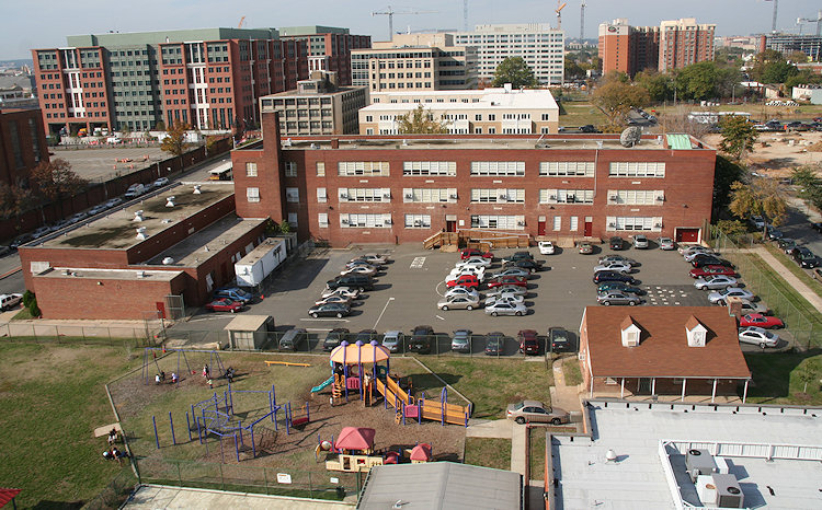
 Arriving in the inbox this morning is notice that a historic landmark nomination application has been filed for the Lincoln Playground Field House, one of the little red brick buildings just to the east of Van Ness Elementary on L Street, SE at the Joy Evans Recreation Center site.
It was built in 1934, and the application's "Statement of Significance Summary Paragraph" (page 10 of 30) is probably the best place to go for the explanation:
"The Lincoln Playground field house qualifies for listing in the National Register under Criterion C as a good example of the city's recreational buildings, designed according to an established building type during the tenure of Municipal Architect Albert Harris (1921-1933). The field house, designed in the Colonial Revival style followed a standard plan for field houses from that period. The Lincoln Playground field house remains a notable example of its type and is the product of Municipal Architect Albert L. Harris, whose work is closely identified with civic architecture in Washington, D.C. Furthermore, it is the only example of this type located outside of NW Washington -- in this case, located in SE -- the only example constructed entirely of brick, and the only example constructed on a "colored" playground during the period when Washington playgrounds were segregated. It is also one of two examples of this type constructed as a Civil Works Administration project.
 "The Lincoln Playground field house retains its integrity of location, setting, design, craftsmanship, materials, feeling and association. The field house is a purpose-built recreational structure of the District of Columbia; it was constructed according to an established design model and embodies characteristics illustrating the evolution of recreational architecture in the District; it stands on its original site; and it retains its original building massing and materials."
There's considerable additional detail in the filing, if you are looking for more. Note that the other two smaller red brick buildings surrounding the playground are not part of the application.
The application was filed by Kent Boese on behalf of "Historic Washington Architecture," the same group that prepared a similar application in 2011 for the Market Deli at 1st and L, which was eventually rejected.
This now goes through the city's landmarking process. The fact that this was filed at about the same time that the plans are going forward for renovating Van Ness Elementary right next door would seem to be more than a coincidence, but I have no background on this yet. Once an application is accepted by the city's Historic Preservation Office, the building becomes protected, and no building permits can be issued for the building until the Historic Preservation Review Board votes on the application.
(In case you're wondering, the overhead photo showing the building in question at lower right was taken in 2007 from the roof of the Old Capper Seniors building, just before it was demolished.)
|
Comments (4)
|
3238 Posts:
Go to Page: 1 | 2 | 3 | 4 | 5 | 6 | 7 | 8 | 9 | 10 ... 324
Search JDLand Blog Posts by Date or Category
Go to Page: 1 | 2 | 3 | 4 | 5 | 6 | 7 | 8 | 9 | 10 ... 324
Search JDLand Blog Posts by Date or Category