
|
| |||||||||||||||||||

|
Please note that JDLand is no longer being updated.
peek >>
Near Southeast DC Past News Items
- Full Neighborhood Development MapThere's a lot more than just the projects listed here. See the complete map of completed, underway, and proposed projects all across the neighborhood.
- What's New This YearA quick look at what's arrived or been announced since the end of the 2018 baseball season.
- Food Options, Now and Coming SoonThere's now plenty of food options in the neighborhood. Click to see what's here, and what's coming.
![-]()
- Anacostia RiverwalkA bridge between Teague and Yards Parks is part of the planned 20-mile Anacostia Riverwalk multi-use trail along the east and west banks of the Anacostia River.
![-]()
- Virginia Ave. Tunnel ExpansionConstruction underway in 2015 to expand the 106-year-old tunnel to allow for a second track and double-height cars. Expected completion 2018.
![-]()
- Rail and Bus Times
Get real time data for the Navy Yard subway, Circulator, Bikeshare, and bus lines, plus additional transit information. - Rail and Bus Times
Get real time data for the Navy Yard subway, Circulator, Bikeshare, and bus lines, plus additional transit information. - Canal ParkThree-block park on the site of the old Washington Canal. Construction begun in spring 2011, opened Nov. 16, 2012.
![-]()
- Nationals Park21-acre site, 41,000-seat ballpark, construction begun May 2006, Opening Day March 30, 2008.
![-]()
- Washington Navy YardHeadquarters of the Naval District Washington, established in 1799.
![-]()
- Yards Park5.5-acre park on the banks of the Anacostia. First phase completed September 2010.
![-]()
- Van Ness Elementary SchoolDC Public School, closed in 2006, but reopening in stages beginning in 2015.
![-]()
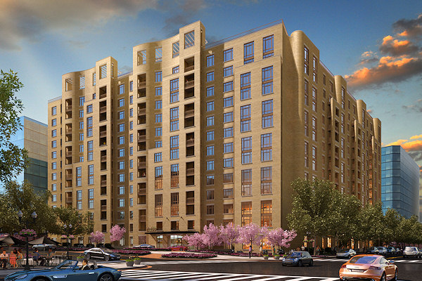
- Agora/Whole Foods336-unit apartment building at 800 New Jersey Ave., SE. Construction begun June 2014, move-ins underway early 2018. Whole Foods expected to open in late 2018.
![-]()
- New Douglass BridgeConstruction underway in early 2018 on the replacement for the current South Capitol Street Bridge. Completion expected in 2021.
![-]()
- 1221 Van290-unit residential building with 26,000 sf retail. Underway late 2015, completed early 2018.

- NAB HQ/AvidianNew headquarters for National Association of Broadcasters, along with a 163-unit condo building. Construction underway early 2017.

- Yards/Parcel O Residential ProjectsThe Bower, a 138-unit condo building by PN Hoffman, and The Guild, a 190-unit rental building by Forest City on the southeast corner of 4th and Tingey. Underway fall 2016, delivery 2018.

- New DC Water HQA wrap-around six-story addition to the existing O Street Pumping Station. Construction underway in 2016, with completion in 2018.

- The Harlow/Square 769N AptsMixed-income rental building with 176 units, including 36 public housing units. Underway early 2017, delivery 2019.

- West Half Residential420-unit project with 65,000 sf retail. Construction underway spring 2017.
![-]()
- Novel South Capitol/2 I St.530ish-unit apartment building in two phases, on old McDonald's site. Construction underway early 2017, completed summer 2019.
![Novel South Capitol]()
- 1250 Half/Envy310 rental units at 1250, 123 condos at Envy, 60,000 square feet of retail. Underway spring 2017.
![-]()
- Parc Riverside Phase II314ish-unit residential building at 1010 Half St., SE, by Toll Bros. Construction underway summer 2017.
![-]()
- 99 M StreetA 224,000-square-foot office building by Skanska for the corner of 1st and M. Underway fall 2015, substantially complete summer 2018. Circa and an unnamed sibling restaurant announced tenants.
![-]()
- The Garrett375-unit rental building at 2nd and I with 13,000 sq ft retail. Construction underway late fall 2017.
![-]()
- Yards/The Estate Apts. and Thompson Hotel270-unit rental building and 227-room Thompson Hotel, with 20,000 sq ft retail total. Construction underway fall 2017.
![-]()
- Meridian on First275-unit residential building, by Paradigm. Construction underway early 2018.
![-]()
- The Maren/71 Potomac264-unit residential building with 12,500 sq ft retail, underway spring 2018. Phase 2 of RiverFront on the Anacostia development.
![-]()
- DC Crossing/Square 696Block bought in 2016 by Tishman Speyer, with plans for 800 apartment units and 44,000 square feet of retail in two phases. Digging underway April 2018.
![DC Crossing]()
- One Hill South Phase 2300ish-unit unnamed sibling building at South Capitol and I. Work underway summer 2018.
![One Hill South Phase 2]()
- New DDOT HQ/250 MNew headquarters for the District Department of Transportation. Underway early 2019.
![New DDOT HQ]()
- 37 L Street Condos11-story, 74-unit condo building west of Half St. Underway early 2019.
![37 L Condos]()
- CSX East Residential/Hotel225ish-unit AC Marriott and two residential buildings planned. Digging underway late summer 2019.
![CSX East Residential/Hotel]()
- 1000 South Capitol Residential224-unit apartment building by Lerner. Underway fall 2019.
![1000 South Capitol Residential]()
- Capper Seniors 2.0Reconstruction of the 160-unit building for low-income seniors that was destroyed by fire in 2018.
![1000 South Capitol Residential]()
- Chemonics HQNew 285,000-sq-ft office building with 14,000 sq ft of retail. Expected delivery 2021.
![1000 South Capitol Residential]()


2751 Blog Posts Since 2003
Go to Page: 1 | 2 | 3 | 4 | 5 | 6 | 7 | 8 | 9 | 10 ... 276
Search JDLand Blog Posts by Date or Category
Go to Page: 1 | 2 | 3 | 4 | 5 | 6 | 7 | 8 | 9 | 10 ... 276
Search JDLand Blog Posts by Date or Category
If yesterday's news about the brewery coming to the Boilermaker Shops in the Yards wasn't enough, today I can pass along that the liquor licensing process looks to be getting started for Xavier Cervera's two upcoming locations in Near Southeast, the Canal Park Tavern planned for the pavilion at Canal Park and the Willie's Brew and Que sports bar also at the Boilermaker Shops.
Both have been added to the agenda for ANC 6D's ABC Committee next meeting, on Jan. 31 at 7 pm at King Greenleaf Rec Center. Hopefully at this meeting there will be some details on both places (seating capacity, hours, when they expect to open, general menu concepts, etc.).
With the Tavern expected to open along with Canal Park sometime this summer and WBQ probably not until late fall or beyond, this is a pretty early start to the ABC process, so don't get your taste buds primed just yet. But all evidence of forward progress is worth noting.
|
Comments (0)
|
 There hasn't been much said so far about the restaurant planned for the Boilermaker Shops at the Yards by the Birch and Barley/Churchkey team, but the Post's All We Can Eat blog posted some morsels today:
* The still unnamed venture will "contain a full-scale production brewery, a brewpub-like tasting room [...] and a 200-plus-seat restaurant."
* A head brewer has been hired: Megan Parisi, former lead brewer at the Cambridge Brewing Company in Massachusetts. And, as a fun side fact, Parisi used to play clarinet for the US Navy Band, right next door at the Navy Yard.
* "Barrel-aged sour beers" will be a major focus. A comparison is made to Belgium's lambic beers, which means I'll be camping on the doorstep (Lindeman's Peche is a personal favorite). Owner Greg Engert called it all "a giant experiment."
* The operation will "open in about a year."
The brewery's neighbors in the building at 4th and Tingey SE, as announced so far, will be an Austin Grill Express, brb ("Be Right Burger"), Buzz Bakery, Huey's 24-7 Diner, and Willie's Brue and 'Que sportsbar, which will be another option for drowning any Prince Fielder-related sorrows, though by the time these places open the Nats will have had a fabulous 2012 season and no one will remember any of the recent drama. Right? Right?
|
Comments (3)
|
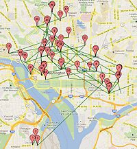 This is little more than an off-topic I-want-to-try-it exercise, but after reading JD Antos's latest crunching of the Capital Bikeshare trip data that came out last week, I decided to see what it would be like to map the movements of a particular bike.
 I picked bike W01000, for no reason other than I saw it while I was browsing through the tables and thought it looked like a nice round number--I make no statements as to how representative it is of other bikes, except that it was in the system for all of 2011, except for a few brief periods when it either didn't hit the rider lottery or was out for maintenance. (And I ignored trips less than a minute long.)
So, want to know where Bike W01000 went on December 1, 2011? Or July 4? Or my birthday? Or any day of your choosing? Take a look and see. Of course, the green lines for "trips" are just as-the-crow flies, and are not the actual routes taken by riders (since the bikes don't have GPS transponders THAT WE KNOW OF!!!).
There's also a table below the map that shows the trips broken out in order for that day, which is handy on days with a number of trips where sometimes the push pins on the map get piled up on each other. Also, note that some trip lines end without a push pin--that's because the pins mark the start of trips, and so if a bike got re-balanced to another station, that ride's endpoint will be pin-less.
You can also browse by month, but it's pretty spaghetti like.
This is quick-and-dirty, so there are probably bugs.
|
Comments (1)
More posts:
Pedestrian/Cycling Issues
|
I guess I'm not unhappy that there's not much to pass along right now, given the firehose of content sprayed from these parts last week. So, while we all wait to find out whether Prince Fielder is going to be a new neighbor, here's the best I can come up with:
* The Atlantic Cities writes a paean to the Yards and the Yards Park, noting that Washington "is finally getting a green waterfront to be proud of," after years and years of poor waterfront access throughout the city for residents.
UPDATE: I'll toss this in, since I'm short on content: a writer at the Hill is Home is bummed that the Lumber Shed is going to be enclosed for retail space (and Forest City's offices upstairs), and is taking a poll to find out who does or doesn't agree.
* Exterior work continues to wrap up at 225 Virginia/200 I, with the new parking deck at 3rd and I mostly completed. Visitors to the building will park on the deck's upper level, via an entrance on 3rd just south of Virginia, while staff will enter the deck's lower level on I Street; there is also employee parking in the building's basement. I imagine traffic on 3rd is going to get even more interesting when the building opens to three city agencies later this year.
|
Comments (1)
|
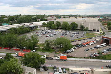
 From ground level, it's not especially easy to see (or photograph) the current state of Canal Park's construction--lots of fences, equipment, and bad winter sunlight, and the only above-ground action is hard to photograph through cyclone fencing. But on Thursday I got to see the progress from higher up, where not only is it easier to get a good overview of the site, but you can now see the outline on the southern block of both the plaza *and the ice rink*. (Shadows still wreaked some havoc, alas.) I added a number of these images to my Canal Park progress page, for your perusal.
As I worked on these, I got to thinking about some photos from high up in 1100 New Jersey many moons ago, when the surrounding landscape looked very different. A few have been sprinkled throughout the site, but I was a little embarrassed to find out I'd never put them in my Overhead Photos Archive, which has now been rectified, and you can see them here. They are from September 2004, so most of the old Capper buildings are still visible, and the USDOT and Capitol Hill Tower lots are just holes in the ground. (And there's one cool view of the buildings at the Yards that sure won't ever be replicated.) I paired them with shots from Thursday where possible.
Then I remembered all the photos I took from the top floor of 1015 Half Street during the BID's annual meeting last week (there were a bunch besides just the "majestic" one). Not exactly a trip down memory lane, but they're now posted as well.
At this point, with a deep breath, I ventured into the folder where I've been dumping my rooftop/on-high photos "to deal with later," and found:
 * A series of strangely blue pictures I took from the roof deck at Onyx in October 2008, just as the building was opening;
* Shots from 100 M Street taken at the BID's annual meeting on a dreary day in December 2008; and
* Photos from 55 M taken during the kick-off for Artomatic in May 2009. (Nyaah, nyaah, National Geospatial Intelligence Agency, I was taking pictures of you!)
For those of you who live and work in the "high-rise" buildings in the neighborhood, many of these views won't be anything exciting, and given the lack of new projects on the west end of the neighborhood, not really much has changed since the 2008-2009 shots. But now they're in the Permanent Collection, to be paired with more photos down the road someday.
If you haven't wandered through the overhead archive before, there's a ton of other photos, including the pictures from atop the Courtyard by Marriott taken from 2006-2010 that really highlight the demolition-and-construction that happened west of New Jersey Avenue. There's also a series of images taken from the roof of the old Capper Seniors building right before it was demolished in 2007, plus all manner of pictures of the waterfront taken from the ballpark's southeast viewing platform starting in 2007 (which I can't wait to update in a few months). And other locations, too.
Hope you find them enjoyable, especially on a Friday afternoon when you might happen to be looking for something to do other than work.
|
Comments (0)
More posts:
Canal Park, photos
|
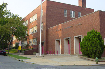 While there has been lots of news over the past few months about Near Southeast getting some of the amenities that it has lacked for a long time (restaurants, grocery), one service that the neighborhood continues to be without is an open elementary school within walking distance. DC Public Schools closed Van Ness Elementary at 5th and M SE back in 2006 because of a lack of school-aged children in the neighborhood thanks to the emptying of the Capper/Carrollsburg public housing project in advance of its reconstruction as Capitol Quarter, but kept the building in its inventory knowing that eventually the neighborhood would fill back up and a school would again be needed.
Fast forward a few years, and the neighborhood now has a number of families with small children, who get to look at unused Van Ness every day while sending their children across South Capitol Street to Amidon/Bowen Elementary in Southwest. So the Parents of the Capitol Riverfront organized themselves to advocate for getting Van Ness reopened, and put together a "delightful" public meeting with then-interim chancellor Kaya Henderson. But DCPS announced last March that the numbers didn't yet support the reopening of Van Ness, saying that it was most likely the school would not reopen before 2015.
But area parents have continued to try to find a solution, and when word got out a few months ago that the well-regarded School Within School at Peabody Elementary was looking to expand its program and would need a new and larger space, Near Southeast parents began to investigate what it might take to get SWS into the neighborhood, whether in the Van Ness building or in some other solution, perhaps even using the modular classrooms (i.e., trailers) that Capitol Hill Day School has been occupying at 5th and K during its building's renovation.
But today a statement from Henderson being sent out to various neighborhood mailing lists seems to put the kabosh on this movement. While the notion of using the CHDS trailers is "an interesting one," Henderson says that school system "already has too many schools that are too small to sustain themselves," and so it would be a "poor stewardship of the public's resources" to pay rent to put SWS in trailers or wherever if there are already a number of available facilities that could be used. Plus, those other facilities are located where placing SWS "could have an equally or potentially greater positive impact."
The statement doesn't specifically explain why Van Ness itself is not an option to house SWS, and perhaps someone who's been close to the many meetings that parents have apparently had with DCPS could explain that in the comments. It seems to still boil down to the neighborhood just not having enough students to support a school, whether it's SWS or a "normal" elementary school. Van Ness is currently home to some administrative offices, plus needs what has been rumored to be a couple million dollars in renovations to get it ready, and it does appear that DCPS is holding fast to its previous ruling that Van Ness won't be back in the system before 2015. But it's also not hard to imagine that neighborhood parents will continue to try to get a school, any school, as soon as they can.
|
Comments (0)
More posts:
Van Ness Elementary
|
 Uh oh, the old bat is bringing out the photo albums....
Yup, it's time for me once again to mention that it was on January 19, 2003 when I made my husband drive me around that neighborhood south of the freeway, which we rarely ventured into, so that I could take some pictures (without getting out of the car, of course), since I'd heard there were some plans to revitalize the public housing and also the areas right along the Anacostia River. (Yeah, right, that'll be the day, we said to each other.) I had no grand plans to launch an all-consuming project that would document what might be coming--I just felt like getting some photos.
 And now here we are, starting Year 10 of this.
I'm saving deep ruminations on the journey until (if?) I successfully cross the First Decade finish line, so for now I'll just say my heartfelt thanks to everyone who reads, comments, passes along information, and provides assistance, because there's no way I'd still be here without all of you.
And I think folks should prepare themselves for the coming avalanche of posts and photos, because 2012 looks to be Near Southeast's busiest year since the golden Nationals Park construction/opening era.
(I need a nap already.)
|
Comments (5)
More posts:
JDLand stuff
|
There's been a whirlwind of "big" posts as 2012 has gotten underway, so here's a few items I've neglected: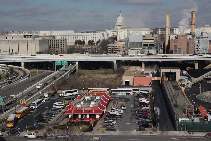 * New Views: While I was at the BID's meeting, I took the opportunity to get some photos of the inside of 1015 Half Street, plus one shot looking out that shows not all views of the U.S. Capitol dome are, by default, "majestic." (Alternate caption: "Would you like fries with that democracy?") One Twitterer suggested that the rock circle at far right, on the Capitol Hill Power Plant's property, is where the ritual sacrifices are held. So, if you see the Congressional leadership skulking around I Street late at night....
* BID Reports: At its annual meeting last week, the Capitol Riverfront BID released both its annual report and the "Green Print of Growth" study they commissioned, which showed that the portion of the Green Line from the Navy Yard station to Georgia Avenue/Petworth has become over the past 10 years a "regional leader" in "capturing highly-prized young professional housing demand and high-wage employment," just nosing ahead of the Orange Line's Rosslyn-Ballston corridor and outstripping the Red Line's stretch in Northwest DC when looking at household growth in the 18-to-34 demographic. The report also says (shocker!) that "the analysis conducted suggests that the Capitol Riverfront--given its Green Line access at the Navy Yard Station and its significant amount of development capacity--is among the most competitive locations in the region for households, companies, and retailers."
You can read the executive summary, the complete version, and the slides that RCLCO's Shyam Kannan displayed during his presentation at the meeting. (Additional coverage from WBJ and CapBiz.)
This was followed by a commentary by BID chief Michael Stevens in Monday's Washington Post/Capital Business in which he argued: "It's time for business and residents to recognize and acknowledge a new reality: The Green Line corridor has emerged as a powerful economic engine for the District and the region. And it's time for Metro, the city and the private sector to invest more in the area to support this growth trajectory."
UPDATE: Also coming out of the annual meeting, the BID voted to change how it handles its taxes, which still needs to be approved by the city council to take effect. (WBJ)
* On a parallel track, though it doesn't have to do with Near Southeast specifically, the Post's Steve Pearlstein wrote over the weekend about how signs suggest "that the next phase of growth in the Washington region will focus on these underdeveloped areas in the eastern quadrants of the District and some of the region’s older, closer-in suburbs."
* New Views: While I was at the BID's meeting, I took the opportunity to get some photos of the inside of 1015 Half Street, plus one shot looking out that shows not all views of the U.S. Capitol dome are, by default, "majestic." (Alternate caption: "Would you like fries with that democracy?") One Twitterer suggested that the rock circle at far right, on the Capitol Hill Power Plant's property, is where the ritual sacrifices are held. So, if you see the Congressional leadership skulking around I Street late at night....* Artomatic Decision: The Post's Jonathan O'Connell tweeted this morning that Artomatic is headed to Crystal City. Organizers had been looking at both 1015 Half and the old National Geospatial Intelligence building at 101 M.
* CSX: The Virginia Avenue Tunnel web site now has public comments on the Nov. 30 "concepts" meeting, as well as the transcript of that session. Comments are still being accepted through the end of January.
* Protest: A reader who lives on 7th Street just across from the Marine Bachelor Enlisted Quarters has passed along that the neighbors on that block have decided to lodge a formal protest at the liquor license renewal of the 7th and L Market, thanks to having witnessed multiple examples over the past few years of public drunkenness and urination, loitering, littering, drug dealing, indecent exposure, and even one proposition by a prostitute. There's no doubt that that market is a bit of a throwback to the neighborhood's previous incarnation; it will be interesting to see how this proceeds, and also how the eventual arrival of the National Community Church on that block changes (or doesn't change) things.
* AIIIEEEE!: Don't have enough to worry about these days? How about rising sea levels inundating areas along DC's waterfronts? (WaPo/Capital Weather Gang)
* Neighborhood News Roundup: The Post's new Where We Live real estate blog has a rundown and photo gallery today on the latest progress on the development and food fronts in Near Southeast. If it all looks and sounds strangely familiar, that shouldn't be a surprise.
|
Comments (2)
|
 When word gets out that some new data set has been posted in an easily digestible format, I am pretty much helpless before its power. So I spent the Friday night of a holiday weekend knee deep in Bikeshare Trip History Data, culling out the
 You'll choose whether you want to see inbound or outbound data for the dock at New Jersey and M in front of the US Department of Transportation or the dock at 1st and N just across the street from Nationals Park. Optionally, you can filter by month of the year or even a specific date. (Tip: green means starting point, red means ending point.) Then there are tables beneath the map that show, for your chosen data set, the number of registered vs. casual users and the top usage days.
It shouldn't be surprising that the docks at the Eastern Market Metro Station and at 4th and M SW (Safeway) are very popular destinations/starting points for the Near Southeast docks, but I'm surprised to be surprised that the top dock for New Jersey & M trips in both directions is Union Station.
Capital Bikeshare is apparently going to release this data quarterly, so I plan to keep the map/search app updated as long as there's data coming. And there should be a new dock in the neighborhood sometime in 2012, at 3rd and Tingey.
PS: Speaking of Bikeshare, read this fascinating piece on one man's transformation into a bicycling commuter thanks to Capital Bikeshare being a "gateway drug." (Any full disclosure I need to make about this link should be pretty clear in the second and fourth paragraphs.)
UPDATE: After reading this great post by JD Antos with scads of analysis of the city-wide Bikeshare trip data, I dug into my tables a little more closely to clear out "rides" of less than 60 seconds' duration at a single station and found that I had inadvertently doubled the records where the both start and stop stations were the two Near Southeast stations. (Argh.) Not a huge change in the data (about 1,250 records out of nearly 30,000), and most likely the data people would have been looking at today would have been for the trips outside of the neighborhood, but I have now cleaned out that boo-boo. And I've deleted 167 sub-60-second trips at a single station as well, just because.
UPDATE II: I added both Union Station and the new dock just north of the freeway at 3rd and G to my Live Transit Data page, which includes a table of the closest docks and their capacity status, along with other live data like Next Train, Next Bus, and Where's My (Circulator) Bus?
|
Comments (4)
More posts:
Pedestrian/Cycling Issues, JDLand stuff
|
In March 2011, I posted on the proposed 2012 tax assessments for the 900-plus tax parcels that I track as Near Southeast properties, which valued the neighborhood at just a teensy bit under $6 billion ($5.994B). But there's a reason those are just "proposed": property owners need a chance to prostrate themselves before the city to try to get their assessments revised. In addition, new properties come onto the rolls during the year as projects get completed. 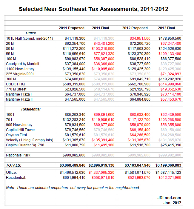 There were 15 properties that received reductions for their 2012 bills, totaling about $148 million. The big property owners managed a few hefty cuts, with JBG's US Department of Transportation building leading the way with a $47.7 million reduction to just under $615 million, followed by CSX's empty lots near the freeway north of I Street getting a $46.3 million haircut down to $66.2 million. Many of the other shiny new-ish buildings of the neighborhood also got their tallies reduced, such as apartment buildings 70/100 I and 909 New Jersey and office buildings 20 M, 55 M, 225 Virginia, and Maritime Plaza I and II.
So, I can now report that the 2012 tax assessment total for Near Southeast is: $6.06 billion. Since the final assessments for 2011 came in at about $5.81 billion, 2012's number is a $248 million increase for actual assessments year-over-year.
There were 15 properties that received reductions for their 2012 bills, totaling about $148 million. The big property owners managed a few hefty cuts, with JBG's US Department of Transportation building leading the way with a $47.7 million reduction to just under $615 million, followed by CSX's empty lots near the freeway north of I Street getting a $46.3 million haircut down to $66.2 million. Many of the other shiny new-ish buildings of the neighborhood also got their tallies reduced, such as apartment buildings 70/100 I and 909 New Jersey and office buildings 20 M, 55 M, 225 Virginia, and Maritime Plaza I and II. But these reductions were offset by $216 million in upward revisions. Most of this is thanks to 1015 Half Street finally being completed, taking that parcel's assessment from last year's $41.1 million to just a hair under $144 million. Three other buildings (80 M, 100 M, and 300 M) received higher final assessments as well. Plus, 32 townhouses in Capitol Quarter came onto the rolls as completed buildings, bringing just under $14 million in new tax revenue. (Yes, yes, PILOT/payment in lieu of taxes--don't stop me when I'm on a roll.)
And, because people always want to know, the ballpark's assessment for 2012 remains the smidgiest smidge under $1 billion, unchanged from 2011, at $999,982,800.
Alas, I can't give good year-to-year comparison numbers on final assessments in previous years because I didn't really grasp this whole revision thing until last year (oops), but I can say that proposed assessments were just a mite over $6 billion in both 2010 and 2011, after having been at $4.47 billion in 2009. My March post has the year-by-year proposed assessed values for the neighborhood, if you want those numbers.
If you feel like digging deeper (since you don't pay me enough to just post all my numbers for you to use), here's the the current assessments database, which you can search yourself. Tune in this March to see what the city proposes for 2013 values, and then in January for what the values really end up being....
|
Comments (0)
More posts:
assessments
|
 Developer William C. Smith is announcing today that the apartment project we've been referring to as 880 New Jersey will be called the Park Chelsea, and is expected to get underway sometime during the second quarter of this year. And there's even a rendering now, and an official web site.
As I reported a few months ago, it will be 13 stories, with 433 units, which I understand will be broken down as 58 studios (about 466 avg sq ft), 281 one-bedrooms (606-738 sq ft), 92 two-bedrooms (1094 sq ft), and 2 three-bedrooms (1788 sq ft). There will be a courtyard garden, club room, gym, pilates/yoga studio, Jacuzzi, and 75-foot indoor lap pool on the ground floor. Then, up on the roof there will be a second pool along with the now-ubiquitous lounging/grilling area, as well as a "community garden" and dog exercise area. There will also be 1,500 square feet of "convenience" retail space on the ground floor, and three levels of underground parking. (They previously mentioned to me a bicycle entrance to a sizeable storage room separate from the car parking areas--I'm assuming that's still part of the plans, but I haven't confirmed.)
It's easy to notice that site clearing that has begun along New Jersey--this is the start of the pre-construction infrastructure work that Smith needs to do in order to relocate some very very deep pipes beneath the block. The company also tells me that they expect DPW to be moving out of their site just to the south of 880 New Jersey about a month from now, which can begin the chain reaction of getting the old trash transfer building demolished so that lots can be split and land transferred along the to-be-built I Street axis. Vertical construction on 880 NJ can't begin until all of that happens, so that will be a pretty easy-to-watch guide to when real work on the new apartment building can begin.
 Once started, construction should take about two years.
This is the first phase of Smith's plans for Square 737, seen at right back in 2008. Originally the company had planned two residential buildings and two office buildings, but now they're looking toward filling the block with apartments, totalling around 1,200 units in four buildings. (And note that the entire four-building project is "matter of right," so there will be no zoning reviews or PUDs.) It's anticipated that there will be greater amounts of retail in the two buildings that will front 2nd Street, near Canal Park and across from 225 Virginia.
If you want to see more photos of Square 737 and get additional background, check my project page and previous posts.
While this will be William C. Smith's first apartment project in Near Southeast, they have been working in the neighborhood for a number of years, and literally working here since 2004 (when they opened 1100 New Jersey Avenue and moved their offices there). They have also been a big player in the creation of Canal Park, and are part of the Capper PUD team as the developers of the planned 250 M Street office building.
UPDATE: Lydia DePillis writes about the building's architecture at City Paper, and WBJ has a piece on the project for subscribers. And it gets a mention in WaPo's Capital Business section.
|
Comments (9)
|
 The meeting probably isn't even finished yet, but if you didn't (or did) stop by the first of DDOT's public meetings on their nine-month M Street SE/SW Transportation study, you can browse the presentation slides and take the stakeholder survey, already posted on the new web site for the project.
There were a pile of high-powered bloggers and transportation geeks in attendance, so I'm sure there will no shortage of coverage of both this meeting and the entire study that I will happily link to, but there wasn't much news coming out of this first session--it was mainly to introduce the study, talk about the methodology (which you can see in the slides) and then break up into small groups to stand around maps and give feedback about what attendees see as issues that need addressing. (But first, just as at the 2010 meeting, one woman who is particularly anti-bike once again made her feelings known.)
DDOT's representatives say they will be using some 33 other studies that have been done on the area in question as part of this overall study, covering the area from 14th St. SW to 12th Street SE south of the freeway down to the waterfront(s), though that then brought a comment from the audience about when studying is going to stop and there's going to be action.
There will be two more public meetings, one in March-ish and another in June-ish, with the study expected to be completed in August-ish.
UPDATE: Here's DCist's report on the meeting. And SWill's.
|
Comments (2)
|
Just a reminder that Thursday night (Jan. 12) is the first public meeting for DDOT's M Street SE/SW Transportation Study, from 6:30 pm to 8:30 pm at Westminster Presbyterian Church at 400 I St., SW.
As the meeting announcement says, "The purpose of the public meeting is to provide an overview of the transportation study, outline the study process/schedule and gather public feedback. Following a brief presentation, attendees will be asked to help identify concerns and issues on maps of the study area and also via a brief survey."
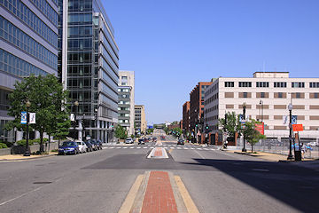
It isn't just about the six lanes on M Street, either: the study area goes from the Southeast/Southwest Freeway south to the Anacostia River and Washington Channel, from 12th Street SE all the way to 14th Street SW.
So, if you think there should be fewer lanes, more lanes, less parking, more parking, more bike lanes, fewer bike lanes, more pedestrian-friendly changes, fewer pedestrian-friendly changes, or just like watching people with wildly divergent views all trying to get their position to be the "right" one, come on down.
(You can also read my post on the last M Street traffic meeting, back in 2010, though note it was not part of this current official nine-month study by DDOT.)
|
Comments (0)
|
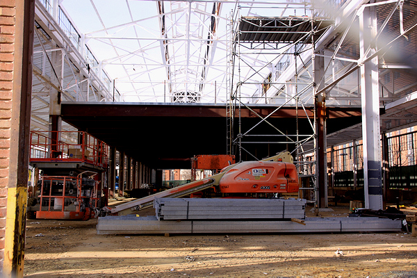
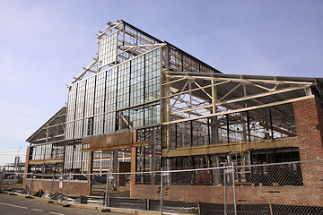
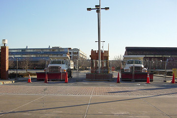
Do you get excited about new windows? Then this latest batch of photos of the Boilermaker Shops rehab is for you!
But, in addition to all the new glass, you can also see that the construction of the mezzanine level has begun as well. (There's a rendering midway down the page of how the mezzanine level will look, if you're having a hard time envisioning it.)
If you're just joining us, this is the project at the Yards that will bring six restaurants to this historic building by the end of 2012: a brewery by the Birch and Barley/Churchkey Folks, Austin Grill Express, BRB burger joint, Huey's 24/7 Diner, Buzz Bakery, and Willie's Brew and 'Que.
And, speaking of restaurants at the Yards, interested parties will like to hear that construction has begun on the Potbelly Sandwich Works shop in the ground floor of the Foundry Lofts building, just south of Boilermaker on the southeast corner of 3rd and Tingey. It is expected to open this spring, as is Kruba Thai and Sushi, which just received its building permit last week for its space in Foundry's southwest corner, just north of the Yards Park.
|
Comments (0)
More posts:
Boilermaker Shops/Yards, Restaurants/Nightlife, Foundry Lofts/Yards, photos, Retail, The Yards
|
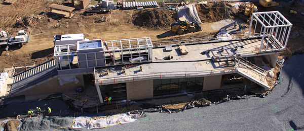
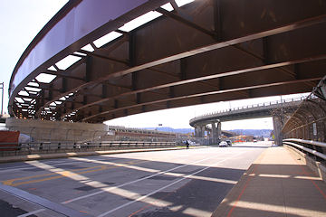
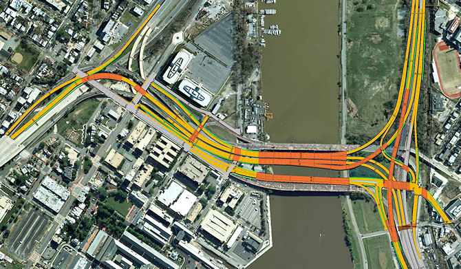
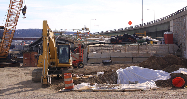 The news of the two freeway spans of the 11th Street Bridges opening over the past few weeks is of course the most interesting part of the current state of the project's construction, but there's plenty of work still happening on the Near Southeast side of the Anacostia River, from the new "11th Street Local" bridge that will open this summer (seen at right) to various other new ramps and flyovers.
 So on Sunday I did a lot of hoofing and driving to bring you this new 11th Street Bridges Project Photo Gallery, showing the most interesting views I came across. I walked up onto the old outbound bridge (totally legal! sidewalk and everything!), I ventured down to N and then O streets, and I went north to where the new girders have been installed above 11th Street to connect the inbound freeway traffic to the Southeast Freeway and where the new ramp up to 11th Street from the old Pennsylvania Avenue/Barney Circle connector is under construction.
I also updated a lot of intersection shots in my official Photo Archive, so if you're wanting to see before-and-afters from the streets surrounding the bridges project, check out 11th & M, 12th & M, 11th & N, 12th & N, 11th & L, and 11th & the freeway (the shots above are a teaser) for all your change-is-a-comin' images. (Though not every photo was updated, so look for the  icon.)
icon.)And, because I'm a goofball, I also tossed together this quick montage of the photos I took on my first trip across the new outbound freeway bridge. (Yes, that's on a JDLand Google+ page. I haven't done anything with it, but if you want to show me there's interest in my getting more active there, you can follow the page and we'll go from there.)
Plus I freshened up the photo portion of my 11th Street Bridges project page, which is the place to go if you're not up to speed on exactly what all this construction is going to accomplish. (DDOT's recent video will help you with that too.) But really, start with the photo gallery.

|
Comments (0)
More posts:
11th Street Bridges, photos
|
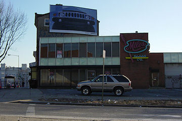 Back in February, the National Community Church applied for a raze permit for the Miles Glass site on the southwest corner of 8th and Virginia that it acquired along with a number of adjoining lots on Square 906 in 2010 and 2011. However, perhaps something was not quite right, because two new raze permit applications for 733 Virginia are now in the city's database, along with a separate new one for the car garage next door at 701 Virginia, the lot that finalized NCC's footprint.
Last week, NCC representatives told ANC 6B's Planning and Zoning Committee that they plan to have the demolitions completed by March, and will "then move to establish a temporary parking lot and community green space for an estimated two-year period" while the church continues to work on its final plans for the site, which in the past have been described as being a combination of coffee house, performance space, and church offices.
Any goings-on at the site, though, will be impacted by CSX's planned Virginia Avenue Tunnel construction, and in October NCC head Mark Batterson told the Washington Business Journal that "it doesn't make sense to do our project and then have them come through and rip everything up and make it difficult for us to even access our property."
Meanwhile, a couple blocks to the southeast, two raze permits have also now been filed for 816 Potomac, the long-closed-up brown apartment building on the northwest corner of 9th and Potomac. This property is one of the lots on Square 930 that Madison Marquette now co-owns as part of its "joint venture" with ICP Partners.
|
Comments (0)
|
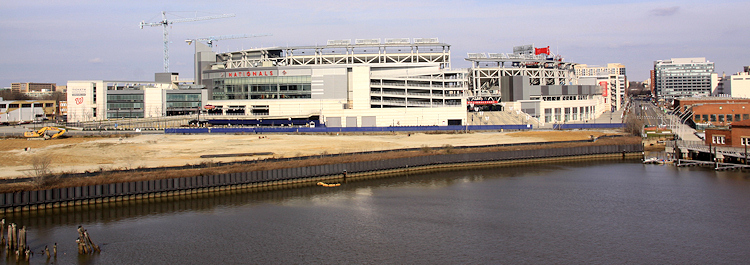
I have been lazy, l-a-z-y, about getting to some of my more far-flung photo spots in recent months, but the guilt of a new year finally overwhelmed me on Sunday, and I ventured up onto the Douglass Bridge and over to Poplar Point with camera in hand, mainly to get updated shots of the now-cleared Florida Rock site (above) and the Yards Park, Yards/Teague Bridge, and other waterside sites.
I pulled the most interesting of them together in an Along the Anacostia Photo Gallery, but you can also see the progression of images I've taken over the years from the Douglass Bridge and at Poplar Point looking toward Florida Rock/Nats Park and toward the Yards. I also gave my Florida Rock project page some much-needed freshening up, and you can also read my post from a few weeks ago about the latest news on the plans for the site. And maybe this year I'll head back to these spots when the ground isn't brown.
And, if you want to see almost the entire Near Southeast waterfront in one (panorama'ed) shot....:

|
Comments (0)
|
 * 1015 Half Buyer: On Friday the Post debuted a "What's Going On With....?" feature at their new Where We Live Real Estate blog (reminds me of my old "What's the Deal With...?" days), and the first item was on the empty office building at 1015 Half Street. One tidbit not mentioned there, or at JDLand before now, is that apparently Prudential Real Estate Investors is buying the building, with the deal supposed to be closing this month, according to Bisnow. Bisnow says that the deal was always for Prudential to buy out Bank of America's stake in the building when it was finished, even back when it was Opus East doing the developing, not current receiver Douglas Wilson Companies.
* Onyx Sale: The Onyx on First apartment building never sold when it first went on the block back in March, and a second offering apparently closed in December. Perhaps there will be news soon.
* Navy Yard Riverwalk Closure: It was announced on Twitter last week that the Navy Yard Riverwalk will be closed from Jan. 5 to Jan. 17 to install fences around the piers. (What? You thought I meant the entire Riverwalk and not just the portion controlled by the Navy Yard? Why ever would you have thought that?)
* Winter Classic Rumoring: I guess if you haven't been following along for the past couple of years, the notion of an NHL Winter Classic in DC and at Nationals Park could be news to you, but at this point there's nothing new actually being reported, since no official announcement has been made.
|
Comments (2)
More posts:
1015 Half, Navy Yard, Nat'l Community Church, Onyx, Square 743N, square 697, Nationals Park, winterclassic
|
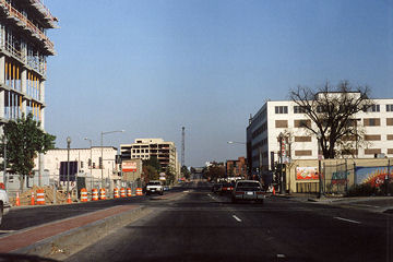
New Jersey Avenue, south of the freeway, looking east, before and after the clearing of brush and trees that happened late last week:
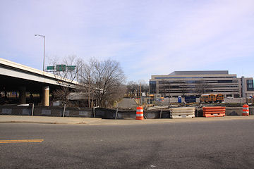
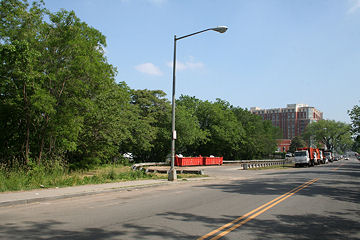
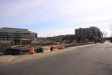
A slightly different angle, looking south-southeast:
This appears to be the work that William C. Smith mentioned would be coming, as part of their preparations for infrastructure work in advance of their 880 New Jersey Avenue apartment project. More before-and-afters here.
(That's 225 Virginia/200 I in the background, if you're bewildered at what you're seeing in this new view.)
(This is the first in what will be an avalanche of new photos over the next few days, after I drove around for about two hours grabbing scads of shots that I have been guilt ridden about not getting to. Rather than trying to put them up in one overwhelming post, I'll be passing them along in manageable bites.)
|
Comments (4)
|
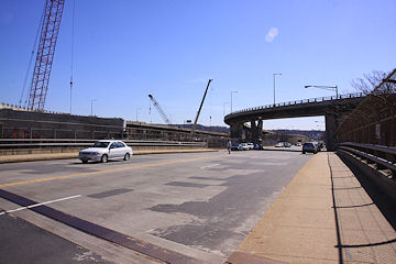
 UPDATE: The new span will indeed open on Saturday, Jan. 7, as confirmed Thursday evening by a DDOT tweet. Watch for detours during the day as they make the switch.
On Tuesday, DDOT tweeted thusly: "Traffic alert: if the weather holds, we expect the new outbound 11th Street Freeway Bridge to open this Saturday."
They also sent out a handy YouTube video explaining the phases of construction that the entire project has seen so far and will see before all is finished, which I urge you to watch so that I don't have to try to summarize it all for the 7,000th time.
One item in the video that I hadn't seen mentioned before (it's at about the 45-second mark): with the opening of the new outbound freeway bridge, commuters from the Southeast Freeway/I-695 who want to get into the neighborhoods just east of the river will need to exit at 6th Street SE and get themselves to the existing ramp at 11th and O SE to go across the old outbound bridge. This will be until the new 11th Street Local bridge opens this summer. So watch for some traffic tieups at the 6th Street ramp and along Virginia Avenue, 8th Street, and M Street.
Dr. Gridlock has more on the changes, and my 11th Street Bridges project page has overviews of the entire reconstruction.
|
Comments (0)
More posts:
11th Street Bridges
|
2751 Posts:
Go to Page: 1 | 2 | 3 | 4 | 5 | 6 | 7 | 8 | 9 | 10 ... 276
Search JDLand Blog Posts by Date or Category
Go to Page: 1 | 2 | 3 | 4 | 5 | 6 | 7 | 8 | 9 | 10 ... 276
Search JDLand Blog Posts by Date or Category